Highlights:
Scenic Mojave Desert region near Las Vegas, centered around a large lake on the Colorado River, formed by the Hoover Dam. Also includes the smaller Lake Mohave, together with large areas of remote lands all around. Various trails and routes visit places in the backcountry
Nearby towns:
Management:
Location:
36.016, -114.737 (Hoover Dam)
Seasons:
Water-based recreation is popular all year, but hiking away from the lake is not recommended in summer, when temperatures can exceed 115°F
Rating (1-5):
★★★★★
Weather:

Lake Mead is part of the Colorado River and Grand Canyon itineraries
Lake Mead - Locations
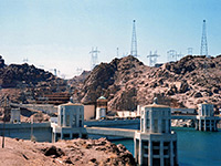
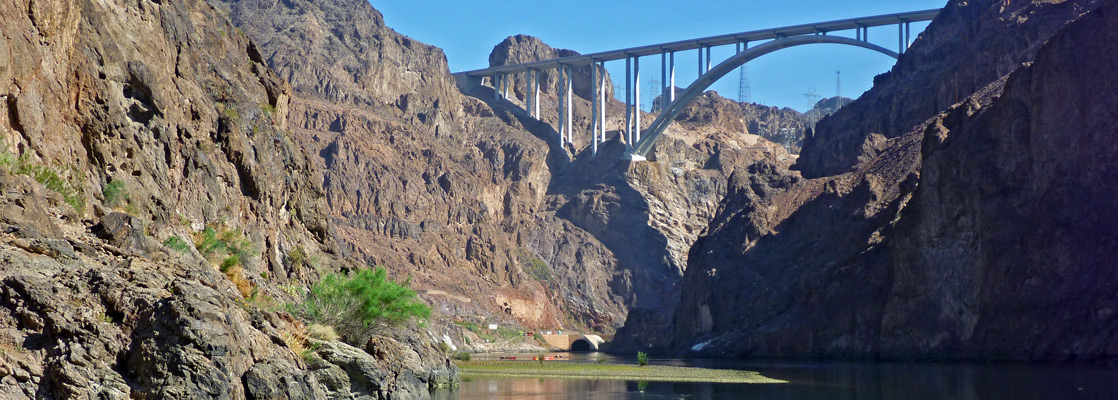
The dam which created Lake Mead, now one of the most popular visitor attractions of the Southwest, and quieter since the construction of the US 93 bypass bridge in 2010
The smaller, southern lake within the NRA; relatively long and thin, formed by Davis Dam across the Colorado River. The main center for visitor activities is at the downstream end, near the dam
Featured Hotel
Best Western Hoover Dam
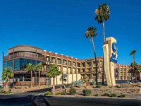 Attractive, affordable hotel with onsite restaurant, along Nevada Way in the center of Boulder City, 7 miles from the Hoover Dam
Check Rates
Either side of the Grand Canyon, the Colorado River is dammed forming two huge artificial lakes; Lake Powell in Utah and Lake Mead on the Arizona/Nevada border (named after Dr. Elwood Mead, Bureau of Reclamation Commissioner from 1924 to 1936). This began filling in 1935 following the completion of Boulder Dam, later designated the Hoover Dam after the 31st president, across the river at Black Canyon, 25 miles from Las Vegas. Indeed, it was the construction of the dam and the arrival of thousands of workers which prompted the legalization of gambling in Nevada and the consequent growth of the city.
Before the dam, this area of the Mojave Desert in northwest Arizona was largely unvisited due to the harsh, irregular terrain, the lack of roads, and the extreme summer temperatures. Now, the lake forms the major component of Lake Mead National Recreation Area, 1.5 million acres that extends quite far south and includes 25 miles of the Colorado River plus the smaller Lake Mohave, formed by Davis Dam near Bullhead City.
Before the dam, this area of the Mojave Desert in northwest Arizona was largely unvisited due to the harsh, irregular terrain, the lack of roads, and the extreme summer temperatures. Now, the lake forms the major component of Lake Mead National Recreation Area, 1.5 million acres that extends quite far south and includes 25 miles of the Colorado River plus the smaller Lake Mohave, formed by Davis Dam near Bullhead City.
Lake Mead Table of Contents
Location
Map of Lake Mead National Recreation Area.
Photographs
Lake Mead NRA, Hoover Dam, Bowl of Fire, Arizona Hot Springs/Lake Mohave. All Lake Mead photographs
Scenery in the NRA
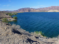
Lake Mead flooded a large area of desert, covering many canyons, several small towns and many relics of ancient settlements. It is not necessarily a compensation, but this inundation has created a major Southwest attraction which now brings many thousands of visitors each year. They come for boating, fishing, jetskiing, camping, swimming and to a lesser extent hiking - outdoor activities are possible year round as the weather is usually sunny and hot, up to 110 °F in midsummer when the water temperature reaches the mid 80's. The scenery is impressive enough - clear blue water beneath gaunt rocky cliffs, but much can only be appreciated using a boat as the majority of the innumerable sheltered coves and flooded canyons, often with clean, empty beaches for camping, are quite inaccessible by road. In general though most of the surrounding land is rather nondescript desert - dry washes, desert plains and low, rugged hills, so the area is not as scenic as Lake Powell, and as there are very few official trails, Lake Mead NRA is not a major destination for hiking and exploring, but rather just for the water-based activities, which are concentrated along the 20 miles of the southwest shore, close to Las Vegas. In recent years the amount of water in the lake has decreased steadily, due to drought; the reservoir is less than 40% full, the surface level has fallen by over 100 feet, and the upper margins of the lake, along the Virgin and Colorado rivers, are several miles closer to the-dam.
Paddling on Lake Mead
Lake Mead Access - West
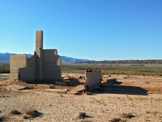
There are rather more access points to the shoreline of Lake Mead compared with Lake Powell, especially the section northwest of Hoover Dam in Nevada which has various beaches, camping areas and marinas. Highway 167 (Northshore Road) runs fairly close to the water for 40 miles passing through colorful, empty, desert surroundings with around a dozen side roads of varying quality leading towards the water of which one is to a developed marina, at Callville Bay. Two other marinas have ceased operations due to the decreasing water levels - Echo Bay in 2013 and Overton Beach in 2010. The road to this latter location is closed, though there is another route just to the north, which leads to the site of St Thomas. This small town was abandoned in the 1930s when Lake Mead was formed, and was for many decades flooded to depths of up to 60 feet, but now the various foundations and ruins sit once again on a dry, flat, bushy plain, half a mile from the Muddy River. A trail runs around the old townsite, and a detailed visitor guide is available. Also along Hwy 167 are two geothermal springs, Rogers and Blue Point.
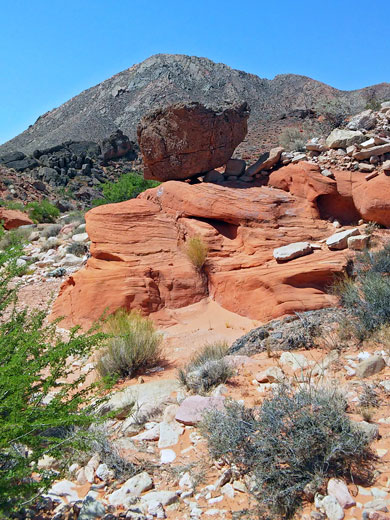
Red Rocks
The nearby desert on the Nevada side of the lake is characterized by gaunt mountain ranges with occasional bright red or orange outcrops of Aztec sandstone- Valley of Fire is the most spectacular, but also worth exploring, though harder to reach, is the Bowl of Fire, a few miles north of the road near the Callville Bay turn-off. Other scenic red rock locations Whitney Pockets north of the lake, near the Virgin River, and the Buffington Pockets. But the most visited section of Lake Mead is that closest to Las Vegas - here are two large marinas at Boulder Beach and Las Vegas Bay, plus campgrounds, beaches, picnic areas and the main NRA visitor center. The proximity to the city and ease of access means that the beaches and overlooks hereabouts tend to have a lot of litter.
Lake Mead Access - East
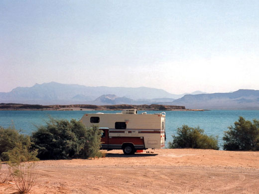
There are also several roads leading to beaches on the southern shores of the Lake Mead in Arizona - at Temple Bar, reached by a lonely 28 mile drive along a side road branching off US 93 18.5 miles south of Hoover Dam, there is a lively marina with an RV site and plenty of colorful Mojave desert scenery. Further east, a longer but still paved road leads through forests of Joshua trees and the extended settlement of Dolan Springs to South Cove (just a boat launch site), and to Pearce Ferry beside the Colorado River, where the Grand Canyon begins (or ends). However, the northeast section of shoreline between the Virgin and Colorado rivers remains virtually unvisited - it may only be reached by driving along many miles of rough dirt roads across the Shivwits Plateau in northwest Arizona, land which is part of the new Grand Canyon-Parashant National Monument.
Camping in Lake Mead NRA
The west side of Lake Mead has a number of free primitive campsites along tracks forking off Northshore Road, for example at Stewarts Point, near Overton Beach at the north end of the lake. Here, camping is allowed on a large area of the shoreline, which is flat, sandy and sheltered. Sites nearer Las Vegas tend to be crowded and full of litter but far fewer people drive further north so camping here is very peaceful and secluded. Official (paid) sites for tents and RVs may be found at all the marinas, and are charged at $20 per site per night (in 2024). In Nevada, the nearest places for primitive camping outside the NRA, and so free of any regulations, are along dirt tracks leading into a range of low hills either side of NV 169, a few miles north of the turn off for Valley of Fire State Park.
Hiking in Lake Mead NRA
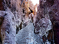
There are very few maintained paths in Lake Mead NRA, though hiking opportunities are numerous. The majority are cross-country, off-trail routes - destinations include narrow canyons, rock art sites, springs and rock formations.
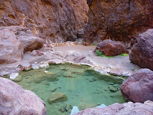
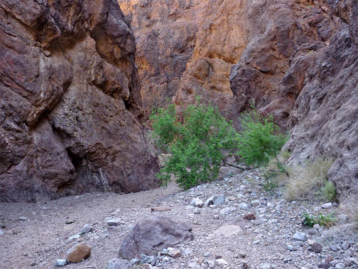
Arizona Hot Springs
★★★★★
★★★★★
3.1 miles, 760 feet
Warm springs in a short, unusually colorful slot canyon bordering Lake Mohave along the Colorado River, reached by the White Rock Canyon Trail starting from US 93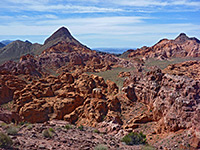
Bowl of Fire
★★★★★
★★★★★
6 miles, 300 feet
Off trail hike to a sizeable group of Aztec sandstone mounds, colored red, orange and pink, eroded into many strange forms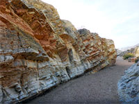
Cottonwood Wash
★★★★★
★★★★★
1.8 miles, 350 feet
Shallow drainage through a geologically-varied area near the north shore of Lake Mead; rocks of many colors and forms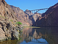
Goldstrike Canyon
★★★★★
★★★★★
2.5 miles, 940 feet
Testing, off-trail hike down a rugged ravine containing pools and hot springs, ending beside the Colorado River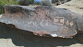
Grapevine Canyon
★★★★★
★★★★★
0.3 miles, 50 feet
Ravine through the Newberry Mountains northwest of Laughlin, containing a small stream; also many petroglyphs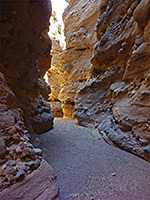
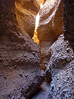
Lake Mohave slot canyons
★★★★★
★★★★★
3 miles, 100 feet (loop)
Two narrow, branched ravines through light-colored conglomerate rocks on the west side of Lake Mohave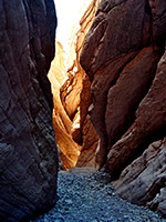
Lovell Wash
★★★★★
★★★★★
3 miles, 200 feet
Seasonal wash forming a short, twisting slot canyon through inclined, thin-layered limestone in the Gale Hills, on the north side of the lake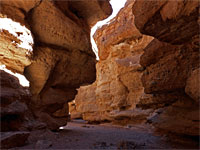
Owl Canyon
★★★★★
★★★★★
1.1 miles, 200 feet
Short slot through orange-brown conglomerate rock layers, on the west edge of Lake Mead
Rainbow Canyon
★★★★★
★★★★★
5.2 miles, 380 feet, partial loop
Ravine through colorful rock layers, below an isolated ridge topped by jagged strata, the Giant Fin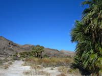
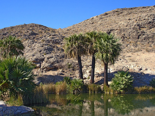
Rogers Spring
★★★★★Warm-water spring at the foot of the Muddy Mountains, lined by non-native California fan-palms; popular for picnics, paddling and bird-watching
★★★★★Warm-water spring at the foot of the Muddy Mountains, lined by non-native California fan-palms; popular for picnics, paddling and bird-watching
Spooky Canyon
★★★★★
★★★★★
0.9 miles, 50 feet
Minor drainage through the hills bordering US 93, on the east side of Lake Mohave; contains a third of a mile of pretty passageways, with overhanging rocks and a natural bridgeLake Mead - Nearby Places
Lake Mead - Similar Places
- Alamo Lake State Park - desert lake in central Arizona
- Flaming Gorge NRA, Utah - more distant lake on the Utah/Wyoming border
All Contents © Copyright The American Southwest | Comments and Questions | Contribute | Affiliate Marketing Disclosure | Site Map