Highlights:
Mountains, valleys and plains at the transition between the Sonoran and Mojave deserts; the western half of the park features magnificent forests of the Joshua tree, plus many cacti, set amongst large outcrops of weathered granite boulders. Many trails, long and short
Nearby town:
Management:
Location:
34.078, -116.036 (north entrance) 33.674, -115.801 (south entrance)
Seasons:
All year, though summers are very hot
Rating (1-5):
★★★★★
Weather:


Joshua Tree NP is part of the California Deserts itinerary
Joshua Tree - Regions and Trails
Scenic drives and places to see in the west, the most visited section of the park; many Joshua trees, plus mountains, rock formations, campgrounds and trailheads
Roads and viewpoints in the lower elevation areas of east, where the land is generally emptier, with fewer Joshua trees. Trails lead to summits, old mines and palm oases
Featured Hotel
Holiday Inn Express Twentynine Palms
 AAA Three Diamond hotel along Hwy 62 through Twentynine Palms, just 2.5 miles from the Oasis Visitor Center. Hot breakfast is complimentary
Check Rates
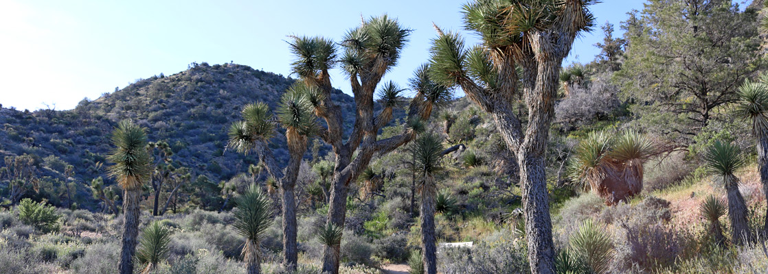
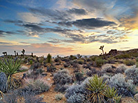
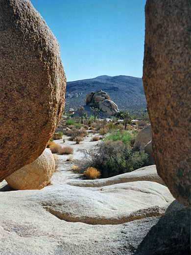
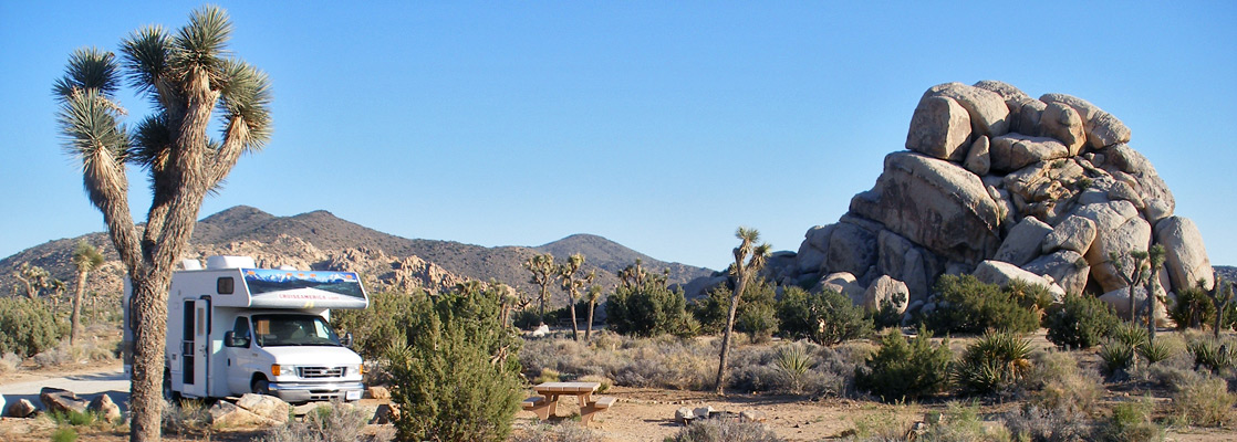
Joshua Tree National Park is popular with the more thoughtful traveler, since there is no spectacular central attraction as is the case with many other Southwest parks, just many square miles of wild, unspoilt desert scenery. Two factors make the park special; the eerie, spiky Joshua trees which grow densely in the western half, and the extensive outcrops of huge granite boulders, up to 100 feet high, which line the mountain ranges scattered over the whole area.
Other prime attractions are six oases where California fan palm trees grow in their natural surroundings, all reachable by trail. This is not a place just to drive through, instead visitors should explore for a while away from the roads - climb some rocks or walk amongst the trees and cacti, but most of all spend a night here and watch the sun set. The Joshuas are especially atmospheric and spooky at dusk, when their stark, irregular outlines become quite menacing.
Joshua Tree, for many years a national monument, was promoted to a national park in 1994, along with nearby Death Valley, and was extended by 230,000 acres, mainly remote mountainous regions at the south and east edges.
The land lies at the transition between the Sonoran and Mojave deserts, and has vegetation and scenery representative of both. Besides the trees, rocks and oases, the park also has many hiking trails, a network of 4WD routes, several historic sites and half a dozen picturesque campgrounds.
Joshua Tree Table of Contents
- Map of the national park
- Photographs
- Regions and trails; east and west
- Access
- Tours of Joshua Tree NP
- Hiking in Joshua Tree NP
- Joshua Tree wildflowers
- The Joshua tree
Location
Maps of Joshua Tree National Park; general features, trails.
Photographs
General views, flowers, trees and cacti; All Joshua Tree National Park photographs.

Access
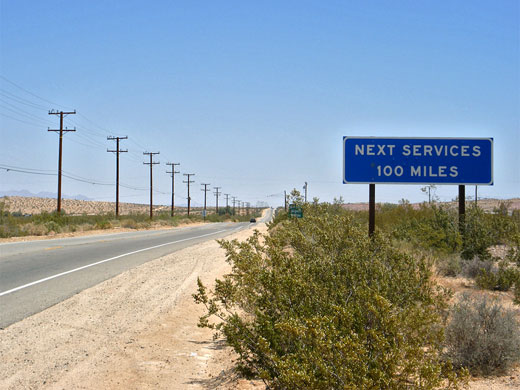
The national park can be reached from the south from a junction of I-10, or from the north by two roads that fork off CA 62, starting from the towns of Joshua Tree and Twentynine Palms - see area map. But the best approach, if applicable, is the westward drive along CA 62 from Parker in Arizona, 108 miles away. This follows the Santa Fe railroad for a while, then crosses empty lands typical of the Mojave Desert, past sand dunes, dried lake beds and rugged mountains, en route to Twentynine Palms. Near the town, on both CA 62 and the parallel Amboy Road are found many unoccupied and/or derelict buildings, at quite widely-spaced intervals over a distance of several miles, which give the whole area a rather sad, mournful air, especially near sunset.
Joshua Tree Tours
Experience the backcountry by 4WD vehicle.
Trails of Joshua Tree
All trails in Joshua Tree NP, from 0.2 miles to over ten miles.
Featured Joshua Tree Trails
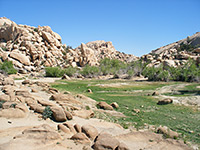
Barker Dam
★★★★★
★★★★★
1.2 miles, 40 feet (loop)
The loop hike past the small, seasonal pool formed by Barker Dam also encounters plenty of Joshua trees, and a petroglyph panel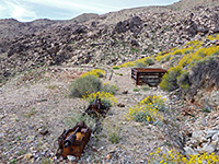
Contact Mine
★★★★★
★★★★★
1.8 miles, 700 feet
Mine relics including sealed shafts and iron equipment, at the end of an unmaintained trail up a sandy wash and over stony slopes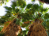
Fortynine Palms Oasis
★★★★★
★★★★★
1.6 miles, 300 feet
This relatively easy and quite popular path climbs to the top of a barren ridge overlooking the town of Twentynine Palms then drops down to a sizeable group of California fan palms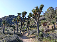
High View Trail
★★★★★
★★★★★
1.6 miles, 300 feet (loop)
Loop into the foothills of the Little San Bernardino Mountains, passing plenty of Joshua trees and other desert plants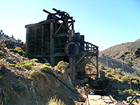
Lost Horse Mine
★★★★★
★★★★★
2 miles, 480 feet
On the road to Keys View, a side track branches westwards ending after a mile at a small parking area at the edge of 5,178 foot Lost Horse Mountain, from where a trail (also once a vehicle track) ascends to the summit, en route passing several restored buildings from the Lost Horse Mine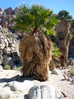
Lost Palms Oasis
★★★★★
★★★★★
4 miles, 450 feet
Perhaps the best day hike in Joshua Tree National Park, the route to the fan palm trees and pools at Lost Palms Oasis encounters rocky ridges, sandy washes, many Sonoran desert cacti and granite boulders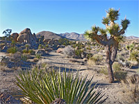
Lucky Boy Vista Loop
★★★★★
★★★★★
3.5 miles, 170 feet (loop)
Traverse of flat land to a viewpoint and old mine site, returning via two shallow drainages, past clumps of boulders, low cliffs and scattered pine trees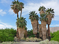
Oasis of Mara
★★★★★
★★★★★
0.5 miles, level (loop)
Paved loop exploring the easiest-reached of the park's six palm oases, beside the main visitor center in Twentynine Palms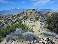
Panorama Trail
★★★★★
★★★★★
8.6 miles, 1,180 feet (partial loop)
The Panorama Trail loops round part of the Little San Bernardino Mountains in the west section of the park, and may be combined with two spur trails to make a varied half day hike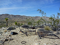
Pine City and Desert Queen Mine
★★★★★
★★★★★
4.5 miles, 350 feet (loop)
Varied loop past two groups of old mine relics, along a canyon and across open flats to a shallow basin with huge boulders and pine trees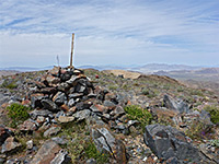
Pinto Mountain
★★★★★
★★★★★
4.5 miles, 2,200 feet (loop)
Mostly off-trail hike across sandy flats and up a ravine to an isolated summit in the north-central area of the park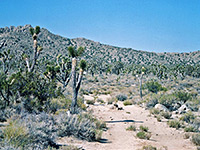
Queen Mountain
★★★★★
★★★★★
2 miles, 1100 feet
From the end of a side road across Queen Valley, a little-used trail climbs the steep southern slope of Queen Mountain, ending at an elevated viewpoint near the summit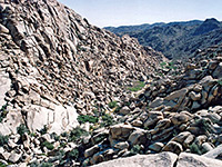
Rattlesnake Canyon
★★★★★
★★★★★
1.2 miles, 400 feet
A faint path enters the lower end of Rattlesnake Canyon, near the Indian Cove campground, and follows the narrow drainage into the north section of the Wonderland of Rocks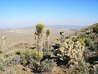
Ryan Mountain
★★★★★
★★★★★
1.5 miles, 1060 feet
Ryan Mountain is a somewhat isolated yet easily reached peak surrounded by open plains so the views from its summit are some of the best in the park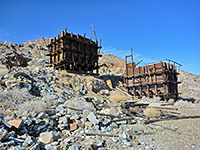
Silver Bell and El Dorado Mines
★★★★★
★★★★★
4 miles, 250 feet (loop)
These are two disused mines in the Hexie Mountains, visited by a moderate loop trail, partly cross-country; relics include two well-preserved wooden tipples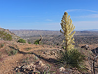
South Park Peak
★★★★★
★★★★★
0.6 miles, 230 feet (loop)
Loop to a minor summit overlooking the town of Yucca Valley; also has good views over the Black Rock Canyon area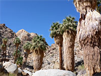
Victory Palms and Munsen Palms
★★★★★
★★★★★
5.4 miles, 450 feet
Backcountry palm oases, beyond the end of the Lost Palms Oasis Trail; the small Victory Palms, and several larger groups extending 1.6 miles along Munsen CanyonJoshua Tree Wildflowers
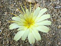
Photographs and descriptions of flowering plants found in the national park
The Joshua Tree
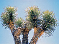
Yucca brevifolia - general information, and distribution map; this species is found in California, Nevada, Arizona and far southwest Utah
All Contents © Copyright The American Southwest | Comments and Questions | Contribute | Affiliate Marketing Disclosure | Site Map