Transept Trail, Grand Canyon National Park
Arizona > Grand Canyon National Park > North Rim > Hiking > Transept Trail
Transept Trail
Level path through mixed pine, oak and aspen woodland along the rim of a deep side canyon, west of Bright Angel Point
Length: 1.5 miles
Elevation change: 150 feet
Difficulty: Easy
Type: One way; two trailheads, both near the road
Usage: Medium
Season: Mid May to mid October
Trailhead: Next to Bright Angel Lodge, and at the North Rim campground
Rating (1-5): ★★★★★
Elevation change: 150 feet
Difficulty: Easy
Type: One way; two trailheads, both near the road
Usage: Medium
Season: Mid May to mid October
Trailhead: Next to Bright Angel Lodge, and at the North Rim campground
Rating (1-5): ★★★★★
The road to Grand Canyon's North Rim ends at Bright Angel Point beside Grand Canyon Lodge, from where most people, on first arriving, make the short walk south to the main canyon viewpoint, a place usually very busy. A more peaceful encounter with this part of the gorge, albeit lacking such far reaching views, is provided by the easy, mostly level Transept Trail which follows the canyon rim from the lodge to the North Rim Campground, 1.5 miles away.
The path runs through mixed pine, oak and aspen woodland along the edge of The Transept, a deep but relatively short tributary of the much longer Bright Angel Canyon; it also provides a backdrop for the first few miles of the even less traveled Widforss Trail. Some parts of the Transept Trail wind through quite dense woodland, out of sight of the canyon, but most is right by the edge, so giving good views across the Transept, and of more distant cliffs and ravines to the south. The route is fairly well used, a bit dusty in places, semi-shaded and not at all difficult.
North Rim location map.
The path begins directly below Grand Canyon Lodge, in view of those sunbathing on the open-air terrace next to the cafe, from where it heads north, passes a railing-protected viewpoint then runs beneath a row of log cabins. These comprise just a few of the 200 rooms available at the lodge, but are some of the most desirable as they have partial canyon views though the pine trees. Next, the trail moves away from the rim for a short distance, to avoid a short side canyon, before climbing back to the edge of the Transept, and following it northwards. Several narrow spur paths snake through the bushes to the very edge of the cliffs, and one promontory about half way along projects out rather more so has the best view of all. A little off-trail scrambling is necessary for the best panorama. From here the path curves around another small ravine then turns away from the rim, ascending slightly to the North Rim Campground. A loop hike can be made by returning via the 1.2 mile Bridle Trail, a not-so-interesting path (also a cycle route) that parallels the main road back south.
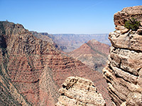
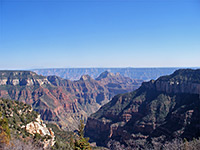
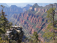
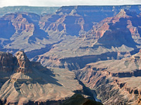
The Transept is particularly steep on the far (west) side, where sheer cliffs of the Coconino, Supai and Redwall layers fall 2,500 feet almost vertically down, and form part of a straight ridge extending south as far as Oza Butte, beyond which the land drops away at the edge of Bright Angel Canyon. The middle third of this canyon can be seen from the Transept Trail, including three prominent peaks on the far rim - Deva Temple, Brahma Temple and Zoroaster Temple. Several miles beyond are Grandview and Shoshone Points on the South Rim, and, on the horizon, the volcanic cone of Red Butte.
The path runs through mixed pine, oak and aspen woodland along the edge of The Transept, a deep but relatively short tributary of the much longer Bright Angel Canyon; it also provides a backdrop for the first few miles of the even less traveled Widforss Trail. Some parts of the Transept Trail wind through quite dense woodland, out of sight of the canyon, but most is right by the edge, so giving good views across the Transept, and of more distant cliffs and ravines to the south. The route is fairly well used, a bit dusty in places, semi-shaded and not at all difficult.
Location
North Rim location map.
The Path
The path begins directly below Grand Canyon Lodge, in view of those sunbathing on the open-air terrace next to the cafe, from where it heads north, passes a railing-protected viewpoint then runs beneath a row of log cabins. These comprise just a few of the 200 rooms available at the lodge, but are some of the most desirable as they have partial canyon views though the pine trees. Next, the trail moves away from the rim for a short distance, to avoid a short side canyon, before climbing back to the edge of the Transept, and following it northwards. Several narrow spur paths snake through the bushes to the very edge of the cliffs, and one promontory about half way along projects out rather more so has the best view of all. A little off-trail scrambling is necessary for the best panorama. From here the path curves around another small ravine then turns away from the rim, ascending slightly to the North Rim Campground. A loop hike can be made by returning via the 1.2 mile Bridle Trail, a not-so-interesting path (also a cycle route) that parallels the main road back south.
Views along the Transept Trail
The Transept is particularly steep on the far (west) side, where sheer cliffs of the Coconino, Supai and Redwall layers fall 2,500 feet almost vertically down, and form part of a straight ridge extending south as far as Oza Butte, beyond which the land drops away at the edge of Bright Angel Canyon. The middle third of this canyon can be seen from the Transept Trail, including three prominent peaks on the far rim - Deva Temple, Brahma Temple and Zoroaster Temple. Several miles beyond are Grandview and Shoshone Points on the South Rim, and, on the horizon, the volcanic cone of Red Butte.
Transept Trail - Similar Hikes
All Contents © Copyright The American Southwest | Comments and Questions | Contribute | Affiliate Marketing Disclosure | Site Map


