Hamburg Trail #122
Secluded path further up Ramsey Canyon, leaving the far end of the nature loop and climbing steeply to pass a cliff-lined section, then following close to the streambed, through thick woodland, past pools and cascades, to an old mine site
Length: 2.4 miles
Elevation change: 1,300 feet
Difficulty: Moderate; steep and rocky in places
Type: One way; links with other trails further into the Huachuca Mountains
Usage: Low
Season: All year
Trailhead: Parking area for Ramsey Canyon Preserve
Rating (1-5): ★★★★★
Elevation change: 1,300 feet
Difficulty: Moderate; steep and rocky in places
Type: One way; links with other trails further into the Huachuca Mountains
Usage: Low
Season: All year
Trailhead: Parking area for Ramsey Canyon Preserve
Rating (1-5): ★★★★★
The Hamburg Trail, also known as the Ramsey Canyon Trail (Coconino National Forest trail #122), accesses the upper part of Ramsey Canyon, beyond the Nature Conservancy preserve, up to the junction with two tributary ravines (Pat Scott Canyon and Wisconsin Canyon), where other paths continue, higher into the Huachuca Mountains. Near the junction is an old prospecting site, Hamburg Mine, and while there seems to be little of interest remaining, the hike to this place is very pleasant, especially in spring and summer.
The path climbs from the flat floor of the lower reaches of the canyon, starting at the far side of the loop through the preserve, to a fine viewpoint above the inaccessible, cliff-bound middle section of the drainage, then drops back down to the creek and follows this through a cool, thickly-wooded valley, past many pools and little waterfalls; good habitat for summer wildflowers, and for birds and other wildlife.
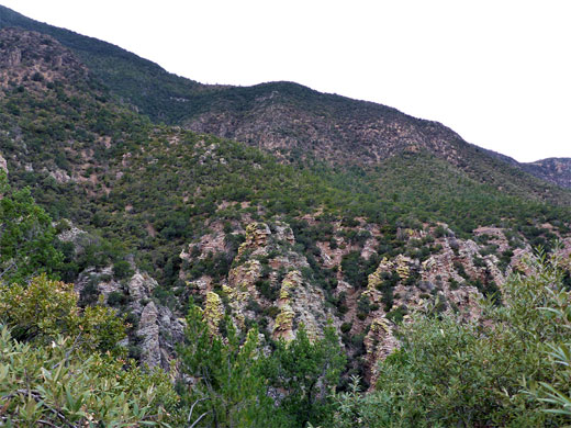
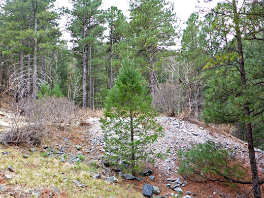
The trail starts through the Nature Conservancy visitor center, where the fees of $8 per person are paid. The shortest route is along the southern section of the loop path, to a junction at the far side, after about half a mile, where the Hamburg Trail starts a steady climb, rising over 500 feet as it switchbacks up the south side of the canyon. Benches are installed at intervals to allow people to rest. The vegetation includes scattered yucca and agave amongst the dense pine, fir and sycamore trees, which prevent any views of the valley below. A notice indicates the edge of the preserve, at the point where the path enters the 20,000 acre Miller Peak Wilderness, part of the Coronado National Forest. After rising a little further, the trail reaches a treeless knoll which allows the first more distant views over the canyon, though not of the creek as this is flowing out-of-sight far below, at the foot of vertical, jagged, lichen-covered volcanic rocks, similar to those at Chiricahua National Monument.
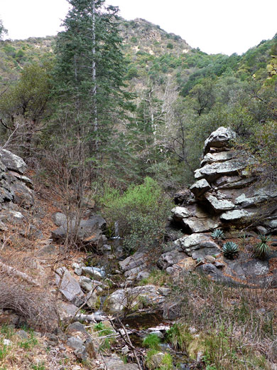
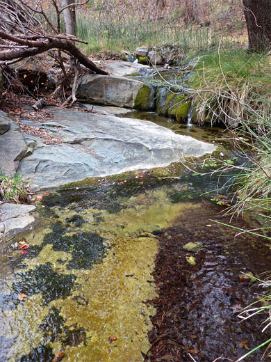
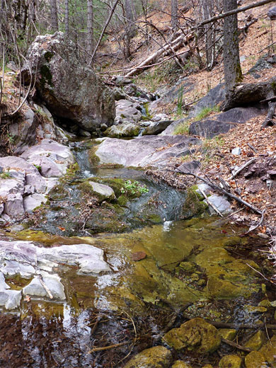
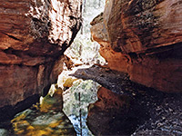
Not far beyond is a second, better overlook (at elevation 6,200 feet), where more of the canyon can be seen, and here the views extend east towards San Pedro Valley. This point is a good intermediate hike destination, and it seems that not too many people continue. The path stays level for a while before descending back to the streambed, which holds water all year, flowing between a line of low cliffs, over mossy waterfalls and through deepish pools. The trees are tall, the canyon tranquil and unspoilt. The trail crosses the creek at several places, one within a section liable to be dry for most of the year, and passes a junction with the Brown Canyon Trail from the north. Beyond here the landscape remains similar - a relatively wide though always shady canyon, with the path a short distance above the creek on one side or other, as the drainage sometimes flows through slightly enclosed sections with a few rocky outcrops, while in other places it winds between boulders and fallen logs. The next junction is at the upper fork in the canyon, just before the site of Hamburg Mine, where relics include a few iron objects and some overgrown spoil heaps. The two onwards paths, up Pat Scott and Wisconsin canyons, appear very little used.
The path climbs from the flat floor of the lower reaches of the canyon, starting at the far side of the loop through the preserve, to a fine viewpoint above the inaccessible, cliff-bound middle section of the drainage, then drops back down to the creek and follows this through a cool, thickly-wooded valley, past many pools and little waterfalls; good habitat for summer wildflowers, and for birds and other wildlife.
Lower Ramsey Canyon
The trail starts through the Nature Conservancy visitor center, where the fees of $8 per person are paid. The shortest route is along the southern section of the loop path, to a junction at the far side, after about half a mile, where the Hamburg Trail starts a steady climb, rising over 500 feet as it switchbacks up the south side of the canyon. Benches are installed at intervals to allow people to rest. The vegetation includes scattered yucca and agave amongst the dense pine, fir and sycamore trees, which prevent any views of the valley below. A notice indicates the edge of the preserve, at the point where the path enters the 20,000 acre Miller Peak Wilderness, part of the Coronado National Forest. After rising a little further, the trail reaches a treeless knoll which allows the first more distant views over the canyon, though not of the creek as this is flowing out-of-sight far below, at the foot of vertical, jagged, lichen-covered volcanic rocks, similar to those at Chiricahua National Monument.
Upper Ramsey Canyon
Not far beyond is a second, better overlook (at elevation 6,200 feet), where more of the canyon can be seen, and here the views extend east towards San Pedro Valley. This point is a good intermediate hike destination, and it seems that not too many people continue. The path stays level for a while before descending back to the streambed, which holds water all year, flowing between a line of low cliffs, over mossy waterfalls and through deepish pools. The trees are tall, the canyon tranquil and unspoilt. The trail crosses the creek at several places, one within a section liable to be dry for most of the year, and passes a junction with the Brown Canyon Trail from the north. Beyond here the landscape remains similar - a relatively wide though always shady canyon, with the path a short distance above the creek on one side or other, as the drainage sometimes flows through slightly enclosed sections with a few rocky outcrops, while in other places it winds between boulders and fallen logs. The next junction is at the upper fork in the canyon, just before the site of Hamburg Mine, where relics include a few iron objects and some overgrown spoil heaps. The two onwards paths, up Pat Scott and Wisconsin canyons, appear very little used.
Hamburg Trail - Similar Hikes
All Contents © Copyright The American Southwest | Comments and Questions | Contribute | Affiliate Marketing Disclosure | Site Map


