Brown Mountain Trail
Loop up and along a narrow ridge with far-reaching views, returning via rocky land below, partially alongside a dry wash across colorful bedrock
Length: 4 miles (round trip)
Elevation change: 370 feet
Difficulty: Moderate
Type: Loop
Usage: Medium to high
Season: Fall to spring
Trailhead: Short side road off Kinney Road
Rating (1-5): ★★★★★
Elevation change: 370 feet
Difficulty: Moderate
Type: Loop
Usage: Medium to high
Season: Fall to spring
Trailhead: Short side road off Kinney Road
Rating (1-5): ★★★★★
Brown Mountain, in Tucson Mountain Park, was named in 1979 in memory of CB Brown who died in that year - he was the man who instigated the creation of the park, in 1929. The mountain is an isolated, elongated summit with a one mile-long ridgeline incorporating five little peaks, the highest, at the center is 3,110 feet. It is an outlier, and affords grand views is all directions - west over the main body of the mountains and east across the vast expanse of Avra Valley towards many more distant peaks, in the Tohono O'odham Reservation.
The Brown Mountain Trail, a 4 mile loop, climbs either end of the ridge and follows the crest, returning across the rocky, bushy land below, encountering the usual variety of Sonoran Desert plants. The trail is one of the more popular in the area owing to the good views and the easy access, along Kinney Road, starting at one of the park's three picnic areas. Despite several steep sections, the route is also popular with mountain bikers.
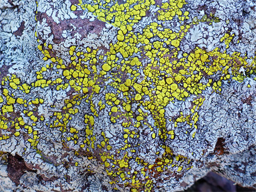
The lower portion of the trail runs for a while alongside a dry wash where the colorful bedrock is exposed - blocks of red and purple line the streambed, from a sandstone strata of uncertain origin. The geology of Brown Mountain is quite complex, and the ground is split by several faults. The north and south ends of the ridge are formed of the sandstone, while at the center is reddish-brown volcanic conglomerate, topped in two locations by rhyolitic ash-flow tuff, and to the northeast, the land below the peak is a bigger expanse of amole arkose.
15 views along the trail.
Map of Tucson Mountain Park.
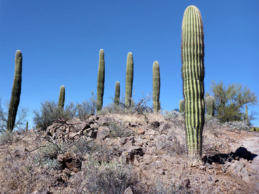
The trailhead for Brown Mountain is about half way along the picnic area loop, a side road off Kinney Road. The path soon crosses the dry wash and reaches a junction at the start of the loop section; turning left, this curves round the south end of the mountain, following the wash, to a second intersection, with the Well Road Trail. Bearing right at this junction, the path begins climbing, up quite a steep slope of the reddish pink sandstone. The trail is initially straight then bends through several switchbacks, up to the southernmost of the ridgeline summits, Peak 3005. The next mile is all along the ridge, over a second minor peak, down and back up to the central pair of summits then down once more via one switchback, quite steeply, and up towards the northernmost summit, passing just below to the east. All this section has fantastic views, and a good assortment of cacti and wildflowers, growing in the coarse, sandy soil.
After traversing just below the final peak, the path winds down the hill and past a short connector to an alternative trailhead at the Juan Santa Cruz picnic area, then starts the return section, across flattish land on the northeast side of the mountain. It rises slightly, passes over a minor saddle and angles gently down, coming alongside the dry wash and its colorful bedrock. Walking directly along the streambed provides an alternative to the actual trail.
The Brown Mountain Trail, a 4 mile loop, climbs either end of the ridge and follows the crest, returning across the rocky, bushy land below, encountering the usual variety of Sonoran Desert plants. The trail is one of the more popular in the area owing to the good views and the easy access, along Kinney Road, starting at one of the park's three picnic areas. Despite several steep sections, the route is also popular with mountain bikers.
The lower portion of the trail runs for a while alongside a dry wash where the colorful bedrock is exposed - blocks of red and purple line the streambed, from a sandstone strata of uncertain origin. The geology of Brown Mountain is quite complex, and the ground is split by several faults. The north and south ends of the ridge are formed of the sandstone, while at the center is reddish-brown volcanic conglomerate, topped in two locations by rhyolitic ash-flow tuff, and to the northeast, the land below the peak is a bigger expanse of amole arkose.
Photographs
15 views along the trail.
Location
Map of Tucson Mountain Park.
Ridgeline Trail
The trailhead for Brown Mountain is about half way along the picnic area loop, a side road off Kinney Road. The path soon crosses the dry wash and reaches a junction at the start of the loop section; turning left, this curves round the south end of the mountain, following the wash, to a second intersection, with the Well Road Trail. Bearing right at this junction, the path begins climbing, up quite a steep slope of the reddish pink sandstone. The trail is initially straight then bends through several switchbacks, up to the southernmost of the ridgeline summits, Peak 3005. The next mile is all along the ridge, over a second minor peak, down and back up to the central pair of summits then down once more via one switchback, quite steeply, and up towards the northernmost summit, passing just below to the east. All this section has fantastic views, and a good assortment of cacti and wildflowers, growing in the coarse, sandy soil.
Return Route
After traversing just below the final peak, the path winds down the hill and past a short connector to an alternative trailhead at the Juan Santa Cruz picnic area, then starts the return section, across flattish land on the northeast side of the mountain. It rises slightly, passes over a minor saddle and angles gently down, coming alongside the dry wash and its colorful bedrock. Walking directly along the streambed provides an alternative to the actual trail.
Brown Mountain Trail - Similar Hikes
All Contents © Copyright The American Southwest | Comments and Questions | Contribute | Affiliate Marketing Disclosure | Site Map


