Coastal Trail
Popular path across sandstone terraces on the Pacific side of Point Loma Peninsula, past cliffs, bluffs and tidepools. Also encounters varied plant life
Length: 0.5 miles
Elevation change: 80 feet
Difficulty: Easy
Type: One way, or loop returning along the road
Usage: High
Season: All year
Trailhead: Parking area along Cabrillo Road
Rating (1-5): ★★★★★
Elevation change: 80 feet
Difficulty: Easy
Type: One way, or loop returning along the road
Usage: High
Season: All year
Trailhead: Parking area along Cabrillo Road
Rating (1-5): ★★★★★
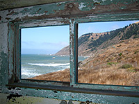
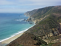
There are only two trails in Cabrillo National Monument - the Bayside Trail, descending the bluffs along the east edge of Point Loma Peninsula, while staying some way above the sea, and the half mile Coastal Trail, also known as the Point Loma Tidepools Trail, which crosses flat terraces on the western, Pacific side of the peninsula, passing cliffs, pools, and varied plant life. The path is easy, mostly level, and has two trailheads, linked by a road which can be used to make a 0.9 mile loop.
Rocks in the area are sandstone, shale and siltstone from the Cretaceous-era Point Loma Formation; thin-layered, inclined at a low angle, and colored rich shades of gray and brown; they form sandy bluffs, banded cliffs and marine terraces, which have been eroded by the waves to create many tidepools. Some parts of the strata are fossiliferous, with ammonite fossils the most common specimen.
The tidepools are one attraction of the hike, together with the dramatic cliff and ocean scenery, and the plants - there are several rare species found across the bluffs including golden cereus, San Diego barrel cactus and coastal agave. The area is particularly rich in wildflowers in the spring, while gray whales, dolphins, seals and sea lions may be observed at some times of the year.
The usual start point for the Coastal Trail is parking lot 1 along Cabrillo Road, as it turns northwards after descending from the center of the peninsula, next to some fenced buildings from the Coast Guard Reservation that occupies the peninsula's southern tip. The publicly-accessible portion of the road extends another half mile to an alternative parking area at the north end of the trail, beyond which it continues a short distance to a waste water treatment plant. The path runs at the edge of the bluffs, generally on the rim of cliffs around 30 feet above sea level, though there are plenty of places to climb down, and, at low tide, explore the terraces and pebble beaches below. The tidepools are not especially widespread; the best ones are around the middle of the route, as the coastline further north becomes steadily more cliff-lined, while the southern portion is mainly pebbly.
Rocks in the area are sandstone, shale and siltstone from the Cretaceous-era Point Loma Formation; thin-layered, inclined at a low angle, and colored rich shades of gray and brown; they form sandy bluffs, banded cliffs and marine terraces, which have been eroded by the waves to create many tidepools. Some parts of the strata are fossiliferous, with ammonite fossils the most common specimen.
The tidepools are one attraction of the hike, together with the dramatic cliff and ocean scenery, and the plants - there are several rare species found across the bluffs including golden cereus, San Diego barrel cactus and coastal agave. The area is particularly rich in wildflowers in the spring, while gray whales, dolphins, seals and sea lions may be observed at some times of the year.
The Trail
The usual start point for the Coastal Trail is parking lot 1 along Cabrillo Road, as it turns northwards after descending from the center of the peninsula, next to some fenced buildings from the Coast Guard Reservation that occupies the peninsula's southern tip. The publicly-accessible portion of the road extends another half mile to an alternative parking area at the north end of the trail, beyond which it continues a short distance to a waste water treatment plant. The path runs at the edge of the bluffs, generally on the rim of cliffs around 30 feet above sea level, though there are plenty of places to climb down, and, at low tide, explore the terraces and pebble beaches below. The tidepools are not especially widespread; the best ones are around the middle of the route, as the coastline further north becomes steadily more cliff-lined, while the southern portion is mainly pebbly.
Coastal Trail Wildflowers
More plants on the trail
 Strawberry cactus |
 Golden cereus |
 Fringed linanthus |
More plants on the trail
Coastal Trail - Similar Hikes
All Contents © Copyright The American Southwest | Comments and Questions | Contribute | Affiliate Marketing Disclosure | Site Map


