Highlights:
Pine/oak woodland, grassy hills, meadows, small streams and the Sweetwater River, crossed by over 100 miles of tracks and trails; popular for camping and hiking
Nearby town:
El Cajon, 25 miles
Management:
Location:
32.928, -116.560 (visitor center)
Seasons:
All year
Rating (1-5):
★★★★★
Weather:
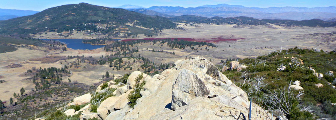
Cuyamaca Rancho State Park is a large preserve, nearly 25,000 acres, in the Peninsular Ranges of far southwest California, 35 miles northwest of San Diego; it contains granitic peaks, oak and pine woodland, canyons, streams and meadows, centred on the picturesque valley of the upper Sweetwater River. Elevations range from 3,420 feet near the river to 6,512 feet at Cuyamaca Peak, the second-highest summit in San Diego County.
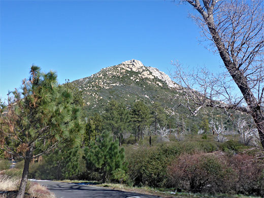
A communications tower sits on top of Cuyamaca Peak, reached by one of the many forest tracks that criss-cross the park; together with foot trails there are over 100 miles of routes available, hiking being one of the main activities, along with camping, biking and horse riding. The place is quite scenic but not especially so, in part due to the lasting effects of the 2003 Cedar Fire, which destroyed most of the native woodland; numerous dead trees remain and large areas are covered with new growth scrub.
A communications tower sits on top of Cuyamaca Peak, reached by one of the many forest tracks that criss-cross the park; together with foot trails there are over 100 miles of routes available, hiking being one of the main activities, along with camping, biking and horse riding. The place is quite scenic but not especially so, in part due to the lasting effects of the 2003 Cedar Fire, which destroyed most of the native woodland; numerous dead trees remain and large areas are covered with new growth scrub.
Cuyamaca Rancho Table of Contents
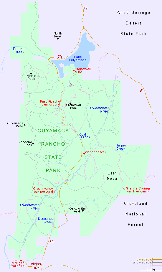
Map of Cuyamaca Rancho State Park
Photographs
21 views of the state park.
Introduction
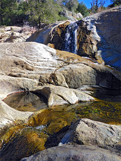
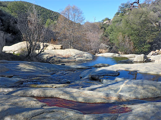
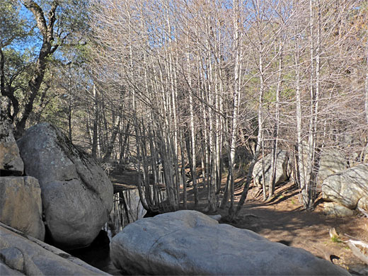
Geographic highlights of the state park are the Sweetwater River, one section of which flows through a pretty sequence of falls and pools across the granitic bedrock, and the views from the higher elevation areas - besides Cuyamaca Peak are paths to three other summits, Middle Peak, Oakzanita Peak and Stonewall Peak, this latter the most popular hiking destination in the park owing to the relatively short distance, the good views, and its isolated summit of bare rock.
Granite-type rocks (granodiorite and quartz diorite) cover around half of the park, to the south and east, while most of the remainder, including Cuyamaca Peak is gabbroic, while further north are exposures of gneiss and some metasedimentary formations.
The Park - Access and Facilities
Cuyamaca Rancho State Park is crossed by just one road, Hwy 79, running from Interstate 8 in the south, northwards to Julian, the nearest town. The preserve is mostly surrounded by the Cleveland National Forest though in the northeast it adjoins a protruding part of the vast Anza-Borrego Desert State Park, the nearest entrance to which is along Hwy 78 a few miles east of Julian. The Cuyamaca park has two regular, no hookup campgrounds, Green Valley (81 sites) and Paso Picacho (85 sites), both along the road, a group camp near Lake Cuyamaca to the north, and a primitive camp to the southeast, at Granite Springs. One other feature of interest is the fragmentary remains of Stonewall Mine, on the southern lakeshore; a gold-mining operation, active from 1870 to 1892.
Lake Cuyamaca
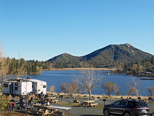
At the north edge of the park, Hwy 79 runs along the shores of Lake Cuyamaca, a reservoir formed in 1888 by construction of a dam across Boulder Creek; this the second oldest dam in California still in use. Lake Cuyamaca itself, 110 acres in area when full, lies just outside the state park, and still fulfils its original purpose of storing drinking water for San Diego - the relatively high elevation of the mountains, and the moderate to heavy winter snowfall, ensure a reliable, year around supply. The lake is a renowned fishing location, stocked with trout and other species, and is also good for boating and shoreline picnics.
Cuyamaca Rancho Trails
The interlinked tracks and paths allow for upwards of 50 recognized hikes in the state park; below are the most popular options.
Cuyamaca Peak Trail
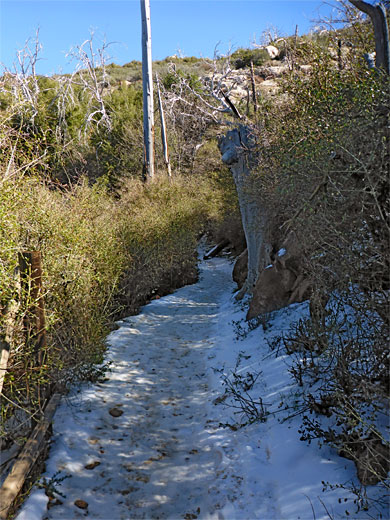
- the highest peak in the park is accessed by a fire road so the hike is not so exciting, but the views at the top make the trip worthwhile. The route starts at the Paso Picacho Campground and is mostly across fire-damaged slopes, but with surviving pine woods at the start and finish. The 2.7 mile hike gains 1,640 feet. An alternative return is via another track to the north, across Azalea Glen, to make a 7.4 mile loop.Dead Horse Falls Trail
- starting at the Merigan day use area along Viejas Boulevard in the southwest corner of the park, this easy 1.3 mile (one-way) trail follows a track to a waterfall along the Sweetwater River.Green Valley Falls
- this is a very short loop, only 0.4 miles, from the Green Valley campground, down to the floor of the Sweetwater River valley, past a sequence of pools and small waterfalls.Harvey Moore Trail
- a little-traveled, 9.7 mile loop across the East Mesa area, north of Oakzanita Peak, mostly across fairly gentle terrain of slopes and meadows, with two steeper sections; in the north, climbing from the valley of Harper Creek, and in the south, ascending from the Sweetwater Valley.Oakzanita Peak Trail
- this peak is a 5,054 foot summit near the south edge of the park, reached by a 2.9 mile trail, ascending 1,150 feet - initially along the wooded valley of Descanso Creek then steeply up the north face of the mountain.Stonewall Peak Trail
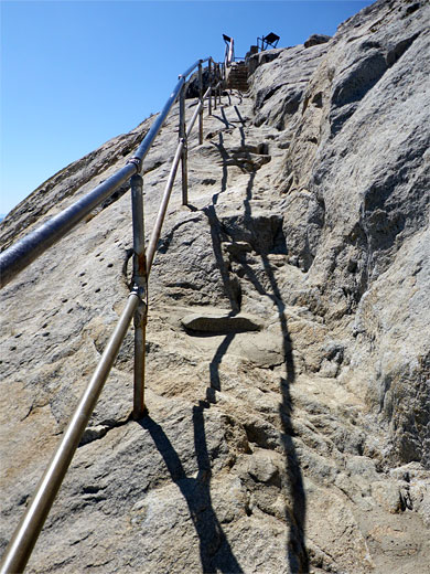
- the most popular hike in Cuyamaca Rancho State Park is a relatively short (1.9 mile) but steep ascent to a bald granite summit, elevation 5,730 feet, with fantastic 360 degree views from the top. Most of the route is through shady oak and manzanita woods. A 5 mile loop can be made by using an alternative approach from the north, from the group campground, linked by a path that parallels the park road.Sweetwater River Loop
- an 8 mile circuit around the lower portion of the Sweetwater River, starting from the Merigan day use area - heading north, up the east side, initially on a track and then a trail, crossing the river on a bridge and returning higher up the boulder-covered slopes to the west. Most of the trip is quite thickly wooded. The elevation gain is 1,150 feet.
Featured Cuyamaca Rancho Hikes
Cuyamaca Peak Trail
★★★★★
★★★★★
2.7 miles, 1,640 feet
Easy hike to the second highest summit in San Diego County, all along forest roads, mostly through fire-damaged woodlandStonewall Peak Trail
★★★★★
★★★★★
1.9 miles, 860 feet
Moderately steep ascent with many switchbacks to a bald granite summit with 360 degree viewsCuyamaca Rancho - Nearby Places
- Anza-Borrego Desert State Park (10 miles) - vast desert area with varied topography
- Mission San Diego de Alcala (38 miles) - southernmost of the California Missions
Cuyamaca Rancho - Similar Places
- Cochise Stronghold, Arizona - narrow ravines and bushy slopes in the Dragoon Mountains
- Granite Mountain, Arizona - prominent peak covered by granite cliffs and boulders
All Contents © Copyright The American Southwest | Comments and Questions | Contribute | Affiliate Marketing Disclosure | Site Map
