Death Valley Buttes, Death Valley National Park
California > Death Valley National Park > The East > Death Valley Buttes
Death Valley Buttes
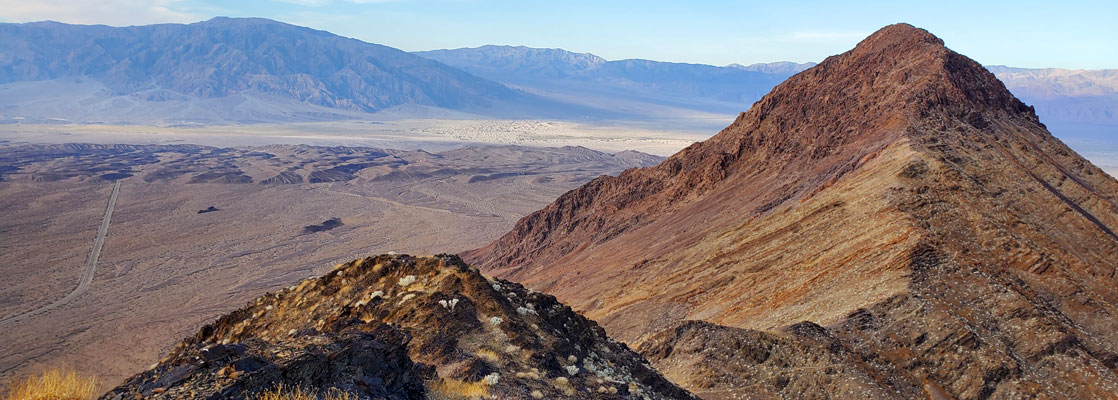
Isolated, elongated peak on the east side of Death Valley, near Hells Gate; the summit may be reached by an unmaintained trail, running all along the rocky ridgeline, with fantastic views all the way
Length: 1.5 miles
Elevation change: 970 feet
Difficulty: Easy to moderate; some loose stones, and scrambling near the summit
Type: One way, unmaintained trail
Usage: Low
Season: Fall, winter, spring
Trailhead: Daylight Pass Road, near Hells Gate
Rating (1-5): ★★★★★
Elevation change: 970 feet
Difficulty: Easy to moderate; some loose stones, and scrambling near the summit
Type: One way, unmaintained trail
Usage: Low
Season: Fall, winter, spring
Trailhead: Daylight Pass Road, near Hells Gate
Rating (1-5): ★★★★★
The Death Valley Buttes are an isolated, detached part of the Grapevine Mountains, on the east side of Death Valley near Hells Gate, composed of reddish, metamorphic rocks. The buttes form a narrow ridge, nearly 3 miles in length, with three distinct high points, 2,068 foot West Death Valley Butte, Peak 2749 towards the east end, and in the center, the main summit (Red Top), 3,017 feet. The buttes are just 4 miles from the valley floor and so offer fantastic views all around, unobscured by any intervening hills.
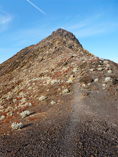
The middle summit may be reached by a hike of 1.5 miles along a faint, unmaintained path, gaining 970 feet, starting from an unmarked pullout along Daylight Pass Road. The route is up the adjacent slope a little way then all along the main ridgeline, first ascending to Peak 2749 then dropping down to a saddle, followed by a longer ascent to the summit.
The last section is more uneven and rockier, requiring scrambling with use of hands in a few places, though nothing too difficult; up to here the walking is straightforward, with loose stones on some of the inclines the only possible problem.
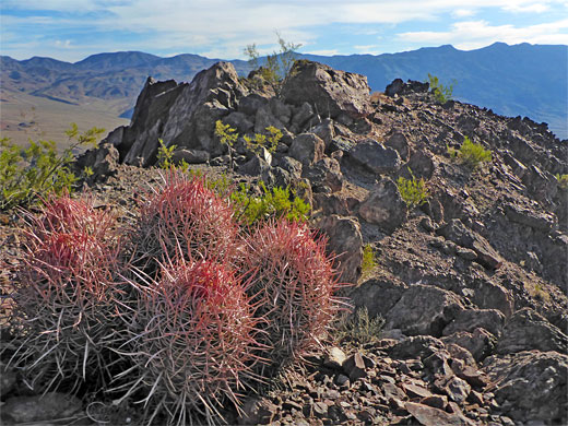
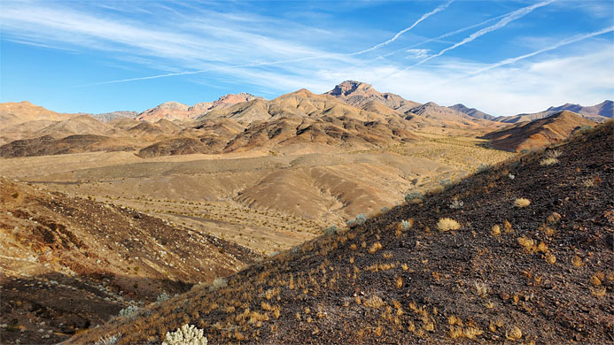
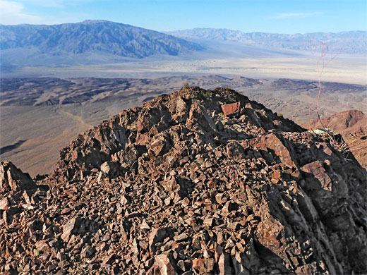
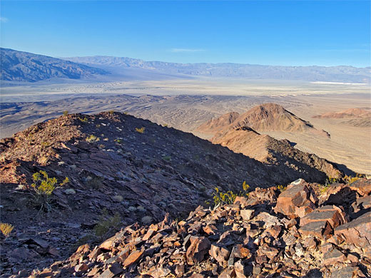
The surrounding land, like most of the Grapevine Mountains, is very little vegetated, just barren, brownish-red slopes, sprinkled with stones and boulders. The bedrock is a complex mix of dolomite, siltstone, feldspathic sandstone and arkosic sandstone. Of the limited plant life, most widespread is desert holly, whilst most conspicuous is the many-headed barrel cactus.
Map of Death Valley National Park and surroundings.
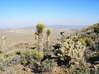
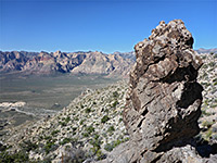
18 views of Death Valley Buttes.
Parking place for the Death Valley Buttes hike is 0.7 miles southwest of the national park information station at Hells Gate, on wide verges, either side of the road, at 2,040 feet elevation, just 150 feet from the edge of the buttes. The road is crossing the upper edge of a huge alluvial fan, which slopes down steadily to below sea level, 8 miles south.
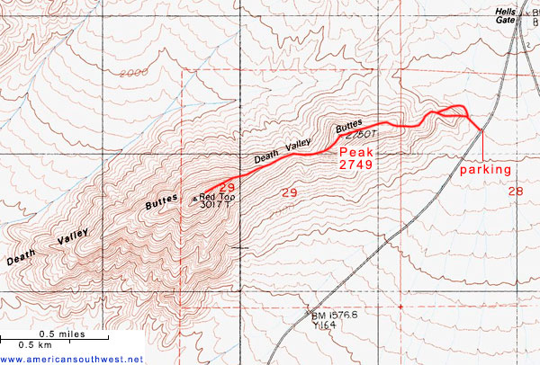
The route up the buttes begins by walking 300 feet north, just past the easternmost edge of the hills, and turning west up a small ravine, where a faint trail appears. This leads up the southern slope to a minor, angled ridge which is followed upwards. Another path joins from the right, an alternative access route that starts from a little further around the base of the butte, and then onwards, all the remainder of the hike is along the central crest. The path rises a little to an intermediate high point, after which a taller summit comes into view - Peak 2749, which in turn hides another, the main summit. The gradient is not too steep, up to this peak, after which the route descends, by 250 feet, to a saddle, followed by a longer climb, up another 500 feet. The last 50 feet or so of the climb is much rockier, requiring scrambling, and here the path is no longer evident. The flat, extended summit is marked with a USGS plaque. A few large barrel cacti grow here and not much else.
The middle summit may be reached by a hike of 1.5 miles along a faint, unmaintained path, gaining 970 feet, starting from an unmarked pullout along Daylight Pass Road. The route is up the adjacent slope a little way then all along the main ridgeline, first ascending to Peak 2749 then dropping down to a saddle, followed by a longer ascent to the summit.
The last section is more uneven and rockier, requiring scrambling with use of hands in a few places, though nothing too difficult; up to here the walking is straightforward, with loose stones on some of the inclines the only possible problem.
The surrounding land, like most of the Grapevine Mountains, is very little vegetated, just barren, brownish-red slopes, sprinkled with stones and boulders. The bedrock is a complex mix of dolomite, siltstone, feldspathic sandstone and arkosic sandstone. Of the limited plant life, most widespread is desert holly, whilst most conspicuous is the many-headed barrel cactus.
Location
Map of Death Valley National Park and surroundings.
Photographs
18 views of Death Valley Buttes.
Death Valley Buttes Video
Parking
Parking place for the Death Valley Buttes hike is 0.7 miles southwest of the national park information station at Hells Gate, on wide verges, either side of the road, at 2,040 feet elevation, just 150 feet from the edge of the buttes. The road is crossing the upper edge of a huge alluvial fan, which slopes down steadily to below sea level, 8 miles south.
The Hike
The route up the buttes begins by walking 300 feet north, just past the easternmost edge of the hills, and turning west up a small ravine, where a faint trail appears. This leads up the southern slope to a minor, angled ridge which is followed upwards. Another path joins from the right, an alternative access route that starts from a little further around the base of the butte, and then onwards, all the remainder of the hike is along the central crest. The path rises a little to an intermediate high point, after which a taller summit comes into view - Peak 2749, which in turn hides another, the main summit. The gradient is not too steep, up to this peak, after which the route descends, by 250 feet, to a saddle, followed by a longer climb, up another 500 feet. The last 50 feet or so of the climb is much rockier, requiring scrambling, and here the path is no longer evident. The flat, extended summit is marked with a USGS plaque. A few large barrel cacti grow here and not much else.
Topographic Map

Death Valley Buttes - Similar Hikes
All Contents © Copyright The American Southwest | Comments and Questions | Contribute | Affiliate Marketing Disclosure | Site Map
