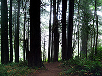
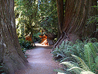
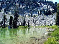
Two highlights of north California are the amazing geological features of Lassen Volcanic National Park, and the giant trees of Redwood National and State Parks. Both parks have many excellent trails.
Map shows trailhead locations
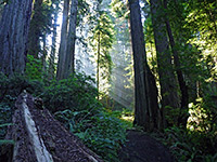
| 1. Big Tree Trail, Humboldt Redwoods State Park Length 1.2 miles (1.9 km) Elevation change 0 feet (0 meters) Difficulty Easy Rating (1-5) ★★★★★ Level path through majestic redwood groves beside Bull Creek, along Mattole Road. Forms a 2.4 mile loop with the Homestead Trail. |
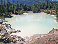
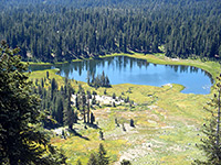
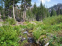
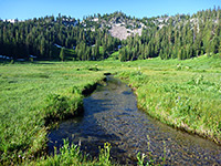
| 2. Boiling Springs Lake, Lassen Volcanic National Park Length 0.8 miles (1.3 km) Elevation change 300 feet (91 meters) Difficulty Easy Rating (1-5) ★★★★★ Set in a deep crater in the mixed fir/pine/cedar forest, Boiling Springs Lake contains simmering, acidic, 125°F water and is surrounded by many small vents, pools and mud pots. The path leading to the lake (part of the Pacific Crest Trail) follows a small stream across a meadow then climbs through the trees, circling around the crater rim though not passing particularly close to any of the thermal springs. It then heads further southeast towards Terminal Geyser (2.9 miles), a recently-created steaming vent thought to result from nearby drilling operations (since abandoned). |
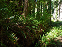
| 3. Boy Scout Tree Trail, Jedediah Smith Redwoods State Park Length 2.6 miles (4.2 km) Elevation change 300 feet (91 meters) Difficulty Easy Rating (1-5) ★★★★★ Starting along the unpaved and narrow Howland Hill Road, this little-used, 2.6 mile trail climbs from Mill Creek Valley through several types of forest, passing many redwoods both large and small, and ending at a small cascade (Fern Falls) close to the west edge of the state park. Near the end, a spur path reaches the Boy Scout Tree - a conjoined redwood. |
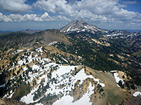
| 4. Brokeoff Mountain, Lassen Volcanic National Park Length 3.5 miles (5.6 km) Elevation change 2600 feet (792 meters) Difficulty Moderate to strenuous Rating (1-5) ★★★★★ The southernmost trail in the national park climbs steeply from a pull out near the entrance station, runs alongside a forested creek then rises above the treeline to a ridge on the south side of Brokeoff Mountain, a remnant of ancient Mount Tehama. The last section zig-zags up the south face of the peak to the 9,235 foot summit, for unsurpassed views of the surroundings. Because of the high elevation, the path is not normally free of snow until August. |
| 5. Brown Creek Trail, Prairie Creek Redwoods State Park Length 1.3 miles (2.1 km) Elevation change 280 feet (85 meters) Difficulty Easy Rating (1-5) ★★★★★ From a trailhead on the east side of the scenic drive, this path follows the cool, well-watered ravine of Brown Creek where the giant redwoods grow particularly close together, before climbing gradually into a slightly drier environment of mixed fir and redwoods, up to a junction with the Rhododendron Trail. A good 3.4 mile loop hike can be made by walking south along this route for a mile then returning to the start point via the lesser-used South Fork Trail. |
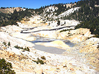
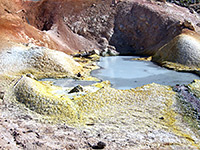
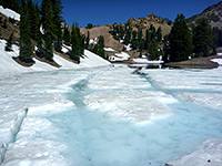
| 6. Bumpass Hell, Lassen Volcanic National Park Length 1.5 miles (2.4 km); (west route) Elevation change 300 feet (91 meters) Difficulty Easy Rating (1-5) ★★★★★ Although unspectacular by Yellowstone's standards, Bumpass Hell is the largest thermal area in Lassen, and in summer many visitors walk the easy trail to the basin, starting near Lake Helen (the west route). The location may also be reached from the Kings Creek picnic area trailhead (the east route), a rather more difficult hike of 2.5 miles. The heavy winter snowfall along the trail does not usually melt until the start of July. |
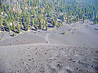
| 7. Butte Lake and Cinder Cone, Lassen Volcanic National Park Length 1.5 miles (2.4 km) Elevation change 850 feet (259 meters) Difficulty Moderate - easy approach followed by a steep climb up the cone Rating (1-5) ★★★★★ Cinder Cone is a well preserved volcanic peak, symmetrical in shape, black in color and completely lacking in vegetation - a highlight of the national park yet one that few people see owing to its isolated location. The trail to the summit starts at Butte Lake and passes through open woodland alongside the Fantastic Lava Beds and the edge of the Painted Dunes before the difficult climb up shifting cinders and lava to the crater on top of the peak. The path then circles the rim and descends to the floor of the crater. |
| 8. Carruthers Cove Trail, Prairie Creek Redwoods State Park Length 0.8 miles (1.3 km) Elevation change 560 feet (171 meters) Difficulty Easy Rating (1-5) ★★★★★ The northernmost trail in the state park starts a mile from the south end of the Coastal Drive; it descends steeply, through a small band of redwoods and into more diverse forest of red alder, sitka spruce and salmonberry. The path then enters an overgrown ravine at the lower end of Johnson Creek and emerges to a sandy section of Pacific Ocean beach (Carruthers Cove), next to a shallow lagoon and a large protruding cliff face. From here the Coastal Trail heads south, linking with the road to Fern Canyon. |
| 9. Cheetham Grove Trail, Grizzly Creek Redwoods State Park Length 0.7 miles (1.1 km) Elevation change 0 feet (0 meters) Difficulty Easy Rating (1-5) ★★★★★ Loop through the best grove of redwoods in the park, occupying the inside of a big bend along the Van Duzen River. The grove has a very pristine, regular appearance, the calmness only slightly spoilt by traffic noise, faintly audible along most of the loop. A few spur trails reach specific trees, a short distance off the main path. |
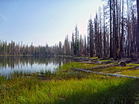
| 10. Cluster Lakes Loop, Lassen Volcanic National Park Length 11 miles (17.7 km); round trip Elevation change 800 feet (244 meters) Difficulty Moderate - not difficult, but long Rating (1-5) ★★★★★ Long hike across mostly level or gently sloping terrain in the middle of the park, past 13 lakes and ponds, all surrounded by thick forest, some burnt in a recent wildfire. A reasonable selection of wildflowers in summer, though much of the woodland is rather dry. Some lakes are reachable by shorter, one-way hikes. |
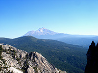
| 11. Crags Trail, Castle Crags State Park Length 2.7 miles (4.3 km) Elevation change 1950 feet (594 meters) Difficulty Moderate Rating (1-5) ★★★★★ The main feature of Castle Crags State Park is an enjoyable trail that starts off through thick, tall woodland but gradually encounters more open terrain. The upper reaches cross stark granite slickrock, and the path ends at the brink of a chasm next to Castle Dome, a major summit at the edge of a spectacular group of jagged peaks. |
| 12. Crumbaugh Lake, Lassen Volcanic National Park Length 1.2 miles (1.9 km) Elevation change 230 feet (70 meters) Difficulty Easy Rating (1-5) ★★★★★ From the end of the side road to Kings Creek picnic area a short trail leads southwards through open woodland to the shallow Cold Boiling Lake, some parts of which gently bubble due to escaping carbon dioxide gas. The path forks here; one branch has a steep ascent towards Bumpass Hell while the other descends through a patch of thicker woodland to larger Crumbaugh Lake, enclosed by long grass and reeds. It then crosses a wooded ridge and winds down the hillside beyond towards Mill Creek Falls. |
| 13. Damnation Creek Trail, Del Norte Coast Redwoods State Park Length 2 miles (3.2 km) Elevation change 1000 feet (305 meters) Difficulty Moderate to strenuous Rating (1-5) ★★★★★ Excellent trail that winds through ancient redwood groves beside US 101 then descends a steep slope of mixed coastal woodland to a secluded rocky beach by the Pacific Ocean, lined by tall cliffs and eroded rocks, plus a photogenic wave-cut arch. |
| 14. Devils Kitchen and Warner Valley, Lassen Volcanic National Park Length 2.1 miles (3.4 km) Elevation change 440 feet (134 meters) Difficulty Easy Rating (1-5) ★★★★★ Devils Kitchen is the second largest thermal area in Lassen Volcanic National Park, and one that receives far fewer visitors than the main region at Bumpass Hell. It is reached by an easy trail that crosses a large meadow then leads through thick forest to the rim of the steep-sided valley of Hot Springs Creek, location of many small fumaroles and hot pools. The trail is heavily used by mule trips from the nearby Drakesbad Guest Ranch, so can be rather smelly. Another path branches off southwards and climbs a forested hillside for one mile to Drake Lake, then heads further south, exits the park and meets a track in Lassen National Forest. |
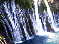
| 15. Falls Loop Trail, McArthur-Burney Falls Memorial State Park Length 1.3 miles (2.1 km); (loop) Elevation change 200 feet (61 meters) Difficulty Easy Rating (1-5) ★★★★★ This trail first descends to the base of spectacular Burney Falls then continues north (downstream) a way, crossing the creek on a footbridge, turning south and climbing back to the brink of the falls (only limited views available from this side), then re-crossing a little way upstream, back to the start. |
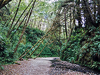
| 16. Fern Canyon Trail, Prairie Creek Redwoods State Park Length 0.7 miles (1.1 km); (loop) Elevation change 160 feet (49 meters) Difficulty Easy Rating (1-5) ★★★★★ Perhaps the most unusual trail in Prairie Creek Redwoods State Park is the short loop around beautiful Fern Canyon, a sheer-sided, flat-floored ravine whose 30 foot walls are densely covered with dark green ferns. The path starts on Gold Bluffs Beach, accessed by the unpaved Davison Road (not for vehicles over 24 feet). |
| 17. Grizzly Creek/Hikers Loop, Grizzly Creek Redwoods State Park Length 0.8 miles (1.3 km) Elevation change 200 feet (61 meters) Difficulty Easy Rating (1-5) ★★★★★ Loop across steep slopes above the Van Duzen River, in the main section of the state park, encountering some large redwoods close to the highway, but otherwise rather smaller trees. |
| 18. Hatton Trail, Jedediah Smith Redwoods State Park Length 2.1 miles (3.4 km) Elevation change 350 feet (107 meters) Difficulty Easy Rating (1-5) ★★★★★ The Hatton Trail begins along US 199, opposite the more popular Simpson Reed Trail. One short section loops round an overgrown redwood grove close to the highway, but the main path leads east, climbing the hillside well away from the highway into a more uniform redwood forest then becoming fairly level for a while (and closer to the road) before joining the Hiouchi Trail near the Smith River. Along the way is a short spur to a small cluster of slightly larger redwoods, the Lohse Grove. |
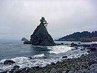
| 19. Hidden Beach Trail, Redwood National and State Parks Length 0.7 miles (1.1 km) Elevation change 50 feet (15 meters) Difficulty Easy Rating (1-5) ★★★★★ Hidden Beach is small, secluded and scenic, lined by tidepools, piles of driftwood and weathered rock formations. A photogenic, steep-sided rock lies a little way out to sea, topped by a few wind blown trees. The beach may be reached either by a path starting immediately north of Trees of Mystery along US 101, or via the Coastal Trail branching off the Yurok Loop. |
| 20. Homestead Trail, Humboldt Redwoods State Park Length 1.2 miles (1.9 km) Elevation change 100 feet (30 meters) Difficulty Easy Rating (1-5) ★★★★★ Short route through varied redwood forest, a little way up the side of the thickly forested valley of Bull Creek, in the quieter, western section of the state park. Forms a loop with the Big Tree Trail. |
| 21. James Irvine Trail, Prairie Creek Redwoods State Park Length 5.1 miles (8.2 km) Elevation change 250 feet (76 meters) Difficulty Easy to moderate Rating (1-5) ★★★★★ James Irvine is amongst the premier trails in the park, encountering some of the largest trees and the densest forest. The eastern trailhead is by the visitor center along the Drury Parkway, from where the path climbs gently along the wide valley of Godwood Creek, crosses a low saddle then descends the slightly narrower ravine formed by Home Creek, passing Fern Canyon and meeting the Coastal Trail along Gold Bluffs Beach. Walking south for 1.2 miles reaches the west end of the Miners Ridge Trail, which can be used to form an 11.5 mile loop - perhaps the best all-day hike in the area. |
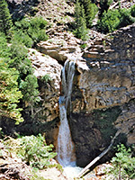
| 22. Kings Creek Falls, Lassen Volcanic National Park Length 1.5 miles (2.4 km) Elevation change 500 feet (152 meters) Difficulty Moderate - steep descent to the base of the falls Rating (1-5) ★★★★★ The 40 foot waterfall on Kings Creek is a popular destination, suitable for families with children; the path is level at first as it crosses marshy meadowland beside the stream then passes through a belt of thick pine forest to the top of a staircase-like cascade that precedes the falls. It then descends steeply to the brink of the main drop. Two long distance paths fork off en route, to Warner Valley and Corral Meadow. |
| 23. Lady Bird Johnson Grove, Redwood National and State Parks Length 1.4 miles (2.3 km); (loop) Elevation change 100 feet (30 meters) Difficulty Easy Rating (1-5) ★★★★★ The most popular trail in Redwood National Park loops around a fine collection of old growth redwoods on a level hilltop, passing the site of the 1969 dedication ceremony, attended by the wife of the 36th president, after whom the grove was named. The trailhead is 2.5 miles along Bald Hills Road. This location is far enough from the main road to be unaffected by traffic noise, though the tranquility is sometimes spoilt by the large number of visitors. |
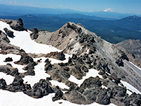
| 24. Lassen Peak, Lassen Volcanic National Park Length 2.4 miles (3.9 km) Elevation change 1957 feet (596 meters) Difficulty Strenuous Rating (1-5) ★★★★★ Beginning at an already high elevation of 8,500 feet, the well defined trail up the south face of Lassen Peak gains another 2,000 feet as it switchbacks across a steep slope of stones and lava blocks to the wind-swept summit, from where the 360-degree views extend for 80 miles in some directions. Because of snowfall, the trail is only open for several months each year. |
| 25. Little Bald Hills Trail, Jedediah Smith Redwoods State Park Length 9.6 miles (15.4 km); 3.2 miles to the first open area Elevation change 1600 feet (488 meters) Difficulty Moderate; quite steep in some parts Rating (1-5) ★★★★★ The only route in the park which is also open to cycles and horses, this trail climbs steadily from the ferns and redwoods near the Smith River into mixed fir/cedar forest and then to open Jeffrey pine woodland at nearly 2,000 feet. The trail enters a detached section of Redwood National Park after one mile, and eventually meets a track linking with the South Fork Road. |
| 26. Manzanita Creek, Lassen Volcanic National Park Length 3.5 miles (5.6 km) Elevation change 1110 feet (338 meters) Difficulty Easy, though relatively long Rating (1-5) ★★★★★ Starting at the south edge of Manzanita Lake Campground, one of the longest and least used day hike trails in the park climbs steadily through mixed pine/fir woodland for 2 miles then meets Manzanita Creek near its upper end. The remainder of the walk is across meadows and wildflower groves beside the stream, with good views of the volcanic peaks to the south. |
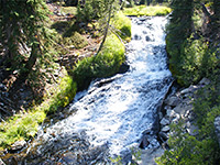
| 27. Mill Creek Falls, Lassen Volcanic National Park Length 1.5 miles (2.4 km) Elevation change 300 feet (91 meters) Difficulty Easy Rating (1-5) ★★★★★ The highest waterfall in the national park (70 feet) is reached by an easy trail that descends gradually through woods and floral meadows to an overlook directly above the drop. The path, now rather less traveled, continues another 1.7 miles to Crumbaugh Lake and then to the Kings Creek picnic area. |
| 28. Miners Ridge Trail, Prairie Creek Redwoods State Park Length 3.6 miles (5.8 km) Elevation change 450 feet (137 meters) Difficulty Easy Rating (1-5) ★★★★★ Forking off the James Irvine Trail near its eastern end, the Miners Ridge route climbs to a narrow ridge and drops down quite steeply towards Squashan Creek, entering a particularly cool, dark and overgrown section of the redwood forest. The path - established by gold miners in the 1880s - follows the creek downstream and exits the trees next to the campground at Gold Bluffs Beach. Together with the James Irvine Trail, the Coastal or Clintonia Trails enable a loop hike, of 11.7 or 7.3 miles respectively. |
| 29. Ossagon Trail, Prairie Creek Redwoods State Park Length 2.7 miles (4.3 km); to the furthest rocks Elevation change 730 feet (223 meters) Difficulty Easy to moderate Rating (1-5) ★★★★★ Starting near the north end of the scenic drive, the Ossagon Trail (a former logging track) is a varied route starting near the upper end of Prairie Creek; through old growth redwoods to a ridge then down into mixed coastal woodland, close to a pretty stream and out to grassland beside a wide, grey sand beach. Nearby are wetlands, freshwater pools and isolated rocks. |
| 30. Paradise Meadows, Lassen Volcanic National Park Length 1.4 miles (2.3 km) Elevation change 700 feet (213 meters) Difficulty Easy Rating (1-5) ★★★★★ The Paradise Meadows Trail begins just south of the Devastated Area, first passing close to the east side of Hat Lake then climbing quite steeply up the forested hillside beyond, up to a marshy, flower-filled meadow set in a basin enclosed on three sides by higher cliffs. Just before the meadow, a less used path branches southwest, gaining height steadily over the next 1.2 miles to a junction with the trail to Terrace Lake. |
| 31. Prairie Creek Trail, Prairie Creek Redwoods State Park Length 4 miles (6.4 km) Elevation change 350 feet (107 meters) Difficulty Easy Rating (1-5) ★★★★★ This trail runs most of the way along Prairie Creek, generally on the west side a short distance above the water, though crossing the stream several times and spending a little time on the east side. It can be accessed from several places along the scenic drive, and links with three paths that climb the steep hills to the west, up to the high ridge at the center of the park. Some sections are within hearing distance of the road but most are quiet and peaceful. All the route encounters very dense, old growth forest of redwoods and maples. |
| 32. Ridge Lakes, Lassen Volcanic National Park Length 1 mile (1.6 km) Elevation change 1045 feet (319 meters) Difficulty Moderate - short but steep Rating (1-5) ★★★★★ Starting from the parking area next to the Sulphur Works, the short but steep Ridge Lakes Trail ascends a partly wooded hillside to the two interconnected Alpine lakes, situated in a sheltered glacial basin surrounded by colorful, volcanic slopes. |
| 33. Simpson Reed Trail, Jedediah Smith Redwoods State Park Length 1 mile (1.6 km) Elevation change 20 feet (6 meters) Difficulty Easy Rating (1-5) ★★★★★ Simpson Reed, and the connected Peterson Memorial Trail, is the most popular path in the state park owing to its short length (one mile), ease of access and the spectacular redwoods along the route. |
| 34. South Fork Trail, Prairie Creek Redwoods State Park Length 1 mile (1.6 km) Elevation change 560 feet (171 meters) Difficulty Easy Rating (1-5) ★★★★★ Like the Brown Creek Trail just to the north, the South Fork Trail links the park road with the high elevation Rhododendron Trail, running mostly along a wooded ridge covered by ancient old growth redwoods, and gaining height quite steeply. The three trails can be used to form a 3.4 mile loop. |
| 35. Spattercone Trail, Hat Creek Volcanic Area Length 1.7 miles (2.7 km); (loop) Elevation change 200 feet (61 meters) Difficulty Easy Rating (1-5) ★★★★★ This short loop trail visits several craters, lava cave entrances, fissures and other, small scale formations, all associated with a large area of volcanic features around Hat Creek, north of Lassen Volcanic National Park. |
| 36. Stout Grove Trail, Jedediah Smith Redwoods State Park Length 0.6 miles (1 km); (loop) Elevation change 40 feet (12 meters) Difficulty Easy Rating (1-5) ★★★★★ This short (0.6 mile) path loops around what some consider to be the most photogenic grove of redwoods in the park, situated on flattish land by the junction of Mill Creek and the Smith River. Like most places in the area the trees are mixed with ferns and a variety of other verdant green plants; tallest redwood here is the 340 foot Stout Tree. Access is from the Howland Hill Road or (in summer) via a footbridge over the Smith River, linking with the campground/day use area. |
| 37. Symbol Bridge Cave, Lava Beds National Monument Length 0.9 miles (1.4 km) Elevation change 0 feet (0 meters) Difficulty Easy Rating (1-5) ★★★★★ This trail passes two short lava tunnels (Big Painted Cave and Symbol Bridge Cave), both of which contain a varied assortment of pictographs; ancient designs painted in black, grey and red on some of the basalt boulders near the entrances. |
| 38. Tall Trees Grove, Redwood National and State Parks Length 1.8 miles (2.9 km) Elevation change 700 feet (213 meters) Difficulty Easy to moderate; not long but rather steep Rating (1-5) ★★★★★ Some of the largest trees in the national park may be seen via a lightly used trail that descends quite steeply through mixed forest including some smaller redwoods to the edge of Redwood Creek, ending with a short loop section around a small grove of much bigger specimens. A free permit is necessary to visit this area, and access is by a narrow, unpaved track, forking off Bald Hills Road 7 miles from US 101. |
| 39. Terrace, Shadow and Cliff Lakes, Lassen Volcanic National Park Length 1.8 miles (2.9 km) Elevation change 700 feet (213 meters) Difficulty Easy to moderate Rating (1-5) ★★★★★ Three of the prettier lakes in Lassen Volcanic National Park may be accessed from the same trail, a generally easy route that begins along the park road 2 miles east of Lassen Peak. Cliff Lake is the most scenic, set directly beneath the near-vertical north face of Reading Peak. The path continues another 2.4 miles to an alternative starting point beside the Summit Lake North campground. |
| 40. Trillium Falls Trail, Redwood National and State Parks Length 2.8 miles (4.5 km); (loop) Elevation change 370 feet (113 meters) Difficulty Easy Rating (1-5) ★★★★★ Starting from the Elk Meadows day use parking lot at the south end of Davison Road, just off US 101, this loop trail first climbs a little way up a redwood-covered hillside to a small waterfall enclosed by mossy, fern-draped rocks, then descends gradually, passing a good selection of large trees. After crossing an old vehicle track, the path turns back and runs close to the east edge of the forest, still through some impressive redwood groves. |
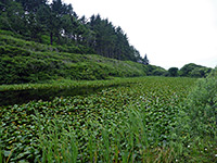
| 41. Yurok Loop Trail, Redwood National and State Parks Length 1 mile (1.6 km); (loop) Elevation change 100 feet (30 meters) Difficulty Easy Rating (1-5) ★★★★★ The trailhead for this easy hike is at the Lagoon Creek picnic area, along US 101 one mile north of Trees of Mystery. The path encounters mixed coastal forest (no redwoods), and has views of False Klamath Cove, sea stacks in the Pacific, and a lily pad-covered pond. |
All Contents © Copyright The American Southwest | Comments and Questions | Contribute | Affiliate Marketing Disclosure | Site Map

