Highlights:
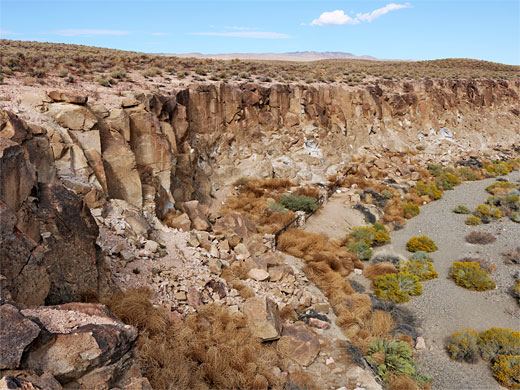
Numerous petroglyphs on a low cliff of rhyolitic tuff at the edge of Chalfant Valley, on the east side of the Volcanic Tableland. Viewed by a 0.5 mile loop hike, starting along a track that leads right to the base of the cliff
Trailhead:
Along a track (Petroglyph Road), 0.9 miles from US 6

The site is reached by an unpaved track, Petroglyph Road, which is generally fine for all vehicles, and located just 0.8 miles from US 6, and 17 miles north of Bishop. They may be viewed along a loop hike of half a mile; the parking place along the track is right at the base of the cliffs, approximately in the middle of the petroglyphs, which extend about an eighth of a mile in either direction.
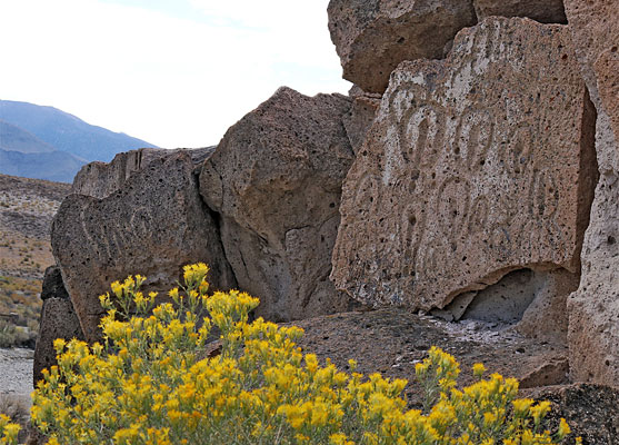
The bedrock is soft, light brown to almost white in color, though weathering to darker shades, and often fracturing to create smooth vertical faces, making it an ideal canvas for the rock art, some of which is at least 1000 years old. The site was added to the National Register of Historic Places in 2000. All the rocks hereabouts are from the Chidago ash-flow; specifically they are non-welded, rhyolitic lapilli tuff.
Chalfant Petroglyphs Table of Contents
Photographs
31 views of the Chalfant Petroglyphs.
Location
Map of the Volcanic Tableland.
Access
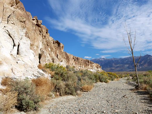
The unsigned track, Petroglyph Road, forks west off US 6, 3.5 miles north of the settlement of Chalfant. After 1500 feet it bends to the north, and in another 600 feet a lesser track forks west, narrower but still with a relatively smooth surface. This track descends a gentle slope to a parking place with wooden railings beside a minor wash, 100 feet from the base of the cliff. The wash may be called Spring Canyon Creek, or Millner Creek, and is dry for most of the year, lined by rabbitbrush and other shrubs including tumbleweed, the dried stems of which tend to accumulate below the cliff.
The Petroglyphs
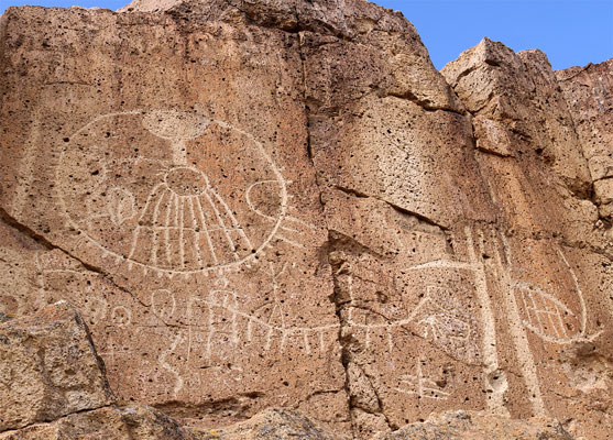
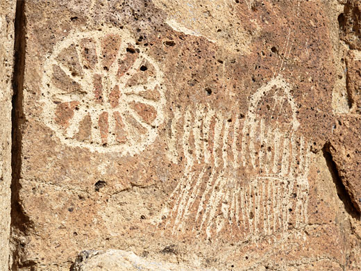
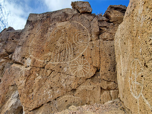
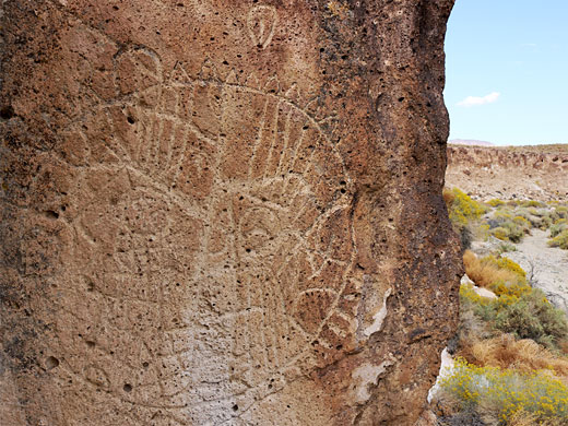
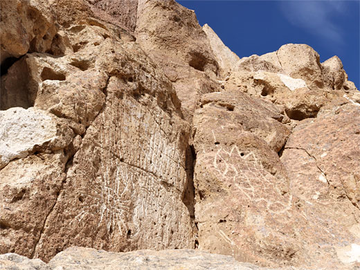
The tuff cliffs are at most 20 feet high, sheer in a few places though less steep in others, and there are several points where it is possible to climb to the rim of the plateau above. A few petroglyphs can be seen directly opposite the parking place, though most are in two groups a short distance north and south. The southern group, reached after a short break where the cliffs fall away, have generally smaller designs, while the main, northern group includes many large and spectacular effigies, most conspicuous based around large circles - up to 3 feet across, with other elements within. Also represented are handprints, arrows, anthropomorphs, shields, rows of short parallel lines - maybe counters, angular shapes, wavy lines, and, perhaps most unusual, vulvas, representing fertility. The petroglyphs are in various states of preservation from very faded and weathered to fresh and crisp; a few look recent but the great majority are clearly ancient. In a few places larger sections of the adjacent rock face have eroded away, leaving the panels incomplete.
All Contents © Copyright The American Southwest | Comments and Questions | Contribute | Affiliate Marketing Disclosure | Site Map