Cook's Meadow Loop, Yosemite National Park
California > Yosemite National Park > Yosemite Valley > Hiking > Cook's Meadow Loop
Cook's Meadow Loop Trail
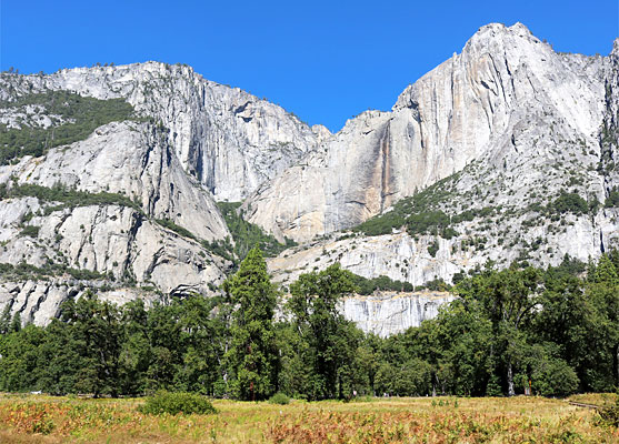
The open spaces of Cook's Meadow provide excellent views of the cliffs above Yosemite Valley, and Yosemite Falls. A wheelchair-accessible path loops around the edge of the grassland, between Northside Drive and Superintendent's Bridge over the Merced River, this reached by a short spur trail
Length: 0.9 miles, round trip
Elevation change: 15 feet
Difficulty: Easy
Type: Loop
Usage: High
Season: All year
Trailhead: Parking place along Sentinel Drive
Rating (1-5): ★★★★★
Elevation change: 15 feet
Difficulty: Easy
Type: Loop
Usage: High
Season: All year
Trailhead: Parking place along Sentinel Drive
Rating (1-5): ★★★★★

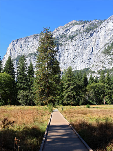
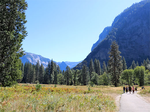
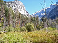
Cook's Meadow is an area of lush grassland, boggy in places, on the north side of the Merced River in Yosemite National Park, right at the center of the busiest area of Yosemite Valley, between Yosemite Lodge and Yosemite Village. The 0.9 mile Cook's Meadow Loop, mostly around the perimeter, encounters a few patches of trees, but otherwise just long grass and summer wildflowers, and has excellent views up and down the valley, and of the granite cliffs above, including, to the north, those either side of Upper Yosemite Fall, hence the trail is one of the most popular in the valley.
The meadow is named after the Cook family, who resided nearby in the late 1800s, after moving here from New York; the first was John Jay Cook, 1837-1904. The grassland was used by the family for cattle grazing, at which time they were living in Stoneman House, a grand lodge which was destroyed by fire in 1896, replaced by a smaller structure, still standing, in Curry Village.
The closest parking place to Cook's Meadow is on the south edge, along Sentinel Drive, just north of Sentinel Bridge over the Merced River, shuttle stop 11. This is often full, however, in which case, the next nearest place is the much larger lot serving Yosemite Village, which always has spaces. This is 0.2 miles east along Sentinel Drive.
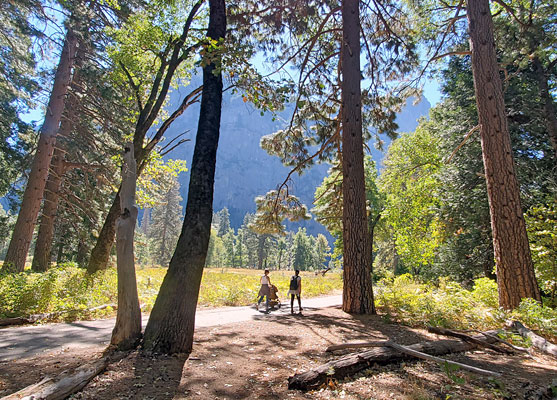
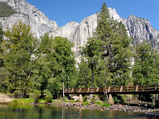
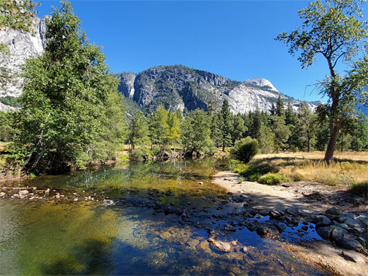
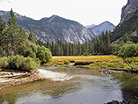
From the Sentinel Bridge parking place, the paved path heads west through the meadow, flanked by long grass and summer wildflowers, including showy milkweed, favored plant of the monarch butterfly. The path briefly changes to a boardwalk to cross a wetter section, then after a few trees reaches a junction with a short spur down to the Merced River, crossing it on Superintendent's Bridge. Around here are some good photo locations, especially from the south bank of the river, where the calm waters allow reflections of the meadow and the cliffs around Yosemite Falls. Just downstream of the bridge is a deep pool, suitable for swimming. A gauge on the bridge records water levels of five great floods in the 20th century, the most severe in 1997, when the bridge was completely covered by the water. Past the junction, the main path bends north, soon entering woodland and intersecting Northside Drive. A lesser path parallels the road eastwards, heading towards the far corner of the meadow, from where the final segment of the loop leads south over another marshy area and a patch of woodland, back to the Sentinel Bridge parking place.
The meadow is named after the Cook family, who resided nearby in the late 1800s, after moving here from New York; the first was John Jay Cook, 1837-1904. The grassland was used by the family for cattle grazing, at which time they were living in Stoneman House, a grand lodge which was destroyed by fire in 1896, replaced by a smaller structure, still standing, in Curry Village.
Parking
The closest parking place to Cook's Meadow is on the south edge, along Sentinel Drive, just north of Sentinel Bridge over the Merced River, shuttle stop 11. This is often full, however, in which case, the next nearest place is the much larger lot serving Yosemite Village, which always has spaces. This is 0.2 miles east along Sentinel Drive.
The Trail
From the Sentinel Bridge parking place, the paved path heads west through the meadow, flanked by long grass and summer wildflowers, including showy milkweed, favored plant of the monarch butterfly. The path briefly changes to a boardwalk to cross a wetter section, then after a few trees reaches a junction with a short spur down to the Merced River, crossing it on Superintendent's Bridge. Around here are some good photo locations, especially from the south bank of the river, where the calm waters allow reflections of the meadow and the cliffs around Yosemite Falls. Just downstream of the bridge is a deep pool, suitable for swimming. A gauge on the bridge records water levels of five great floods in the 20th century, the most severe in 1997, when the bridge was completely covered by the water. Past the junction, the main path bends north, soon entering woodland and intersecting Northside Drive. A lesser path parallels the road eastwards, heading towards the far corner of the meadow, from where the final segment of the loop leads south over another marshy area and a patch of woodland, back to the Sentinel Bridge parking place.
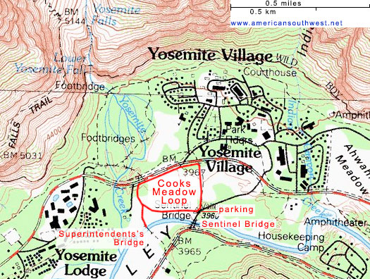
Map of Cook's Meadow
Cook's Meadow Loop - Similar Hikes

All Contents © Copyright The American Southwest | Comments and Questions | Contribute | Affiliate Marketing Disclosure | Site Map