Highlights:
Epitome of Nevada's basin and range landscapes - a very remote region in the far northwest, where stark, treeless mountains enclose a vast dry lake bed, home to the Burning Man festival
Nearby town:
Fernley, 78 miles
Management:
BLM
Location:
40.769, -119.230 (Black Rock City)
Seasons:
Spring, summer, fall; the lake bed is wet and/or frozen in winter
Rating (1-5):
★★★★★
Black Rock Desert is part of the Great Basin Desert itinerary
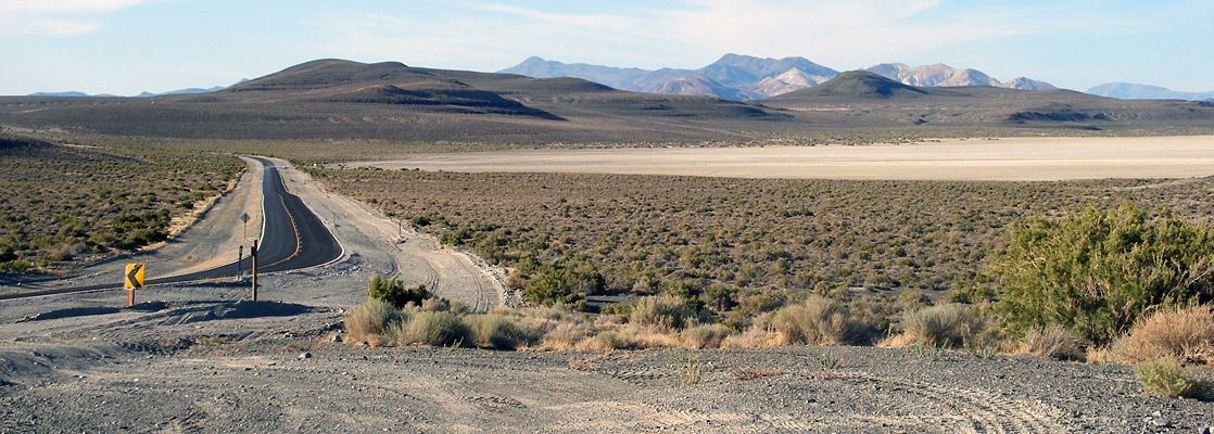
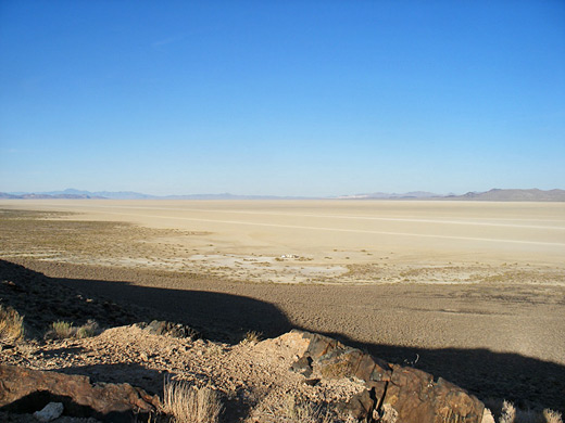
The basin and range topography that characterizes most landscapes in Nevada is best illustrated by the Black Rock Desert in the far northwest, where the ground is flat for over 400 square miles, between the barren but mineralized Calico and Jackson mountain ranges. This part of the state was once covered by a huge area of water (Lake Lahontan), remnants of which are found today at the Carson Sink and Pyramid Lake, but most of its former area is now just a series of dry, alkaline flats, of which the Black Rock Desert is the largest example.
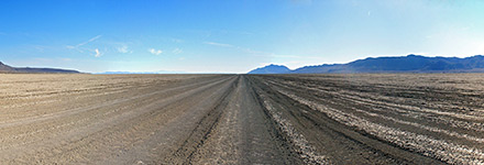
The levellest and most uniform section is the Black Rock Playa, which stretches for 35 miles, beginning just south of the small town of Gerlach and extending northeast towards the edge of the Black Rock Range - a region completely dry much of the year though partially flooded (and frozen) during winter. Together with the surrounding mountains and a remote, historically-important valley to the northwest (High Rock Canyon), the desert is managed by the BLM as a lightly-regulated, multi-use recreation district - a National Conservation Area (NCA) - offering many opportunities for adventurous, self-reliant visitors including cross-country hiking, primitive camping, off road driving, rock collecting and hunting.
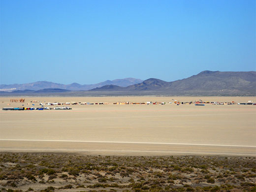
The playa is also home to the annual Burning Man event, attracting 50,000 people for a week-long festival at a temporary city built in the middle of the dry lake bed ten miles from Gerlach.
Black Rock Desert Table of Contents
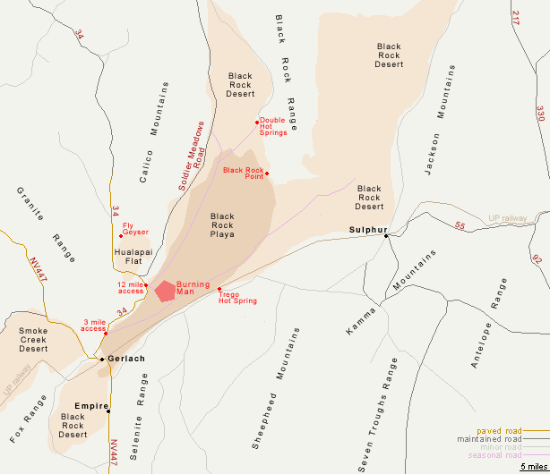
Map of the Black Rock Desert
Photographs
16 views of the Black Rock Desert.
Approach to Black Rock Desert from the South
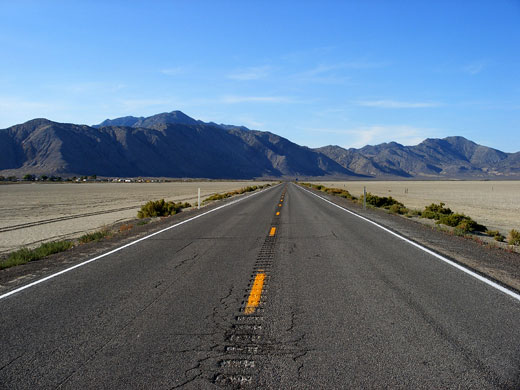
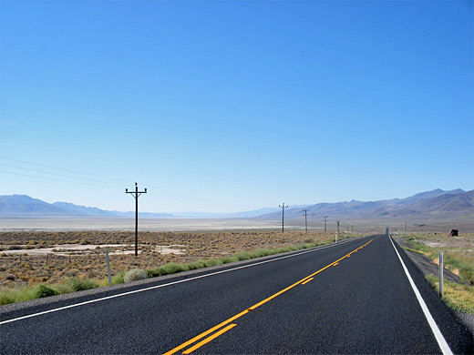
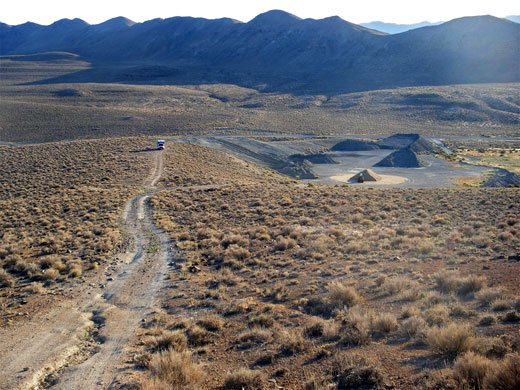
The usual approach to the Black Rock Desert is from the south, via a long straight road (NV 447) leading north from the Pyramid Lake Indian Reservation, and passing no development of any kind. Once past Nixon, the only significant town in the reservation, much of the 60 miles to Gerlach is through a straight, narrow valley, containing the dry bed of Winnemucca Lake and lined by treeless, grassy mountains. The last few miles pass over an undulating hilly area, site of a few working mines, before the highway descends to the edge of the desert and the tiny village of Empire, which has a general store, a few houses, a gypsum processing plant, an airstrip and even a 9-hole golf course. The road then crosses the south end of Black Rock Playa, here just half a mile wide, and reaches Gerlach, a slightly larger settlement of around 100 homes, a gas station, railway sidings, and a selection of bars and other businesses, including the permanent headquarters of the Burning Man organization. A BLM caravan on the north side of town has information about the NCA, and free maps.
Black Rock Playa
Past Gerlach, NV 447 turns away to the northwest, reaching Alturas in California after 82 empty miles. The main access to the Black Rock Desert and the playa is by county route 34/2094, forking right just north of town, and running right along the edge of the playa for 12 miles. Vehicles may drive onto the lake bed at two places, after 3 miles and 12 miles (the Burning Man entrance). The 3 mile point is most used, and in season a well-defined road develops, extending for around 40 miles northeast towards the Black Rock Range, until the land becomes a little uneven and less firm. In summer, when rainfall is rare and the temperature regularly exceeds 100°F, the surface of the playa is dusty but hard-packed so it is possible to drive fast in any direction, though the occasional wet, muddy patch may exist all times of the year, and even 4WD vehicles quite often need to be rescued. The only part of the desert not open to mechanized travel is the section east of the Black Rock Range, which is protected as a wilderness area. Vehicle tracks on the light clay beds of the playa leave conspicuous dark lines so even from afar it doesn't appear completely even in color, but it certainly does in terms of flatness, and presents quite an inspiring, yet intimidating sight. The first European explorer of this region (John C Fremont, in 1843) was supposedly too scared to enter.
Other Roads
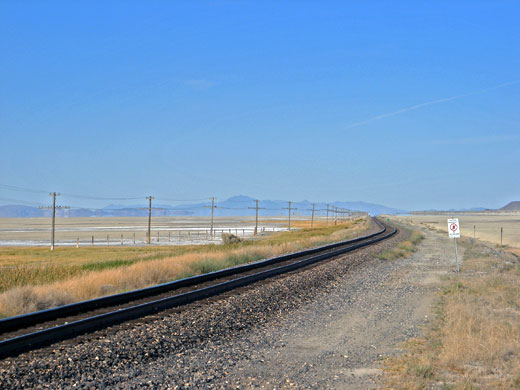
After 12 miles, route 34 veers away from the playa, passing a much smaller dry lake (Hualapai Flat), then becoming unpaved and leading to various entry points for the isolated High Rock Canyon area, location of one of the longest remaining stretches of the California/Oregon Emigrant Trail. Two other routes follow the edges of the playa, the main one being Soldier Meadows Road along the west side; this is maintained but still rough in places, and runs at the foot of the colorful Calico Mountains, past scenic canyons and various other playa access points before climbing into the hills on the north side of the desert, and continuing to the Summit Lake Indian Reservation. The second route is a 4WD track on the east side of the playa, forking off NV 447 just south of Gerlach, and accessing much remote, little-visited scenery. One quite well known site, popular for camping, is Trego Hot Spring, an 85°C (187°F) source that feeds a long, artificially created pool good for bathing, in a peaceful location only spoilt by occasional trains on the railroad that runs right past. The NCA has several similar pools including Black Rock Hot Springs and Double Hot Springs, though these are even less accessible. Fly Geyser is another unusual thermal feature; a spouting tufa mound colored bright red and green by algae, though the spring is a recent, man-made creation resulting from a test well drilled into a underground reservoir of hot water, in 1964.
Burning Man
Burning Man is a week-long fusion of individually organized art, music, performance and parties, focusing on freedom of self-expression and a shared sense of community, all culminating in the Saturday night burning of a 40 foot high, wicker-style effigy. The transient site occupies a pentagon of land reached by the 12 mile playa access point; the perimeter is just over one mile from the highway. Building of the temporary town, known as Black Rock City, typically starts about six weeks before the festival opens at the end of August (the week preceding Labor Day), and at the end all structures are removed and every scrap of litter picked up so that no trace remains one month later - a situation checked by the BLM who grant a license for the event to operate. The festival has grown considerably since its 1986 beginning as a private summer solstice party on Baker Beach in San Francisco, moving to the Black Rock site in 1990. Although Burning Man is still fairly relaxed, in keeping with its early days - all day drinking, drug taking, loud music and nudity are all commonplace - the festival is expensive to enter (tickets cost between $200 and $400 per person) and has a lengthy list of regulations such as no vending, no video cameras unless with written permission, no driving once on site (except for mutant art vehicles), no pets, no fireworks, and no leaving of the site once inside, unless paying extra for a one-time exit pass.
Black Rock Desert - Nearby Places
- Pyramid Lake (65 miles) - large saline lake with desert and mountain surroundings
Black Rock Desert - Similar Places
- Pinnacles National Natural Landmark, California - spires in a dry lake bed, near Death Valley
- Salt Lake Desert, Utah - salt flats and a shallow lake
All Contents © Copyright The American Southwest | Comments and Questions | Contribute | Affiliate Marketing Disclosure | Site Map
