Highlights:
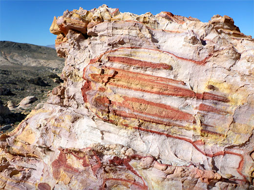
Photogenic expanse of Aztec sandstone, eroded into an endless variety of forms, at the edge of the Muddy Mountains a few miles south of Valley of Fire; rocks in shades of purple, pink, red, orange and yellow. Also a few petroglyph panels. No trails, but explorable by cross-country hiking
Nearby town:
North Las Vegas, 30 miles
Management:
BLM
Location:
Bitter Springs Backcountry Byway (2WD parking)
Seasons:
Fall, winter, spring; hot and exposed in summer
Rating (1-5):
★★★★★
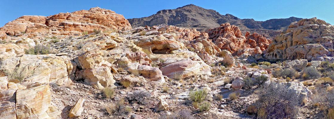
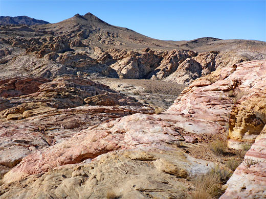
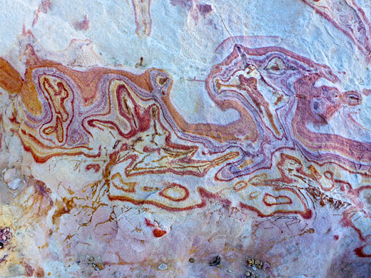
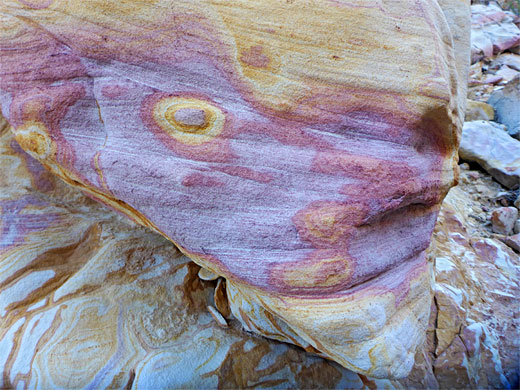
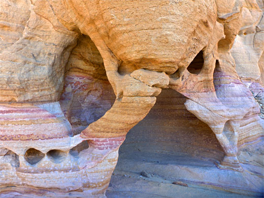
Buffington Pockets is an area of exposed, uneven rock, along the north edge of the Muddy Mountains, 30 miles northeast of Las Vegas and a few miles southwest of Valley of Fire State Park. Like the rocks in the Valley, the sedimentary strata of the Pockets are very colorful, contrasting greatly with the dull grey shades of the surrounding hills; all are Aztec sandstone, which is naturally red or off-white but stained by iron compounds in a range of colors including purple, pink, orange and yellow. The rocks form a myriad of shapes and erosional forms - arches, pinnacles, alcoves and small-scale ridges, extending for about 2 miles.
The central area of the pockets is crossed by a 4WD route, Bitter Springs Backcountry Byway, linking Valley of Fire Road, with Northshore Road within Lake Mead NRA; away from here there are no trails, though cross-country hiking is fairly easy, due to the relatively low relief of the surrounding landscape. The incredible, multicolored rock formations are the main reason to visit, while also of note are a few petroglyph panels, these concentrated along the seasonal wash which runs through the middle, and is partly followed by the backcountry byway.
The vegetation is typical of the Mojave Desert, with Mojave yucca the most noticeable plant, plus a sprinkling of cacti. The majority of the area has good long-distance views, to the higher reaches of the mountains in the east and across a vast desert plain to the west.
Buffington Pockets Table of Contents
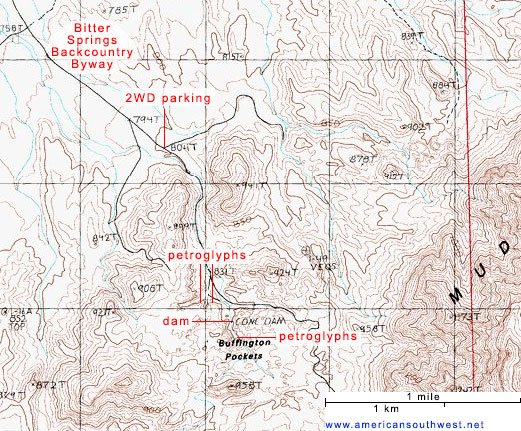
Buffington Pockets Topo Map
Photographs
70 views of Buffington Pockets.
Approach Route
Bitter Springs Byway forks southwards off Valley of Fire Road opposite a bend, 3 miles from I-15. The road is straight at first, past cross-road junctions after 0.5, 2.6 and 4.0 miles, this latter signed, to the southwest, to Color Rock Quarry, another interesting sandstone area. The byway proceeds another mile to a lesser junction, now very close to the north end of the Pockets - a suitable place for 2WD vehicles to park, since the road then descends to the streambed and becomes rougher. Up to this point, the surface is in places covered with many sharp stones but most vehicles including small RVs should be able to make it this far.
Buffington Pockets Geology
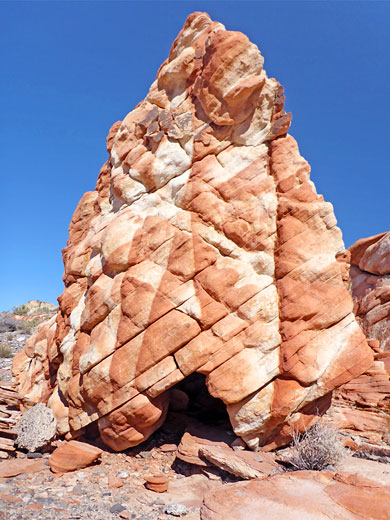
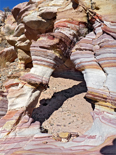
Aztec sandstone is composed of two units - an lower band, generally red, and an upper band, mostly white to pale brown. This latter unit forms most of the southern section of Buffington Pockets, around and south of the byway, where colorful formations seem somewhat more limited; the most photogenic area is to the north, where the upper unit is exposed. Here, the base color is enhanced by presence of iron compounds - haematite (iron oxide), and goethite (iron hydroxide). Haematite creates shades of red and orange, the precise color dependent on crystal size, while goethite (together with small amounts of two iron sulphide compounds, jarosite and alunite) result in shades of yellow and purple. The color variations, often striped, curved or irregularly swirling, are the result of what are known as alteration bands, and they combine with faults and joints to create an endless variety of patterns.
Petroglyphs
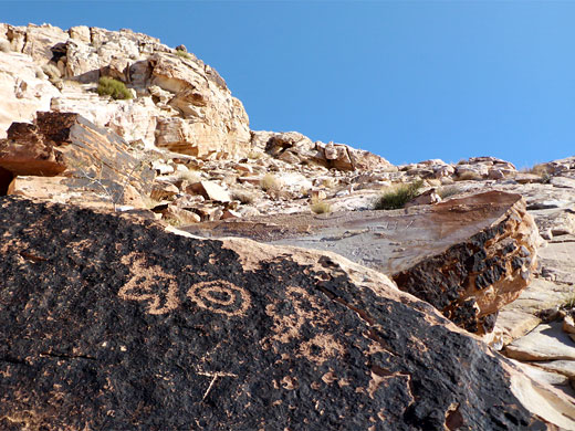
From the 2WD parking place, the byway descends into the streambed of the wash and follows it through a shallow valley, with pinkish bedrock exposed along the drainage. The land opens out a little after 0.7 miles and the track leaves the wash to the east; the streambed continues south into quite a narrow ravine, partially blocked after a short distance by a concrete dam, bearing a large mural of a flying snowy owl, created around 2019. 500 feet upstream of the dam, the ravine narrows further, its floor now entirely bare rock, and containing a few residual pools. The cliffs at either side are adorned with many petroglyphs, the best panel a little way up on the east side. More petroglyphs can be found along cliffs on the south side of the open area, just after the road leaves the wash - all are created on the dark patina of brown sandstone rock faces. Most are not so clear, in part because the rocks are naturally rather uneven and coarse-grained.
Rock Formations
Either side of the drainage are large areas of light-colored sandstone, pretty enough but rather uniform in hue, and without too many distinctive formations, though they do contain many little cavities and arches. The scenery becomes more interesting to the north - over a low peak and across a drainage, as here the rocks change to red, the upper unit of the Aztec sandstone, where the full range of colors are on display, in an area about 0.5 by 0.3 miles in extent, roughly bordered by two minor washes to north and south. Many hours could be spent exploring; much of the exposed rocks are split by cavities and gullies, concealing countless photogenic features. The return walking route is along either of the two washes that approach from the west; they soon meet a curving track which leads back to the 2WD parking place.
Buffington Pockets - Nearby Places
- Lake Mead (25 miles) - large lake on the Colorado River
- Valley of Fire State Park (15 miles) - extensive outcrops of red, yellow and pink rocks
Buffington Pockets - Similar Places
- Buckskin Hollow, Utah - eroded, stripy, thin-layered rocks
- Little Finland, Nevada - colorful sandstone outcrops
All Contents © Copyright The American Southwest | Comments and Questions | Contribute | Affiliate Marketing Disclosure | Site Map
