Magnesite Wash, Valley of Fire State Park
Nevada > Valley of Fire State Park > Scenic Drive > Magnesite Wash
Magnesite Wash
Relatively wide, open drainage crossing the park from west to east, though rocks of many different colors; much photogenic scenery, including arches, hoodoos, short narrow passageways and deep, water-filled potholes
Length: 3.5 miles, round trip
Elevation change: 300 feet
Difficulty: Easy
Type: Loop, off-trail
Usage: Low
Season: Fall, winter, spring; off-trail hiking is not permitted in this area between mid May and end of September, due to the heat
Trailhead: Northernmost point on the scenic drive, at the junction with a disused track
Rating (1-5): ★★★★★
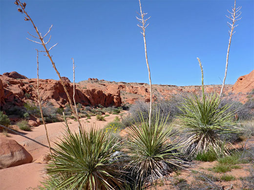
Of the limited number of trails in Valley of Fire State Park, the majority are either within the main band of formations, but rather short, or are longer routes to the south, across open desert. Cliffs and ravines restrict cross-country hiking in the rockier areas, but several washes provide easier routes and in the most colorful region there are three that may be followed; Fire Canyon Wash downstream of Mouse's Tank, Kaolin Wash - either the lower section or the upper part, which forms most of the Prospect Trail - and Magnesite Wash. This latter, which traverses the park from west to east a short distance beyond the end of the scenic drive, is explored the least, though it contains no significant obstructions and offers an easy hike past photogenic rocks in a great range of shapes and colors. The wash is usually dry but contains a few deep potholes that retain water for many weeks after rain.
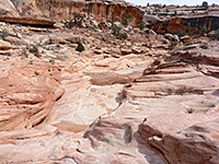
The wash passes through bands of brightly colored strata for 1.5 miles, then continues downstream through duller, reddish-grey surroundings. A hike through the more colorful section may either be out and back, or done as a shorter loop, returning cross-country over fairly flat land to the south; a great expense of bare rock crossed by little ridges and gullies.
Magnesite Wash begins amongst fins and cliffs just west of the White Domes parking area at the end of the scenic drive, but the upper section is less noteworthy as the surrounding rocks are uniformly red. The closest parking location to the more colorful part is at the northernmost point of the road, where it bends back south, at the junction with an old, gated track, now used by ATVs but once a main route through the park. The track reaches the wash in 0.6 miles, then continues to the next drainage, Overton Wash, and links with other 4WD routes into the rarely-visited northern section of the state park, where the land is more evenly colored, and generally less scenic.
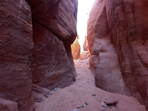
An alternative way to reach Magnesite Wash, instead of walking along the old vehicle track, is to hike northwest a short distance down into a little tributary drainage. This forms a shallow slot for 300 feet before widening and gradually descending, becoming about 50 feet deep. The streambed is rocky for a while then sandy, as the cliffs recede and the ravine joins the main channel of the wash, which is also sandy, and wider. Continuing north (downstream), the streambed drops down a few feet, forming a possibly watery pothole, then curves round a wide bend to the crossing point of the old road. Gravel remnants are visible at either side, but most of the carriageway has long since been washed away by flash floods. A short distance downstream are two large corrugated pipes, probably once used to take water under the road.
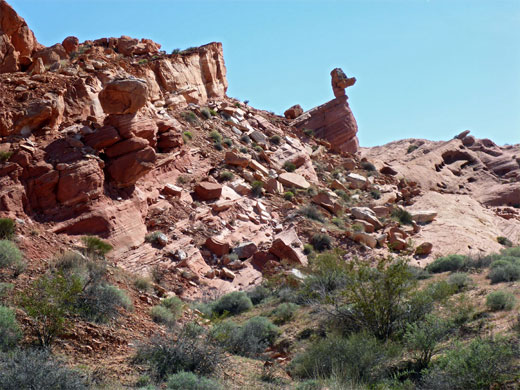
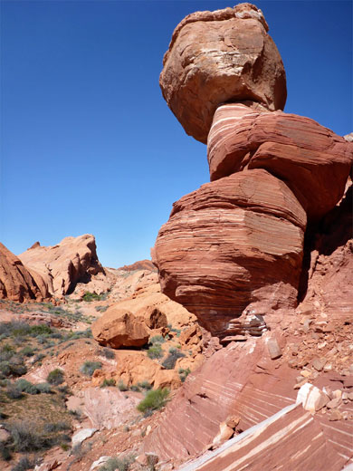
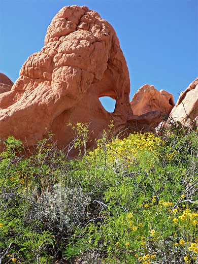
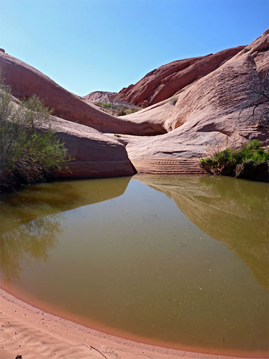
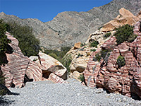
The surroundings up to this point are fairly unremarkable - low rocks, dull red in color, but become more interesting after the road, as the rocks are lighter in shade, and varied - pink, orange, white, and less homogenous, crossed by thin stripes and wider bands. One named feature, on the south side, is Duck Rock, a protruding ridge with a head-shaped boulder on top, all formed of thin-layered strata. There are several similar, smaller formations nearby, and plenty of photogenic stripy outcrops. The wash next bends through a tighter curve between higher rocks and descends a slope via several pools in potholes, the lowest sometimes 50 feet across and maybe ten feet deep, lined by tamarisks. On the north side of the wash, just before the potholes, is a small arch, in a detached boulder at the base of a line of cliffs.
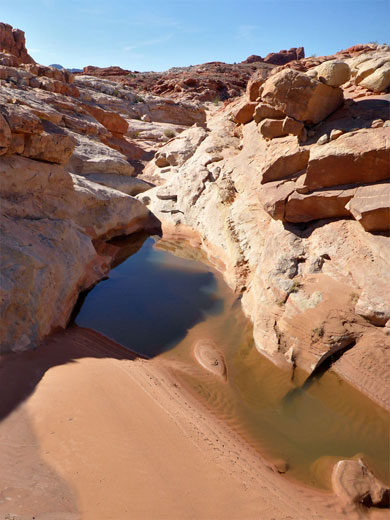
Below the potholes, the streamway is quite wide for a few hundred feet, bordered now by blackish grey conglomerate, as two minor tributaries join from either side. The rocks soon change back to red for the next quarter of a mile, followed by a whitish patch, with pink bands. More bends, and smaller pools, take the wash through an expanse of jumbled, low relief rocks, within sight of higher peaks to the north, leading to a particularly striking section with a very shallow slot between rocks richly colored in shades of red, purple and yellow. Another tributary joins from the north, followed by two more potholes, also quite large. The enclosing rocks are now mostly white, then change back to light red, and a final band of white before becoming darker red, at the east end of the interesting section of the wash - just over 1.5 miles from the old road. The return route can be back in the wash all the way, or cross-country; leaving the streambed in the white-pink area, about half a mile before the final change to red, then walking south over an expanse of small, inclined, parallel ridges, later veering southwest, over less rocky, more earthen ground, past some bigger reddish outcrops and finally across bushy, sandy flats, back to the parking area.
The wash passes through bands of brightly colored strata for 1.5 miles, then continues downstream through duller, reddish-grey surroundings. A hike through the more colorful section may either be out and back, or done as a shorter loop, returning cross-country over fairly flat land to the south; a great expense of bare rock crossed by little ridges and gullies.
Magnesite Wash Trailhead
Magnesite Wash begins amongst fins and cliffs just west of the White Domes parking area at the end of the scenic drive, but the upper section is less noteworthy as the surrounding rocks are uniformly red. The closest parking location to the more colorful part is at the northernmost point of the road, where it bends back south, at the junction with an old, gated track, now used by ATVs but once a main route through the park. The track reaches the wash in 0.6 miles, then continues to the next drainage, Overton Wash, and links with other 4WD routes into the rarely-visited northern section of the state park, where the land is more evenly colored, and generally less scenic.
Entering the Wash
An alternative way to reach Magnesite Wash, instead of walking along the old vehicle track, is to hike northwest a short distance down into a little tributary drainage. This forms a shallow slot for 300 feet before widening and gradually descending, becoming about 50 feet deep. The streambed is rocky for a while then sandy, as the cliffs recede and the ravine joins the main channel of the wash, which is also sandy, and wider. Continuing north (downstream), the streambed drops down a few feet, forming a possibly watery pothole, then curves round a wide bend to the crossing point of the old road. Gravel remnants are visible at either side, but most of the carriageway has long since been washed away by flash floods. A short distance downstream are two large corrugated pipes, probably once used to take water under the road.
Potholes and an Arch
The surroundings up to this point are fairly unremarkable - low rocks, dull red in color, but become more interesting after the road, as the rocks are lighter in shade, and varied - pink, orange, white, and less homogenous, crossed by thin stripes and wider bands. One named feature, on the south side, is Duck Rock, a protruding ridge with a head-shaped boulder on top, all formed of thin-layered strata. There are several similar, smaller formations nearby, and plenty of photogenic stripy outcrops. The wash next bends through a tighter curve between higher rocks and descends a slope via several pools in potholes, the lowest sometimes 50 feet across and maybe ten feet deep, lined by tamarisks. On the north side of the wash, just before the potholes, is a small arch, in a detached boulder at the base of a line of cliffs.
Downstream
Below the potholes, the streamway is quite wide for a few hundred feet, bordered now by blackish grey conglomerate, as two minor tributaries join from either side. The rocks soon change back to red for the next quarter of a mile, followed by a whitish patch, with pink bands. More bends, and smaller pools, take the wash through an expanse of jumbled, low relief rocks, within sight of higher peaks to the north, leading to a particularly striking section with a very shallow slot between rocks richly colored in shades of red, purple and yellow. Another tributary joins from the north, followed by two more potholes, also quite large. The enclosing rocks are now mostly white, then change back to light red, and a final band of white before becoming darker red, at the east end of the interesting section of the wash - just over 1.5 miles from the old road. The return route can be back in the wash all the way, or cross-country; leaving the streambed in the white-pink area, about half a mile before the final change to red, then walking south over an expanse of small, inclined, parallel ridges, later veering southwest, over less rocky, more earthen ground, past some bigger reddish outcrops and finally across bushy, sandy flats, back to the parking area.
Magnesite Wash Wildflowers
More plants along the wash
 Silver cholla |
 Widow's milkvetch |
 Devil's spineflower |
More plants along the wash
Magnesite Wash - Similar Hikes
All Contents © Copyright The American Southwest | Comments and Questions | Contribute | Affiliate Marketing Disclosure | Site Map


