Highlights:
Abundant rock art in a short sandstone canyon off Largo Wash, in a remote part of northwestern New Mexico; mostly from the Dinétah (Navajo) people, between the 16th and 18th centuries
Nearby town:
Farmington, 43 miles
Management:
BLM
Location:
36.547, -107.629 (mouth of the canyon)
Seasons:
All year, unless after heavy rain, as the access road (across Largo Wash) may be impassable
Rating (1-5):
★★★★★
Southeast of Farmington and Bloomfield stretches a large expense of high desert land without any paved roads - a triangle, around 50 miles across, bounded by US 550, US 64 and Hwy 537. Within this remote, little visited area are three major drainages, Blanco Canyon, Canon Largo and Carrizo Canyon, coalescing towards the northwest, shortly before the confluence with the San Juan River, and along these three, and their numerous tributaries, are countless ruined settlements and rock art panels, the best known being along Cuervo Canyon, more widely referred to by its English name, Crow Canyon.
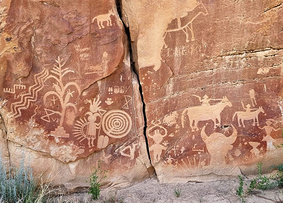
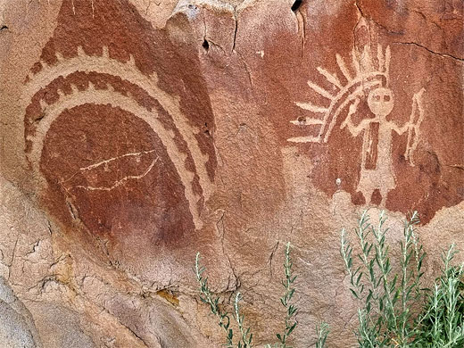
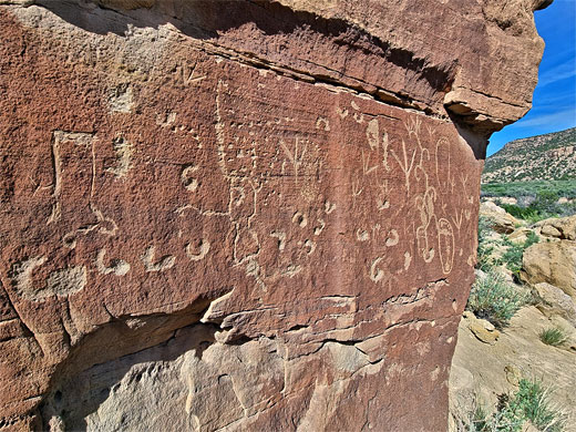
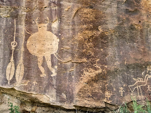
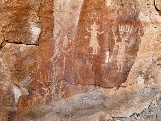
Crow Canyon contains a couple of 18th century pueblitos, small defensive structures, though is most famous for its petroglyphs, with over 40 major groupings across the base of the south-facing cliffs, extending for about 2 miles. Most are relatively recent, etched into the low walls of San Jose Sandstone between the 16th and 18th centuries by the Dinétah (Navajo), though in some places, older, fainter designs can be seen, contemporary with such nearby settlements as Chaco and the Aztec Ruins. As they are not so ancient, the majority of the designs are crisp and still in good condition. Many are of humanoid, anthropomorphic figures, in a variety of styles, while also represented are animals, plants, implements and geometric shapes.
The area is known as the Crow Canyon Petroglyphs, or Crow Canyon Archaeological District, not to be confused with the Crow Canyon Archaeological Center, an unrelated organisation in Colorado.
Crow Canyon Petroglyphs Table of Contents
Photographs
25 views of the Crow Canyon Petroglyphs.
Crow Canyon Access
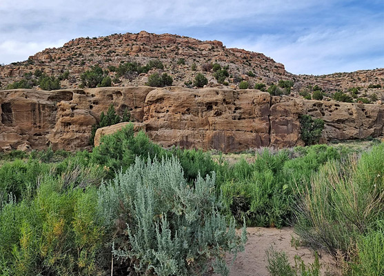
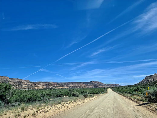
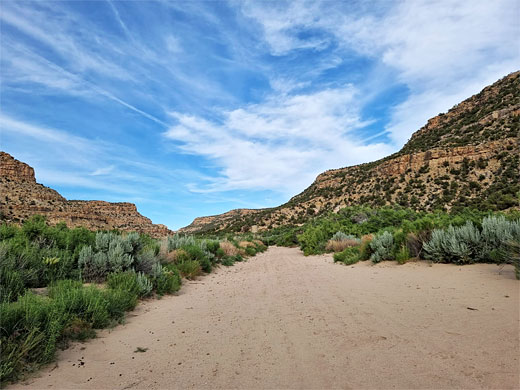
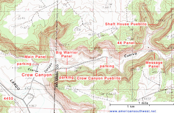
Crow Canyon is managed by the BLM, who provide three parking places and trailheads, for hikes to the major panels. The mouth of the drainage is reached by an 18 mile drive on unpaved put good quality County Road 4450, fine for all vehicles, then a short drive (or walk) of up to 2 miles along a lesser track. Road 4550 leaves US 64 just east of the San Juan river crossing at Blanco, and heads southeast alongside Canon Largo, crossing to the south, past the confluence of Blanco Canyon and Carrizo Canyon after 7 miles, continuing, still along Largo (west side) for another 11 miles, to a junction with a narrower track at the mouth of Crow Canyon. All the main valley is similar in appearance - a wide, bushy floor flanked by brown sandstone cliffs. The side track heads north, soon crossing the sandy Largo Wash streambed, a possible problem for some vehicles especially during wet weather, and, after two junctions, reaches the first of the three trailheads (for the Main Panel), after 0.8 miles. At the previous junction, a track leads upcanyon for 1.2 miles, past a second trailhead and across the Cuervo streambed to a third, where it ends.
The Main Panel
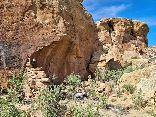
From the closest of the three parking places, a half mile path leads to then along the cliffs, round a corner into a little side ravine, to the Main Panel. Along the way are several smaller groups of petroglyphs, some from the earlier, Ancestral Puebloan era, plus the remains of a stone shelter, from the Navajo. In two places the trail passes through narrow gaps between the cliffs and a huge fallen slab; one has some large humanoid petroglyphs at the entrance. The biggest panel is at the end of the trail, either side of a deep crack in the cliff face; it contains several dozen designs, expertly carved into the dark, reddish brown patina of the sandstone.
Big Warrior Panel
The next major group, a third of a mile along the main track into the canyon, is the Big Warrior Panel, so-named for a distinctive depiction of a hunter with shield and two spears. From the trailhead, a short path crosses a bushy area, the dry streambed and a fence, to the base of the cliffs. Some lesser petroglyphs can be seen to the east, while the warrior panel is a little way west.
More Petroglyphs
Back on the track, this continues 0.8 miles, ending at the final trailhead, for hikes upstream, to several sites. In another 0.6 miles the canyon forks; just; inside the south branch (south side) is a group of petroglyphs known as the Message Panel, while opposite on the north side of the main canyon, continuing along the northern fork, are a sequence of other designs, and a little further, the 44 Panel, after 0.9 miles - the name refers to its most distinctive components, a group of four angular figures, shaped like the number 4.
Crow Canyon Pueblitos
Also in the canyon are the remains of two defensive structures, both quite high above the canyon floor - the Crow Canyon Pueblito, on the south side, 0.3 miles before the end of the track, and the Shaft House Pueblito a little way beyond the 44 Panel, reached by a continuation path, climbing steeply up the canyon sides.
Crow Canyon Petroglyphs - Nearby Places
- Lybrook Badlands (48 miles) - branched ravines, with many fine hoodoos
- Navajo Lake State Park (33 miles) - artificial lake along the San Juan River
Crow Canyon Petroglyphs - Similar Places
- McConkie Ranch Petroglyphs, Utah - dozens of petroglyphs and pictographs, many intricate and well-preserved
- Sego Canyon, Utah - canyon in the Book Cliffs, containing several pictograph panels
All Contents © Copyright The American Southwest | Comments and Questions | Contribute | Affiliate Marketing Disclosure | Site Map
