Piedras Marcadas Canyon, Petroglyph National Monument
New Mexico > Petroglyph National Monument > Piedras Marcadas Canyon
Piedras Marcadas Canyon Trail
Path into the least-visited section of Petroglyph National Monument, along a wide, branched valley containing several hundred petroglyphs on the north side
Length: 1 mile, or a 2.3 mile loop
Elevation change: 30 feet
Difficulty: Easy
Type: One-way, or loop
Usage: High
Season: All year
Trailhead: Jill Patricia Street or Las Marcadas Park II, off Golf Course Road
Rating (1-5): ★★★★★
Elevation change: 30 feet
Difficulty: Easy
Type: One-way, or loop
Usage: High
Season: All year
Trailhead: Jill Patricia Street or Las Marcadas Park II, off Golf Course Road
Rating (1-5): ★★★★★
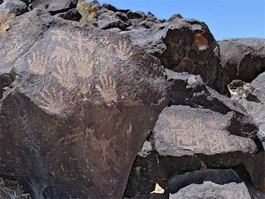
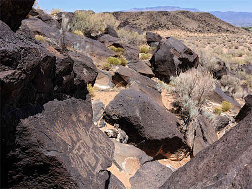
At the northernmost point of Petroglyph National Monument, Piedras Marcadas Canyon is a wide, branched valley containing several hundred petroglyphs on the north side, toured by a one mile trail that begins from either of two small parking areas next to a residential estate. Access is from Golf Course Road near the junction with Paradise Boulevard. The drawings are just as good as those at other areas though this location is the closest to the Albuquerque suburbs, so noise and litter can be present, at least around the start of the trail. The canyon is open daily, from sunrise to sunset. Admission is free and there are no trailhead amenities.
Around 400 petroglyphs can be seen, along the main trail or on very short spurs. The path goes in and out of a couple of side valleys, and while the petroglyphs end after one mile, the trail does continue, further west to the head of the valley and up a minor slope, then back all along the plateau above to the north, to make a loop of 2.3 miles.
This southerly of the two parking places is at Las Marcadas Park II, on Tia Christina Drive, but most people start a little way north, from a parking place off Jill Patricia Street - an incongruous location, between houses and a couple of business premises. A path leads between two homes and out to sandy desert at the base of the mesa, and a junction; right is the path up to the mesa top, while other leads to the petroglyphs. This route starts a little way from the base of the plateau but soon comes close and passes the first of many petroglyphs, some rather faded, the majority still crisp and clear. A few areas have 'Closed for Restoration' signs, and visitors are encouraged not to leave the trail. The path winds into the first of the two side valleys, then rounds two promontories and crosses the second valley to the last group of petroglyphs, around a third promontory, just after which is a 'Trail End' sign, though this refers only to the petroglyphs, as the route does continue, along the 2.3 mile loop.
Around 400 petroglyphs can be seen, along the main trail or on very short spurs. The path goes in and out of a couple of side valleys, and while the petroglyphs end after one mile, the trail does continue, further west to the head of the valley and up a minor slope, then back all along the plateau above to the north, to make a loop of 2.3 miles.
The Canyon
This southerly of the two parking places is at Las Marcadas Park II, on Tia Christina Drive, but most people start a little way north, from a parking place off Jill Patricia Street - an incongruous location, between houses and a couple of business premises. A path leads between two homes and out to sandy desert at the base of the mesa, and a junction; right is the path up to the mesa top, while other leads to the petroglyphs. This route starts a little way from the base of the plateau but soon comes close and passes the first of many petroglyphs, some rather faded, the majority still crisp and clear. A few areas have 'Closed for Restoration' signs, and visitors are encouraged not to leave the trail. The path winds into the first of the two side valleys, then rounds two promontories and crosses the second valley to the last group of petroglyphs, around a third promontory, just after which is a 'Trail End' sign, though this refers only to the petroglyphs, as the route does continue, along the 2.3 mile loop.
All Contents © Copyright The American Southwest | Comments and Questions | Contribute | Affiliate Marketing Disclosure | Site Map


