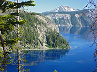
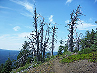
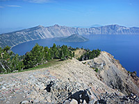
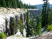
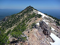
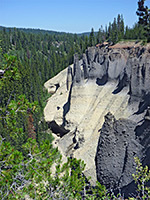
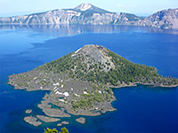
Several long paths cross the densely wooded backcountry of Crater Lake National Park, including 33 miles of the Pacific Crest Trail, but most visitors hike only the shorter routes around the lake - either to viewpoints on the rim, or the tops of nearby mountains. Two other popular routes are the Cleetwood Trail, the only one that descends to water level, and the short Pinnacles Trail past a group of pumice spires. There are also a few short paths to sites in the forest below the crater rim, including the recently created Plaikni Falls Trail.
The Crater Lake National Park map shows the location of all trails.
The Crater Lake National Park map shows the location of all trails.
Crater Lake Trails
|
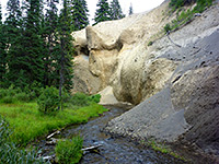
Annie Creek Canyon Trail Length 1.7 miles (2.7 km) (loop) Elevation change 300 feet (91 meters) Trailhead Loop C, Mazama Village Campground Rating (1-5) ★★★★★ Starting beside Mazama Campground, this loop trail explores the upper end of the deep, wooded valley of Annie Creek, which starts abruptly at Annie Spring just upstream. One half of the loop runs along the rim, at the edge of the campsite; the other is along the canyon floor, returning to the plateau via a short, steep climb. En route are a collection of volcanic spires, like the more well known Pinnacles area in the southeast. |
|
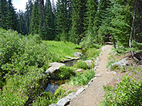
Castle Crest Wildflower Trail Length 0.4 miles (0.6 km) loop Elevation change 100 feet (30 meters) Trailhead Pullout along the Rim Drive, near the park headquarters Rating (1-5) ★★★★★ The short Castle Crest Wildflower Trail loops around an open area with trees, springs, a wet meadow and a stream; ideal habitat for summer wildflowers. The trailhead is along the Rim Drive a short distance east of the junction with the southern entrance road, and the loop may also be accessed via a connecting path from the park headquarters. |
|
Cleetwood Trail Length 1.1 miles (1.8 km) Elevation change 700 feet (213 meters) Trailhead Parking area along the Rim Drive, on the north side of the lake Rating (1-5) ★★★★★ Due to steep slopes and unstable rocks there is only one trail that descends from the caldera rim to the edge of Crater Lake, hence the route is popular and often rather busy. The route descends the wooded slopes above Cleetwood Cove, on the north side of the lake, ending at the boat launch pier, near which is a small beach and some rocks suitable for jumping off, or sunbathing on. The pier is the embarkation point for boat tours of the lake, so all passengers have to take the trail. |
|
Crater Peak Trail Length 3.2 miles (5.1 km) Elevation change 750 feet (229 meters) Trailhead Along Grayback Drive, 3 miles east of the park headquarters Rating (1-5) ★★★★★ The conical, 7,263 foot summit of Crater Peak (a shield volcano) may be reached by a not too difficult trail that follows a gently ascending ridge southwards for 2 miles then has a steep climb to the top, from where the views extend across a huge area of hilly, forested land, and south towards Klamath Falls. Crater Lake is out of sight, however. The trailhead is along a short side road, opposite Vidae Falls. |
|
Discovery Point Trail Length 1.1 miles (1.8 km) Elevation change 100 feet (30 meters) Trailhead Rim Village Rating (1-5) ★★★★★ Discovery Point is a slightly elevated promontory along the west rim, close to Wizard Island, and reachable either via a very short walk from a nearby pullout along the scenic drive, or by a 1.1 mile trail beginning at Rim Village. Past the overlook the path continues along the crater rim another mile to a second pullout, and all the route is a good choice for quieter views of the lake, without the crowds often present at the roadside overlooks. |
|
Fumarole Bay Trail Length 0.7 miles (1.1 km) Elevation change 25 feet (8 meters) Trailhead Wizard Island boat landing area Rating (1-5) ★★★★★ From the boat landing area on Wizard Island, this path traverses rocky terrain to a beach on Fumarole Bay, a shallow inlet good for fishing and swimming. Reaching the trailhead requires a hike down the Cleetwood Cove Trail followed by the 20 minute boat trip to the island. |
|
Garfield Peak Trail Length 1.7 miles (2.7 km) Elevation change 1000 feet (305 meters) Trailhead Crater Lake Lodge Rating (1-5) ★★★★★ The path to Garfield Peak, one of three summits around the crater rim with a trail to the top, is intermediate in difficulty and length to the other two (Mount Scott and Watchman Peak), and hence is a popular choice for a half day hike. The path starts at Crater Lake Lodge and stays on the rim the whole way, climbing steadily to the 8,054 foot summit, between Castle Crest and the Eagle Crags. |
|
Godfrey Glen Trail Length 1 miles (1.6 km) (loop) Elevation change 100 feet (30 meters) Trailhead Wide pull-out along the park road Rating (1-5) ★★★★★ The Godfrey Glen Loop Trail winds around the upper end of a tributary of Annie Creek Canyon, which deepens abruptly after a scenic cascade (Duwee Falls) into a narrow, overgrown ravine. The surroundings are mostly forested, but with a few open patches where summer wildflowers thrive. |
|
Lady of the Woods Trail Length 0.3 miles (0.5 km) (loop) Elevation change 100 feet (30 meters) Trailhead Park Headquarters Rating (1-5) ★★★★★ Just north of the visitor center, the Lady of the Woods Trail (also known as the Park Headquarters Historic Trail) winds through fairly level, hemlock/fir woodland at the upper end of Munsen Valley, passing a meadow, a creek, several historic buildings and the lady herself - a sculpture dating from 1917, carved into a volcanic boulder. |
|
Pacific Crest Trail Length 33 miles (53 km) Trailhead Several access points Rating (1-5) ★★★★★ The Pacific Crest Trail enters the national park in the north, climbs gradually across the lower slopes of Timber Crater, then turns southwest, skirting the edge of the Pumice Desert and approaching the northern entrance road. Here it splits; the original alignment moves further west, away from the crater rim and out of sight of Crater Lake, eventually passing close to Mazama Village and exiting into the adjacent national forest. The other branch, for hikers only, climbs to the crater rim and follows it for 6 miles, rejoining the main route by a connecting path along Dutton Creek. Three further paths also link the PCT with park roads; Annie Creek Cutoff near the village, Lightning Spring Trail near Discovery Point, and Pumice Flat Trail near the south entrance. |
|
Mount Scott Trail Length 2.5 miles (4 km) Elevation change 1500 feet (457 meters) Trailhead Parking area along the Rim Drive, on the east side of Crater Lake near Cloudcap Junction Rating (1-5) ★★★★★ Rated most difficult of the day hikes around Crater Lake, the trail to the fire lookout tower on top of Mount Scott first follows a wooded ridge on the west side of the mountain, then switchbacks up the south face and ends by traversing another, mostly treeless ridge to the summit, which at 8,928 feet is the highest in the park. Although nearly 2 miles from the edge of the lake, the views are still quite spectacular. |
|
Pinnacles Trail Length 0.5 miles (0.8 km) Elevation change 100 feet (30 meters) Trailhead End of Pinnacles Road, southeast of the Rim Drive Rating (1-5) ★★★★★ Some of the amazingly tall and slender volcanic pinnacles lining the valley of Wheeler Creek can be viewed by overlooks at the end of the paved approach road, but more are seen via an easy trail that descends very gradually along the canyon rim, ending at an old entrance sign on the park boundary, from where a track continues into the adjacent Winema National Forest. |
|
Plaikni Falls Trail Length 1.1 miles (1.8 km) Elevation change 50 feet (15 meters) Trailhead Parking area along Pinnacles Road Rating (1-5) ★★★★★ Open summer 2011, the new, accessible Plaikni Falls Trail crosses the flat, forested floor of Kerr Valley to a good sized waterfall along Sand Creek, in an open area with many wildflowers in summer. The cascade has only now been given an official name after consultation with the local Klamath tribe; Plaikni means 'from the high country'. The path intersects the disused Anderson Bluff Trail, which heads further east through the forest, running along the base of a range of cliffs. |
|
Sun Notch Trail Length 0.25 miles (0.4 km) Elevation change 115 feet (35 meters) Trailhead Parking area along the Rim Drive Rating (1-5) ★★★★★ The shortest trail in Crater Lake National Park leads up a grassy, partly wooded slope to several overlooks on the crater rim; features in view include Phantom Ship, a tiny island at the end of a partly submerged ridge. |
|
Watchman Trail Length 0.8 miles (1.3 km) Elevation change 420 feet (128 meters) Trailhead Watchman Overlook, along the Rim Drive Rating (1-5) ★★★★★ The best views of Wizard Island are from the summit of the Watchman, an isolated peak on the west rim, reached by a short but steep path that forks off the Pacific Crest Trail after traversing a pumice slope then climbs a lightly wooded ridge to the mountain top. Also on the summit is one of the park's two fire lookout towers. |
|
Wizard Island Summit Trail Length 0.5 miles (0.8 km) Elevation change 700 feet (213 meters) Trailhead Wizard Island boat landing area Rating (1-5) ★★★★★ This interesting path climbs the southwest side of Wizard Island, ending with a short loop around the compact, well preserved crater on top. Reaching the trailhead requires a hike down the Cleetwood Cove Trail followed by the 20 minute boat trip to the island. |
All Contents © Copyright The American Southwest | Comments and Questions | Contribute | Affiliate Marketing Disclosure | Site Map


