Home
|
Parks
|
Trails
|
Plants
|
Canyons
Maps
|
Landscapes
|
Site Map
|
Whats New?
|
More...
×
General Pages
Home
Parks
Trails
Plants
Slot Canyons
Maps
Landscapes
Itineraries
Site Map
What's New?
More pages...
States
Arizona
California
Colorado
Idaho
Nevada
New Mexico
Oregon
Texas
Utah
Wyoming
MENU
ARIZONA
CALIFORNIA
COLORADO
IDAHO
NEVADA
NEW MEXICO
OREGON
TEXAS
UTAH
WYOMING
Slot Canyons
INTRODUCTION
|
MAP
|
BOOKS
Slot Canyon Locations...
Capitol Reef
Death Valley
Escalante River
Grand Canyon
North Lake Powell
Other Locations
Page
Paria River
San Rafael Swell
Sedona
Zion National Park
Slot canyons site map
Photographs of Palm Wash and Calcite Mine, Anza Borrego Desert State Park
Slot Canyons
>
Other Locations
>
Palm Wash and Calcite Mine
> Photographs
Calcite Mine
Calcite Mine Road
Straight section of the road
Ravine near Calcite Mine
Weathered cliffs
Shallow excavations
Midde Fork of Palm Wash, Main Branch
Narrowing canyon
Vertical canyon walls
Bend in the narrows
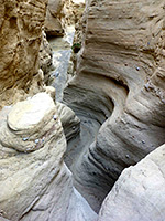
Smooth rocks
Layered walls
Middle of the slot
Dark passage
Pebbles in the streambed
Chokestone
Rocky floor
Tight bend
Calcite adit
Above a dryfall
Curving rock layers
Overhanging cliffs
Relatively wide passageway
Fallen boulders
Conglomerate walls
Midde Fork of Palm Wash, South Branch
Entrance to the narrows
Middle Fork - upper end of the narrows
Middle of the canyon
South Fork of Palm Wash
Smooth curves
South Fork rock textures
Dark passage
South Fork - canyon near the trailhead
South Fork - layered walls
South Fork - cliffs below the narrows
South Fork - V-shaped passage
Related Photographs:
Anza Borrego Desert SP
-
Badlands
-
Dry wash
Back to Top
All Contents © Copyright The American Southwest
|
Comments and Questions
|
Contribute
|
Affiliate Marketing Disclosure
|
Site Map