Crack Canyon
Three sections of angular narrows between more open sections, all likely to contain pools and mud. The surrounding rock is unusually varied in texture and color. Explorable as a short one-way hike or a longer loop through adjacent Chute Canyon, which has some less good narrows
Length: 2.3 miles to the end of the narrows, 10.5 miles for the full loop
Difficulty: Easy to moderate; several dryfalls to climb down
Management: BLM
Rocks: Wingate sandstone, Kayenta formation
Season: Spring, fall, or summer for shorter hikes
Trailhead: North; 4 miles along a dirt track forking southwest off Temple Mountain Road. An alternative trailhead is to the south, along the road to Goblin Valley
Rating (1-5): ★★★★★
It is not quite the epitome of a slot canyon that the name might suggest, but Crack Canyon does have three fine sections of narrows separated by wider areas, formed by a seasonal stream that cuts deep into the domes and ridges of the San Rafael Reef.
The best aspect is the weathering of the surrounding rock which has formed an amazingly complex medley of hollows and pinnacles, colours and textures - although most of the cliffs along the 3 mile canyon are part of the same Wingate sandstone layer, this has many individual strata with differing composition and properties. The variation is the reason why there are no long extended narrows as are found in similar canyons of the more homogenous Navajo sandstone.
Topographic map of Crack Canyon.
Crack is another canyon of the southeastern San Rafael Reef, close to Goblin Valley State Park, and can be explored starting from either direction though the upper end is preferred - access is via the Temple Mountain Road, the main route into the southern part of the San Rafael Swell. This leaves UT 24 near milepost 137, passes the left turn to Goblin Valley after 5 miles then winds through the reef where it becomes unpaved. Two miles beyond the state park junction and just after the cliffs recede, the Behind-the-Reef Road forks off to the left (west). This is somewhat narrow and steep in places but like most roads in this area it is well-maintained and good for any vehicle except during wet weather.
The track follows just inside the reef close to the high Wingate cliffs and passes the openings of several narrow ravines: the North and Main forks of Wild Horse Creek then Crack, Chute, Little Wild Horse, Bell, Ding, Dang and Cistern Canyons, though vehicular travel is no longer permitted beyond Chute. Crack Canyon is reached after 4.25 miles, at a point where the road takes a sharp bend to the right. A rough side track heads down the drainage a way, though most will want to park at the junction. This is a quiet, secluded area with plenty of potential campsites. The main road continues west into Sinbad Country and is used to reach many other places in the Swell, including Muddy Creek.
The quickest way to reach the lower part of Crack Canyon is to drive towards Goblin Valley and park 1.5 miles before the entrance station, then walk cross-country in a northwesterly direction for about the same distance, to the edge of the cliffs where the canyon emerges. An alternative, if extending the trip into a loop hike through adjacent Chute Canyon - a ravine with equally nice rock formations but no narrow parts, is to drive 2.5 miles along the dirt track to Little Wild Horse Canyon to where it crosses the second drainage, then hike up Chute, east along the Behind-the-Reef Road, down Crack and back 2 miles across the soft sand dunes.
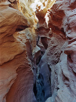
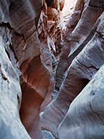
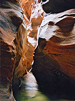
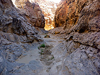
8 views of Crack Canyon.
The side road, inside the reef, crosses the stony streambed several times as it descends towards the huge, multi-colored cliffs of the San Rafael Reef. Purple, green, white and red are the dominant colours, of both the rocks at the base of the cliffs and the sand dunes beneath, which are part of the uranium-bearing Chinle Formation. The track extends for about 1.5 miles, almost to the beginning of the canyon proper. A signpost marks the edge of the Crack Canyon Wilderness Study Area - beyond here all mechanised transport is forbidden though soon after a small dryfall would prevent any such access.
Downstream of this ledge the canyon has some pleasant sunny, sandy passages then it constricts just before the first of the three slot-like stretches, between which are wider parts with no shade. The first begins after a chokestone and a 10 foot drop - a few hundred yards of medium depth narrows, quite straight and with the delicately potmarked walls characteristic of this region. The cliffs become higher before the second section, a narrower canyon through very angular rocks made of many thin strata, and which has several minor dryfalls, some pools and patches of clayish mud.
The final narrows is the deepest, through redder rocks - a little wider but with the same nice tilted layers and curvy eroded formations. Past this, the Wingate strata are replaced by first the Kayenta Formation then Navajo sandstone, and the rest of the canyon is more open, winding through great white ridges and domes for another mile until the reef subsides, the land levels out and the flat plains of the San Rafael Desert come into view.
The best aspect is the weathering of the surrounding rock which has formed an amazingly complex medley of hollows and pinnacles, colours and textures - although most of the cliffs along the 3 mile canyon are part of the same Wingate sandstone layer, this has many individual strata with differing composition and properties. The variation is the reason why there are no long extended narrows as are found in similar canyons of the more homogenous Navajo sandstone.
Map
Topographic map of Crack Canyon.
Location
Crack is another canyon of the southeastern San Rafael Reef, close to Goblin Valley State Park, and can be explored starting from either direction though the upper end is preferred - access is via the Temple Mountain Road, the main route into the southern part of the San Rafael Swell. This leaves UT 24 near milepost 137, passes the left turn to Goblin Valley after 5 miles then winds through the reef where it becomes unpaved. Two miles beyond the state park junction and just after the cliffs recede, the Behind-the-Reef Road forks off to the left (west). This is somewhat narrow and steep in places but like most roads in this area it is well-maintained and good for any vehicle except during wet weather.
Upper Approach Route
The track follows just inside the reef close to the high Wingate cliffs and passes the openings of several narrow ravines: the North and Main forks of Wild Horse Creek then Crack, Chute, Little Wild Horse, Bell, Ding, Dang and Cistern Canyons, though vehicular travel is no longer permitted beyond Chute. Crack Canyon is reached after 4.25 miles, at a point where the road takes a sharp bend to the right. A rough side track heads down the drainage a way, though most will want to park at the junction. This is a quiet, secluded area with plenty of potential campsites. The main road continues west into Sinbad Country and is used to reach many other places in the Swell, including Muddy Creek.
Lower Approach Route
The quickest way to reach the lower part of Crack Canyon is to drive towards Goblin Valley and park 1.5 miles before the entrance station, then walk cross-country in a northwesterly direction for about the same distance, to the edge of the cliffs where the canyon emerges. An alternative, if extending the trip into a loop hike through adjacent Chute Canyon - a ravine with equally nice rock formations but no narrow parts, is to drive 2.5 miles along the dirt track to Little Wild Horse Canyon to where it crosses the second drainage, then hike up Chute, east along the Behind-the-Reef Road, down Crack and back 2 miles across the soft sand dunes.
Photographs
8 views of Crack Canyon.
Crack Canyon Route Description
The side road, inside the reef, crosses the stony streambed several times as it descends towards the huge, multi-colored cliffs of the San Rafael Reef. Purple, green, white and red are the dominant colours, of both the rocks at the base of the cliffs and the sand dunes beneath, which are part of the uranium-bearing Chinle Formation. The track extends for about 1.5 miles, almost to the beginning of the canyon proper. A signpost marks the edge of the Crack Canyon Wilderness Study Area - beyond here all mechanised transport is forbidden though soon after a small dryfall would prevent any such access.
Slots
Downstream of this ledge the canyon has some pleasant sunny, sandy passages then it constricts just before the first of the three slot-like stretches, between which are wider parts with no shade. The first begins after a chokestone and a 10 foot drop - a few hundred yards of medium depth narrows, quite straight and with the delicately potmarked walls characteristic of this region. The cliffs become higher before the second section, a narrower canyon through very angular rocks made of many thin strata, and which has several minor dryfalls, some pools and patches of clayish mud.
Below the Narrows
The final narrows is the deepest, through redder rocks - a little wider but with the same nice tilted layers and curvy eroded formations. Past this, the Wingate strata are replaced by first the Kayenta Formation then Navajo sandstone, and the rest of the canyon is more open, winding through great white ridges and domes for another mile until the reef subsides, the land levels out and the flat plains of the San Rafael Desert come into view.
Crack Canyon - Similar Hikes
All Contents © Copyright The American Southwest | Comments and Questions | Contribute | Affiliate Marketing Disclosure | Site Map


