Grotto Canyon
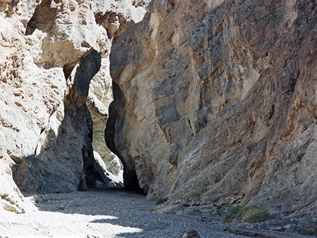
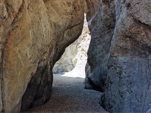
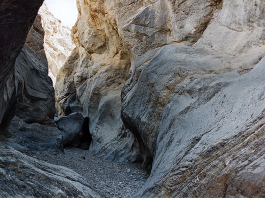
Perhaps the most beautiful narrows in Death Valley - a long succession of enchanting passages through light-colored rocks, often polished smooth by floodwaters. Many enclosed chambers, dryfalls and chokestones
Length: 3+ miles
Difficulty: Moderate to strenuous - frequent high dryfalls which may either be free-climbed, or bypassed by retreating a way and scaling the steep slopes at either side
Management: NPS
Rocks: Dolomite
Season: Fall, winter, spring
Trailhead: End of a short, signed side track
Rating (1-5): ★★★★★
Difficulty: Moderate to strenuous - frequent high dryfalls which may either be free-climbed, or bypassed by retreating a way and scaling the steep slopes at either side
Management: NPS
Rocks: Dolomite
Season: Fall, winter, spring
Trailhead: End of a short, signed side track
Rating (1-5): ★★★★★
Many canyons slice into the steep, metamorphic rocks that form the slopes of Tucki Mountain, south of Stovepipe Wells in Death Valley National Park, and doubtless all are interesting although most are rather inaccessible and not easily followed. Exceptions are three close to the main highway CA 190 which have a recognised trail at least part of the way: Mosaic, Little Bridge and Grotto, last of which is perhaps the best, and has various graceful narrow sections bordered by polished, twisted, greyish-blue rocks. These tend to end at deep, enclosed passages beneath dryfalls, above which the canyon is temporarily more open, so exploration requires backtracking a way then climbing up the cliffs to bypass the obstruction.

Only one faded sign set some way back from the highway points the way to Grotto Canyon, though the entrance can easily be reached by a rough track that leaves CA 190 to the south, about 4 miles east of Stovepipe Wells Village, and opposite the extended lay-by where people often park to explore and photograph the alluring sand dunes nearby. The track is narrow and stony, climbing 500 feet over 2 miles up the large alluvial fan radiating from the canyon mouth, then it drops down into the streambed. All cars should be able to reach the edge of the wash but high clearance vehicles are advisable to continue - ahead another mile is driveable, as far as the first enclosed section and dryfall.
No special permit is required, just a standard Death Valley National Park entry fee which is payable at the visitor center at Furnace Creek.
12 views of Grotto Canyon.
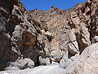
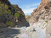
From the parking area at the edge of the wash, the track follows the streamway into the gorge, which is at first quite wide, filled with pebbles and shifting gravel. Cliffs gradually rise at either side - made of faded, brown, crumbling rock that supports no plant life, the heat increases as any breeze in the main valley is extinguished, and the general atmosphere becomes quite oppressive. After a few wide bends the canyon constricts quite suddenly, shortly below the first 'grotto' - a cool, sheltered narrow section at the base of a 3-step dryfall, each component being around 10 feet high. High clearance vehicles can drive to within 50 meters of this point, which is said to be a good place for a picnic.
Those with suitable climbing skills may continue directly upstream but an alternative option is to scramble up a boulder-filled ravine a little way back on the southwest (left) side and then, after climbing quite far, follow a route on the left up to the top of the exposed ridge that separates the ravine from the main canyon, which can then be re-entered by walking back along the ridge and down the slope on the far side where this becomes less steep - joining the wash at a point just above the grotto. The ridge has nice views down to the Stovepipe Wells dunes and up to the continuation of the canyon; not far ahead this seems to disappear into a swirl of tall, colorful rocks. This is one possible route though there is an easier, more well established bypass of the falls on the east side, reached by walking 0.1 miles back downcanyon, then following cairns up a side drainage on the right, returning to the main canyon a little further above the grotto.
Back on the streambed, the walk is through an open area for ten minutes or so and into a second, much longer section of narrows characterised by a clean, flat sandy floor edged by weathered light grey rocks. The cliffs above overhang in a few places creating almost tunnel-like conditions, then further on they rise quite sharply, preceding an impassable dryfall of about 10 meters. This can be overcome by back-tracking again and climbing around on the left side, returning via an easy return route shortly beyond the falls. Another temporary wide part is soon replaced by more lengthy narrows, very beautiful throughout - extensive smooth, bluish-grey, sometimes marble-like channels, worn shiny in places, with occasional small dryfalls, many twists and curves. Eventually the way ahead is blocked by a 12 foot dryfall - maybe free climbable, and certainly negotiable coming back down, but if not then it may be passed by walking back once more about 100 meters and ascending a steep slope on the left, past some large barrel cacti which grow profusely at this elevation, then higher still across the rocky hillside to traverse above some sheer cliffs and finally back down to the streamway.
The next narrows start quite soon and are also extensive and pretty, not quite as deep as the previous stretch but with more dryfalls and boulders in the range 3-8 feet, sometimes a little difficult to climb over. One possible end point is the base of a smooth 8 foot high pour-off, reached after a walk of about 3 miles from the parking area, and a 1,500 foot elevation gain.
Overall this is an excellent canyon - just testing enough to be interesting, it has a variety of unusual narrow sections, begins after only a short walk from the trailhead and offers the likelihood of complete solitude once past the first grotto.
Topographic Map of Grotto Canyon

Location
Only one faded sign set some way back from the highway points the way to Grotto Canyon, though the entrance can easily be reached by a rough track that leaves CA 190 to the south, about 4 miles east of Stovepipe Wells Village, and opposite the extended lay-by where people often park to explore and photograph the alluring sand dunes nearby. The track is narrow and stony, climbing 500 feet over 2 miles up the large alluvial fan radiating from the canyon mouth, then it drops down into the streambed. All cars should be able to reach the edge of the wash but high clearance vehicles are advisable to continue - ahead another mile is driveable, as far as the first enclosed section and dryfall.
Permit
No special permit is required, just a standard Death Valley National Park entry fee which is payable at the visitor center at Furnace Creek.
Photographs
12 views of Grotto Canyon.
Route Description for Grotto Canyon
From the parking area at the edge of the wash, the track follows the streamway into the gorge, which is at first quite wide, filled with pebbles and shifting gravel. Cliffs gradually rise at either side - made of faded, brown, crumbling rock that supports no plant life, the heat increases as any breeze in the main valley is extinguished, and the general atmosphere becomes quite oppressive. After a few wide bends the canyon constricts quite suddenly, shortly below the first 'grotto' - a cool, sheltered narrow section at the base of a 3-step dryfall, each component being around 10 feet high. High clearance vehicles can drive to within 50 meters of this point, which is said to be a good place for a picnic.
Bypass Route
Those with suitable climbing skills may continue directly upstream but an alternative option is to scramble up a boulder-filled ravine a little way back on the southwest (left) side and then, after climbing quite far, follow a route on the left up to the top of the exposed ridge that separates the ravine from the main canyon, which can then be re-entered by walking back along the ridge and down the slope on the far side where this becomes less steep - joining the wash at a point just above the grotto. The ridge has nice views down to the Stovepipe Wells dunes and up to the continuation of the canyon; not far ahead this seems to disappear into a swirl of tall, colorful rocks. This is one possible route though there is an easier, more well established bypass of the falls on the east side, reached by walking 0.1 miles back downcanyon, then following cairns up a side drainage on the right, returning to the main canyon a little further above the grotto.
Narrows and Dryfalls
Back on the streambed, the walk is through an open area for ten minutes or so and into a second, much longer section of narrows characterised by a clean, flat sandy floor edged by weathered light grey rocks. The cliffs above overhang in a few places creating almost tunnel-like conditions, then further on they rise quite sharply, preceding an impassable dryfall of about 10 meters. This can be overcome by back-tracking again and climbing around on the left side, returning via an easy return route shortly beyond the falls. Another temporary wide part is soon replaced by more lengthy narrows, very beautiful throughout - extensive smooth, bluish-grey, sometimes marble-like channels, worn shiny in places, with occasional small dryfalls, many twists and curves. Eventually the way ahead is blocked by a 12 foot dryfall - maybe free climbable, and certainly negotiable coming back down, but if not then it may be passed by walking back once more about 100 meters and ascending a steep slope on the left, past some large barrel cacti which grow profusely at this elevation, then higher still across the rocky hillside to traverse above some sheer cliffs and finally back down to the streamway.
The Upper Canyon
The next narrows start quite soon and are also extensive and pretty, not quite as deep as the previous stretch but with more dryfalls and boulders in the range 3-8 feet, sometimes a little difficult to climb over. One possible end point is the base of a smooth 8 foot high pour-off, reached after a walk of about 3 miles from the parking area, and a 1,500 foot elevation gain.
Overall this is an excellent canyon - just testing enough to be interesting, it has a variety of unusual narrow sections, begins after only a short walk from the trailhead and offers the likelihood of complete solitude once past the first grotto.
Nearby Slot Canyons
Grotto Canyon - Similar Hikes
All Contents © Copyright The American Southwest | Comments and Questions | Contribute | Affiliate Marketing Disclosure | Site Map


