Tributaries of North Wash - Canyon Three, Leprechaun
Slot Canyons > North Lake Powell > Tributaries of North Wash > Canyon Three
Leprechaun Canyon
A relatively long North Wash tributary with an unusual enclosed approach that narrows abruptly then splits into two main forks, both of which need ropes to explore and are best entered from the top end
Length: 1 mile, to the junction with the two upper forks
Difficulty: Easy to moderate
Trailhead: Beside UT 95
Rating (1-5): ★★★★★
Difficulty: Easy to moderate
Trailhead: Beside UT 95
Rating (1-5): ★★★★★
Map
Map of the North Wash tributaries.
Leprechaun Canyon Route Description
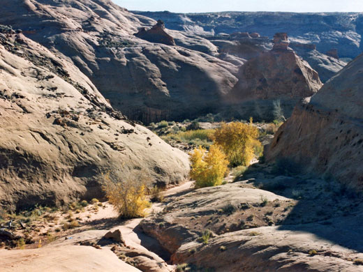
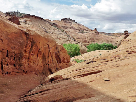
Leprechaun Canyon, the third and largest of the North Wash tributaries, is set quite far back from the road, beginning at the upper end of a wide valley overgrown by cottonwood trees, tamarisk bushes, reeds and long grass. The size of the streambed indicates this canyon receives rather more water than other drainages in this region, as do the marshy pools and patches of quicksand that persist for some time following rainfall, long after the stream itself dries up. The watercourse crosses UT 95 at mile 28.2, near to a short side track that leads to a parking/camping area on a sandbank above the creek.
After a 20 minute walk up the valley, the floor becomes sandy, the undergrowth dies away and the walls close in. A small, steep tributary joins on the left side then soon after the first short stretch of narrows begins - a graceful, wavy passage with rocks that overhang to create a tunnel-like effect. The slot ends at a pool and dryfall beyond which the canyon floor is flat, bare rock, and remains so for several hundred yards, while Leprechaun Canyon deepens further, enclosed by sheer, desert varnish stained cliffs that curve inwards creating an unusual, echoing chamber. This has a gloomy, rather forbidding atmosphere, indicative of darkness ahead, and sure enough after a couple more bends the walls close in suddenly. Ahead is a passage many yards high and just inches wide although a (usually) flooded cavern continues at ground level. This is very dark but not too long, and opens out after a few dozen yards into a lighter section preceding a junction in the canyon. The rocks hereabouts have many name carvings, some dating from the early 1970s.
The right branch of Leprechaun Canyon ascends steeply with several linked potholes and a slanting dryfall, not easily climbable. The left (main) fork has more extreme narrows, only 6 inches across, inclined at about 80° and very deep. This can be followed, though only by thin people as chokestones and further narrowing make progress difficult. Both branches may only properly be explored by descending from the top end and using ropes; the start of the canyons can be reached by retreating a way and climbing the sloping rocks just after the first tributary on the left, then walking half a mile over slickrock. This allows glimpses into the left fork of the canyon below, which splits again and has a few open areas with swirling potholes but mostly just long stretches of very deep, very narrow passages.
All Contents © Copyright The American Southwest | Comments and Questions | Contribute | Affiliate Marketing Disclosure | Site Map


