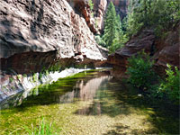
Aravaipa Canyon
Hike through Aravaipa Canyon, from west to east: from relatively wide, wooded surroundings into a narrower, cliff-bound gorge, followed by a long, straight, wider section as the rocks change from volcanic to conglomerate. The final 2 miles, to the eastern trailhead, are narrower again, and more winding
Length: 10.4 miles
Elevation change: 460 feet
Difficulty: Moderate; no major obstacles, but the canyon is long, overgrown in places, and requires some wading
Type: One way
Usage: Low; visitor numbers are restricted
Season: All year, except at times of high water
Trailhead: Parking area at the end of the partly unpaved Aravaipa Road, 12.2 miles from Hwy 77. Also accessible from the east
Rating (1-5): ★★★★★
The spectacular canyon of Aravaipa Creek can be explored from either end, though the easier access means that most people begin from the western trailhead, along a side road off Hwy 77. There are many areas suitable for camping, facilitating multi-day trips, but probably the most popular option is a day hike exploring just the first few miles, though traversing the whole canyon (a round trip of 21 miles), is possible for strong hikers in one day.
Another option is a one-way hike, requiring a car shuttle between the two trailheads; a long journey of 155 miles along regular highways. The very rough Rug Road provides a shorter (84 mile) connection, crossing the Galiuro Mountains to the south, but driving this 4WD route needs at least one full day.
The western trailhead is 12.2 miles along Aravaipa Canyon Road, which is unpaved for the last 8 miles, though usually negotiable by all vehicles up to small RVs. The trailhead has a restroom, map and register, where hikers enter their permit numbers (see recreation.gov for permit details and availability). The walk starts along the road another third of a mile - through a gate, around a bend and across a little side ravine, to a sign indicating a path on the east side. This descends a bushy hillside home to many wildflowers and cacti, past several notices warning against trespassing on the private land at either side, into the flat, wooded floodplain on the canyon floor and out to a stony beach beside the creek, which is broadly similar in appearance throughout the whole canyon.
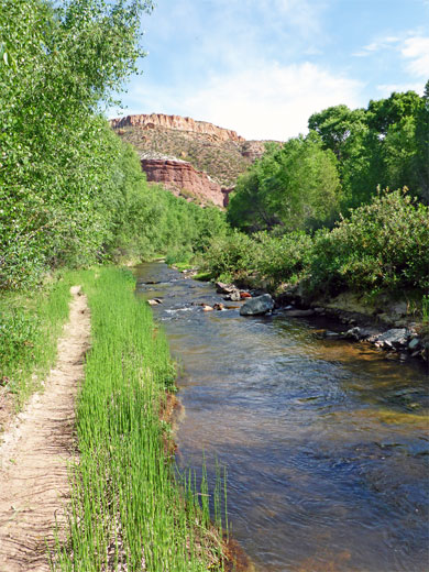
The water is just a few inches deep, clean, quite fast flowing, forming some pools and small rapids or cascades; there are no big falls or deeper pools. Most sections are overgrown along both sides, with grassy banks ranging in width from a few feet to 500 feet - numerous big trees including oak, alder, willow, cottonwood and sycamore cover much of the canyon floor, and dozens of wildflower species grow in the sunnier spaces below. Cacti are in general not found along the creek or the lower banks, only higher up, on the stepped cliffs which become especially tall along the middle section. Big brush piles in the woods along the initial section of the hike show that the canyon is sometimes subject to powerful flash floods.
The hiking route proceeds along narrow paths through the trees, crossing the creek a few times, then heading northwards along a lengthy straight stretch, staying mostly on the west side, aiming for a line of reddish cliffs, at the foot of which the canyon turns back south. The trail moves away further to the south, to cut off the bend, passing through dryer, sandy surroundings for a while as the canyon remains generally wide, bordered by bushy slopes rather than rocky cliffs. The first place where cliffs directly border the stream is reached after 1.7 miles, just before Hells Half Acre Canyon; the creek forms a few deeper pools and beyond are some more enclosed passages and a few tighter bends, to and past the next tributary, Cave Canyon, on the north side. Much taller cliffs come into view ahead, dotted with many saguaro.
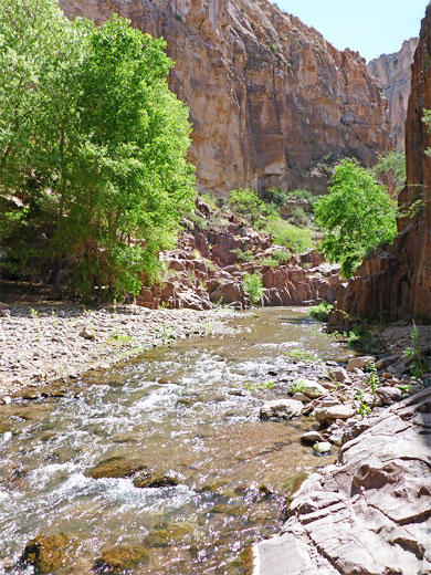
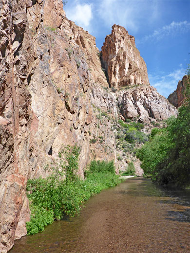
Cliffs now border the creek on both sides. Occasional boulders in the stream create minor cascades, as the canyon moves through a U-shaped bend and past a steeply-ascending, south-side tributary (2.4 miles). A few more bends and a longer straight leads to a pretty section of the creek framed by stepped, reddish-grey cliffs and benches - the narrowest part of the whole canyon. The rocks here are Precambian schist, very hard, and hence more resistant to erosion. The ravine widens, and one point the path climbs about 50 feet above the floor to bypass some cliffs; soon after the creek enters a longer straight leading to the largest tributary, Virgus Canyon, on the south side (4.2 miles). Beyond here canyon widens and the path runs through an extended grove of big cottonwood trees on the south side, past several flat areas used as camp sites. The path returns to the stream after passing through a mesquite thicket, near the north-side tributary of Horse Camp Canyon (4.7 miles). This marks the end of the most enclosed section, and for the next few miles the canyon is much wider, straighter and has more extensive woodland at either side, with broad pebble or gravel areas beside the flowing stream.
Spring-fed Booger Canyon joins after 6.2 miles and the smaller Paisano Canyon after 6.9 miles, both from the north. A bend beneath tall cliffs on the south side marks a change in the underlying rocks, from Galiuro volcanics to holey, uneven Hell Hole conglomerate. Tiny drainages join from the south, creating little chutes and dryfalls down the irregularly-textured cliffs. Saguaro are much in evidence, now rather closer to creek level, though never on the canyon floor. The canyon widens more around the junction with Deer Creek (8 miles), this the narrowest of the tributaries, forming several miles of slot-like passageways, in an area known as Hell Hole Valley. The last major tributary is Parsons Canyon on the south side (8.7 miles), after which Aravaipa Creek flows through four tight bends, quite narrow once more, to the eastern trailhead at Turkey Creek (10.4 miles).
Typical scene in a narrow part of the canyon, and a gila monster lizard (0:46 min).
Another option is a one-way hike, requiring a car shuttle between the two trailheads; a long journey of 155 miles along regular highways. The very rough Rug Road provides a shorter (84 mile) connection, crossing the Galiuro Mountains to the south, but driving this 4WD route needs at least one full day.
Trailhead
The western trailhead is 12.2 miles along Aravaipa Canyon Road, which is unpaved for the last 8 miles, though usually negotiable by all vehicles up to small RVs. The trailhead has a restroom, map and register, where hikers enter their permit numbers (see recreation.gov for permit details and availability). The walk starts along the road another third of a mile - through a gate, around a bend and across a little side ravine, to a sign indicating a path on the east side. This descends a bushy hillside home to many wildflowers and cacti, past several notices warning against trespassing on the private land at either side, into the flat, wooded floodplain on the canyon floor and out to a stony beach beside the creek, which is broadly similar in appearance throughout the whole canyon.
The Creek
The water is just a few inches deep, clean, quite fast flowing, forming some pools and small rapids or cascades; there are no big falls or deeper pools. Most sections are overgrown along both sides, with grassy banks ranging in width from a few feet to 500 feet - numerous big trees including oak, alder, willow, cottonwood and sycamore cover much of the canyon floor, and dozens of wildflower species grow in the sunnier spaces below. Cacti are in general not found along the creek or the lower banks, only higher up, on the stepped cliffs which become especially tall along the middle section. Big brush piles in the woods along the initial section of the hike show that the canyon is sometimes subject to powerful flash floods.
The Lower Canyon
The hiking route proceeds along narrow paths through the trees, crossing the creek a few times, then heading northwards along a lengthy straight stretch, staying mostly on the west side, aiming for a line of reddish cliffs, at the foot of which the canyon turns back south. The trail moves away further to the south, to cut off the bend, passing through dryer, sandy surroundings for a while as the canyon remains generally wide, bordered by bushy slopes rather than rocky cliffs. The first place where cliffs directly border the stream is reached after 1.7 miles, just before Hells Half Acre Canyon; the creek forms a few deeper pools and beyond are some more enclosed passages and a few tighter bends, to and past the next tributary, Cave Canyon, on the north side. Much taller cliffs come into view ahead, dotted with many saguaro.
Narrows
Cliffs now border the creek on both sides. Occasional boulders in the stream create minor cascades, as the canyon moves through a U-shaped bend and past a steeply-ascending, south-side tributary (2.4 miles). A few more bends and a longer straight leads to a pretty section of the creek framed by stepped, reddish-grey cliffs and benches - the narrowest part of the whole canyon. The rocks here are Precambian schist, very hard, and hence more resistant to erosion. The ravine widens, and one point the path climbs about 50 feet above the floor to bypass some cliffs; soon after the creek enters a longer straight leading to the largest tributary, Virgus Canyon, on the south side (4.2 miles). Beyond here canyon widens and the path runs through an extended grove of big cottonwood trees on the south side, past several flat areas used as camp sites. The path returns to the stream after passing through a mesquite thicket, near the north-side tributary of Horse Camp Canyon (4.7 miles). This marks the end of the most enclosed section, and for the next few miles the canyon is much wider, straighter and has more extensive woodland at either side, with broad pebble or gravel areas beside the flowing stream.
The Upper Canyon
Spring-fed Booger Canyon joins after 6.2 miles and the smaller Paisano Canyon after 6.9 miles, both from the north. A bend beneath tall cliffs on the south side marks a change in the underlying rocks, from Galiuro volcanics to holey, uneven Hell Hole conglomerate. Tiny drainages join from the south, creating little chutes and dryfalls down the irregularly-textured cliffs. Saguaro are much in evidence, now rather closer to creek level, though never on the canyon floor. The canyon widens more around the junction with Deer Creek (8 miles), this the narrowest of the tributaries, forming several miles of slot-like passageways, in an area known as Hell Hole Valley. The last major tributary is Parsons Canyon on the south side (8.7 miles), after which Aravaipa Creek flows through four tight bends, quite narrow once more, to the eastern trailhead at Turkey Creek (10.4 miles).
Video of Aravaipa Canyon
Typical scene in a narrow part of the canyon, and a gila monster lizard (0:46 min).
Aravaipa Canyon - Similar Hikes
All Contents © Copyright The American Southwest | Comments and Questions | Contribute | Affiliate Marketing Disclosure | Site Map


