Lower Fish Creek
Permanent drainage through a deep, overgrown and relatively wide canyon; forms little cascades and long, shallow pools. Many wildflowers on the canyon floor, and saguaro on the cliffs. Explorable by off-trail hiking. As of 2019 the canyon may be inaccessible, since the approach road (Apache Trail) is closed
Length: as far as desired; 5.5 miles to the Salt River
Elevation change: up to 500 feet
Difficulty: Moderate; navigating through often dense vegetation, and wading in the creek
Type: One way, off trail
Usage: Low
Season: All year; plenty of shade for summer hikes, and water
Trailhead: Pull-out on the north side of the Apache Trail
Rating (1-5): ★★★★★
Elevation change: up to 500 feet
Difficulty: Moderate; navigating through often dense vegetation, and wading in the creek
Type: One way, off trail
Usage: Low
Season: All year; plenty of shade for summer hikes, and water
Trailhead: Pull-out on the north side of the Apache Trail
Rating (1-5): ★★★★★
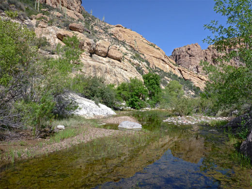
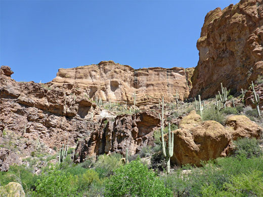
Fish Creek is a major drainage in the Superstition Mountains of south central Arizona, containing year-round flowing water and draining into the Salt River, between Canyon and Apache lakes. Most is enclosed by high volcanic cliffs, forming quite a substantial canyon, filled with much vegetation, as the stream flows through a succession of pools and little cascades, in some places bordered by sheer rock walls, in others by sand or pebble beaches.
There is no trail through the canyon, but it can be explored with moderate effort, by walking beside or often along the stream. The creek is crossed by the unpaved section of the Apache Trail, and can be followed either downstream (northwest; this hike), leading to the river, or upstream, deeper into the mountains, though no part of the canyon sees many visitors apart from a short stretch near the road bridge, as here are found several deep pools suitable for swimming and diving. The lower section of the canyon is generally deeper, but wider and more overgrown around the creek; the upper part is somewhat narrow and slopes upwards a little bit more so has a greater number of pools and waterfalls.
All the canyon contains many flower species and plentiful wildlife, and the cooling waters and partial shade allow hikes all year, even during the hot summer months. The sometimes thick vegetation and rocky terrain make progress slower than might be expected - around one mile per hour.
Since 2019, the canyon may be inaccessible since a nine mile section of the Apache Trail, either side of the crossing, is closed 'indefinitely', due to landslips following a wildfire.
Topo map of Fish Creek
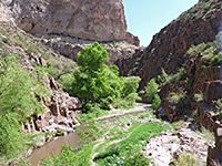
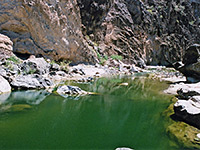
15 views of the canyon.
The Apache Trail crosses Fish Creek 9 miles east of Tortilla Flat, just east of the big descent marking the west end of the rough, unpaved portion of the road. Parking for the downstream section of the creek used to be along a little spur on the north side, one mile north of the bridge and the more popular access point for the upper canyon - though this point is now only reachable on foot, due to the closeure of the road. This part of the valley is wide and the parking area is also a good picnic spot, with easy access to the stream, here flowing along level ground beneath big, shady trees.
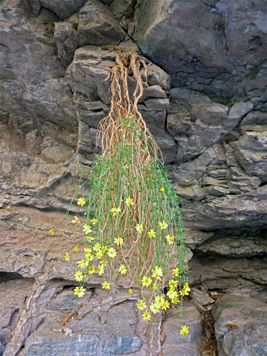
Plant growing upside-down from overhanging rocks; possibly ericameria linearfolia, interior goldenbush
In the vicinity of the parking area, the water in Fish Creek is usually just a few inches deep, or less, and flows intermittently between lines of trees. Parallel, dry, stony channels, slightly higher in elevation, tell of great floods that occasionally follow heavy rainfall. Away from these open areas, all of the valley floor is rather overgrown, becoming more so after about a half mile downstream, where longer, bushy thickets fill all the space between the stream and the canyon walls - primarily willow, bamboo and mesquite, with occasional light-barked Arizona sycamores and other tall trees. The streamway may have shallow water or deeper pools between boulders, and in the occasional open areas is bordered by smooth slickrock, vertical rocks, pebble beaches or sandy flats. Rocks in the creek are slippery due to a covering of algae, and the water is often rather dull brown in color. Saguaro and other cacti are abundant in the higher reaches of the canyon, on benches and crevices in the cliffs, though they are not generally found at stream level.
The canyon narrows gradually and bends to the west. Amongst the first interesting sites is a flooded overhang on the west side - a quite deep pool in a semi-circular alcove, containing clear water and creating nice reflective patterns on the ceiling. Bigger cliffs rise up beyond, as the canyon continues to deepen. The creek winds around a tighter bend, centered on a block shaped butte high above, then enters another densely vegetated section. Spires and eroded ridges adorn the cliffs to the northeast. Around the next bend, a wider and less overgrown section leads to the junction with the first major tributary, also on the northeast side. The canyon then curves left, beneath sheer, banded cliffs, as even higher cliffs come into view further downstream. A steep-sided tributary is passed on the left (2 miles), and the main ravine veers right. The canyon around the junction is overgrown once more, especially with bamboo, and is quite narrow. Two lesser side ravines join from the right, beyond which is a long, straight, initially open stretch, with a few pretty pools and cliffs, then lots of trees and bushes, extending to the next bend where the canyon moves northwards, curves one more and reaches the first point where water covers all of the canyon floor, requiring a rather deeper wade to continue. This point is 3.4 miles from the trailhead, a little over half way to the Salt River.
There is no trail through the canyon, but it can be explored with moderate effort, by walking beside or often along the stream. The creek is crossed by the unpaved section of the Apache Trail, and can be followed either downstream (northwest; this hike), leading to the river, or upstream, deeper into the mountains, though no part of the canyon sees many visitors apart from a short stretch near the road bridge, as here are found several deep pools suitable for swimming and diving. The lower section of the canyon is generally deeper, but wider and more overgrown around the creek; the upper part is somewhat narrow and slopes upwards a little bit more so has a greater number of pools and waterfalls.
All the canyon contains many flower species and plentiful wildlife, and the cooling waters and partial shade allow hikes all year, even during the hot summer months. The sometimes thick vegetation and rocky terrain make progress slower than might be expected - around one mile per hour.
Since 2019, the canyon may be inaccessible since a nine mile section of the Apache Trail, either side of the crossing, is closed 'indefinitely', due to landslips following a wildfire.
Location
Topo map of Fish Creek
Photographs
15 views of the canyon.
Fish Creek Trailhead
The Apache Trail crosses Fish Creek 9 miles east of Tortilla Flat, just east of the big descent marking the west end of the rough, unpaved portion of the road. Parking for the downstream section of the creek used to be along a little spur on the north side, one mile north of the bridge and the more popular access point for the upper canyon - though this point is now only reachable on foot, due to the closeure of the road. This part of the valley is wide and the parking area is also a good picnic spot, with easy access to the stream, here flowing along level ground beneath big, shady trees.

Plant growing upside-down from overhanging rocks; possibly ericameria linearfolia, interior goldenbush
Rocks and Vegetation
In the vicinity of the parking area, the water in Fish Creek is usually just a few inches deep, or less, and flows intermittently between lines of trees. Parallel, dry, stony channels, slightly higher in elevation, tell of great floods that occasionally follow heavy rainfall. Away from these open areas, all of the valley floor is rather overgrown, becoming more so after about a half mile downstream, where longer, bushy thickets fill all the space between the stream and the canyon walls - primarily willow, bamboo and mesquite, with occasional light-barked Arizona sycamores and other tall trees. The streamway may have shallow water or deeper pools between boulders, and in the occasional open areas is bordered by smooth slickrock, vertical rocks, pebble beaches or sandy flats. Rocks in the creek are slippery due to a covering of algae, and the water is often rather dull brown in color. Saguaro and other cacti are abundant in the higher reaches of the canyon, on benches and crevices in the cliffs, though they are not generally found at stream level.
The Canyon
The canyon narrows gradually and bends to the west. Amongst the first interesting sites is a flooded overhang on the west side - a quite deep pool in a semi-circular alcove, containing clear water and creating nice reflective patterns on the ceiling. Bigger cliffs rise up beyond, as the canyon continues to deepen. The creek winds around a tighter bend, centered on a block shaped butte high above, then enters another densely vegetated section. Spires and eroded ridges adorn the cliffs to the northeast. Around the next bend, a wider and less overgrown section leads to the junction with the first major tributary, also on the northeast side. The canyon then curves left, beneath sheer, banded cliffs, as even higher cliffs come into view further downstream. A steep-sided tributary is passed on the left (2 miles), and the main ravine veers right. The canyon around the junction is overgrown once more, especially with bamboo, and is quite narrow. Two lesser side ravines join from the right, beyond which is a long, straight, initially open stretch, with a few pretty pools and cliffs, then lots of trees and bushes, extending to the next bend where the canyon moves northwards, curves one more and reaches the first point where water covers all of the canyon floor, requiring a rather deeper wade to continue. This point is 3.4 miles from the trailhead, a little over half way to the Salt River.
Fish Creek Wildflowers
 Stachys coccinea |
 Scutellaria platyphylla |
 Funastrum cynanchoides |
 Abutilon palmeri |
Lower Fish Creek - Similar Hikes
All Contents © Copyright The American Southwest | Comments and Questions | Contribute | Affiliate Marketing Disclosure | Site Map


