New Hance Trail, Grand Canyon National Park
Arizona > Grand Canyon National Park > South Rim > Hiking > New Hance Trail
New Hance Trail
Spectacular, unmaintained rim to river path that follows Red Canyon to Hance Rapids; perhaps the most difficult South Rim trail
Length: 8 miles
Elevation change: 4,530 feet
Difficulty: Strenuous, steep, remote, no water sources along the trail
Type: One way; leads to an intersection beside the Colorado, with the Tonto Trail and the Escalante Trail
Usage: Low
Season: Accessible all year but the upper section may be snow-covered in winter, while most of the route is exposed and very hot in summer
Trailhead: Unmarked location along the East Rim Drive, west of Moran Point
Rating (1-5): ★★★★★
There are seven official routes that descend from the South Rim of the Grand Canyon towards the Colorado, of which five actually reach the river - the easiest is the Bright Angel Trail since drinking water is available at several places on the way, while the most difficult is generally considered to be either the Beamer Trail or the New Hance Trail. This latter is certainly the least traveled path, and although it has a similar length (8 miles) and elevation change (4,530 feet) to the others, the path presents several extra challenges including steep and sometimes unstable terrain, complete lack of water along the whole journey, and occasional difficulties in locating the correct route.
The New Hance Trail was originally constructed by prospector John Hance around 1894, built to access mines near the Colorado, and for most of its length descends a scenic tributary ravine (Red Canyon), starting on the East Rim Drive half a mile southwest of Moran Point.
The trail is usually visited as part of a backpacking trip, spending at least one night by the river, but a (long) day hike is quite possible, taking 8 hours or more. The main requirement in such a trip is the need to take enough water, and unless purifying extra from the river, supplies should be cached in several places on the way down. The hike is best attempted in the cooler seasons of spring and fall since summers are too hot, especially in the exposed lower few miles of Red Canyon, where the temperature can exceed 110°F (43°C).
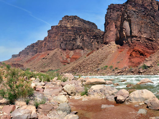
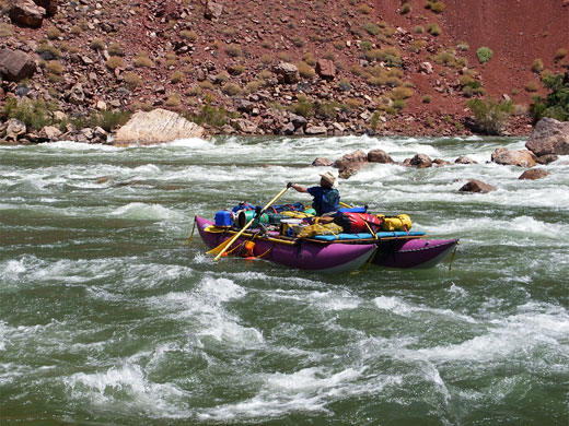
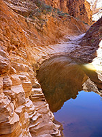
Much of the New Hance Trail is not outstandingly scenic, being along a bushy gorge with only limited views of the wider landscape, though the last section makes up for that - firstly by the fantastic colors and formations of the sandstone in the walls of lower Red Canyon, and secondly because of the Colorado itself; the trail ends at the edge of Hance Rapids, the largest single drop in the whole Grand Canyon, and where the river is enclosed by particularly steep and colorful cliffs.
New Hance Trail topographic map, South Rim location map.
14 views along the New Hance Trail.
Colorado River, at the end of the trail (mp4; 0:51 min; 6.8 mb).

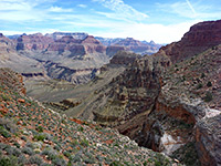
Upper Red Canyon - view across to the North Rim, including Vishnu Temple, Rama Shrine and Solomon Temple
The New Hance trailhead (elevation 7,010 feet) is not signposted from the East Rim Drive but recognizable by a small pull-out on the west side, marked with two No Parking signs - a location just north of milepost 257. Vehicles can stop here to unload gear, but for the hike have to be left either half a mile south, at the start of a forest track (a safe, shady location), or one mile north at Moran Point, although there are several other small roadside verges nearby that don't have any no parking signs.
This stretch of the highway is lined by low pinyon/juniper pine forest which hides the canyon, though the rim is soon reached by a three minute walk from the trailhead along a wide path through the trees. At the edge, two NPS signs warn of the dangers that lie ahead, as the trail starts its descent, initially down a bushy, overgrown slope formed of whitish Kaibab limestone. After traversing eastwards a way above a vertical layer, the trail winds down a break in the cliffs, cuts back west then resumes the descent of the rocky hillside. The surface is slippery in many places due to loose stones and soil, as are various other locations further along the route. This initial section is quite shady all day, owing to the northeast-facing slopes and the pine trees, which persist for the first couple of miles. After about one mile, the trail arrives at a saddle linking the main south rim with Coronado Butte to the north; to the right begins an overgrown ravine, the very upper end of Red Canyon, a drainage that is now followed all the way to the Colorado River.
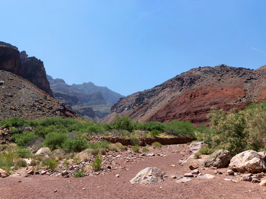
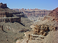
The next mile is down the ravine (dropping another 1,000 feet), staying mostly on the north side, still through wooded terrain but now passing shorter trees mixed with yucca and cacti. The ravine has a few dryfalls of 5 to 10 feet over sandstone layers, between long straight sections where the ground slopes down evenly. Cairns mark the path in some places where the route is just a little difficult to follow. The trees have all faded away by the 5,000 foot mark, and the canyon drops vertically over the Redwall limestone into a deep, inaccessible, sheer-walled gorge, so the path turns right just above, passes over a ridge, crosses a tributary ravine that also drops off downstream, then starts a long traverse of the hillside, staying relatively level for another mile. This part of the trail is straight at first then more bendy, curving around two side drainages and out to the top of a sandstone pinnacle, from where the colorful lower end of Red Canyon comes properly into view for the first time. This point is one possible target for a day (or half day) hike as next begins the second major descent, through an area of jumbled rocks and loose earth then across an exposed, grassy hillside high above the streambed.
The slopes now bear only scattered cacti and bushes - the land is largely unvegetated, and in full sun most of the day. This is also where the temperature really starts to increase. The ground takes on unusual colors - red, yellow, grey, as the path descends through the Bright Angel Shale layer and nears the canyon floor. After dropping over 1,000 feet in little more than a mile, the route bends round a side canyon, crossing its red rock floor just above a dryfall, and is soon following the main drainage, staying above the streambed to avoid several other pour-offs. Directly opposite are the conspicuous, tilted, bright red strata (Hakatai shale, underneath the darker Dox sandstone) that can be glimpsed from several places on the south rim including Moran Point and Zuni Point. Overlying these angled layers is the flat Bright Angel shale - the difference in orientation is one indication of the Great Unconformity, representing a gap of around half a billion years of geological history.
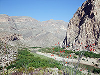
Cliffs of the inner canyon gorge can now be seen ahead and although there is still 2 miles to go before the end of the trail, the remainder of the walk is relatively easy; the path soon descends to stream level after the final drop off and stays there all the way to the river apart from one place where it climbs the hillside a short distance to pass some large boulders. The course of the path is not always obvious in the widening lower end of the canyon but it is easy enough to walk directly down the stony streambed. Cottonwood trees and large bushes grow as the river approaches, and tall sandbanks rise up around the Colorado River confluence. The Tonto Trail forks off westwards and the lesser used Escalante Route branches off to the east, while ahead is a sizeable open area of sand, boulders and mesquite thickets, directly beside Hance Rapids - the largest and most dangerous drop on the river within the Grand Canyon. The cliffs opposite are composed of more deep red strata, crossed by a dark volcanic dyke at a 30° angle. About one mile of the cold, fast-flowing river is in view - more downstream can be seen by walking a little way along the Tonto Trail. Upstream the canyon walls are more sheer, and the river curves out of sight towards the next tributary canyon (Papago Creek).
The New Hance Trail was originally constructed by prospector John Hance around 1894, built to access mines near the Colorado, and for most of its length descends a scenic tributary ravine (Red Canyon), starting on the East Rim Drive half a mile southwest of Moran Point.
The trail is usually visited as part of a backpacking trip, spending at least one night by the river, but a (long) day hike is quite possible, taking 8 hours or more. The main requirement in such a trip is the need to take enough water, and unless purifying extra from the river, supplies should be cached in several places on the way down. The hike is best attempted in the cooler seasons of spring and fall since summers are too hot, especially in the exposed lower few miles of Red Canyon, where the temperature can exceed 110°F (43°C).
Much of the New Hance Trail is not outstandingly scenic, being along a bushy gorge with only limited views of the wider landscape, though the last section makes up for that - firstly by the fantastic colors and formations of the sandstone in the walls of lower Red Canyon, and secondly because of the Colorado itself; the trail ends at the edge of Hance Rapids, the largest single drop in the whole Grand Canyon, and where the river is enclosed by particularly steep and colorful cliffs.
Maps
New Hance Trail topographic map, South Rim location map.
Photographs
14 views along the New Hance Trail.
Video
Colorado River, at the end of the trail (mp4; 0:51 min; 6.8 mb).

Upper Red Canyon - view across to the North Rim, including Vishnu Temple, Rama Shrine and Solomon Temple
New Hance Trailhead
The New Hance trailhead (elevation 7,010 feet) is not signposted from the East Rim Drive but recognizable by a small pull-out on the west side, marked with two No Parking signs - a location just north of milepost 257. Vehicles can stop here to unload gear, but for the hike have to be left either half a mile south, at the start of a forest track (a safe, shady location), or one mile north at Moran Point, although there are several other small roadside verges nearby that don't have any no parking signs.
Start of the New Hance Trail
This stretch of the highway is lined by low pinyon/juniper pine forest which hides the canyon, though the rim is soon reached by a three minute walk from the trailhead along a wide path through the trees. At the edge, two NPS signs warn of the dangers that lie ahead, as the trail starts its descent, initially down a bushy, overgrown slope formed of whitish Kaibab limestone. After traversing eastwards a way above a vertical layer, the trail winds down a break in the cliffs, cuts back west then resumes the descent of the rocky hillside. The surface is slippery in many places due to loose stones and soil, as are various other locations further along the route. This initial section is quite shady all day, owing to the northeast-facing slopes and the pine trees, which persist for the first couple of miles. After about one mile, the trail arrives at a saddle linking the main south rim with Coronado Butte to the north; to the right begins an overgrown ravine, the very upper end of Red Canyon, a drainage that is now followed all the way to the Colorado River.
Upper Red Canyon
The next mile is down the ravine (dropping another 1,000 feet), staying mostly on the north side, still through wooded terrain but now passing shorter trees mixed with yucca and cacti. The ravine has a few dryfalls of 5 to 10 feet over sandstone layers, between long straight sections where the ground slopes down evenly. Cairns mark the path in some places where the route is just a little difficult to follow. The trees have all faded away by the 5,000 foot mark, and the canyon drops vertically over the Redwall limestone into a deep, inaccessible, sheer-walled gorge, so the path turns right just above, passes over a ridge, crosses a tributary ravine that also drops off downstream, then starts a long traverse of the hillside, staying relatively level for another mile. This part of the trail is straight at first then more bendy, curving around two side drainages and out to the top of a sandstone pinnacle, from where the colorful lower end of Red Canyon comes properly into view for the first time. This point is one possible target for a day (or half day) hike as next begins the second major descent, through an area of jumbled rocks and loose earth then across an exposed, grassy hillside high above the streambed.
Lower Red Canyon
The slopes now bear only scattered cacti and bushes - the land is largely unvegetated, and in full sun most of the day. This is also where the temperature really starts to increase. The ground takes on unusual colors - red, yellow, grey, as the path descends through the Bright Angel Shale layer and nears the canyon floor. After dropping over 1,000 feet in little more than a mile, the route bends round a side canyon, crossing its red rock floor just above a dryfall, and is soon following the main drainage, staying above the streambed to avoid several other pour-offs. Directly opposite are the conspicuous, tilted, bright red strata (Hakatai shale, underneath the darker Dox sandstone) that can be glimpsed from several places on the south rim including Moran Point and Zuni Point. Overlying these angled layers is the flat Bright Angel shale - the difference in orientation is one indication of the Great Unconformity, representing a gap of around half a billion years of geological history.
End of the Trail
Cliffs of the inner canyon gorge can now be seen ahead and although there is still 2 miles to go before the end of the trail, the remainder of the walk is relatively easy; the path soon descends to stream level after the final drop off and stays there all the way to the river apart from one place where it climbs the hillside a short distance to pass some large boulders. The course of the path is not always obvious in the widening lower end of the canyon but it is easy enough to walk directly down the stony streambed. Cottonwood trees and large bushes grow as the river approaches, and tall sandbanks rise up around the Colorado River confluence. The Tonto Trail forks off westwards and the lesser used Escalante Route branches off to the east, while ahead is a sizeable open area of sand, boulders and mesquite thickets, directly beside Hance Rapids - the largest and most dangerous drop on the river within the Grand Canyon. The cliffs opposite are composed of more deep red strata, crossed by a dark volcanic dyke at a 30° angle. About one mile of the cold, fast-flowing river is in view - more downstream can be seen by walking a little way along the Tonto Trail. Upstream the canyon walls are more sheer, and the river curves out of sight towards the next tributary canyon (Papago Creek).
New Hance Trail - Similar Hikes
All Contents © Copyright The American Southwest | Comments and Questions | Contribute | Affiliate Marketing Disclosure | Site Map


