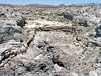
Blue Mesa Trail, Petrified Forest National Park
Arizona > Petrified Forest National Park > Hiking > Blue Mesa Trail
Blue Mesa Trail
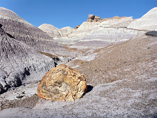
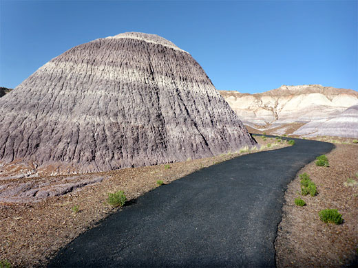
Reached by a short loop road, Blue Mesa features many logs lying beneath undulating, purple-grey mounds of bentonite clay, below a narrow plateau. A paved trail descends the west side of the mesa and loops around some of the badlands, past a selection of large logs
Length: 1 mile (loop)
Elevation change: 130 feet
Difficulty: Easy
Type: One way, mostly off trail
Usage: High
Season: Spring, summer, fall - winters are cold and snowy
Trailhead: Parking lot along a spur road off the park drive
Rating (1-5): ★★★★★
Elevation change: 130 feet
Difficulty: Easy
Type: One way, mostly off trail
Usage: High
Season: Spring, summer, fall - winters are cold and snowy
Trailhead: Parking lot along a spur road off the park drive
Rating (1-5): ★★★★★
The Blue Mesa Trail is a fully paved, one mile lollipop loop, amongst the most popular paths in Petrified Forest National Park, descending from the rim of an isolated mesa and following both sides of a shallow valley between colorful stripy mounds of bentonite clay, in shades of grey, purple and blue, accompanied by a fair amount of petrified wood, here mostly orange-red in colour. Many other fossils have been excavated from the crumbly rocks of the surrounding hills, of both animals and plants.
The path is briefly quite steep then almost level, and the route is considered to be fully accessible. Along the way are six notices giving information about the geology of the area. More of the hills can be seen along the Historic Blue Forest Trail, a primitive route that departs to the west, later linking with an old roadbed that meets the main park road, after 1.3 miles.
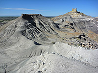
All the rocks are from the Blue Mesa Member of the Chinle Formation, strata exposed in many other places in the park including the Tepees, along the main road. The formation occurs extensively across the Colorado Plateau and is always fossiliferous, including many other exposures of petrified wood elsewhere in Arizona and Utah.
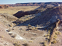
Blue Mesa is reached by a side road east of the highway, across a grassy flat and up to the south edge of the mesa, where it splits into a short, one-way loop, with the trailhead at the far end. Another pullout a little further gives a good elevated view of the trail, looking all across the valley. The path starts right at the edge of the mesa, overlooking vast, featureless prairie to the north, and it runs initially along a narrow neck of land before descending by 100 feet, into the upper end of the valley, where the first petrified wood specimens are seen. The trail soon reaches the start of the half mile loop section, for which anticlockwise is the usual walking direction. This path veers to the west, to the unsigned junction with the primitive trail, continuing down the valley below a line of banded hills. It crosses to the far side and turns back north, running beneath the roadside overlook, and past the most photogenic piece of petrified wood in the area, a thick log balanced on a narrow whitish pedestal. The route rises slightly and arrives back at the junction at the start of the loop.

The path is briefly quite steep then almost level, and the route is considered to be fully accessible. Along the way are six notices giving information about the geology of the area. More of the hills can be seen along the Historic Blue Forest Trail, a primitive route that departs to the west, later linking with an old roadbed that meets the main park road, after 1.3 miles.
All the rocks are from the Blue Mesa Member of the Chinle Formation, strata exposed in many other places in the park including the Tepees, along the main road. The formation occurs extensively across the Colorado Plateau and is always fossiliferous, including many other exposures of petrified wood elsewhere in Arizona and Utah.
Route
Blue Mesa is reached by a side road east of the highway, across a grassy flat and up to the south edge of the mesa, where it splits into a short, one-way loop, with the trailhead at the far end. Another pullout a little further gives a good elevated view of the trail, looking all across the valley. The path starts right at the edge of the mesa, overlooking vast, featureless prairie to the north, and it runs initially along a narrow neck of land before descending by 100 feet, into the upper end of the valley, where the first petrified wood specimens are seen. The trail soon reaches the start of the half mile loop section, for which anticlockwise is the usual walking direction. This path veers to the west, to the unsigned junction with the primitive trail, continuing down the valley below a line of banded hills. It crosses to the far side and turns back north, running beneath the roadside overlook, and past the most photogenic piece of petrified wood in the area, a thick log balanced on a narrow whitish pedestal. The route rises slightly and arrives back at the junction at the start of the loop.
Topographic Map of the Blue Mesa Trail

Blue Mesa Trail - Similar Hikes
All Contents © Copyright The American Southwest | Comments and Questions | Contribute | Affiliate Marketing Disclosure | Site Map


