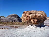
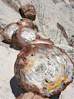
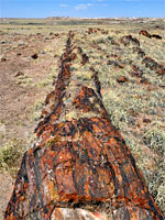
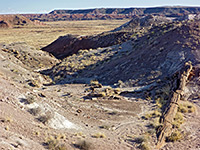
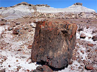
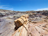
Hiking in Petrified Forest National Park comprises eight easy trails along the park road, the longest a 1.6 mile loop, and ten primitive routes, of up to 8.5 miles - known by the NPS as Off the Beaten Path trails. The maintained trails are mostly through collections of petrified wood, while the wilderness routes cross badlands and plains, also filled with the fossilized logs, plus petroglyphs and eroded rock formations.
The Petrified Forest National Park map shows the location of all trails - indicated by a number.
The Petrified Forest National Park map shows the location of all trails - indicated by a number.
Petrified Forest National Park - Maintained Trails
|
1 Agate House Trail Length 1 mile (1.6 km) Elevation change 50 feet (15 meters) Trailhead Parking lot at Rainbow Forest Museum Rating (1-5) ★★★★★ Agate House, a small stone hut, was constructed entirely of petrified wood by Puebloan Indians in the 14th century. The house has been partially reconstructed and is quite an impressive sight. The mostly level trail to the hut passes many petrified wood fragments, though they are not as large as those along the adjacent Long Logs Trail. |
|
2 Blue Mesa Trail Length 1 mile (1.6 km) loop Elevation change 130 feet (40 meters) Trailhead Parking lot along a spur road off the park drive Rating (1-5) ★★★★★ Reached by a short loop road, Blue Mesa features many logs lying on undulating purple-grey mounds of bentonite clay, beneath a narrow plateau. A partly paved trail descends the west side of the mesa and loops around some of the whitish-purple badlands, past many of the largest logs. Fossils of animals and other plants may also be found along the trail. |
|
3 Crystal Forest Trail Length 0.75 miles (1.2 km) loop Elevation change 30 feet (9 meters) Trailhead Parking lot along the park drive Rating (1-5) ★★★★★ The area known as Crystal Forest was once strewn with especially beautiful logs, which had crevices containing clear quartz and purple amethyst crystals, but all the best specimens were removed by souvenir hunters long ago. A few small crystalline specimens can still be seen, amongst other more typical logs, by the paved 0.75 loop path that has a few short steepish sections across ravines. |
|
4 Giant Logs Trail Length 0.4 miles (.6 km) loop Elevation change 40 feet (12 meters) Trailhead Parking lot at Rainbow Forest Museum Rating (1-5) ★★★★★ Popular, paved loop trail with a few short slights of steps, around a hill on the west side of the Rainbow Forest Museum, past some of the largest and most colorful petrified logs in the park. |
|
5 Long Logs Trail Length 1.6 miles (2.6 km) loop Elevation change 50 feet (15 meters) Trailhead Parking lot at Rainbow Forest Museum Rating (1-5) ★★★★★ At the end of a service road (closed to vehicles), the Long Logs Trail gives perhaps the most impressive views in Petrified Forest National Park - a 1.6 mile circular path passes hundreds of large, beautifully colored examples, some over 30 feet in length. |
|
6 Painted Desert Rim Trail Length 0.5 miles (.8 km) Elevation change 25 feet (8 meters) Trailhead Tawa Point, along the park road Rating (1-5) ★★★★★ Follows the plateau rim overlooking the Painted Desert, at the north end of the park scenic drive. Runs between Tawa Point and Kachina Point (site of the Painted Desert Inn), across sparsely wooded terrain with good views all the way. |
|
7 Puerco Pueblo Length 0.3 miles (.5 km) loop Elevation change 15 feet (5 meters) Trailhead Parking area along the park road Rating (1-5) ★★★★★ Short loop around the site of an Ancestral Puebloan dwelling dating from the 1500s, once containing over a hundred rooms. Runs alongside the rim of a shallow canyon for a short distance, within sight of dozens of petroglyphs. |
|
8 Tawa Trail Length 1.2 miles (1.9 km) Elevation change 80 feet (24 meters) Trailhead Park headquarters Rating (1-5) ★★★★★ Easy grassland route with a paved, accessible surface; crosses the gently rising plateau between the northern park visitor center and Tawa Point, overlooking the Painted Desert badlands. |
Petrified Forest National Park - Primitive Routes
('Off the Beaten Path')|
1 Billings Gap Length 3 miles (4.8 km) loop Elevation change 30 feet (9 meters) Trailhead Pullout along the Blue Mesa Loop Road Rating (1-5) ★★★★★ Loop all around the edge of a flat, treeless plateau on the east side of Blue Mesa; a viewpoint at the eastern tip overlooks a drainage flanked by colorful badlands, on the far side of which is another mesa. Nearby are some photogenic hoodoos formed of conglomerate rock. |
|
2 Black Forest and Onyx Bridge Length 2.5 miles (4 km) Elevation change 350 feet (107 meters) Trailhead Parking area at Kachina Point Rating (1-5) ★★★★★ Wilderness region in the north section of the national park, containing badlands, eroded rock formations and much petrified wood including many complete trunks, one (Onyx Bridge) spanning a dry wash. The hike is relatively easy since the terrain is mostly level; seasonal hazards include rainfall which makes the clayish earth difficult to walk over, and the extreme heat of midsummer. |
|
3 Dead Wash Overlook Length 1.8 miles (2.9 km) Elevation change 300 feet (91 meters) Trailhead Gravel pullout on the east side of the park road, 0.8 miles south of I-40 Rating (1-5) ★★★★★ Varied, cross-country route through a strip of grassland, down a slope to an area of colorful badlands with some petrified wood, then across a sandy streambed and up a side ravine to a ridgetop viewpoint, overlooking a bigger drainage to the east, Dead Wash. |
|
4 Devil's Playground Length 7.4 miles (11.9 km) Elevation change 200 feet (61 meters) Trailhead 2.5 miles from I-40 exit 303, along unpaved roads Rating (1-5) ★★★★★ Partial loop in a rarely visited region of badlands, hoodoos and other eroded formations, in the southwest corner of the northern section of the park, near I-40; within the Petrified Forest National Wilderness Area. Only accessible with a permit, of which just three are available each week. Reached by unpaved roads. |
|
5 First Forest Point Length 2.1 miles (3.4 km) Elevation change 170 feet (52 meters) Trailhead Southwest corner of the parking place at the end of Jasper Forest Road Rating (1-5) ★★★★★ Primitive trail/route that descends from the plateau at the end of Jasper Forest Road, across badlands with much petrified wood, then over an old wagon trail through a wide grassland valley, past several buttes and up to a mesa, continuing to a viewpoint at its northern edge. The region was once known as First Forest since it provided the first view of petrified wood for travelers along the old trail. |
|
6 Historic Blue Forest Trail Length 1.3 miles (2.1 km) Elevation change 200 feet (61 meters) Trailhead Pullout on the east side of the park road, just south of the Tepees Rating (1-5) ★★★★★ The most popular of the 'off the beaten path routes', this heads east from the park road across an open plain flanked by bluish mounds, then climbs into stark badlands, winding along some narrow ridges, and descends to an intersection with the paved Blue Mesa Trail. The route - a short road, then a trail - was built by the CCC in the 1930s, closed in 1955 then reopened as a cross-country path in 2013. |
|
7 Jasper Forest Trail Length 1.2 miles (1.9 km) Elevation change 100 feet (30 meters) Trailhead North side of the parking area at the end of Jasper Forest Road Rating (1-5) ★★★★★ From the parking lot at the Jasper Forest overlook, this trail descends gently to a dry wash then enters an area of much petrified wood, later crossing a minor saddle, rounding a mesa and heading up a larger drainage to the base of Eagle Nest Rock, a once-famous hoodoo that toppled in January 1941. Part of the route follows an old road, constructed in the 1930s; culverts and stretches of gravel can still be seen. |
|
8 Martha's Butte Length 0.9 miles (1.4 km) Elevation change 70 feet (21 meters) Trailhead Small parking place just south of a wash crossing, east side of the park road Rating (1-5) ★★★★★ Short route over open terrain, alongside a wash then past several mounds to the base of a slightly taller peak, the lower slopes of which are covered with large, reddish boulders, some bearing many petroglyphs, the most famous a spiral, solar marker. |
|
9 Red Basin Clam Beds Length 8.5 miles (13.7 km) loop Elevation change 100 feet (30 meters) Trailhead Entrance to a disused track, on the east side of the road to Blue Mesa Rating (1-5) ★★★★★ Long loop through a remote region in the east of the park, mostly across open lands of mounds and small washes; encounters petrified wood, fossilized clam beds, pastel-colored badlands and eroded rock formations. Passes through Billings Gap, a drainage between two mesas. |
|
10 Wilderness Loop Length 7 miles (11.3 km) round trip Elevation change 350 feet (107 meters) Trailhead Painted Desert Inn Rating (1-5) ★★★★★ Circuit of the Black Forest region in the north of the park, through badlands and past several large concentrations of petrified wood, including the Chalcedony Forest and the Lithodendron Forest. Also hereabouts are many light-colored erosional formations, and a few petroglyphs, such as the Flatiron Panel. |
All Contents © Copyright The American Southwest | Comments and Questions | Contribute | Affiliate Marketing Disclosure | Site Map


