Arizona State Parks, State Historical Parks and State NaturalAreas
Other Arizona listings: national parks and monuments, national forests and national wildlife refuges.
The two attractions of Alamo Lake are the excellent fishing (for bass and catfish), and the surrounding desert scenery - the lake has a rather remote location north of the Buckskin Mountains of west central Arizona, and is reached by a lonely road that crosses completely undeveloped land for 30 miles, ending beside Alamo Dam at the west edge of the lake. Spring is the most popular time to visit because of the profusion of wildflowers and cactus blossoms. Description | Photographs |
|
| Buckskin Mountain State Park Camping and short hikes in desert terrain alongside the Colorado River, just south of Parker Dam. |
|
This popular park features hills and canyons at the edge of the Santa Catalina Mountains north of Tucson, covered by giant saguaro and many other cacti. Facilities comprise a campground, equestrian center, picnic areas and short trails, three of which link with longer routes higher into the mountains, through the adjacent Coronado National Forest; the most popular path is the 2.3 mile Canyon Loop Trail. Description and Map | Photographs |
|
| Cattail Cove State Park Undeveloped section of the east shore of Lake Havasu on the Colorado River; park offers swimming, fishing, camping, jetskiing and sunbathing. |
|
At the north edge of Cottonwood in central Arizona, Dead Horse Ranch is a 423 acre state park containing meadows, lagoons and riparian woodland bordering the Verde River; camping, biking, canoeing and fishing are the main activities, rather than hiking, though there are various short trails along the river, and longer routes into the surrounding hills. Description and Map |
|
| Fool Hollow Lake Recreation Area This park encloses an artificial lake in forested country just north of Show Low in east Arizona, and offers the usual activities of camping, fishing, boating and looking at wildlife. |
|
| Fort Verde State Historic Park Fort Verde was a base for the US military during the Indian Wars of the late 19th century, and the well preserved buildings are contained within a state park, near Camp Verde just off I-17. |
|
| Homolovi State Park Large state park with over 300 ancient sites (only some of which are open to the public), spread across desert land near Winslow. |
|
Jerome is a small town built on the steep slopes of the Black Hills, at the west side of the Verde River valley in central Arizona, and was for many years a center for copper mining, an industry that continued until 1953. The mines were managed by the Douglas family, and their former mansion is now a museum, the main attraction of Jerome State Historic Park, which also contains various pieces of mining machinery. The park reopened October 2010 after a year's closure to allow repairs to the mansion, plus other improvements. |
|
| Kartchner Caverns State Park Recently discovered limestone cave system in the Whetstone Mountains south of Benson; beautiful formations but expensive entry prices. |
|
Boat ramps, a short nature trail, a picnic area, beaches and a 47-site campground are the main facilities of Lake Havasu State Park, occupying several miles of the eastern shore of Lake Havasu. These facilities are located just north of London Bridge in Lake Havasu City, though the park also includes a longer, undeveloped section of the shoreline further south which is accessed only by a few rough tracks. Description |
|
Named after a lost gold mine worked by a Dutch immigrant, Lost Dutchman State Park provides a good introduction to the plants, scenery and wildlife of the Superstition Mountains, east of Phoenix. The park has several easy, maintained trails, picnic areas and a campground, occupying cactus-covered slopes in the mountain foothills. The best path is the Siphon Draw Trail, which climbs 1,000 feet to a viewpoint of the city suburbs. Description | Photographs |
|
Formed by a dam on the Little Colorado River, Lyman is a large lake (1,500 acres), popular for boating, fishing and various kinds of water sports. There are a few trails, leading to petroglyphs and the ruins of a pueblo village, though most activities are concentrated on the water - the lake is surrounded by gently sloping, bush-covered hills, not especially scenic. |
|
| McFarland State Historic Park Preserved jail and courthouse in Florence, 50 miles southeast of Phoenix. Currently closed pending reconstruction. |
|
| Oracle State Park Wildlife refuge and environmental learning center near Tucson, in the Santa Catalina Mountains - offers hiking, horse riding, cycling and camping. |
|
This quite popular state park contains a 2.5 mile lake along Sonoita Creek, in the foothills of the Patagonia Mountains near Nogales in far south Arizona. The lake is enclosed by a band of green trees and bushes, beyond which are barren hillsides bearing various species of cactus. Boating, camping, birdwatching and fishing are the usual activities; the park has no hiking trails. Description |
|
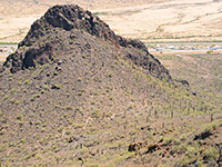
Picacho Peak is one of several prominent, isolated mountains rising from the flat land alongside I-10 between Tucson and Phoenix, and its summit provides a grand view over the desert surroundings. The top is reached by a 2 mile trail that gains 1,300 feet in elevation and has a few sections where the ascent is aided by railings and metal ladders. Also available at the park are a campsite, visitor center, picnic areas and four shorter trails. Description and Map |
|
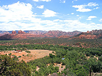
A few miles southwest of Sedona, Red Rock State Park features a short section of Oak Creek as it flows through a shallow valley, sustaining a flourishing riparian environment. Several short trails run along the creek and over the dry hills above, which have good views of the red rock cliffs surrounding Sedona to the north. The day use park also has a visitor center and picnic areas. Description |
|
| Riordan Mansion State Historic Park Forty-room mansion built in 1904 by the Riordan family, a few blocks south of downtown Flagstaff. Guided tours are available. |
|
| River Island State Park Campsite, sandy beach and boat launch along the Colorado River, 12 miles northeast of Parker. |
|
| Roper Lake State Park Small lake with desert surroundings, used for fishing, camping and swimming. Located on the south side of Thatcher, close to US 191. |
|
| San Rafael State Natural Area Grassy plains and gentle hills bearing cottonwood and oak trees, east of Nogales near the border with Mexico. Not currently open to the public. |
|
North of Sedona, Oak Creek flows through a narrow canyon between red and white sandstone rocks, forming pools, waterfalls, and cascades. One section of the creek has particularly smooth rocks under the water, perfect for sliding, swimming and paddling, and is contained within a very popular state park, one that may see thousands of visitors on a hot weekend in summer. Description |
|
| Sonoita Creek State Natural Area Narrow riparian corridor through barren hills east of Nogales, adjacent to Patagonia Lake State Park. Home to several endangered species. |
|
| Tombstone Courthouse State Historic Park Courthouse (built 1882) at the famous Wild West town of Tombstone, now a museum with gift shop and picnic areas. |
|
In one of the many steep-sided canyons draining the Mogollon Rim of central Arizona, a group of underground springs have deposited a large travertine formation, through which the year round flow of Pine Creek has eroded a large passageway, creating a natural bridge. This unusual feature is the highlight of Tonto Natural Bridge State Park, reached by a side road forking off AZ 87/260 northwest of Payson. Description | Photographs |
|
| Tubac Presidio State Historic Park Ruins and relics from a Spanish fort founded in 1752 and in operation for the next 100 years, plus various more recent buildings. |
|
| Verde River Greenway State Natural Area Six mile section of the Verde River near Cottonwood, adjacent to Dead Horse Ranch State Park. The river is the center of a lush belt of trees and greenery, important for many species of birds and other wildlife. |
|
| Yuma Quartermaster Depot State Historic Park Preserved military depot in downtown Yuma, overlooking the Colorado River. |
|
| Yuma Territorial Prison State Historic Park The old prison at Yuma - stone buildings beside the Colorado River, in operation from 1876 to 1909. |
All Contents © Copyright The American Southwest | Comments and Questions | Contribute | Affiliate Marketing Disclosure | Site Map


