Mountain Palm Springs, Anza-Borrego Desert State Park
California > Anza-Borrego Desert State Park > The South > Mountain Palm Springs
Mountain Palm Springs
Six groves of California fan palms, in four adjacent ravines at the edge of Carrizo Valley - surrounded by low elevation desert, very hot in summer
Length: 2.5 miles for the northern groves, 3.5 miles for all
Elevation change: 200 feet
Difficulty: Easy
Type: Loop hikes, partly cross-country
Usage: Light
Season: Winter, spring and fall
Trailhead: At the end of a short side road off Hwy S2
Rating (1-5): ★★★★★
Elevation change: 200 feet
Difficulty: Easy
Type: Loop hikes, partly cross-country
Usage: Light
Season: Winter, spring and fall
Trailhead: At the end of a short side road off Hwy S2
Rating (1-5): ★★★★★
Around 20 California fan palm oases are contained within the 940 square miles of Anza-Borrego Desert State Park, in well separated locations ranging from the low deserts of the northeast (Seventeen Palms, Five Palms, Una Palma), to the edge of the high mountains in the northwest (Borrego Palm Canyon, Coyote Canyon), and several sites further south of which the easiest reached is Mountain Palm Springs, at the foot of the Tierra Blanca Mountains.
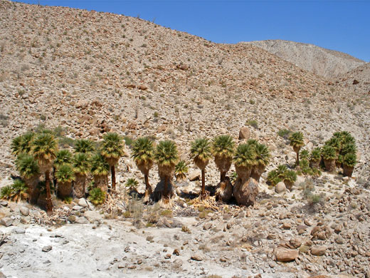
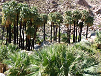
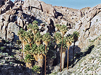
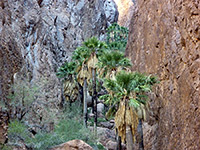
Six flourishing groves grow close together, on top of underground water sources in a shallow ravine, forming oases with grass, bushes and cool air, but surrounded by particularly arid slopes bearing scattered cacti and ocotillo.
The largest group is Palm Bowl Grove, at the end of a faint, 1.2 mile trail up the ravine that passes one smaller cluster en route; the other four are in side canyons a short distance north and south; all can be seen in around 2 hours. This southern section of the state park is generally quieter and less traveled than the busier area around Borrego Springs to the north, and Mountain Palm Springs is not often visited, especially in summertime when the whitish earth and bare rocks intensify the already very high temperatures (well above 100°F).
Map of Anza-Borrego Desert State Park.
San Diego County highway S2 is the only paved road across the south part of Anza-Borrego Desert State Park, and for 15 miles it runs along the flat Carrizo Valley, between the Tierra Blanca Mountains to the west and the Carrizo Badlands to the east. A small sign near milepost 47 marks the start of the short side track to the Mountain Palm Springs trailhead, next to the dry wash emerging from the low hills just beyond. This location is a good place for free primitive camping, far enough from the highway to be peaceful and private, though there is an official park campsite one mile south at the entrance to Bow Willow Canyon (which also contains a large palm grove, 3.5 miles upstream).
The hills bordering Carrizo Valley are composed of light-colored sand and white granite boulders, sparsely vegetated (most conspicuous species are cholla, ferocacti and yucca), usually very dry and extremely hot. A few palms can be seen in the distance due west from the trailhead, along one branch of the wash, which leads first to the Pygmy Grove and then the Southwest Grove after 0.8 miles. The main route, however, is a little to the north, along the major channel of the drainage. This forks again after a quarter of a mile; continuing straight on soon reaches North Grove, a compact group of around two dozen mature palms, followed soon after by Marys Grove, a similarly sized cluster spread out in a line just uphill from the streambed. A short walk southwards rejoins the other (middle) branch of the wash, which upstream passes Surprise Grove, comprising several clusters of palms extending for 500 feet along the ravine. The final group is further west where the canyon starts to gain height more steeply; Palm Bowl Grove has about 200 trees in two main clumps, one quite enclosed, its trees arranged around a cool, moist, sandy clearing. This grove is identified by a sign, unlike the others.
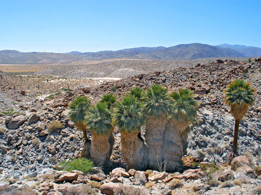
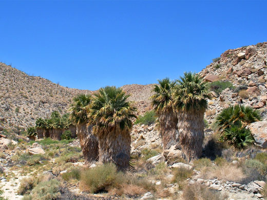
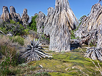
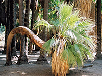
Most of the palm trees in the Mountain Palm Springs area bear a complete covering of dead fronds, helping to cool the trunk and providing a home for snakes, lizards, birds and other creatures of the desert. Some have bare trunks, surrounded at the base by great piles of fallen fronds. Although the majority of the palms are ancient there is plenty of new growth as well, especially around the base of the older specimens.

Six flourishing groves grow close together, on top of underground water sources in a shallow ravine, forming oases with grass, bushes and cool air, but surrounded by particularly arid slopes bearing scattered cacti and ocotillo.
The largest group is Palm Bowl Grove, at the end of a faint, 1.2 mile trail up the ravine that passes one smaller cluster en route; the other four are in side canyons a short distance north and south; all can be seen in around 2 hours. This southern section of the state park is generally quieter and less traveled than the busier area around Borrego Springs to the north, and Mountain Palm Springs is not often visited, especially in summertime when the whitish earth and bare rocks intensify the already very high temperatures (well above 100°F).
Location
Map of Anza-Borrego Desert State Park.
Approach to Mountain Palm Springs
San Diego County highway S2 is the only paved road across the south part of Anza-Borrego Desert State Park, and for 15 miles it runs along the flat Carrizo Valley, between the Tierra Blanca Mountains to the west and the Carrizo Badlands to the east. A small sign near milepost 47 marks the start of the short side track to the Mountain Palm Springs trailhead, next to the dry wash emerging from the low hills just beyond. This location is a good place for free primitive camping, far enough from the highway to be peaceful and private, though there is an official park campsite one mile south at the entrance to Bow Willow Canyon (which also contains a large palm grove, 3.5 miles upstream).
The Palm Groves
The hills bordering Carrizo Valley are composed of light-colored sand and white granite boulders, sparsely vegetated (most conspicuous species are cholla, ferocacti and yucca), usually very dry and extremely hot. A few palms can be seen in the distance due west from the trailhead, along one branch of the wash, which leads first to the Pygmy Grove and then the Southwest Grove after 0.8 miles. The main route, however, is a little to the north, along the major channel of the drainage. This forks again after a quarter of a mile; continuing straight on soon reaches North Grove, a compact group of around two dozen mature palms, followed soon after by Marys Grove, a similarly sized cluster spread out in a line just uphill from the streambed. A short walk southwards rejoins the other (middle) branch of the wash, which upstream passes Surprise Grove, comprising several clusters of palms extending for 500 feet along the ravine. The final group is further west where the canyon starts to gain height more steeply; Palm Bowl Grove has about 200 trees in two main clumps, one quite enclosed, its trees arranged around a cool, moist, sandy clearing. This grove is identified by a sign, unlike the others.
Palm Trees
Most of the palm trees in the Mountain Palm Springs area bear a complete covering of dead fronds, helping to cool the trunk and providing a home for snakes, lizards, birds and other creatures of the desert. Some have bare trunks, surrounded at the base by great piles of fallen fronds. Although the majority of the palms are ancient there is plenty of new growth as well, especially around the base of the older specimens.
Topographic Map of Mountain Palm Springs

Mountain Palm Springs - Similar Hikes
All Contents © Copyright The American Southwest | Comments and Questions | Contribute | Affiliate Marketing Disclosure | Site Map


