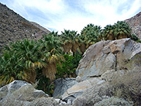
Grapevine Springs, Death Valley National Park
California > Death Valley National Park > The North > Grapevine Springs
Grapevine Springs
California fan palm oases, shallow canyons and hot springs in a rarely-visited area near Scottys Castle. Most of the palm trees are dead, but still photogenic
Length: about 5 miles, round trip
Elevation change: 650 feet
Difficulty: Easy to moderate; requires cross-country navigation
Type: Loop, off-trail
Usage: Low
Season: Fall, winter, spring
Location: Junction along Ubehebe Road
Rating (1-5): ★★★★★
Elevation change: 650 feet
Difficulty: Easy to moderate; requires cross-country navigation
Type: Loop, off-trail
Usage: Low
Season: Fall, winter, spring
Location: Junction along Ubehebe Road
Rating (1-5): ★★★★★
Grapevine Springs are a group of several dozen water sources spread across two miles of a low alluvium bench near the north edge of the Grapevine Mountains, right at the northern end of the paved road through Death Valley. A small amount of water is piped away but most is undisturbed, and the springs lie at the center of largest natural, riparian environment in the national park - they sustain many small streams (some seasonal, others permanent), flowing through shallow canyons containing much undergrowth; bright green corridors up to 200 feet across, separated by arid ridges.
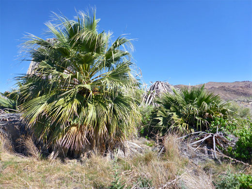
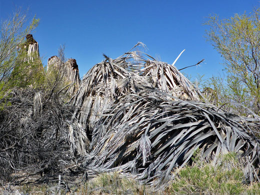
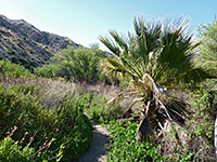
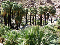
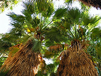
Several of the biggest springs are surrounded by groves of Californian fan palms (washingtonia filifera), and even though nearly all the large specimens are dead, seemingly killed by recent frosts, there are plenty of new growth trees amongst the old trunks and fronds. The palms were discovered in 1986, and are thought to be naturalized, originating from seeds blown here from specimen trees planted at Scotty's Castle. At least one of the springs is hot, its waters emerging from a clear pool about 2 feet deep, though most of the emergent pools are obscured by the vegetation.
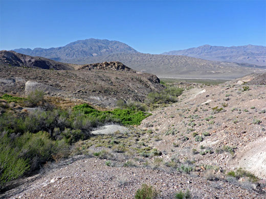
This region also has a few colorful rock outcrops, and a good variety of flowering plants, even on the dry slopes above the streams, and the land is high enough for grand views over the north end of the main valley. The most photogenic aspect though are the forlorn dead trunks of the old palms, contrasting with the verdant new growth, and the shallow pools of algae-lined water at the base.
The springs are not crossed by any trail and seem very rarely visited, though are easy enough to explore - navigation is generally straightforward as the relief is low, and the terrain not steep; the only minor problems are crossing some of the ravines, due to loose stones on the enclosing slopes, and the thick brush along the floor. The northern half of the springs, which contains the most concentrated group, and the easiest terrain, can be viewed on a cross-country loop of about five miles, visiting three significant palm oases plus various smaller springs. Like all such hikes, the trip is only recommended for the cooler months of the year, though here the hiking season might perhaps be extended owing to the availability of water.
Grapevine Springs can be viewed from afar along the paved road to Ubehebe Crater, west of Scottys Castle. A suitable parking spot if exploring the northern half is at the junction with the unpaved Big Pine Road, shortly before the crossing of the wide but usually dry Death Valley Wash. The many small streams from this portion of the springs meet and eventually form two main valleys, emerging from the edge of the hills 0.9 and 1.2 miles north of the junction, so the logical hike is a loop, following one valley and returning down the other. The cross-country walk is initially over a broad alluvial fan crossed by numerous shallow, gravelly washes, and it is probably easiest to first walk northwards along Big Pine Road, for up to a mile, and then head east to the mouth of the northernmost valley. Although very stony and bumpy this road is generally fine for most vehicles, however the high verges on both sides mean there are no obvious parking places, at least not until a small pull-out after about a mile; this could be an alternative start point, therefore.
The alluvial fan west of the springs is covered with innumerable specimens of small-flowered plants including purple mat, daisy desert star and broad-leaved gilia, plus scattered cacti, most colorful being beavertail prickly pear. The walk to the mouth of the northernmost canyon, up the road and across the gravelly flat, takes about 40 minutes, gaining 400 feet. A patch of trees indicates the furthest extent of flowing water, and at some times of the year a stream runs through relatively unvegetated surroundings at the edge of the woodland, before its waters sink below ground; above here the creek soon becomes obscured by impenetrable vegetation. To the north is a narrower tributary containing less water, and separated from the main drainage by a rocky ridge, which provides easier walking than the bushy ravines below. The trees and other vegetation in the larger canyon, including at least one tall, dead palm, extend for 0.8 miles, up to the base of steeper slopes to the east, while the remainder of the springs and riparian areas extend southwards. The land here is flatter and less overgrown, at first containing only minor springs and seeps enclosed by smaller patches of growth, but a larger oasis comes into view after about half a mile - a group of dead palms, with a hot pool and short section of open stream on the east side, and just a few new growth plants. Other vegetation near the palms includes tamarisk, mesquite and cattail.
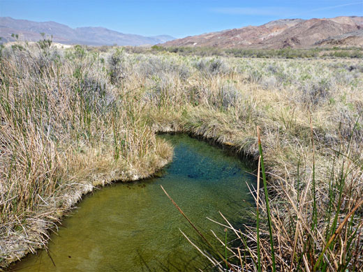
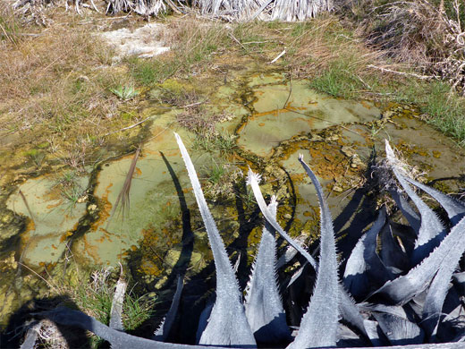
Six hundred feet south is another palm grove, with more trees; stark stumps at the center of great piles of fallen fronds, visible from some distance away. These trees are arranged around a wide, slow-moving stream lined by green and yellow algae, at the edge of which grow many specimens of the rare Death Valley blue-eyed grass. A third major group is not far south, at the head of a small ravine - one big live palm, in the shadow of thick, dead trunks, some very closely spaced, again set around a shallow pool and stream, which has created travertine terraces as the water flows downhill and evaporates. Another solitary palm rises to the northwest, near several smaller living palms, partly hidden in a bushy area to one side. This location is near the south branch of the southernmost of the two main valleys in this part of the springs, and it provides a route back towards the alluvial fan below the hills; vegetation along the floor is not too dense, enabling walking directly along the streambed, half a mile west to the junction with the north branch, after which the drainage (Little Grapevine Creek) exits the hills and curves southwards, still partly filled with bushes for another few hundred feet. The cross-country route back to Ubehehe Crater Road is 0.7 miles, over more washes and piles of cobbles, left by ancient floods.

Several of the biggest springs are surrounded by groves of Californian fan palms (washingtonia filifera), and even though nearly all the large specimens are dead, seemingly killed by recent frosts, there are plenty of new growth trees amongst the old trunks and fronds. The palms were discovered in 1986, and are thought to be naturalized, originating from seeds blown here from specimen trees planted at Scotty's Castle. At least one of the springs is hot, its waters emerging from a clear pool about 2 feet deep, though most of the emergent pools are obscured by the vegetation.
This region also has a few colorful rock outcrops, and a good variety of flowering plants, even on the dry slopes above the streams, and the land is high enough for grand views over the north end of the main valley. The most photogenic aspect though are the forlorn dead trunks of the old palms, contrasting with the verdant new growth, and the shallow pools of algae-lined water at the base.
The springs are not crossed by any trail and seem very rarely visited, though are easy enough to explore - navigation is generally straightforward as the relief is low, and the terrain not steep; the only minor problems are crossing some of the ravines, due to loose stones on the enclosing slopes, and the thick brush along the floor. The northern half of the springs, which contains the most concentrated group, and the easiest terrain, can be viewed on a cross-country loop of about five miles, visiting three significant palm oases plus various smaller springs. Like all such hikes, the trip is only recommended for the cooler months of the year, though here the hiking season might perhaps be extended owing to the availability of water.
Location
Grapevine Springs can be viewed from afar along the paved road to Ubehebe Crater, west of Scottys Castle. A suitable parking spot if exploring the northern half is at the junction with the unpaved Big Pine Road, shortly before the crossing of the wide but usually dry Death Valley Wash. The many small streams from this portion of the springs meet and eventually form two main valleys, emerging from the edge of the hills 0.9 and 1.2 miles north of the junction, so the logical hike is a loop, following one valley and returning down the other. The cross-country walk is initially over a broad alluvial fan crossed by numerous shallow, gravelly washes, and it is probably easiest to first walk northwards along Big Pine Road, for up to a mile, and then head east to the mouth of the northernmost valley. Although very stony and bumpy this road is generally fine for most vehicles, however the high verges on both sides mean there are no obvious parking places, at least not until a small pull-out after about a mile; this could be an alternative start point, therefore.
Valleys and Springs
The alluvial fan west of the springs is covered with innumerable specimens of small-flowered plants including purple mat, daisy desert star and broad-leaved gilia, plus scattered cacti, most colorful being beavertail prickly pear. The walk to the mouth of the northernmost canyon, up the road and across the gravelly flat, takes about 40 minutes, gaining 400 feet. A patch of trees indicates the furthest extent of flowing water, and at some times of the year a stream runs through relatively unvegetated surroundings at the edge of the woodland, before its waters sink below ground; above here the creek soon becomes obscured by impenetrable vegetation. To the north is a narrower tributary containing less water, and separated from the main drainage by a rocky ridge, which provides easier walking than the bushy ravines below. The trees and other vegetation in the larger canyon, including at least one tall, dead palm, extend for 0.8 miles, up to the base of steeper slopes to the east, while the remainder of the springs and riparian areas extend southwards. The land here is flatter and less overgrown, at first containing only minor springs and seeps enclosed by smaller patches of growth, but a larger oasis comes into view after about half a mile - a group of dead palms, with a hot pool and short section of open stream on the east side, and just a few new growth plants. Other vegetation near the palms includes tamarisk, mesquite and cattail.
Palm Trees
Six hundred feet south is another palm grove, with more trees; stark stumps at the center of great piles of fallen fronds, visible from some distance away. These trees are arranged around a wide, slow-moving stream lined by green and yellow algae, at the edge of which grow many specimens of the rare Death Valley blue-eyed grass. A third major group is not far south, at the head of a small ravine - one big live palm, in the shadow of thick, dead trunks, some very closely spaced, again set around a shallow pool and stream, which has created travertine terraces as the water flows downhill and evaporates. Another solitary palm rises to the northwest, near several smaller living palms, partly hidden in a bushy area to one side. This location is near the south branch of the southernmost of the two main valleys in this part of the springs, and it provides a route back towards the alluvial fan below the hills; vegetation along the floor is not too dense, enabling walking directly along the streambed, half a mile west to the junction with the north branch, after which the drainage (Little Grapevine Creek) exits the hills and curves southwards, still partly filled with bushes for another few hundred feet. The cross-country route back to Ubehehe Crater Road is 0.7 miles, over more washes and piles of cobbles, left by ancient floods.
Grapevine Springs Route Map

Grapevine Springs Wildflowers
More flowers near the springs
 Broad-leaved gilia |
 Desert star |
 Death Valley blue-eyed grass |
 Desert linanthus |
More flowers near the springs
Grapevine Springs - Similar Hikes
All Contents © Copyright The American Southwest | Comments and Questions | Contribute | Affiliate Marketing Disclosure | Site Map


