Sand Canyon, Canyons of the Ancients National Monument
Colorado > Canyons of the Ancients National Monument > Sand Canyon
Sand Canyon
North-side, two-level tributary of McElmo Creek; a narrow inner gorge through Navajo sandstone, wide benches of the Carmel Formation, and upper cliffs of Entrada sandstone, with at least seven large alcoves containing ancient ruins
Length: 3.5 miles, to the northernmost ruin, or 6.5 to the northern trailhead
Elevation change: 400 feet, or 1,390 feet
Difficulty: Easy to moderate
Type: One way, along a maintained trail
Usage: Medium to low
Season: All year, though hot and exposed in summer
Trailhead: North side of Road G
Rating (1-5): ★★★★★
Elevation change: 400 feet, or 1,390 feet
Difficulty: Easy to moderate
Type: One way, along a maintained trail
Usage: Medium to low
Season: All year, though hot and exposed in summer
Trailhead: North side of Road G
Rating (1-5): ★★★★★
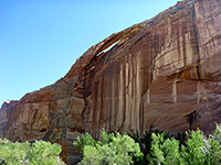
Like Rock Creek to the west, Sand Canyon is a wide, two-level drainage, with a deep and narrow inner gorge through Navajo sandstone, bordered by bushy, sandy benches of the Carmel Formation, below outer cliffs of light-colored Entrada sandstone, in which are found many large alcoves, at least seven occupied by ancient Ancestral Puebloan ruins. Both canyons are north-side tributaries of McElmo Creek, along the southern edge of Canyons of the Ancients National Monument, and may be explored by maintained trails starting from a parking area along (paved) Road G; a relatively popular location, publicized by the BLM as one of the best places in the state to view unrestored ruins in a backcountry setting.
Sand Canyon has ruins on both sides but those to the west are more numerous and much more easily accessed, from the mostly level trail that follows the bench below the upper-level cliffs, and reaches the northernmost ancient site after 3.5 miles, then later climbs steeply to a higher elevation plateau and follows its rim to another road, site of the Sand Canyon Pueblo, once a village of over 400 rooms, now a collection of low walls and overgrown stone piles. As this can be viewed via a short walk from the road, the northern part of the Sand Canyon Trail is not much used since all the other interesting sites, the alcove ruins, are concentrated towards the south end.
Ruins above the eastern bench of Sand Canyon are much less accessible due to private land to the south, preventing access from this direction, but the westside path is easy to follow, and it passes close to all the ruins, some of which are reached by very short side trails. The majority of people who hike the path see only the first four groups of ruins, however, since beyond, the path is somewhat less well-defined, and there is a gap of nearly a mile with no ruins, before the final three groups, even though these northern sites are the largest and most photogenic.
Map of Canyons of the Ancients National Monument.
21 views of Sand Canyon.
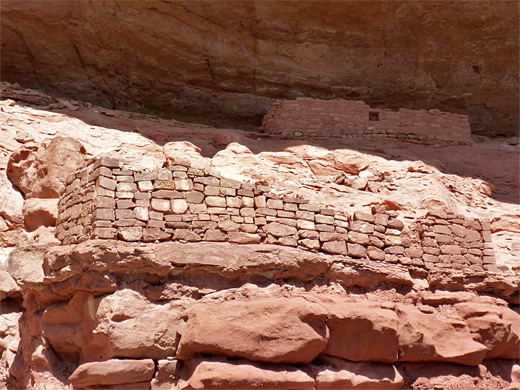
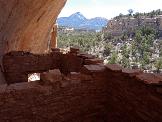
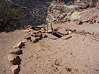
The cairned trail from the parking place climbs over a band of slickrock, passes a small butte (Castle Rock) then crosses more bare sandstone to a junction, with the route to Rock Creek to the west. The Sand Canyon path soon approaches a low cliff and follows this round a corner to the first of the alcoves containing ruins, which face south, like all those on this side of the canyon. There are some minor wall fragments at the base. The next big alcove is a third of a mile further, containing a rectangular room - named Storage Room Pueblo - with a broken wall at the front where the entrance used to be, while the next ruin site, Saddlehorn Pueblo, is just beyond, and consists of one mostly intact room beside an isolated, perpendicular wall fragment, set in a neat, semi-circular alcove beneath a distinctive, smooth-sided butte. This point is close to a ravine, a short tributary of the deep inner part of Sand Canyon, which comes gradually closer to the path as the bench narrows. The third major alcove holds the remains of a smaller room and is followed by a projecting cliff, beyond which much more of the canyon comes into view ahead. The path crosses a larger open area, rounds the head of another ravine in the middle and continues to a junction with a westwards connecting path towards East Fork Rock Creek, allowing a loop of 4 miles. Just before the junction are two spur paths to the east, leading to viewpoints on the rim of the inner canyon.
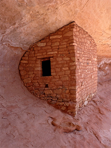
The main path becomes briefly steeper, zig-zagging down a wooded slope and giving views of the next ruin (Double Cliff House), on the far side of another little ravine - contained within are three long, rectangular-walled rooms, the upper pair inaccessible. Past here is a rather longer walk to the next ruin, the fifth main site and perhaps the most spectacular (Sunny Alcove), set in an extravagantly streaked alcove with a big overhang, holding various interlinked rooms and wall fragments. Site six is a little way up a side canyon, and consists of two ruins, one a very neat construction, 'Tucked Away Two Story House', with perfectly square corners at the front and curving walls behind, matching the shape of the alcove, and the other a mostly collapsed wall in an adjacent alcove (Wall Curves with Bedrock House). The seventh and last site (House with Standing Curved Wall) contains a longer wall, partly broken and leaning, incorporating much adobe, making it appear quite smooth, with a square corner at one side and a curve at the other. The inner canyon has by now risen almost to bench level, while the Entrada cliffs are somewhat lower, and soon recede further, as the path approaches the steep section where it ascends 700 feet via many switchbacks, up the sloping sides of the plateau to the north. A sign warns of the difficult section ahead, and this is the usual turn-around point for most hikers.
Sand Canyon has ruins on both sides but those to the west are more numerous and much more easily accessed, from the mostly level trail that follows the bench below the upper-level cliffs, and reaches the northernmost ancient site after 3.5 miles, then later climbs steeply to a higher elevation plateau and follows its rim to another road, site of the Sand Canyon Pueblo, once a village of over 400 rooms, now a collection of low walls and overgrown stone piles. As this can be viewed via a short walk from the road, the northern part of the Sand Canyon Trail is not much used since all the other interesting sites, the alcove ruins, are concentrated towards the south end.
Ruins above the eastern bench of Sand Canyon are much less accessible due to private land to the south, preventing access from this direction, but the westside path is easy to follow, and it passes close to all the ruins, some of which are reached by very short side trails. The majority of people who hike the path see only the first four groups of ruins, however, since beyond, the path is somewhat less well-defined, and there is a gap of nearly a mile with no ruins, before the final three groups, even though these northern sites are the largest and most photogenic.
Regulations for the Sand Canyon/Rock Creek Area
- Stay on the Designated Trail
- Don't enter structures, climb on walls, take or move artifacts, or touch rock art
- Leave No Trace. Collect nothing and leave what you see for others to enjoy
- East Rock Trail archaeological sites are too fragile for public access
- Only archaeological sites on the main Sand Canyon Trail are designated for visitation
- No Camping
Location
Map of Canyons of the Ancients National Monument.
Photographs
21 views of Sand Canyon.
Sand Canyon Trailhead
The cairned trail from the parking place climbs over a band of slickrock, passes a small butte (Castle Rock) then crosses more bare sandstone to a junction, with the route to Rock Creek to the west. The Sand Canyon path soon approaches a low cliff and follows this round a corner to the first of the alcoves containing ruins, which face south, like all those on this side of the canyon. There are some minor wall fragments at the base. The next big alcove is a third of a mile further, containing a rectangular room - named Storage Room Pueblo - with a broken wall at the front where the entrance used to be, while the next ruin site, Saddlehorn Pueblo, is just beyond, and consists of one mostly intact room beside an isolated, perpendicular wall fragment, set in a neat, semi-circular alcove beneath a distinctive, smooth-sided butte. This point is close to a ravine, a short tributary of the deep inner part of Sand Canyon, which comes gradually closer to the path as the bench narrows. The third major alcove holds the remains of a smaller room and is followed by a projecting cliff, beyond which much more of the canyon comes into view ahead. The path crosses a larger open area, rounds the head of another ravine in the middle and continues to a junction with a westwards connecting path towards East Fork Rock Creek, allowing a loop of 4 miles. Just before the junction are two spur paths to the east, leading to viewpoints on the rim of the inner canyon.
Continuation Path
The main path becomes briefly steeper, zig-zagging down a wooded slope and giving views of the next ruin (Double Cliff House), on the far side of another little ravine - contained within are three long, rectangular-walled rooms, the upper pair inaccessible. Past here is a rather longer walk to the next ruin, the fifth main site and perhaps the most spectacular (Sunny Alcove), set in an extravagantly streaked alcove with a big overhang, holding various interlinked rooms and wall fragments. Site six is a little way up a side canyon, and consists of two ruins, one a very neat construction, 'Tucked Away Two Story House', with perfectly square corners at the front and curving walls behind, matching the shape of the alcove, and the other a mostly collapsed wall in an adjacent alcove (Wall Curves with Bedrock House). The seventh and last site (House with Standing Curved Wall) contains a longer wall, partly broken and leaning, incorporating much adobe, making it appear quite smooth, with a square corner at one side and a curve at the other. The inner canyon has by now risen almost to bench level, while the Entrada cliffs are somewhat lower, and soon recede further, as the path approaches the steep section where it ascends 700 feet via many switchbacks, up the sloping sides of the plateau to the north. A sign warns of the difficult section ahead, and this is the usual turn-around point for most hikers.
Sand Canyon Wildflower
 Mountain pepperweed |
Sand Canyon - Similar Hikes
All Contents © Copyright The American Southwest | Comments and Questions | Contribute | Affiliate Marketing Disclosure | Site Map


