Colorado Hiking Trails
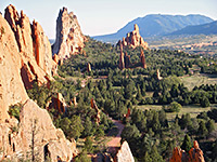
Other hiking locations include Mesa Verde, the San Juan Mountains and Garden of the Gods.
Map shows trailhead locations
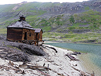
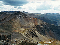
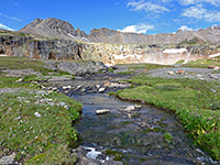
| 1. Arrastra Basin, San Juan Mountains Length 3.8 miles (6.1 km); if starting near Mayflower Mill Elevation change 2750 feet (838 meters) Difficulty Strenuous Rating (1-5) ★★★★★ High elevation basin containing a large lake (Silver Lake) lined with extensive old mine ruins; reached by a stony track, ending at another mine (Mayflower), and then a rough trail. |
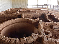
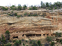
| 2. Badger House Trail, Mesa Verde National Park Length 1.2 miles (1.9 km) Elevation change 130 feet (40 meters) Difficulty Easy Rating (1-5) ★★★★★ The ruins of Badger House comprise four mesa top sites, all now protected by metal enclosures. A trail visits the ruins, accessed from several places along the Wetherill Mesa tram route, and linked by a longer path from the end of the approach road. The shortest hike to see all sites is 0.6 miles. |
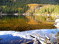
| 3. Bear Lake, Rocky Mountain National Park Length 4.6 miles (7.4 km); to Flattop Mountain; many other destinations Elevation change 2849 feet (868 meters) Difficulty Easy to strenuous, depending on the destination Rating (1-5) ★★★★★ The close proximity to much beautiful scenery and several peaks along the continental divide makes Bear Lake the most popular trailhead in Rocky Mountain National Park. An easy half mile path circles the lake itself, while three other trails lead into the backcountry. One climbs the wooded hillside at the north edge of the lake for half a mile to a junction; the right branch descends gently through more dense forest to Bierstadt Lake while the left path climbs steeply and continuously to 12,324 foot Flattop Mountain, well above the treeline - a relatively difficult hike, but perhaps the easiest in the park that reaches a major summit. En route is one other junction, with a long path that eventually leads to the Fern Lake Trailhead, while passing several lakes near the upper edge of the forest including Helene and Odessa. Another trail from Bear Lake links with the nearby Glacier Gorge Trailhead, allowing for a 5 mile loop with the third route; this latter climbs steadily but not too steeply past small Nymph Lake and reaches narrow, scenic Dream Lake, and a spur path to Emerald Lake, backed by the high granite cliffs of Tyndall Gorge. After a steeper climb, another short spur leads to Lake Haiyaha - also very pretty, bordered by cliffs on three sides. 0.7 miles past here the path meets the main route along Glacier Gorge, so hikers can either turn left for the loop back to Bear Lake or right for a journey further into the mountains, to places such as The Loch and Andrews Glacier. |
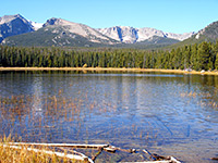
| 4. Bierstadt Lake, Rocky Mountain National Park Length 1.3 miles (2.1 km); to the lake; path continues Elevation change 800 feet (244 meters) Difficulty Easy Rating (1-5) ★★★★★ The Bierstadt Lake Trail climbs a steep, mostly treeless hillside above Glacier Creek, then crosses flatter but more wooded land to the south shore, which provides a scenic view of the lake, backed by Flattop Mountain and Hallett Peak. A 0.9 mile path loops all around the lake, and three branches fork off, to the north (Mill Creek Basin), west (Bear Lake) and east (an alternative Bierstadt Lake trailhead, 1.3 miles away next to the shuttlebus parking area). |
| 5. Bridal Veil Falls and Ingram Basin, San Juan Mountains Length 3.8 miles (6.1 km); to the ridge above Ingram Basin Elevation change 3800 feet (1158 meters) Difficulty Strenuous Rating (1-5) ★★★★★ Exploration of the high mountains east of Telluride - to a 385 foot waterfall, an Alpine basin and a narrow ridge at 12,860 feet, overlooking the Red Mountain mining district. Accessible to hikers or 4WD vehicles. Optional off-trail return route via a 13,477 summit and another basin to the south |
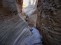
| 6. Buckwater Draw Length 3 miles (4.8 km); to see the upper narrows then climb around and re-enter the canyon lower down Elevation change 800 feet (244 meters) Difficulty Moderate - climbing over obstacles, and scrambling across steep, bushy slopes Rating (1-5) ★★★★★ Dryfalls and short slots through attractive, light-colored sandstone, in two forks of a minor drainage close to Dinosaur National Monument. Sheer drops prevent hiking all the way through, but the upper and lower ends can be visited separately. |
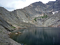
| 7. Chasm Lake, Rocky Mountain National Park Length 4.2 miles (6.8 km) Elevation change 2360 feet (719 meters) Difficulty Moderate Rating (1-5) ★★★★★ Lake in a spectacular glacial basin below Longs Peak, the national park's highest summit. Reached by a popular trail that runs mostly across the tundra zone, above the treeline, giving good views in all directions |
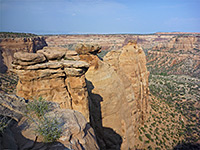
| 8. Coke Ovens Trail, Colorado National Monument Length 0.5 miles (0.8 km) Elevation change 160 feet (49 meters) Difficulty Easy Rating (1-5) ★★★★★ From the busy trailhead at the upper end of Monument Canyon, this short path descends a little way down the drainage then follows a level bench out to a fenced viewpoint of the Coke Ovens - a series of smooth conical domes that have been eroded out of the yellow-brown Wingate sandstone. The overlook is still high above the canyon, and has excellent views up and down. |
| 9. Colorado River, Rocky Mountain National Park Length 5.2 miles (8.4 km); to Little Yellowstone Elevation change 1230 feet (375 meters) Difficulty Easy to moderate Rating (1-5) ★★★★★ The fairly level path along the upper Colorado River valley to the site of the former mining settlement of Lulu City provides an easy introduction to the scenery of Rocky Mountain National Park, although views are somewhat limited since much of the trail passes through thick woodland. After the townsite the path continues another mile through the forest to a junction; the right fork has better views as it climbs rather more steeply up to a small summit (Little Yellowstone) where it meets a forest track that leads 1.3 miles further north to La Poudre Pass. The left branch follows the tributary stream of Lulu Creek all the way to 11,331 Thunder Pass, at the national park boundary. Another side trail runs along a scenic side valley (Skeleton Gulch) for 1.5 miles, until the cliffs become too steep to continue. |
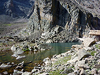
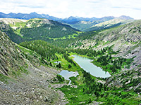
| 10. Columbine Lake Trail, San Juan Mountains Length 3.3 miles (5.3 km); plus up to 0.7 miles to reach the trailhead Elevation change 2325 feet (709 meters) Difficulty Strenuous Rating (1-5) ★★★★★ Path of three parts, forest, meadows and tundra, climbing steeply at first then nearly level towards the end, leading to a beautiful high elevation lake, enclosed on three sides by rocky ridges |
| 11. Corkscrew Trail, Colorado National Monument Length 3.3 miles (5.3 km); round trip Elevation change 760 feet (232 meters) Difficulty Moderate - steep in places Rating (1-5) ★★★★★ Counter-clockwise is the suggested direction for hiking the Corkscrew Loop; from the Wildwood Drive trailhead along the east edge of the national monument the path climbs gently for 0.5 miles to a junction, then more steeply for another half mile to a second intersection, in the lower end of Ute Canyon. Turning left (south), the trail traverses a hillside for a little way, at the foot of steep cliffs, then winds back down, rejoining the route at the first junction. |
| 12. Crater Lake Trail, Maroon Bells Length 1.8 miles (2.9 km) Elevation change 550 feet (168 meters) Difficulty Easy Rating (1-5) ★★★★★ This is the shortest path into the Maroon Bells-Snowmass Wilderness, starting beside reflective Maroon Lake and soon reaching Crater Lake after climbing through fir, spruce and aspen forest. The trail continues beyond the lake, leading to West Maroon Pass and Buckskin Pass, both much more strenuous hikes |
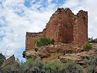
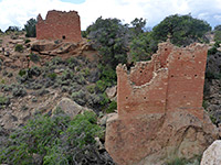
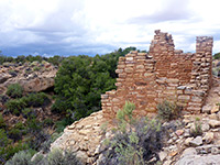
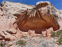
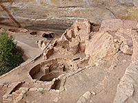
| 13. Cutthroat Castle, Hovenweep National Monument Length 1.4 miles (2.3 km); from the paved road Elevation change 100 feet (30 meters) Difficulty Easy Rating (1-5) ★★★★★ The northernmost unit of Hovenweep National Monument, in Colorado, containing three round towers, a square tower with attached rooms, and several kivas, on the rim of a shallow canyon. Reached by a rough track and a very short trail, or a longer hike from the main road. |
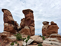
| 14. Devils Kitchen, Colorado National Monument Length 0.7 miles (1.1 km) Elevation change 200 feet (61 meters) Difficulty Easy Rating (1-5) ★★★★★ Devils Kitchen is a small group of sandstone spires, on a low ridge with long distance views in all directions. The location is easily reached, by the first 0.25 miles of the No Thoroughfare Canyon Trail, across a grassy valley, and then another 0.25 miles on a spur trail, ascending a little over slickrock. |
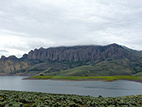
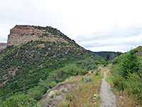
| 15. Dillon Pinnacles Trail, Curecanti National Recreation Area Length 2 miles (3.2 km) Elevation change 300 feet (91 meters) Difficulty Easy Rating (1-5) ★★★★★ Path across sagebrush slopes on the north shore of Blue Mesa Reservoir to the base of a line of volcanic spires along the south edge of Dillon Mesa. The trail also has good views over the lake and the surrounding mountains. |
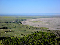
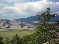
| 16. Dunes Overlook Trail, Great Sand Dunes National Park and Preserve Length 0.8 miles (1.3 km) Elevation change 300 feet (91 meters) Difficulty Easy Rating (1-5) ★★★★★ This short trail is a spur that forks off near the beginning of the Sand Ramp Trail, just north of the crossing of Buck Creek, and climbs a little way up a lightly wooded ridge to an overlook of Medano Creek and the sand dunes. |
| 17. East Fork of Rock Creek, Canyons of the Ancients National Monument Length 3.5 miles (5.6 km); to the slot Elevation change 330 feet (101 meters) Difficulty Moderate Rating (1-5) ★★★★★ Wide but relatively short drainage, a tributary of McElmo Creek, containing at least eight groups of ancient ruins, plus photogenic rock formations. The first three are along a trail, east of the main canyon, while the others are off-trail, further upstream. The upper end of the canyon narrows to a shallow slot |
| 18. Echo Canyon Trail, Colorado National Monument Length 1.3 miles (2.1 km) Elevation change 300 feet (91 meters) Difficulty Easy to moderate, exposed at the beginning, so hot in summer Rating (1-5) ★★★★★ The Echo Canyon Trail follows a short box canyon to the cool, sheltered alcove (and seasonal waterfall) at its upper end. The route starts across open flats and slickrock but most is close to the bushy streambed, which is lined by many wildflowers in spring. |
| 19. Estes Cone Trail, Rocky Mountain National Park Length 3.6 miles (5.8 km) Elevation change 2060 feet (628 meters) Difficulty Moderate; steep at the end Rating (1-5) ★★★★★ Beginning at Lily Lake along Hwy 7 south of Estes Park, this trail crosses the upper end of a valley, ascends through forested land to Storm Pass then climbs further to the top of a conical summit, giving a 360 degree view over the eastern edge of Rocky Mountain National Park. |
| 20. Fern, Odessa and Tourmaline Lakes, Rocky Mountain National Park Length 3.7 miles (6 km); to Fern Lake; path continues Elevation change 1400 feet (427 meters) Difficulty Moderate Rating (1-5) ★★★★★ Just one trail begins at the Fern Lake trailhead, at the far end of the road past Moraine Park campground - the path climbs steadily up the valley of Big Thompson River, which is tree-covered on the south side and much rockier on the north. The first junction is near a small pond (The Pool), where a 1.4 mile uphill path branches off towards Mill Creek Basin, and then on to Bierstadt Lake. The main trail turns southeast and ascends more steeply up a tributary valley (Fern Creek), into increasingly more mountainous land though the immediate surroundings remain generally forested. One waterfall (Fern Falls) and four pretty lakes are encountered - Spruce (along a spur path), Fern, Odessa and Helene, after which the path turns east and starts to descend towards the Bear Lake trailhead. Also reachable, off-trail, is Tourmaline Lake. |
| 21. Garden of the Gods, Garden of the Gods Length 1.6 miles (2.6 km); loop Elevation change 120 feet (37 meters) Difficulty Easy Rating (1-5) ★★★★★ Many short, intersecting trails wind through the spectacular red rock formations of the Garden of the Gods, on the west side Colorado Springs. Other routes climb the higher, more undulating land further west, but the main group of ridges and pinnacles can be seen by a 1.6 mile loop. A trail map is posted at major junctions so there is no chance of getting lost. |
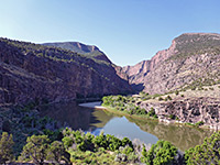
| 22. Gates of Lodore Trail, Dinosaur National Monument Length 0.7 miles (1.1 km) Elevation change 0 feet (0 meters) Difficulty Easy Rating (1-5) ★★★★★ The only trail in the north section of the national monument runs along the east bank of the Green River for a short distance, to the point where the enclosing walls become high and sheer, marking the start of the Canyon of Lodore. Noticeboards along the way give information about the plant life and geology of the area. |
| 23. Gem Lake and Balanced Rock, Rocky Mountain National Park Length 3.8 miles (6.1 km); to Balanced Rock Elevation change 1100 feet (335 meters) Difficulty Moderate Rating (1-5) ★★★★★ In the northeast corner of the national park, the Lumpy Ridge trailhead is reached via Devils Gulch Road a few miles from Estes Park. The main day hike destination is little Gem Lake (1.6 miles), attractively enclosed by vertical cliffs. The surroundings have many unusual, eroded rock formations, seen especially along a continuation path (Balanced Rock Trail) that penetrates further along the sparsely wooded Lumpy Ridge. Another much longer path heads up Black Canyon towards Lawn Lake (8 miles) in the distant Mummy Range. |
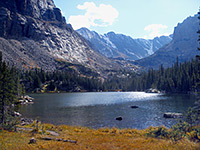
| 24. Glacier Gorge, Rocky Mountain National Park Length 5.3 miles (8.5 km); to Andrews Glacier; many other destinations Elevation change 2510 feet (765 meters) Difficulty Easy to strenuous, depending on the destination Rating (1-5) ★★★★★ Like nearby Bear Lake, the Glacier Gorge trailhead is the gateway to the most spectacular yet accessible section of Rocky Mountain National Park. One path leads along Glacier Creek downstream towards Sprague Lake, and a short connecting path links with Bear Lake, but the main route follows the creek upstream, into the mountains. This splits into four - one branch is a long and difficult path that reaches the summit of Longs Peak after 9 miles, while the other three are one-way paths along very scenic valleys, each ending beneath a glacier, and all suitable for a day hike. After the whitewater cascade of Alberta Falls, the first junction (after the Long Peak Trail) is reached at the 2 mile point; from here the southernmost branch enters Glacier Gorge itself, a deep, straight, steep-walled ravine containing several beautiful lakes including Mills and Black. Back at the junction, another path heads northwest towards Lake Haiyaha and eventually to the Bear Lake trailhead, while a third branch climbs along a tributary of Glacier Creek (Brook Creek) to The Loch, surely one of the prettiest subalpine lakes in the area owing to its shallow, reflective waters, the unusual rocky shoreline, and the towering mountains all around. Not far after here, the path forks once more; one branch passes Timberline Falls to Lake of Glass and Sky Pond, the other ends at turquoise-colored Andrews Tarn at the base of Andrews Glacier. |
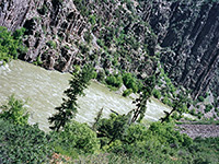
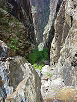
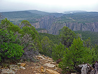
| 25. Gunnison Route, Black Canyon of the Gunnison National Park Length 1 mile (1.6 km) Elevation change 1800 feet (549 meters) Difficulty Very strenuous Rating (1-5) ★★★★★ Unmaintained route vertically down the precipitous cliffs of Black Canyon, all the way to the river - aided over one 80 meter stretch by a metal chain. Loose rocks underfoot. Considered the easiest of the six such trails, but still very strenuous. |
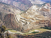
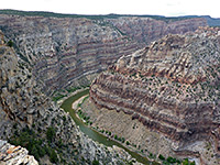
| 26. Harpers Corner Trail, Dinosaur National Monument Length 2 miles (3.2 km) Elevation change 200 feet (61 meters) Difficulty Easy Rating (1-5) ★★★★★ The Harpers Corner Trail heads northeast from the parking area at the end of the park road, running on top of a narrow, steep-sided ridge far above Green River as it flows round a U-bend close to the Yampa River junction. The trail ends at an amazing viewpoint of the rivers, both enclosed in deep canyons cutting through twisted, eroded sedimentary rock; in the distance the convoluted, inaccessible country extends for many miles. |
| 27. Holly, Hovenweep National Monument Length 0.6 miles (1 km) Elevation change 40 feet (12 meters) Difficulty Easy Rating (1-5) ★★★★★ Two large and three small ancient buildings, along a canyon rim and on top of large boulders, plus a few petroglyphs; an enclave within Canyons of the Ancients National Monument. The trailhead is along a rough track; some vehicles may have to park along the main road, adding 2.2 mile to the hike. |
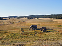
| 28. Hornbeck Wildlife Loop, Florissant Fossil Beds National Monument Length 4 miles (6.4 km); (loop) Elevation change 60 feet (18 meters) Difficulty Easy Rating (1-5) ★★★★★ The longest trail in the national monument runs entirely through open meadowland, along the east and west sides of the valley; it starts at the visitor center, crosses the highway twice, intersects with several other trails, and also passes the Hornbek Homestead. |
| 29. Horseshoe/Hackberry, Hovenweep National Monument Length 0.6 miles (1 km) Elevation change 40 feet (12 meters) Difficulty Easy Rating (1-5) ★★★★★ Ruined towers and buildings at the upper end of Hackberry Canyon, reached by a cairned path over slickrock; an enclave within Canyons of the Ancients National Monument. The trailhead is along a rough track; some vehicles may have to park along the main road, adding one mile to the hike. |
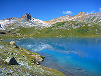
| 30. Ice Lake Trail, San Juan Mountains Length 10 miles (16.1 km); round trip, to all 3 lakes Elevation change 2800 feet (853 meters) Difficulty Strenuous Rating (1-5) ★★★★★ Steep but relatively short trail to an exceptionally beautiful Alpine Basin, visiting three large lakes (Ice, Fuller and Island), each different in character, plus several smaller ponds, all surrounded by high peaks. Long distance views east. |
| 31. Knife Edge Trail, Mesa Verde National Park Length 1 mile (1.6 km) Elevation change 60 feet (18 meters) Difficulty Easy Rating (1-5) ★★★★★ Easy walk along an old roadbed, through a low pass then gently down across a steep slope, with long distance views across Montezuma Valley towards Sleeping Ute Mountain. A good selection of summer wildflowers may be seen along the way, and the final viewpoint is a good place to watch the setting sun. |
| 32. Lawn Lake, Rocky Mountain National Park Length 6.2 miles (10 km); to Lawn Lake; other destinations nearby Elevation change 2249 feet (685 meters) Difficulty Strenuous Rating (1-5) ★★★★★ The Lawn Lake trailhead is located close to the junction of Old Fall River Road with US 34, just east of the large alluvial fan that poured out of Roaring River Canyon following flooding in July 1982. The trail heads north up this canyon and soon splits; the left branch climbs a wooded ridge to Ypsilon Lake (from where the Spectacle Lakes can be reached by some off-trail climbing) while the right fork follows the canyon further, climbing more steeply at the upper end, to a junction with a path from Lumpy Ridge, and soon after to Lawn Lake, at the treeline. It continues further into the stark granite landscape of the high mountains to the two Crystal Lakes (via a short spur path), and ends with yet more climbing to a fine viewpoint on a bench between two 13,500 foot summits in the Mummy Range (The Saddle, 8.2 miles). |
| 33. Long Draw, Black Canyon of the Gunnison National Park Length 1 mile (1.6 km); including the short road walk at the start Elevation change 1800 feet (549 meters) Difficulty Strenuous Rating (1-5) ★★★★★ The descent to the Gunnison River via Long Draw (also known as Devils Slide) on the North Rim is very steep, down a cool, narrow, sheer-walled tributary ravine that provides some shade most of the day. A few places require negotiation of vertical ledges several feet high. |
| 34. Montville Nature Trail, Great Sand Dunes National Park and Preserve Length 0.5 miles (0.8 km); (loop) Elevation change 50 feet (15 meters) Difficulty Easy Rating (1-5) ★★★★★ This short loop climbs a little way up the wooded hills on the east side of the dunes, passing the site of a late 1800s homestead, and reaching a high point that gives good views of the sands below. The start is along the lower end of the Mosca Pass Trail. |
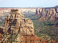
| 35. Monument Canyon Trail, Colorado National Monument Length 6 miles (9.7 km) Elevation change 1440 feet (439 meters) Difficulty Moderate Rating (1-5) ★★★★★ This popular trail has two start points, at the upper and lower ends of the canyon. The higher trailhead is busier, along the Rim Rock Drive; from here the path descends quite steeply down a side ravine, below the Coke Ovens, then levels out and turns north, contouring around some other tributaries while staying a little way above the streamway. The last section drops down again quite sharply, to the east entrance of the canyon, then skirts a residential area and reaches the southern trailhead near Hwy 340. Just the upper 2.5 miles makes for a good short hike, as far as the base of Independence Monument. |
| 36. Mosca Pass Trail, Great Sand Dunes National Park and Preserve Length 3.5 miles (5.6 km) Elevation change 1520 feet (463 meters) Difficulty Easy to moderate Rating (1-5) ★★★★★ The trail to 9,737 foot Mosca Pass climbs steadily but not too steeply up a wooded valley, staying close to a small creek most of the way. The path starts along the short Montville Nature Trail. The trail is best for wildflowers rather than scenery as apart from short stretches near the start, the views are quite restricted. Trees fade away at the top but even here there is no grand panorama, as gently sloping hillsides hide the wider landscape. |
| 37. Nordenskiold Site 16 Trail, Mesa Verde National Park Length 0.8 miles (1.3 km) Elevation change 90 feet (27 meters) Difficulty Easy Rating (1-5) ★★★★★ An otherwise inaccessible ruin is viewed from an overlook on the east rim of Rock Canyon, reached by a short trail across the mesa top, which is level at first then descends slightly towards the end. |
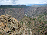
| 38. North Vista Trail, Black Canyon of the Gunnison National Park Length 3.5 miles (5.6 km) Elevation change 860 feet (262 meters) Difficulty Strenuous Rating (1-5) ★★★★★ The longest trail in the national park explores the western section of the North Rim, starting at the ranger station near the end of the park road and climbing, gently at first then more steeply, via several long switchbacks, up to the summit of 8,563 foot Green Mountain. About half way along, a short spur leads to an overlook (Exclamation Point) right on the canyon rim, above one of the most sheer-walled sections of the whole gorge. |
| 39. Ottos Trail, Colorado National Monument Length 0.5 miles (0.8 km) Elevation change 110 feet (34 meters) Difficulty Easy Rating (1-5) ★★★★★ Another of the short routes near the visitor center, Otto's Trail heads east from the scenic drive along a narrowing promontory, descending slightly, ending at a fenced, rocky overlook directly opposite the Pipe Organ formation. The latter section of the path has excellent views up and down Monument Canyon, and of Independence Monument a short distance south. |
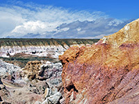
| 40. Paint Mines Trails, Paint Mines Interpretive Park Length 4 miles (6.4 km); two loops Elevation change 250 feet (76 meters) Difficulty Easy Rating (1-5) ★★★★★ Two connected loops and several short spurs wind around the three main ravines in this small state park which features much colorful, clayish rock, once mined by Native Americans to make paints. The most extensive area is around the uppermost part of the largest ravine, viewed from above from West Overlook, and close-up by a path along the gully, which downstream of the colorful section passes two of the park's four interpretive sites. |
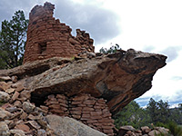
| 41. Painted Hand Pueblo, Canyons of the Ancients National Monument Length 0.3 miles (0.5 km) Elevation change 40 feet (12 meters) Difficulty Easy Rating (1-5) ★★★★★ Painted Hand Pueblo, perhaps the best of the visible backcountry sites in the national monument, is reached by a path that follows the rim of a shallow canyon then drops down a short distance. There are several ruined structures here, the best a circular tower atop a projecting boulder. |
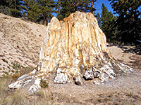
| 42. Petrified Forest Loop, Florissant Fossil Beds National Monument Length 1 mile (1.6 km); (loop) Elevation change 60 feet (18 meters) Difficulty Easy Rating (1-5) ★★★★★ The most used trail in the national monument loops around the main fossil region, passing five well preserved stumps in a natural setting, unprotected apart from wooden fences - largest is the Big Stump, 12 feet across. Most of the path crosses open, grassy meadows, quite close to the highway. The trail also passes the Scudder Pit, one of the original fossil excavation sites, but which has nothing of obvious interest to look at. |
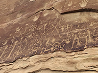
| 43. Petroglyph Point Trail, Mesa Verde National Park Length 2.9 miles (4.7 km); round trip Elevation change 300 feet (91 meters) Difficulty Easy to moderate; some short, steep climbs, and narrow passages Rating (1-5) ★★★★★ Starting at the cliff dwelling ruins of Spruce Tree House, this trail heads downstream along the canyon, giving a good appreciation of the landscape, passing colorful rock formations and another small ruin as well as a set of petroglyphs. The path later climbs to the rim above the canyon and returns along the plateau, with views of distant lands to the west. |
| 44. Plug Hat Trail, Dinosaur National Monument Length 0.3 miles (0.5 km) Elevation change 0 feet (0 meters) Difficulty Easy Rating (1-5) ★★★★★ North of the Canyon Area visitor center, Harpers Corner Road crosses mostly flat land for 3 miles then climbs up to the top of a pinyon/juniper-covered plateau, passing the protruding summit of Plug Hat Butte. On one side of the road is a spacious, secluded picnic area, while on the far side, a short trail follows the plateau rim to a viewpoint above the highway, looking out over many square miles of desert land to the south. |
| 45. Point Lookout Trail, Mesa Verde National Park Length 1.1 miles (1.8 km) Elevation change 530 feet (162 meters) Difficulty Easy to moderate - steep at the start Rating (1-5) ★★★★★ Point Lookout, an 8,427 foot summit, overlooks the north part of the national park entrance road, as well as vast areas of the surrounding countryside, including Mancos Valley and Montezuma Valley. The short trail to the top climbs steeply from Morfield Campground then traverses nearly level terrain to the viewpoint. |
| 46. Porphyry Basin, San Juan Mountains Length 4 miles (6.4 km); from US 550 to the crest Elevation change 2000 feet (610 meters) Difficulty Moderate Rating (1-5) ★★★★★ Beautiful, high-elevation, flower-filled basin containing an old mine, streams, waterfalls, cliffs and four small lakes, just below the mountain crest. Reached by walking or driving 3 miles along a 4WD track, then by relatively easy hiking |
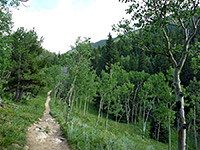
| 47. Racoon Trail, Golden Gate Canyon State Park Length 2.2 miles (3.5 km) Elevation change 500 feet (152 meters) Difficulty Easy to moderate Rating (1-5) ★★★★★ This path descends 500 feet through the pine forest and follows a drainage into a more open valley, then returns via a mix of long grass meadows, airy aspen groves and small creeks, with some fleeting views of 10,540 foot Thorodin Mountain just north of the state park, one of the few places where the granite bedrock is exposed. |
| 48. Sand Canyon, Canyons of the Ancients National Monument Length 3.5 miles (5.6 km); to the northernmost ruin Elevation change 400 feet (122 meters) Difficulty Easy to moderate Rating (1-5) ★★★★★ North-side, two-level tributary of McElmo Creek; a narrow inner gorge through Navajo sandstone, wide benches of the Carmel Formation, and upper cliffs of Entrada sandstone, with at least seven large alcoves containing ancient ruins |
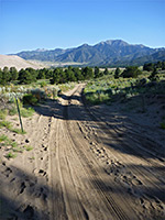
| 49. Sand Ramp Trail, Great Sand Dunes National Park and Preserve Length 11 miles (17.7 km); (loop) Elevation change 400 feet (122 meters) Difficulty Easy to moderate Rating (1-5) ★★★★★ Most people just walk one mile along the Sand Ramp Trail, as far as an overlook of the dunes, a little way up in the Sangre de Cristo foothills, but the path continues ten miles further. The trail stays a little way from the edge of the sands, continuing north then later west, where it does return to the dunes, and ends at a wooded area beside another large drainage (Sand Creek). There are several primitive campsites en route. One option, for a loop hike, is to leave the path after 2 or 3 miles and walk west, across Medano Pass Road and Medano Creek, returning beside or through the dunes. |
| 50. Sawmill Trail, Florissant Fossil Beds National Monument Length 2.2 miles (3.5 km); (loop) Elevation change 100 feet (30 meters) Difficulty Easy Rating (1-5) ★★★★★ Perhaps the best choice for a longer hike in the national monument, this loop follows an old vehicle track over grassy slopes up to the top of a forested ridge, runs alongside the course of a seasonal stream through a narrow, partly wooded valley then rounds the side of a large meadow back to the visitor center. This is a good route on which to look for the characteristic all-black Abert's squirrels that inhabit the woodland. |
| 51. Sneffels Highline Trail, San Juan Mountains Length 14 miles (22.5 km); (loop), including half a mile each way to reach the trailhead Elevation change 3500 feet (1067 meters) Difficulty Strenuous Rating (1-5) ★★★★★ Excellent loop trail visiting two Alpine basins high above Telluride, including 5 miles above the treeline; ever-changing views of forests, wildflowers, meadows, streams, ridges and summits |
| 52. Soda Canyon Overlook Trail, Mesa Verde National Park Length 0.6 miles (1 km) Elevation change 40 feet (12 meters) Difficulty Easy Rating (1-5) ★★★★★ Soda Canyon Overlook Trail winds through wooded surroundings, around the head of a side ravine and on to a viewpoint on the rim of a much larger canyon, opposite the ruins of Balcony House - the only location where these may be viewed. Other, more distant ruins are visible further downstream. |
| 53. Spruce Canyon Trail, Mesa Verde National Park Length 2.4 miles (3.9 km); (loop) Elevation change 550 feet (168 meters) Difficulty Moderate Rating (1-5) ★★★★★ Spruce Canyon borders Chapin Mesa to the west, and may be explored by a loop trail that while not coming close to any ruins does pass within sight of a few cliff dwellings high up on the far side. The path starts by Spruce Tree House, following the first part of the Petroglyph Point Trail then forking off to the west, leading up Spruce Canyon for a mile then climbing back to the mesa. |
| 54. Step House Trail, Mesa Verde National Park Length 0.8 miles (1.3 km); (loop) Elevation change 90 feet (27 meters) Difficulty Easy Rating (1-5) ★★★★★ The ruins of Step House sit in an alcove at the upper end of a short tributary of Long Canyon; they may be viewed by a self-guided loop trail that drops down quite steeply, passes in front of the site then climbs back to the mesa top. |
| 55. Steps Trail, Dinosaur National Monument Length 1.4 miles (2.3 km); to the viewpoint Elevation change 780 feet (238 meters) Difficulty Easy, moderate Rating (1-5) ★★★★★ Half mile path in the little-visited Deerlodge Park area, over a ridge of inclined strata to a beach at the mouth of Yampa Canyon, from where an off-trail continuation is to climb a much bigger slope to a grand viewpoint high above the river. |
| 56. Timber Lake, Rocky Mountain National Park Length 4.6 miles (7.4 km); to the lake Elevation change 2060 feet (628 meters) Difficulty Moderate to strenuous Rating (1-5) ★★★★★ Right opposite the busy Colorado River trailhead, the less used path to Timber Lake is moderately steep as it climbs the forested hillside above Timber Creek, up to the source of the stream at a pretty lake beyond the treeline, close to the continental divide. There are several primitive campsites near the upper end of the path, and one side trail, which heads back along the far side of the valley to the source of a tributary stream, at Long Meadows. Continuation hikes, off trail, lead to ridges and summits with even better views. |
| 57. Warner Point Nature Trail, Black Canyon of the Gunnison National Park Length 0.7 miles (1.1 km) Elevation change 150 feet (46 meters) Difficulty Easy Rating (1-5) ★★★★★ Starting at the far end of the park road, this trail follows the rim a little way further west, first descending slightly to a saddle then rising a little more, to a flat-topped summit at 8,302 feet. The views are very extensive, both north to the canyon and south towards Montrose, and the path passes a good variety of vegetation. |
| 58. Wedding Canyon Trail, Colorado National Monument Length 2.5 miles (4 km) Elevation change 500 feet (152 meters) Difficulty Moderate Rating (1-5) ★★★★★ The route through Wedding Canyon is one of the national monument's unmaintained paths but the terrain is still relatively easy. The trail crosses sagebrush flats then enters the lower end of the canyon which is followed southwards to the base of Independence Monument, meeting with the busier path down adjacent Monument Canyon. This enables a 5 mile loop hike, providing an alternative way back to the trailhead along Hwy 340. |
| 59. Window Rock Trail, Colorado National Monument Length 0.25 miles (0.4 km) Elevation change 60 feet (18 meters) Difficulty Easy Rating (1-5) ★★★★★ This very short trail descends gently through lightly wooded surroundings to a railing-protected viewpoint on the rim of Monument Canyon, adjacent to a small natural arch (Window Rock) which has formed at the top of the Wingate sandstone cliffs. There are good long distance views over the northern section of the national monument, and across to the Book Cliffs. |
| 60. Ypsilon Lake, Rocky Mountain National Park Length 6.2 miles (10 km); to Lawn Lake; other destinations nearby Elevation change 2249 feet (685 meters) Difficulty Strenuous Rating (1-5) ★★★★★ The Lawn Lake Trail heads north up this canyon and soon splits; the left branch climbs a wooded ridge to Ypsilon Lake (from where the Spectacle Lakes can be reached by some off-trail climbing) while the right fork follows the canyon further, climbing more steeply at the upper end, to a junction with a path from Lumpy Ridge, and soon after to Lawn Lake, at the treeline. |
All Contents © Copyright The American Southwest | Comments and Questions | Contribute | Affiliate Marketing Disclosure | Site Map
