Ypsilon and Spectacle Lakes, Rocky Mountain National Park
Colorado > Rocky Mountain National Park > Trails in the East > Ypsilon and Spectacle Lakes
Ypsilon and Spectacle Lakes
Varied hike up the Roaring River valley and along a wooded ridge, past small Chipmunk Lake to the larger Ypsilon Lake, at the treeline. Off-trail climbing leads to the much more remote Spectacle Lakes, set amidst stark scenery of rock and scree
Length: 4.2 miles to Ypsilon Lake, 5.2 miles to the Spectacle Lakes
Elevation change: 2,180 feet, 2,800 feet
Difficulty: Moderate, strenuous
Type: One way
Usage: Medium, low
Season: Late spring, summer, fall
Trailhead: Parking area for Lawn Lake, at the end of Old Fall River Road
Rating (1-5): ★★★★★
Elevation change: 2,180 feet, 2,800 feet
Difficulty: Moderate, strenuous
Type: One way
Usage: Medium, low
Season: Late spring, summer, fall
Trailhead: Parking area for Lawn Lake, at the end of Old Fall River Road
Rating (1-5): ★★★★★
Although just seven miles from Estes Park, the Lawn Lake trailhead in Rocky Mountain National Park is relatively little used compared with those south of US 34, partly since the two main destinations - Ypsilon Lake and Lawn Lake - are quite far away, 4.5 miles and 6.2 miles respectively. Both lakes have a primitive camping area nearby for those staying overnight, but they are equally suited to day trips.
Ypsilon Lake is the least visited of the two because there is no (official) continuation path, though a steep off-trail scramble reaches the two Spectacle Lakes, set amidst stark granite scenery at the foot of Ypsilon Mountain. Ypsilon Lake is less spectacular but still pretty, and the path also passes a smaller, photogenic pond (Chipmunk Lake). The route is along the lower end of the valley of the Roaring River for a short distance then up a lengthy forested ridge with fleeting views of the surrounding mountains, and the hike to Ypsilon Lake at least is relatively easy, and quite varied. The optional extension to the Spectacle Lakes is rather more strenuous, requiring a small amount of climbing over steep slickrock or boulders, but the rewards are much more remote scenery and better views, usually without any other people.
Rocky Mountain National Park map, Ypsilon and Spectacle Lakes topographic map.
28 views of Ypsilon Lakes and the Spectacle Lakes.
The Lawn Lake trailhead is situated at the east end of Old Fall River Road near the US 34 junction - at the edge of Horseshoe Park, the wide, flat grassland surrounding this section of the river. The parking area has space for several dozen vehicles, with overflow areas along the road. The trail starts with a few switchbacks leading to a junction with the Little Horseshoe Park Trail, and up a little more to a bench, 200 feet above the valley floor, then straightens out and moves northwest, climbing more gradually to the brink of the major valley of the Roaring River, above the steep lower section (Horseshoe Falls). A huge flood in 1982 created an extensive boulder pile at the mouth of the canyon, which may be toured from below by the short Alluvial Fan Trail. Lesser landslips are common; the valley is bordered by steep slopes of loose earth and boulders, easily eroded at times of high water. The path follows the east side of the river northwards, through pleasant, cool surroundings of tall trees and light undergrowth. The rim slopes gently while the river gains height more sharply so the deep canyon soon becomes shallow and the path approaches the water level, where the Ypsilon Lake Trail forks off to the west, leaving the more well used Lawn Lake Trail continuing alongside the river.
The Ypsilon route crosses the river on a footbridge, has a short, steep climb and nears the edge of Fall River valley once more, giving views of Horseshoe Park through gaps in the lodgepole pine forest. Beyond, the path curves back north and for the next mile follows the crest of a sloping ridge, steep in places. The land falls away on both sides, most noticably to the east, allowing brief glimpses of the wider surroundings, and making the climb less monotonous. The gradient becomes gentle as the ridge widens, the trees now less tall and more spaced out, with more undergrowth, in between many whitish granite boulders. The steep peaks of the Mummy Range are now visible ahead.
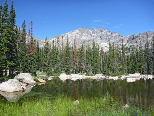
The trail drops down slightly to little Chipmunk Lake, a tree-lined pond which is especially pretty whenever the sun shines, creating reflections. On the far side is an open area with more boulders, as the path descends again, past a tiny creek and several seeps to the larger entry stream into Ypsilon Lake, and finally down to the shoreline. This lake has mostly wooded surrounds; cliffs and scree line only part of the north edge, so the scenery, while pretty, is not that special. A narrower path follows the east shore towards the exit stream, past a number of trout fishing sites, and giving rather better views of the mountains.
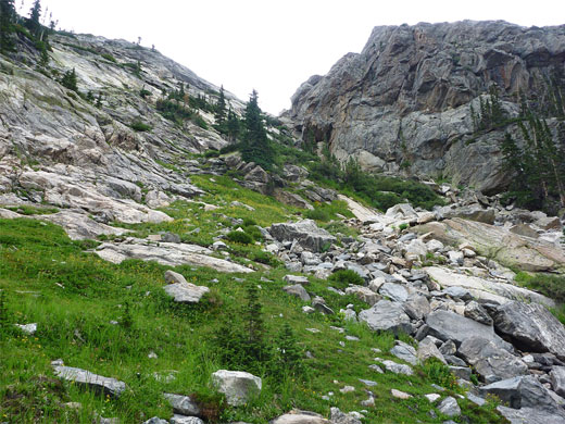
It may be unofficial, but the continuation route to the Spectacle Lakes is well enough hiked to have a recognizable trail most of the way; the faint path climbs the steeply wooded slopes on the south side of the Ypsilon Lake entry stream, gaining 200 feet, past several cascades and small waterfalls, to a more level stretch where the stream is crossed on two log bridges and followed on the north side a little further, over a lesser tributary to a bushy area around the junction with the larger drainage that originates from the Spectacle Lakes, 600 feet above. The main creek continues to Chiquita Lake, further away but above somewhat easier terrain. The Spectacle Lakes trail winds through brushes and granite blocks to the edge of the streamway, where cairns mark the suggested route, staying on the west side of the creek. The stream flows out of sight for short distances, below a jumble of granite boulders. The path veers away briefly, up a slope of grass and wildflowers before returning to the creek about half way up the ascent.
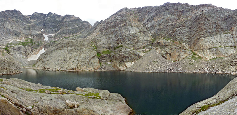
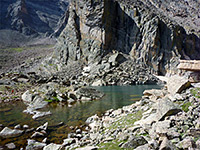
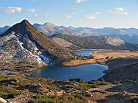
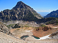
The next section is either right along the creek bed, climbing the large borders, or up the smooth granite slabs to the west, some parts of which have a certain amount of exposure. Above this steep section, the stream flows through a rocky bowl and a little pond, not far from the edge of the lake. The granite now is angular, unvegetated, grey in color with reddish tints and a covering of green lichen - stark, mountainous scenery, well above the treeline. The far side of the Spectacle Lakes is bordered by some sheer cliffs, while the near edge, although generally less enclosed, is also partly cliff-bound and so the lake cannot be followed at water level. A low spit separates the eastern lake from the slightly larger western component, set directly beneath the precipitous eastern slope of 13,514 foot Ypsilon Mountain, holding some snow all year. Both lakes look deep, filled by cool, grey-blue water.
Ypsilon Lake is the least visited of the two because there is no (official) continuation path, though a steep off-trail scramble reaches the two Spectacle Lakes, set amidst stark granite scenery at the foot of Ypsilon Mountain. Ypsilon Lake is less spectacular but still pretty, and the path also passes a smaller, photogenic pond (Chipmunk Lake). The route is along the lower end of the valley of the Roaring River for a short distance then up a lengthy forested ridge with fleeting views of the surrounding mountains, and the hike to Ypsilon Lake at least is relatively easy, and quite varied. The optional extension to the Spectacle Lakes is rather more strenuous, requiring a small amount of climbing over steep slickrock or boulders, but the rewards are much more remote scenery and better views, usually without any other people.
Maps
Rocky Mountain National Park map, Ypsilon and Spectacle Lakes topographic map.
Photographs
28 views of Ypsilon Lakes and the Spectacle Lakes.
Start of the Trail
The Lawn Lake trailhead is situated at the east end of Old Fall River Road near the US 34 junction - at the edge of Horseshoe Park, the wide, flat grassland surrounding this section of the river. The parking area has space for several dozen vehicles, with overflow areas along the road. The trail starts with a few switchbacks leading to a junction with the Little Horseshoe Park Trail, and up a little more to a bench, 200 feet above the valley floor, then straightens out and moves northwest, climbing more gradually to the brink of the major valley of the Roaring River, above the steep lower section (Horseshoe Falls). A huge flood in 1982 created an extensive boulder pile at the mouth of the canyon, which may be toured from below by the short Alluvial Fan Trail. Lesser landslips are common; the valley is bordered by steep slopes of loose earth and boulders, easily eroded at times of high water. The path follows the east side of the river northwards, through pleasant, cool surroundings of tall trees and light undergrowth. The rim slopes gently while the river gains height more sharply so the deep canyon soon becomes shallow and the path approaches the water level, where the Ypsilon Lake Trail forks off to the west, leaving the more well used Lawn Lake Trail continuing alongside the river.
Ascent
The Ypsilon route crosses the river on a footbridge, has a short, steep climb and nears the edge of Fall River valley once more, giving views of Horseshoe Park through gaps in the lodgepole pine forest. Beyond, the path curves back north and for the next mile follows the crest of a sloping ridge, steep in places. The land falls away on both sides, most noticably to the east, allowing brief glimpses of the wider surroundings, and making the climb less monotonous. The gradient becomes gentle as the ridge widens, the trees now less tall and more spaced out, with more undergrowth, in between many whitish granite boulders. The steep peaks of the Mummy Range are now visible ahead.
Spectacle Lakes
The trail drops down slightly to little Chipmunk Lake, a tree-lined pond which is especially pretty whenever the sun shines, creating reflections. On the far side is an open area with more boulders, as the path descends again, past a tiny creek and several seeps to the larger entry stream into Ypsilon Lake, and finally down to the shoreline. This lake has mostly wooded surrounds; cliffs and scree line only part of the north edge, so the scenery, while pretty, is not that special. A narrower path follows the east shore towards the exit stream, past a number of trout fishing sites, and giving rather better views of the mountains.
Continuation Route
It may be unofficial, but the continuation route to the Spectacle Lakes is well enough hiked to have a recognizable trail most of the way; the faint path climbs the steeply wooded slopes on the south side of the Ypsilon Lake entry stream, gaining 200 feet, past several cascades and small waterfalls, to a more level stretch where the stream is crossed on two log bridges and followed on the north side a little further, over a lesser tributary to a bushy area around the junction with the larger drainage that originates from the Spectacle Lakes, 600 feet above. The main creek continues to Chiquita Lake, further away but above somewhat easier terrain. The Spectacle Lakes trail winds through brushes and granite blocks to the edge of the streamway, where cairns mark the suggested route, staying on the west side of the creek. The stream flows out of sight for short distances, below a jumble of granite boulders. The path veers away briefly, up a slope of grass and wildflowers before returning to the creek about half way up the ascent.
Spectacle Lakes
The next section is either right along the creek bed, climbing the large borders, or up the smooth granite slabs to the west, some parts of which have a certain amount of exposure. Above this steep section, the stream flows through a rocky bowl and a little pond, not far from the edge of the lake. The granite now is angular, unvegetated, grey in color with reddish tints and a covering of green lichen - stark, mountainous scenery, well above the treeline. The far side of the Spectacle Lakes is bordered by some sheer cliffs, while the near edge, although generally less enclosed, is also partly cliff-bound and so the lake cannot be followed at water level. A low spit separates the eastern lake from the slightly larger western component, set directly beneath the precipitous eastern slope of 13,514 foot Ypsilon Mountain, holding some snow all year. Both lakes look deep, filled by cool, grey-blue water.
Ypsilon Lake Wildflower
 Elephant heads |
Ypsilon and Spectacle Lakes - Similar Hikes
All Contents © Copyright The American Southwest | Comments and Questions | Contribute | Affiliate Marketing Disclosure | Site Map


