The Slot, Anza-Borrego Desert State Park
Slot Canyons > Other Locations > The Slot, Anza-Borrego Desert State Park
The Slot
Short, fairly shallow, narrow canyon through grey-brown conglomerate rocks surrounded by desert badlands, towards the low elevation east side of Anza-Borrego Desert State Park
Length: 0.4 miles to the end of the narrows
Difficulty: Easy
Management: California State Parks
Rocks: Sandstone, clays and conglomerate from the Palm Spring Formation
Season: Fall, winter, spring; summers are very hot
Trailhead: Along Buttes Pass Road, 1.9 miles from Hwy 78
Rating (1-5): ★★★★★
Difficulty: Easy
Management: California State Parks
Rocks: Sandstone, clays and conglomerate from the Palm Spring Formation
Season: Fall, winter, spring; summers are very hot
Trailhead: Along Buttes Pass Road, 1.9 miles from Hwy 78
Rating (1-5): ★★★★★
There are many short slot canyons in the California deserts, enclosed not by the brightly colored sandstone of the Colorado Plateau, but by predominantly dull-colored, grey or brown rocks, often conglomerate, where more solid layers alternate with looser, pebble-containing strata. In Anza-Borrego Desert State Park such ravines are found mostly in the badlands towards the east, including the foothills of the Vallecito Mountains, the Carrizo Badlands in the south and the Palm Wash area in the north.
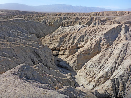
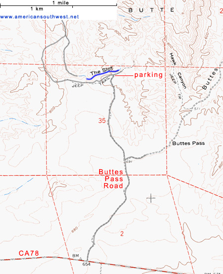
Another area with a few slots is the Borrego Badlands between roads 78 and S22, and the most frequently visited is known simply as the Slot, close to Hwy 78. One and a half miles east of the junction with Borrego Springs Road and 5 miles west of Ocotillo Wells, a dirt track - Buttes Pass Road - heads north across flat, sandy ground towards a ridge of low hills. The track forks halfway to the westernmost peak (West Butte), and the left branch climbs a little to the head of a ravine (Borrego Mountain Wash) then bends away to the west, later crossing the same ravine lower down. The Slot is the upper half mile or so of the drainage, where the passageways are enclosed, particularly so for one 200 yard section.
The Slot is the most popular slot canyon in the state park and is marked on the official map, and signed from the highway (CA 78). Buttes Pass Road, which leads to the trailhead, should be passable by all vehicles; if not it takes less than an hour to walk the 2 miles from Hwy 78, over gently sloping, cactus-covered land that has several potential primitive camping places. In recent years, increased visitation to the canyon has resulted in the parking lot becoming full on some days, so at busy times the area is now managed by park rangers, who control access, perhaps resulting in a wait of ten minutes or more for spaces to become available. A parking fee of $10 is charged on such days. Also at busy times, there may be queues in the canyon, at some of the narrower spots.
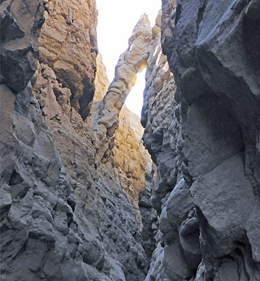
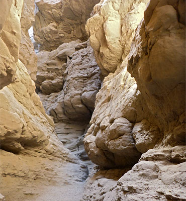
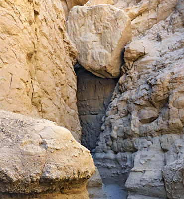
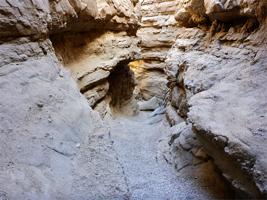
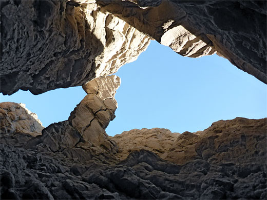
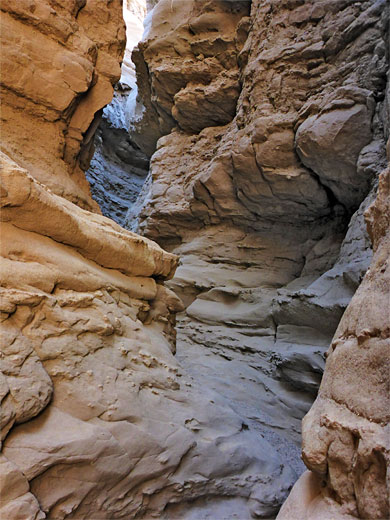
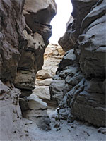
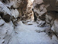
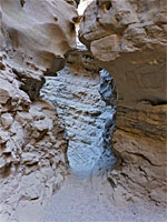
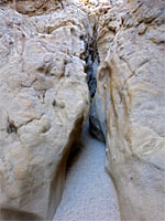
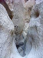
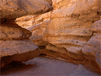
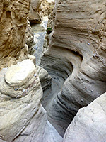
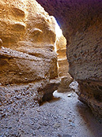
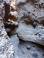
The parking area is on the canyon rim, just before the approach road makes the tight bend to the west. A 300 foot path leads northeastwards, then down a little ravine to the sandy, gravelly streambed. The canyon at the entry point, just above the narrows, has similar features to parts of Cathedral Gorge in Nevada - many small branches with mud walls, pinnacles and other eroded formations. Lower down, after a temporarily wider section, the wash cuts through a more resistant sandstone layer and for a few hundred yards becomes a true slot canyon, often quite dark due to overhanging cliffs above and in places just a few feet wide. The colors are rather drab though - light brown or gray and generally without nice reflected light patterns. Towards the lower end, high above the streambed, is an angular arch, or natural bridge, formed by a pinnacle on one side of the canyon, partially falling so that it rests against the opposite cliff.
The walk through the Slot is easy, and soon the passageway opens out to a section accessible by 4WD vehicles, by driving up the canyon from the point where it is crossed by Buttes Pass Road, 1.1 miles beyond the trailhead. A few short side canyons join from the right side but these do not extend very far. Soon after the end of the narrows there are several climb out routes, though some people retrace steps back through the slot, or continue downstream for a longer loop hike - returning either along the road (2.2 miles), or via a little-used path that heads in the opposite direction, over badlands and little drainages, back to the entry point (2.8 miles).
Another area with a few slots is the Borrego Badlands between roads 78 and S22, and the most frequently visited is known simply as the Slot, close to Hwy 78. One and a half miles east of the junction with Borrego Springs Road and 5 miles west of Ocotillo Wells, a dirt track - Buttes Pass Road - heads north across flat, sandy ground towards a ridge of low hills. The track forks halfway to the westernmost peak (West Butte), and the left branch climbs a little to the head of a ravine (Borrego Mountain Wash) then bends away to the west, later crossing the same ravine lower down. The Slot is the upper half mile or so of the drainage, where the passageways are enclosed, particularly so for one 200 yard section.
Topographic Map of The Slot

Access to the Slot
The Slot is the most popular slot canyon in the state park and is marked on the official map, and signed from the highway (CA 78). Buttes Pass Road, which leads to the trailhead, should be passable by all vehicles; if not it takes less than an hour to walk the 2 miles from Hwy 78, over gently sloping, cactus-covered land that has several potential primitive camping places. In recent years, increased visitation to the canyon has resulted in the parking lot becoming full on some days, so at busy times the area is now managed by park rangers, who control access, perhaps resulting in a wait of ten minutes or more for spaces to become available. A parking fee of $10 is charged on such days. Also at busy times, there may be queues in the canyon, at some of the narrower spots.
The Narrows
The parking area is on the canyon rim, just before the approach road makes the tight bend to the west. A 300 foot path leads northeastwards, then down a little ravine to the sandy, gravelly streambed. The canyon at the entry point, just above the narrows, has similar features to parts of Cathedral Gorge in Nevada - many small branches with mud walls, pinnacles and other eroded formations. Lower down, after a temporarily wider section, the wash cuts through a more resistant sandstone layer and for a few hundred yards becomes a true slot canyon, often quite dark due to overhanging cliffs above and in places just a few feet wide. The colors are rather drab though - light brown or gray and generally without nice reflected light patterns. Towards the lower end, high above the streambed, is an angular arch, or natural bridge, formed by a pinnacle on one side of the canyon, partially falling so that it rests against the opposite cliff.
Loop Hikes
The walk through the Slot is easy, and soon the passageway opens out to a section accessible by 4WD vehicles, by driving up the canyon from the point where it is crossed by Buttes Pass Road, 1.1 miles beyond the trailhead. A few short side canyons join from the right side but these do not extend very far. Soon after the end of the narrows there are several climb out routes, though some people retrace steps back through the slot, or continue downstream for a longer loop hike - returning either along the road (2.2 miles), or via a little-used path that heads in the opposite direction, over badlands and little drainages, back to the entry point (2.8 miles).
More Photographs of the Slot
The Slot - Similar Hikes
All Contents © Copyright The American Southwest | Comments and Questions | Contribute | Affiliate Marketing Disclosure | Site Map
