Owl Canyon
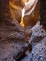
Short slot through orange-brown conglomerate rock layers, along an otherwise shallow drainage on the west edge of Lake Mead; accessed by a recognized trail
Length: 1.1 miles
Difficulty: Easy - no obstructions
Management: NPS - part of Lake Mead NRA
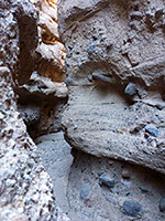
Rocks: Coarse grained facies from the Muddy Creek Formation
Season: All year
Trailhead: 33 Hole Overlook parking area, off Lakeshore Drive
Rating (1-5): ★★★★★
Difficulty: Easy - no obstructions
Management: NPS - part of Lake Mead NRA
Rocks: Coarse grained facies from the Muddy Creek Formation
Season: All year
Trailhead: 33 Hole Overlook parking area, off Lakeshore Drive
Rating (1-5): ★★★★★
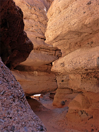
Owl Canyon, or White Owl Canyon, a minor drainage along the western shore of Lake Mead, is unnamed on topographic maps, just one of hundreds of little washes that drain the surrounding dusty hills, but notable for a short section of narrows through greyish-brown conglomerate rock layers.
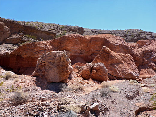
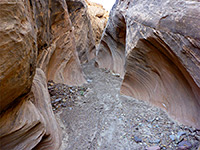
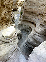
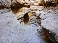
The most confined section, up to 100 feet deep, is only a quarter of a mile long but pretty, quite colorful, and sufficiently enclosed for good patterns of light and shadows. Beyond is another quarter mile of less deep though still narrow canyon before the drainage opens out and becomes uninteresting, the only other nearby feature of note being an outcrop of more richly colored red sandstone just upstream, crossed by a cave-like passage. Desert rock nettle is the most abundant of the limited number of wildflower species in the canyon.
The canyon has become well enough known in recent years for the NPS to install a trailhead notice, since although there are doubtless many other similar short slot canyons around the lake, this is one of the easiest to reach. Other popular slots nearby include Lovell Wash and Spooky Canyon.

The Owl Canyon trailhead is accessed by the short, paved spur road to 33 Hole Overlook, a picnic area and viewpoint, on a ridge which was at one time just above the lake, until declining water levels moved the shoreline a quarter of a mile east, so the area is not as popular as it once was. Most of the water hereabouts is not so nice anyway; shallow, muddy and often partly covered by algae. This area is also known as The Cliffs, since the land slopes down rather more steeply than at other nearby parts of the shoreline. The side road divides into three branches, each with picnic ramadas; the trail starts along the western branch. The natural state of Owl Canon is somewhat spoilt since it is crossed in two places by roads, necessitating the streambed to be contained within large culverts - one under the current park road (Lakeshore Drive) just above the end of the main slot, and a pair beneath a former alignment of the highway, now the River Mountains Loop Trail, just beyond the upper narrows. All three are easily tall enough to walk through.
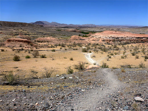
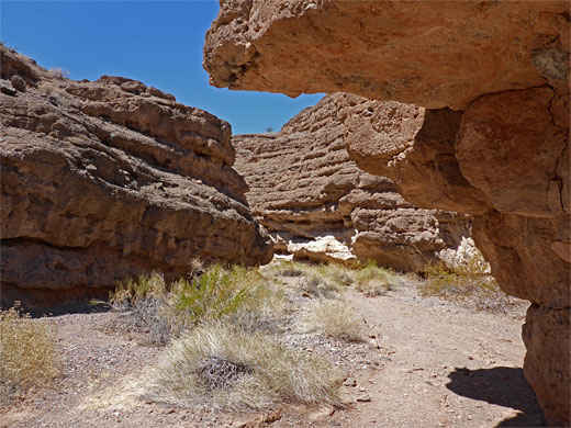
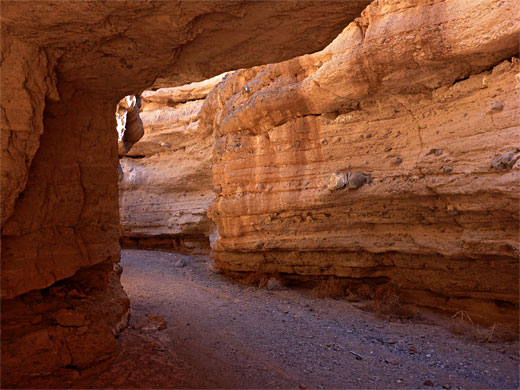
The trailhead notice is accompanied by warnings about loose rocks, soft sand and the hot conditions in summer, when temperatures can exceed 110°F. A narrow but obvious path leads 70 feet down a grey slope to a dry, bushy flat then up and over a little ridge to the next drainage north - Owl Canyon - which is followed upstream. This narrows after a few hundred yards, as low cliffs rise up, then, after bearing left at a divide, the slot section is soon reached, 0.4 miles from the trailhead. The walls partially overhang in many places and are formed of distinct layers that sometimes project outwards, having been undercut, so the canyon floor is in shadow for most of the day. There are many signs of the white owls that live in the canyon, nesting high above the floor on inaccessible ledges. The ravine winds through several pretty, enclosed bends before opening out abruptly in front of the culvert underneath Lakeshore Drive. The next section is not so confined though still fairly narrow, and contains a small arch, partly formed by fallen boulders; after this the twin culverts take the wash underneath the old highway, beyond which the streambed becomes wide and shallow. The red sandstone outcrop lies on the southeast side of the drainage a little way beyond the culvert, and is crossed by a tiny wash that runs partly underground through a short cave.
The most confined section, up to 100 feet deep, is only a quarter of a mile long but pretty, quite colorful, and sufficiently enclosed for good patterns of light and shadows. Beyond is another quarter mile of less deep though still narrow canyon before the drainage opens out and becomes uninteresting, the only other nearby feature of note being an outcrop of more richly colored red sandstone just upstream, crossed by a cave-like passage. Desert rock nettle is the most abundant of the limited number of wildflower species in the canyon.
The canyon has become well enough known in recent years for the NPS to install a trailhead notice, since although there are doubtless many other similar short slot canyons around the lake, this is one of the easiest to reach. Other popular slots nearby include Lovell Wash and Spooky Canyon.
Topographic Map of Owl Canyon

Location
The Owl Canyon trailhead is accessed by the short, paved spur road to 33 Hole Overlook, a picnic area and viewpoint, on a ridge which was at one time just above the lake, until declining water levels moved the shoreline a quarter of a mile east, so the area is not as popular as it once was. Most of the water hereabouts is not so nice anyway; shallow, muddy and often partly covered by algae. This area is also known as The Cliffs, since the land slopes down rather more steeply than at other nearby parts of the shoreline. The side road divides into three branches, each with picnic ramadas; the trail starts along the western branch. The natural state of Owl Canon is somewhat spoilt since it is crossed in two places by roads, necessitating the streambed to be contained within large culverts - one under the current park road (Lakeshore Drive) just above the end of the main slot, and a pair beneath a former alignment of the highway, now the River Mountains Loop Trail, just beyond the upper narrows. All three are easily tall enough to walk through.
Route Description for Owl Canyon
The trailhead notice is accompanied by warnings about loose rocks, soft sand and the hot conditions in summer, when temperatures can exceed 110°F. A narrow but obvious path leads 70 feet down a grey slope to a dry, bushy flat then up and over a little ridge to the next drainage north - Owl Canyon - which is followed upstream. This narrows after a few hundred yards, as low cliffs rise up, then, after bearing left at a divide, the slot section is soon reached, 0.4 miles from the trailhead. The walls partially overhang in many places and are formed of distinct layers that sometimes project outwards, having been undercut, so the canyon floor is in shadow for most of the day. There are many signs of the white owls that live in the canyon, nesting high above the floor on inaccessible ledges. The ravine winds through several pretty, enclosed bends before opening out abruptly in front of the culvert underneath Lakeshore Drive. The next section is not so confined though still fairly narrow, and contains a small arch, partly formed by fallen boulders; after this the twin culverts take the wash underneath the old highway, beyond which the streambed becomes wide and shallow. The red sandstone outcrop lies on the southeast side of the drainage a little way beyond the culvert, and is crossed by a tiny wash that runs partly underground through a short cave.
Owl Canyon - Similar Hikes
All Contents © Copyright The American Southwest | Comments and Questions | Contribute | Affiliate Marketing Disclosure | Site Map


