Booker Canyon
Short but pretty narrows in a remote, little-visited region; a tight, V-shaped slot that gives way to a deeper canyon through photogenic, angled, thin-layered rocks
Length: 2.5 miles to the end of the upper slot; 3 miles to the drop off
Difficulty: Easy to moderate; one place requiring downclimbing (can be bypassed)
Management: BLM - part of Grand Staircase-Escalante NM
Rocks: Navajo sandstone
Season: Spring, summer, fall
Trailhead: 1.5 miles along Rush Beds Road. 4WD vehicles can drive 2 miles further to near the start of the canyon
Rating (1-5): ★★★★★
The slot in Booker Canyon extends only for a quarter of a mile but the rocks are pretty, the narrows just a little difficult to descend, and the lower drainage has other interesting sections with dryfalls, thin strata and eroded sandstone formations. It is also quite unspoilt and remote, a long way from a paved road in a seldom visited part of Grand Staircase-Escalante National Monument, yet is easy enough to reach.
The surrounding rock is the familiar Navajo sandstone, here generally white to pale yellow in color, and forming a varied landscape of rounded hills, vertical cliffs, V-shaped ravines and large patches of sand. Above the narrows, Booker Canyon has a few drop offs between open stretches, while not far below it meets Hackberry Canyon which eventually joins Cottonwood Creek, shortly before its confluence with the main drainage in the area, the Paria River.
Topographic map of Booker Canyon.
Booker is reached by first driving along the unpaved Cottonwood Canyon Road to a valley on the east side of Slickrock Bench - a point 32 miles north of US 89 and 6.7 miles from the turn-off to Kodachrome Basin State Park - and then branching south along the Rush Beds Road. This is a narrower, less good track that gradually deteriorates as it encounters sandy or rocky ground en route to a large plateau west of Cottonwood Canyon (used for cattle grazing), though the surface is maintained semi-regularly. The track crosses Round Valley Draw twice, the second time shortly before the start of its slot canyon after 1.7 miles, then reaches the Booker drainage in another 2 miles. Regular cars should be ok as far as the second crossing if the weather is dry, though not far after is the first of several patches of soft sand around Round Valley Seep that will usually require 4WD to overcome. If parking by the draw, Booker is an easy 40 minute walk away up a gentle incline. The surface is firmer after a mile, as the track passes over a saddle then descends into the westernmost of two small ravines at the head of the target canyon.
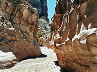
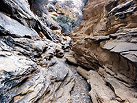
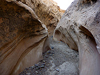
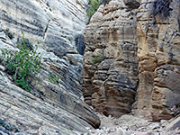
13 views of Booker Canyon.
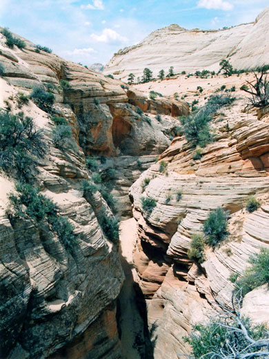
The easiest way down is to walk along the ridge separating the two ravines, then descend the slickrock slope just to the east, shortly before the ground falls away in all directions to the main drainage, which is 300 feet deep. There is another possible entry point down the east side of the eastern ravine. For most of its length, Booker Canyon has a floor of soft, white sand so walking is rather tiring, though the scenery is nice - striated, white, sandstone cliffs rise high above, tinged pink or orange in places and with bright green bushes and pine trees growing in crevices, some quite high up. Flat benches and sand hills line the streambed, which heads southwest, relatively straight, while descending quite gently. The canyon soon drops by about 40 feet, an obstruction passable on either side, then reaches a junction with an east-side tributary, where for a short distance the waters have carved a narrow, curving channel across a flat rock layer. Not far below is a second, smaller dryfall which can be passed most easily on the left side.
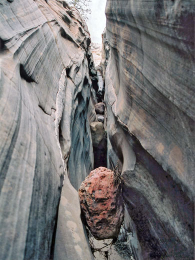
The slot comes into view about 2.5 miles from the Rush Beds Road, where the drainage falls away into a narrow cleft that is soon 30 feet deep but just a few feet across. This starts quite abruptly with a two-stage drop, down to a chokestone then several yards deeper into quite a dark passage, though as the walls are always quite straight, without any overhanging rocks, the narrows are generally well lit. To reach the floor requires bridging along for a while then downclimbing, with the aid of several narrow, slanting ridges. If this maneuver is not appealing, the whole slot section can be avoided by climbing around on the north side, passing quite high above over a rocky slope, then descending back to the streambed via a sandy chute and entering from the lower end.
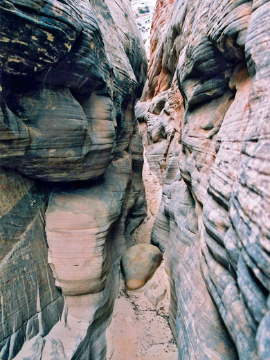
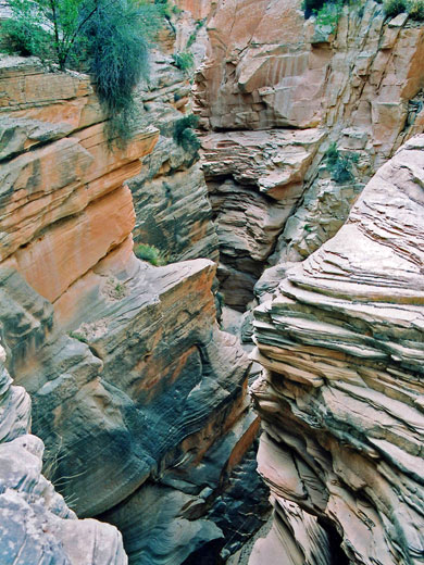
The slot has a few other chokestones and small drops, remaining very narrow until it opens out fully, once more to a sandy-floored gorge but between cliffs that are higher and more vertical. Some sections of sandstone near the edges have an unusual, criss-cross pattern formed by erosion of embedded strata into thin ridges. Easy passage through the canyon ends soon after since the floor drops off about 30 feet in the middle of a photogenic, enclosed section through many thin, angled strata. This can be descended using ropes, though Booker ends soon after at a junction with the wider Hackberry Canyon. The round trip to the dryfall from the approach road takes around 4 hours.
The surrounding rock is the familiar Navajo sandstone, here generally white to pale yellow in color, and forming a varied landscape of rounded hills, vertical cliffs, V-shaped ravines and large patches of sand. Above the narrows, Booker Canyon has a few drop offs between open stretches, while not far below it meets Hackberry Canyon which eventually joins Cottonwood Creek, shortly before its confluence with the main drainage in the area, the Paria River.
Map
Topographic map of Booker Canyon.
Location
Booker is reached by first driving along the unpaved Cottonwood Canyon Road to a valley on the east side of Slickrock Bench - a point 32 miles north of US 89 and 6.7 miles from the turn-off to Kodachrome Basin State Park - and then branching south along the Rush Beds Road. This is a narrower, less good track that gradually deteriorates as it encounters sandy or rocky ground en route to a large plateau west of Cottonwood Canyon (used for cattle grazing), though the surface is maintained semi-regularly. The track crosses Round Valley Draw twice, the second time shortly before the start of its slot canyon after 1.7 miles, then reaches the Booker drainage in another 2 miles. Regular cars should be ok as far as the second crossing if the weather is dry, though not far after is the first of several patches of soft sand around Round Valley Seep that will usually require 4WD to overcome. If parking by the draw, Booker is an easy 40 minute walk away up a gentle incline. The surface is firmer after a mile, as the track passes over a saddle then descends into the westernmost of two small ravines at the head of the target canyon.
Photographs
13 views of Booker Canyon.
Route Description for Booker Canyon
The easiest way down is to walk along the ridge separating the two ravines, then descend the slickrock slope just to the east, shortly before the ground falls away in all directions to the main drainage, which is 300 feet deep. There is another possible entry point down the east side of the eastern ravine. For most of its length, Booker Canyon has a floor of soft, white sand so walking is rather tiring, though the scenery is nice - striated, white, sandstone cliffs rise high above, tinged pink or orange in places and with bright green bushes and pine trees growing in crevices, some quite high up. Flat benches and sand hills line the streambed, which heads southwest, relatively straight, while descending quite gently. The canyon soon drops by about 40 feet, an obstruction passable on either side, then reaches a junction with an east-side tributary, where for a short distance the waters have carved a narrow, curving channel across a flat rock layer. Not far below is a second, smaller dryfall which can be passed most easily on the left side.
Start of the Slot
The slot comes into view about 2.5 miles from the Rush Beds Road, where the drainage falls away into a narrow cleft that is soon 30 feet deep but just a few feet across. This starts quite abruptly with a two-stage drop, down to a chokestone then several yards deeper into quite a dark passage, though as the walls are always quite straight, without any overhanging rocks, the narrows are generally well lit. To reach the floor requires bridging along for a while then downclimbing, with the aid of several narrow, slanting ridges. If this maneuver is not appealing, the whole slot section can be avoided by climbing around on the north side, passing quite high above over a rocky slope, then descending back to the streambed via a sandy chute and entering from the lower end.
Narrow Passages
The slot has a few other chokestones and small drops, remaining very narrow until it opens out fully, once more to a sandy-floored gorge but between cliffs that are higher and more vertical. Some sections of sandstone near the edges have an unusual, criss-cross pattern formed by erosion of embedded strata into thin ridges. Easy passage through the canyon ends soon after since the floor drops off about 30 feet in the middle of a photogenic, enclosed section through many thin, angled strata. This can be descended using ropes, though Booker ends soon after at a junction with the wider Hackberry Canyon. The round trip to the dryfall from the approach road takes around 4 hours.
Booker Canyon - Similar Hikes
All Contents © Copyright The American Southwest | Comments and Questions | Contribute | Affiliate Marketing Disclosure | Site Map


