Highlights:
Remote, hard-to-reach region of grassland and isolated red rocks, between Canyonlands National Park (the Needles) and the Abajo Mountains, containing ancient ruins, rock art and other historic artifacts
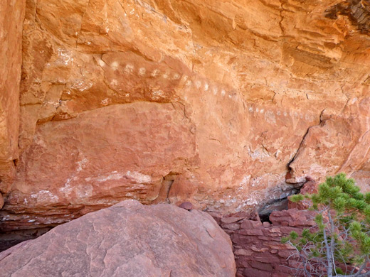
The unspoilt, wide open landscape is one attraction, but most people come here for the historic sites, including ancient ruins, rock art, pioneer cabins and other artifacts, some found along cliffs, others out in the grassland. The largest of the meadows is South Park, 3 miles across, while the others, from east to west are, are House Park, Middle Park, Ruin Park and Pappy's Pasture. There are about ten main ruins, plus a number of smaller sites, and several days could be spent exploring.
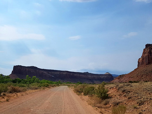
A 4WD vehicle is needed to reach Beef Basin, and the usual approach involves a drive of 30 miles once leaving the paved road, Hwy 111 to the Needles. Much is smooth and fairly level, albeit sandy; the rougher sections are along the middle third where the road climbs into the northern Abajo foothills to avoid several deep upper tributaries of Salt Creek Canyon. The journey from the highway typically takes around 2 hours.
Beef Basin Table of Contents
- Map of Beef Basin
- Photographs
- Driving Routes to Beef Basin
- Roads in the basin
- Ancient sites in Beef Basin
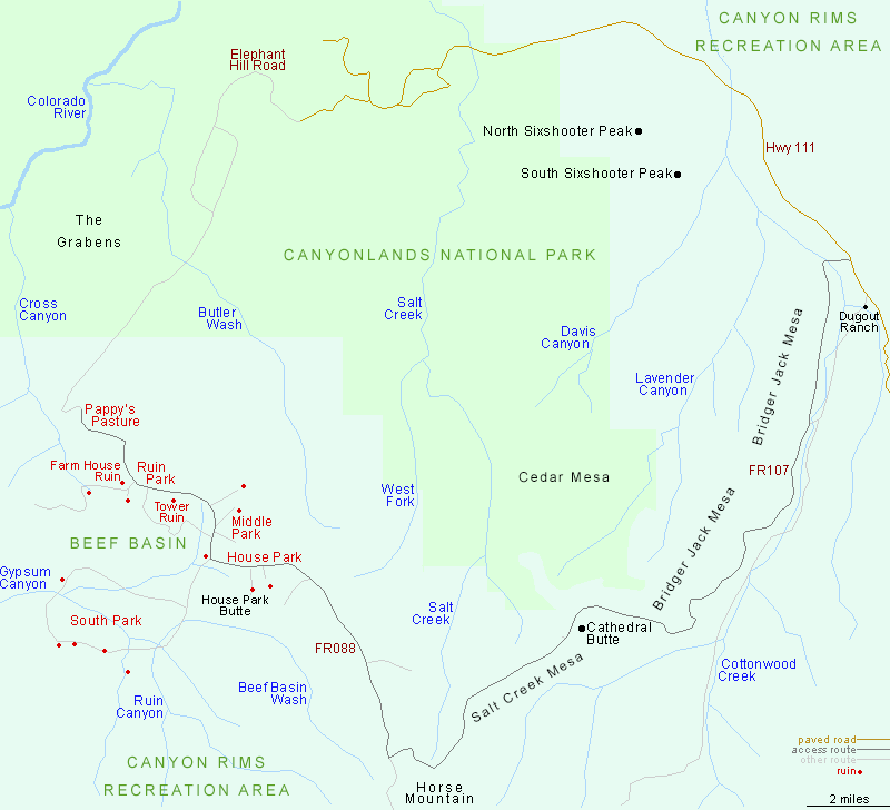
Map of Beef Basin

Photographs
29 views of Beef Basin.
Driving Routes to Beef Basin
The shortest route to Beef Basin is from the north, starting from Elephant Hill in the Needles, initially via the famous Elephant Hill 4WD route then along Devil's Lane, through the Grabens, alongside the edge of Butler Wash Wilderness Study Area and over a divide to Pappy's Pasture at the northwest corner of the basin, a distance of 15 miles. This route is perhaps suitable only for hikers or mountain bikers since beside the difficult section at the start, towards the end is another very rocky stretch including a high ledge, so very few drive this way, and instead the vehicular approach is from the opposite, southeast side, via Beef Basin Road, FR088. This has two connections to paved roads, one from the vicinity of Natural Bridges National Monument in the south, the other Hwy 111 to the northeast; the latter is the shortest and most used; it begins near Dugout Ranch, 12 miles before the Canyonlands National Park boundary, crosses a wash (Salt Creek) then follows the drainage south as it enters a long, straight canyon bordered by the Wingate cliffs of Bridger Jack Mesa to the west and a similar red wall to the east. Initially level with the streambed, it later ascends to a wide bench which contours round some tributary ravines then curves westwards below the south edge of the mesa and passes the isolated summit of Cathedral Butte. Next is a traverse of another block of elevated land, Salt Creek Mesa, followed by a steady climb, rising over a thousand feet into the wooded slopes of the Abajo Mountains, in order to pass the Salt Creek tributaries, and then a similarly steep descent down a sloping ridgeline, exiting the woodland slopes and returning to a country of red rocks and sagebrush plains. At the end of the ridge the road enters the grassland of House Park, easternmost of the Beef Basin meadows.
Roads in the Basin
From House Park, the flat, sandy road leads to the larger Middle Park, and a major junction. The track on the left goes south, over a wash and a low ridge, with some rough places, to another junction at the start of a ten mile loop all around the perimeter of South Park, passing close to five major ruins. The other road heads north over a minor divide to Ruin Park, location of most of the ancient sites, then through Pappy's Pasture and via a rough descent to Bobbys Hole at the edge of the Grabens, continuing north towards Elephant Hill.
Ancient Sites in Beef Basin
Near the east entrance to House Park, a very short side road, southwards, reaches a ruin at base of a north-facing cliff, while soon after, a parallel side road, a little longer, leads to an old cabin and corral near the base of a bigger cliff, the north side of House Park Butte. These wooden structures were built by rancher Mel Turner in the 1890s, and have seemingly been abandoned for around 100 years, though the cabin still retains some of its contents including a stove, old cans and rusting pieces of equipment. In Middle Park are some ruins to the east, at foot of a cliff, and at least four granaries to the northwest, also near the base of cliffs - both sites are reached by sandy side roads. Ruin Park has more ancient structures, most out in the grassland rather than below cliffs, and at least two have a name - Tower Ruin, south of the main road, is a two story structure still over 12 feet high, while Farmhouse Ruin, on a side track to the west, is the largest dwelling in the whole region. There are several more sites along the track. South Basin is less visited since the road is rougher, both the approach and the loop itself. The ruins are mostly along the south side of the loop, at the edge of the mountains.
All Contents © Copyright The American Southwest | Comments and Questions | Contribute | Affiliate Marketing Disclosure | Site Map


