National Parks, National Monuments and National Recreation Areas in Utah
Other Utah listings: national forests and state parks.
Erosion of soft red Entrada sandstone north of Moab has formed over 1,000 natural arches, the largest of which (Landscape Arch) has a span of 290 feet. Besides these features, Arches National Park also contains spires, thin ridges, narrow ravines and many other fantastic rock formations, separated by flat, sandy desert. There are plenty of viewpoints and short trails, including a 1.5 mile path to Delicate Arch, the most-photographed site in the park. Description | Hiking | Map | Photographs | Devils Garden |
|
Proposed for many years and finally created in December 2016, Bears Ears National Monument covers 1.35 million acres in southeast Utah, incorporating several existing preserves including Canyon Rims Recreation Area, Dark Canyon Primitive Area, Cedar Mesa and the Abajo Mountain section of Manti-La Sal National Forest. The monument is named after a distinctive rock formation, the Bears Ears Buttes, and extends south to the Navajo Reservation, and west to Glen Canyon and Canyonlands National Park. Description | Map |
|
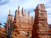
The world famous formations of Bryce Canyon were formed by erosion of the Pink Cliffs, a sandstone layer forming the edge of the Paunsaugunt Plateau in southwest Utah. Thousands of strange, fragile 'hoodoos' in subtle shades of pink, white, yellow and red extend for 25 miles along the cliffs, seen from above by the paved scenic drive, or from close up via a network of trails. The national park has a high elevation (up to 9,100 feet), and receives heavy snowfall in winter. Description | Hiking | Map | Photographs | Scenic Drive |
|
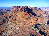
Utah's largest national park is Canyonlands, covering a vast region of rocky wilderness in the southeast, centered around the confluence of the Green and Colorado rivers. This largely roadless region contains countless mesas, spires, arches, canyons and hoodoos, and includes some of the roughest, most inaccessible land in the state. There are four main sections: Island In the Sky, The Needles, The Maze, and Horseshoe Canyon, location of best Indian pictographs (rock art) on the Colorado Plateau. Description | Map | Island in the Sky | The Needles | Horseshoe Canyon |
|
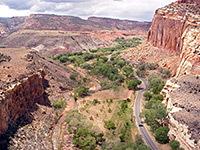
Capitol Reef NP contains most of the Waterpocket Fold, a 100 mile long ridge of tilted and layered rock stretching from the Fishlake Mountains to Lake Powell, and like most parks in south Utah it features vast areas of colorful, eroded rock formations, including domes, arches, cliffs and slot canyons. UT 24 crosses the middle of park and gives access to various viewpoints and trails, while a variety of lesser routes lead into the remote backcountry. Description | Hiking | Map | Photographs | Roads |
|
High in the mountains above Cedar City, Cedar Breaks NM is centered on a steep, bowl-shaped cliff face eroded into the west side of the Markagunt Plateau, quite similar to nearby Bryce Canyon (though much less visited), with multicolored limestone strata and strange rock formations. The monument has a short scenic drive, a selection of trails and a campground; all are open only between April and November, due to the heavy winter snowfall. Description | Photographs | Panorama |
|
An extensive wilderness of sandstone canyons and mountains around the confluence of the Green and Yampa Rivers is protected as the Dinosaur National Monument, either side of the Utah/Colorado border, though the area is most famous for the many large dinosaur fossils that were excavated from just one location, close to the Green River near Vernal. The discovery site is now enclosed by a building (currently closed for reconstruction) allowing close-up inspection of various unexcavated bones; besides this the monument has two paved scenic drives and a selection of trails. Description | Hiking | Map | Photographs | Panorama | Harpers Corner |
|
Formed by a concrete dam built in 1964 across the Green River in northeast Utah, Flaming Gorge Reservoir extends for 91 miles northwards into Wyoming - a long, branched lake surrounded by sloping, treeless hills for most of its extent, but enclosed within a deep, red rock canyon at the southern end. Fishing, boating, swimming, camping and rock climbing are the main activities, together with driving along the scenic roads around the lake. Description | Map | Photographs | Panorama |
|
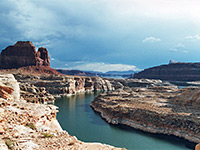
Although the most visited part of Glen Canyon NRA (Wahweap/Page) is in Arizona, the vast majority lies in Utah, including the lakeside marinas of Hite, Halls Crossing and Bullfrog. The NRA contains the vast expanse of Lake Powell, created in 1964 after flooding of the Colorado River by Glen Canyon Dam. The lake is surrounded by many square miles of largely inaccessible red rock wilderness, crossed by numerous narrow canyons, and it offers endless possibilities for exploration, both on land and on water. Description | Map | Page | Hite | Halls Crossing | Bullfrog Marina |
|
Golden Spike NHS commemorates the 1869 completion of the transcontinental railroad, by the union of the east and west portions at Promontory Summit, a remote, barren location north of the Great Salt Lake. At the park headquarters visitors can view historical exhibits, replica steam trains and recreations of the Golden Spike ceremony, while elsewhere, attractions include two driving tours along sections of the former railroad, and the 1.5 mile Big Fill Trail. Description | Map | Photographs | Video |
|
The small town of Escalante is surrounded by some of the most rugged yet beautiful country in Utah, amongst the last areas in the USA to be explored and mapped. The main attractions are dozens of narrow canyons, tributaries of the two main river systems (Paria and Escalante), now contained within a BLM-administered national monument, created in 1996. There are few facilities or paved roads, but endless possibilities for exploration. Description | Cottonwood Canyon | US 89/Paria | Hole-in-the-Rock Road |
|
In an isolated and little-visited part of the Southwest either side of the Utah-Colorado border, Hovenweep National Monument preserves the remains of six villages from the Pueblo period of the mid thirteenth century. Although in some cases little remains beyond a pile of stones or low wall remnants, the interest and appeal is enhanced by the general remoteness and peaceful nature of the surroundings. Description | Photographs |
|
Three large natural sandstone bridges and some Anasazi cliff dwellings are the main attractions of Natural Bridges National Monument, located just off scenic highway 95 in southeast Utah - in a rather remote part of the state, well away from the other more popular parks but close to many other beautiful landscapes such as White Canyon and the La Sal Mountains. The bridges can all be viewed at a distance from the road, or seen close up by short but steep trails. Description | Hiking | Map | Photographs | Panorama |
|
| Rainbow Bridge National Monument (NPS) The massive span of Rainbow Bridge can only be seen by a 13 mile hike across desert lands of the Navajo Indian Reservation, or a two hour boat trip from Wahweap, Arizona - the natural arch spans a narrow canyon close to the south shore of Lake Powell in Glen Canyon NRA, many miles from the nearest road. |
|
Occupying an area of less than one square mile, Timpanogos Cave National Monument protects three interlinked limestone caverns, 1,060 feet above the floor of American Fork Canyon in the Wasatch Mountains, reached by a steep 1.5 mile trail up the rocky slopes. The main feature of the caves is the multitude of helicites - an unusual, twisting, microcrystalline variety of calcite with many delicate forms. Description | Photographs |
|
Zion Canyon is perhaps the most spectacular of the many geological wonders in Utah - sheer red and white sandstone cliffs rise 2,500 feet above the Virgin River, constricting upstream to form one of the best slot canyons in the USA. The ravine is just one part of a 150,000 acre national park that also contains mountains, plateaus and many other narrow canyons. Zion is one of the best hiking locations in the state, including the famous Narrows Trail along the upper Virgin River, and the precipitous route to Angels Landing. Description | Map | Zion Canyon | Kolob Reservoir | The Southeast |
All Contents © Copyright The American Southwest | Comments and Questions | Contribute | Affiliate Marketing Disclosure | Site Map


