Page Sand Cave
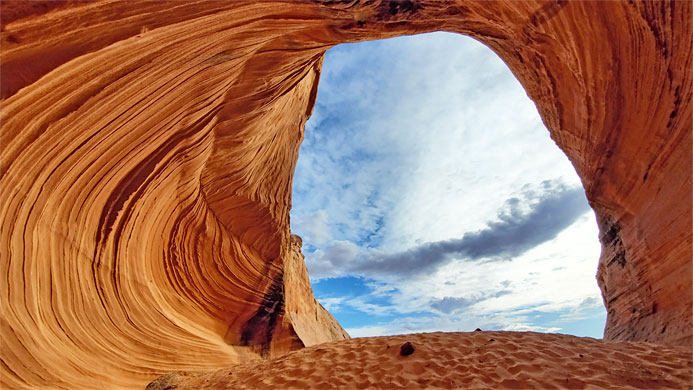
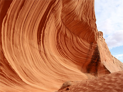
Alcove, or shallow cave, at the south edge of a low mesa of Page sandstone, lined by colorful, curving, thin-layered strata, with a sand dune at its base; a photogenic location, like a smaller version of the Great Chamber near Kanab
Length: 700 feet
Elevation change: 30 feet
Difficulty: Easy
Type: One-way
Usage: Medium
Season: All year
Trailhead: Behind the Shell gas station, off Coppermine Road
Rating (1-5): ★★★★★
Elevation change: 30 feet
Difficulty: Easy
Type: One-way
Usage: Medium
Season: All year
Trailhead: Behind the Shell gas station, off Coppermine Road
Rating (1-5): ★★★★★

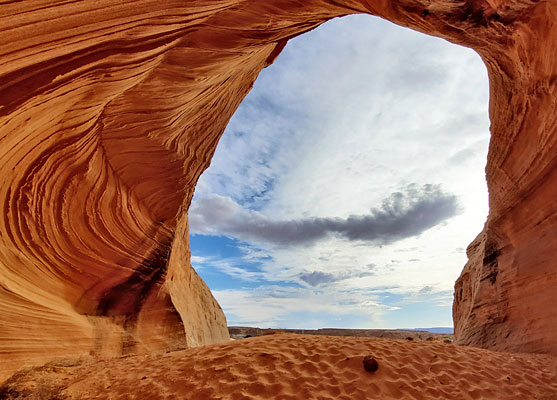
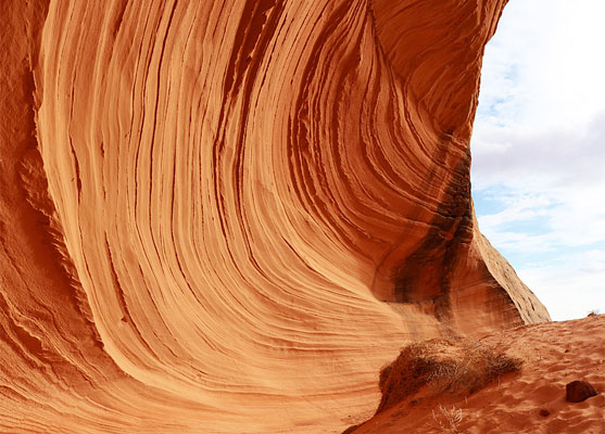
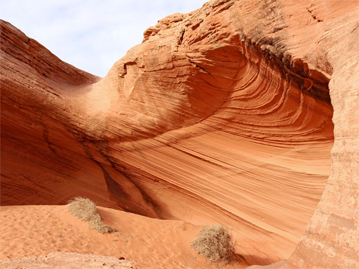
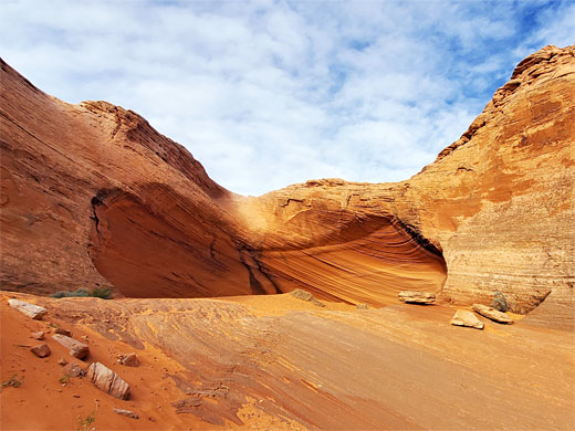
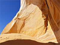
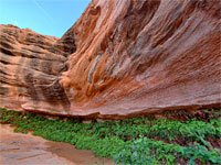
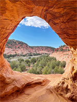
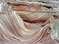
The Sand Cave, or Secret Alcove, or Big Lake Sand Cave, is a recently-popularized feature along the south edge of Page; a wind-eroded cavity below the rim of a small, unnamed mesa, framed by colorful walls of curvy, inclined, thin-layered strata, some extending slightly to form delicate, narrow fins. On the floor of the alcove is a sand dune and a few boulders, and the view from the rear is perfectly framed by the enclosing cliffs, looking out southwestwards towards the Colorado River.
Rocks around the cavity, and on all sides of the mesa, are orange-colored Page sandstone, while on top is a thin layer of the darker, brown Carmel Formation. All the surrounding land is covered by aeolian sand deposits, generally quite flat. The cave is very similar to the Great Chamber near Kanab, just smaller in scale, differently colored, and much easier to reach, just 800 feet from the nearest parking place.
The Sand Cave is visible from the approach, along Coppermine Road on the south side of town, behind a Shell gas station, just before the road crosses Hwy 98. Parking is on a gravel area beside the station, from where a very short walk, over a flat and up a little sandy hill, reaches the alcove, which has formed at the head of a V-shaped cleft in the mesa. The cliffs are only about 30 feet tall, vertical in some places, in others more sloping, allowing scrambling up to the mesa top, if desired. In the cave, the orange strata are crossed by vertical dark bands in two places; staining left by rainwater flowing down from above. The cave looks neither large nor very photogenic on the approach, but the formation is a lot more impressive once inside, looking back out. Unfortunately, one side of the alcove is already marred by graffiti.
Rocks around the cavity, and on all sides of the mesa, are orange-colored Page sandstone, while on top is a thin layer of the darker, brown Carmel Formation. All the surrounding land is covered by aeolian sand deposits, generally quite flat. The cave is very similar to the Great Chamber near Kanab, just smaller in scale, differently colored, and much easier to reach, just 800 feet from the nearest parking place.
The Cave
The Sand Cave is visible from the approach, along Coppermine Road on the south side of town, behind a Shell gas station, just before the road crosses Hwy 98. Parking is on a gravel area beside the station, from where a very short walk, over a flat and up a little sandy hill, reaches the alcove, which has formed at the head of a V-shaped cleft in the mesa. The cliffs are only about 30 feet tall, vertical in some places, in others more sloping, allowing scrambling up to the mesa top, if desired. In the cave, the orange strata are crossed by vertical dark bands in two places; staining left by rainwater flowing down from above. The cave looks neither large nor very photogenic on the approach, but the formation is a lot more impressive once inside, looking back out. Unfortunately, one side of the alcove is already marred by graffiti.
Page Sand Cave - Similar Hikes
All Contents © Copyright The American Southwest | Comments and Questions | Contribute | Affiliate Marketing Disclosure | Site Map