Manns Peak Trail
Varied trail to the fifth highest summit in the La Sal Mountains, encountering meadows, aspen groves, pine woodland, scree and tundra; wide-ranging views along the latter stages
Length: 3.7 miles, from Geyser Pass
Elevation change: 1,830 feet
Difficulty: Moderate
Type: One-way
Usage: Low
Season: Summer and fall
Trailhead: Geyser Pass, or Horse Creek meadow
Rating (1-5): ★★★★★
Elevation change: 1,830 feet
Difficulty: Moderate
Type: One-way
Usage: Low
Season: Summer and fall
Trailhead: Geyser Pass, or Horse Creek meadow
Rating (1-5): ★★★★★
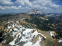
Manns Peak is the easiest reached of the main summits of the La Sal Mountains - the only one with a recognized path to the top, climbing a mostly treeless ridge starting at Burro Pass, which is 2.2 miles by trail from Geyser Pass, at the end of an unpaved road. This path passes mixed terrain of pine woods, aspen groves, meadows and streams, while the summit route is over grass, tundra and scree, so overall the 3.7 miles encounters a good range of scenery, and numerous wildflowers, with perhaps 50 different species en route. At 12,272 feet the peak is only the fifth highest in the range, 449 feet lower than the tallest (Mount Peale), but more than high enough for fantastic views in all directions, from the red rocks of Castle Valley in the north and Canyonlands in the west, across many lesser peaks and valleys to the south and east.
The hike is usually passable from early summer, once most of the snow has melted, while the wildflowers reach a peak in July and August. The majority of the 1,830 foot elevation gain is achieved over the last mile, climbing from Burro Pass; the earlier stages are fairly level, and part descends for a while, into a shallow valley.
The road to the trailhead at Geyser Pass is 8 miles long, climbing 2,800 feet, and once dry and snow free it is in general suitable for nearly all vehicles including small RVs, at least until a meadow on Horse Creek, after 5.5 miles; the last 2.5 miles are narrower, steeper and have some patches of loose stones, and earthen stretches that become slippery if wet, so at some times of the year the hike might have to begin at the meadow.
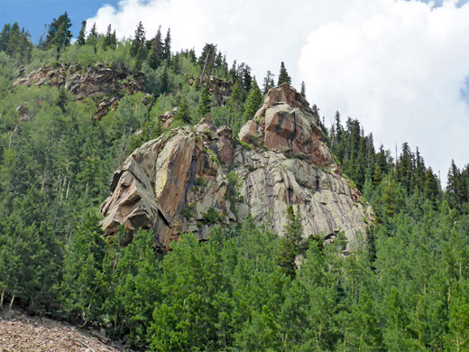
The unpaved road (FR071) to Geyser Pass branches eastwards off the La Sal Loop Road at 7,950 feet, zig-zagging up Brumley Ridge, and reaching Horse Creek meadow at 9,900 feet, where another track forks south to Gold Basin. The continuation route, narrower and more enclosed, climbs through thick pine and aspen forest all the remainder of the way apart from a brief open scree corridor, either side of a tight bend; it also passes a number of tiny streams and grassy patches, and is lined by numerous wildflowers in the summer. At the pass is a flat area with plenty of parking space, plus a map detailing the various tracks and trails in the vicinity. Lesser (4WD) vehicular routes branch off north, east and southeast, the middle of which leads to the West Fork Burro Pass trailhead, a place also encountered along the Manns Peak hiking path, which branches off eastwards a short distance along the northern track (signed as 240R). This trail also forms part of the long distance Whole Enchilada mountain bike route.
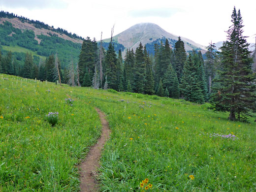
The trail is signed to Burro Pass, 2.25 miles; it leads through a patch of open pine woods on level ground, and out to a meadow containing long grass mixed with many tall thistle plants; a sheltered location, often frequented by cattle in summer. Two of the high peaks come into view for the first time - Haystack Mountain to the north, and Mount Tomasaki ahead to the northeast. The next section passes through four aspen groves, separated by smaller grassy areas, as the land starts to slope down to a valley, containing a small stream, an upper tributary of Geyser Creek. The path rises slightly on the far side and meets the 4WD track from Geyser Pass, a short distance before the West Fork trailhead, from where the path heads due north, and is signed Burro Pass 0.9 miles, Warner Lake 4.5 miles. The trail climbs fairly gently at first, in woods then largely treeless, crossing a meadow with tall grass and many more wildflowers. The route is straight as it climbs to the head of the valley, then switchbacks as it ascends to the pass, which is a saddle between the southern ridge of Manns Peak to the north, and a lesser, transverse ridge to the south.
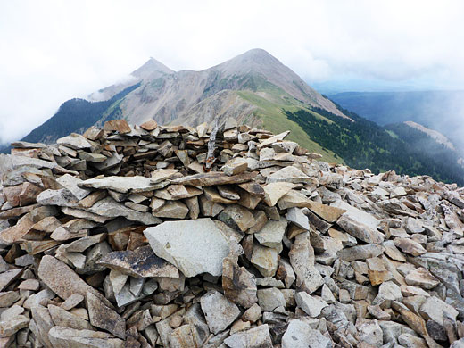
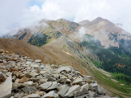
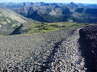
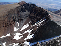
The path to the summit (distance given as one mile) is up an broad ridge, briefly into sparse woods, a temporarily less steep section, followed by more open terrain, now completely above the treeline. Flowers hereabouts include several species of white saxifrage, yellow aster and purple clover, plus white yarrow. The trail fades away for a while, crossing a short grass area and then resumes as a well constructed route up a patch of scree, where steps lead to a false summit, beyond which is more short tundra grass, mixed with several types of low growing, mat-forming wildflowers. The final section is up a ridge, steepening at the end, and onto the summit, which is formed of jagged, lichen-covered boulders, some roughly arranged into a circular shelter. All around are grey-green peaks and slopes plus a distant red ridge to the north, split by several valleys of which the closest, and largest, is formed by Deep Creek to the east. Cavities between the rocks on the summit are home to a small population of pikas. The hike can be extended by walking southeast along the ridge that leads to Mount Tomasaki, returning to the West Fork trailhead by descending the steep slopes to the southwest.

The hike is usually passable from early summer, once most of the snow has melted, while the wildflowers reach a peak in July and August. The majority of the 1,830 foot elevation gain is achieved over the last mile, climbing from Burro Pass; the earlier stages are fairly level, and part descends for a while, into a shallow valley.
The road to the trailhead at Geyser Pass is 8 miles long, climbing 2,800 feet, and once dry and snow free it is in general suitable for nearly all vehicles including small RVs, at least until a meadow on Horse Creek, after 5.5 miles; the last 2.5 miles are narrower, steeper and have some patches of loose stones, and earthen stretches that become slippery if wet, so at some times of the year the hike might have to begin at the meadow.
Manns Peak Access Road
The unpaved road (FR071) to Geyser Pass branches eastwards off the La Sal Loop Road at 7,950 feet, zig-zagging up Brumley Ridge, and reaching Horse Creek meadow at 9,900 feet, where another track forks south to Gold Basin. The continuation route, narrower and more enclosed, climbs through thick pine and aspen forest all the remainder of the way apart from a brief open scree corridor, either side of a tight bend; it also passes a number of tiny streams and grassy patches, and is lined by numerous wildflowers in the summer. At the pass is a flat area with plenty of parking space, plus a map detailing the various tracks and trails in the vicinity. Lesser (4WD) vehicular routes branch off north, east and southeast, the middle of which leads to the West Fork Burro Pass trailhead, a place also encountered along the Manns Peak hiking path, which branches off eastwards a short distance along the northern track (signed as 240R). This trail also forms part of the long distance Whole Enchilada mountain bike route.
Geyser Pass to Burro Pass
The trail is signed to Burro Pass, 2.25 miles; it leads through a patch of open pine woods on level ground, and out to a meadow containing long grass mixed with many tall thistle plants; a sheltered location, often frequented by cattle in summer. Two of the high peaks come into view for the first time - Haystack Mountain to the north, and Mount Tomasaki ahead to the northeast. The next section passes through four aspen groves, separated by smaller grassy areas, as the land starts to slope down to a valley, containing a small stream, an upper tributary of Geyser Creek. The path rises slightly on the far side and meets the 4WD track from Geyser Pass, a short distance before the West Fork trailhead, from where the path heads due north, and is signed Burro Pass 0.9 miles, Warner Lake 4.5 miles. The trail climbs fairly gently at first, in woods then largely treeless, crossing a meadow with tall grass and many more wildflowers. The route is straight as it climbs to the head of the valley, then switchbacks as it ascends to the pass, which is a saddle between the southern ridge of Manns Peak to the north, and a lesser, transverse ridge to the south.
Trail to the Summit
The path to the summit (distance given as one mile) is up an broad ridge, briefly into sparse woods, a temporarily less steep section, followed by more open terrain, now completely above the treeline. Flowers hereabouts include several species of white saxifrage, yellow aster and purple clover, plus white yarrow. The trail fades away for a while, crossing a short grass area and then resumes as a well constructed route up a patch of scree, where steps lead to a false summit, beyond which is more short tundra grass, mixed with several types of low growing, mat-forming wildflowers. The final section is up a ridge, steepening at the end, and onto the summit, which is formed of jagged, lichen-covered boulders, some roughly arranged into a circular shelter. All around are grey-green peaks and slopes plus a distant red ridge to the north, split by several valleys of which the closest, and largest, is formed by Deep Creek to the east. Cavities between the rocks on the summit are home to a small population of pikas. The hike can be extended by walking southeast along the ridge that leads to Mount Tomasaki, returning to the West Fork trailhead by descending the steep slopes to the southwest.
Map of the Manns Peak Trail

Manns Peak Wildflowers
More plants along the trail
 Tall fleabane |
 Ball-head sandwort |
 Alpine chickweed |
 Orange sneezeweed |
More plants along the trail
Manns Peak Trail - Similar Hikes
All Contents © Copyright The American Southwest | Comments and Questions | Contribute | Affiliate Marketing Disclosure | Site Map


