Highlights:
The best and most scenic of the many unpaved roads across the San Rafael Swell, passing the San Rafael River and the Buckhorn Draw Pictograph Panel, plus a side track to the Wedge Overlook, above a section of the river known as Little Grand Canyon
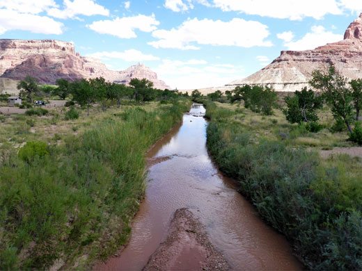
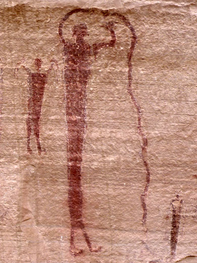
The road is so named since part runs along Buckhorn Wash, a north-side tributary of the San Rafael River, which it joins just downstream of a lengthy enclosed section known as Little Grand Canyon on account of its dramatic cliff, bench and canyon scenery. The most spectacular part can be viewed from above at Wedge Overlook, which is reached via a side track of equally good quality. Other points of interest along Buckhorn Draw Road are the crossing of the San Rafael River, site of a historic suspension bridge and a scenic campground, and the Buckhorn Draw Pictograph Panel, a 150-foot wide array of dozens of well preserved pictographs, plus some petroglyphs. There are several other rock art panels nearby.
Including a link route, the road is 45 miles long, from I-70 exit 131 in the south to Cleveland in the north. In the south, the road starts across open terrain of flats and benches, descending along a wide valley to the river crossing. On the far side, Buckhorn Wash flows through a deep, winding canyon, which eventually gives way to more flat plains between small, isolated mesas; barren, wide-ranging country that extends towards Castle Valley and Cleveland. Other routes link to the nearby towns of Castle Dale and Huntington, along Highway 10. Free primitive camping is allowed anywhere along Buckhorn Draw Road, and there are many lesser places that invite exploration including peaks, narrow canyons, abandoned dwellings and other historic sites.
Buckhorn Draw Road Table of Contents
- Map
- Photographs
- I-70 to the San Rafael River
- Pictographs and petroglyphs
- Wedge Overlook
- Buckhorn Flat to Cleveland
Map
Map of the San Rafael Swell.
Photographs
29 views along the road.
I-70 to the San Rafael River
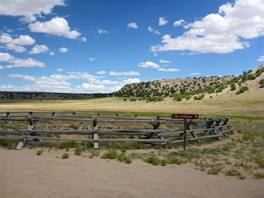
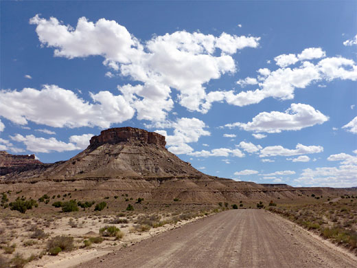
Exit 131 of Interstate 70 is the terminus of Temple Mountain Road to the south as well as Buckhorn Draw Road to the north. This latter road is paved for the first 3.6 miles, running eastwards close to the interstate, becoming gravel as it curves to the north (past a junction with a track to Eardley Canyon), then crossing a wide plain between low, stony hills, and descending into a shallow, grassy valley. The first feature of interest, right beside the road, is The Sinkhole, a fenced-off, vertical-walled depression. Beyond here the land becomes more undulating as various side tracks fork off in both directions. The first significant wash crossing (Cottonwood Draw) is at ten miles, soon followed by a second, as the surface becomes somewhat bumpier and the downhill gradient increases. After a few more miles of open ground (Limestone Bench), mesas rise on both sides, framing a wide valley, while ahead higher cliffs come into view, on the far side of the San Rafael River. The road follows a meandering drainage, Road Draw, over more stony ground, which becomes smoother as the river approaches; just before is a region of small mud hills and little washes, lined with concrete where the road crosses. There are two isolated, prominent summits either side of the road; Bottleneck Peak to the west, Assembly Hall Peak to the east.
Pictographs and Petroglyphs
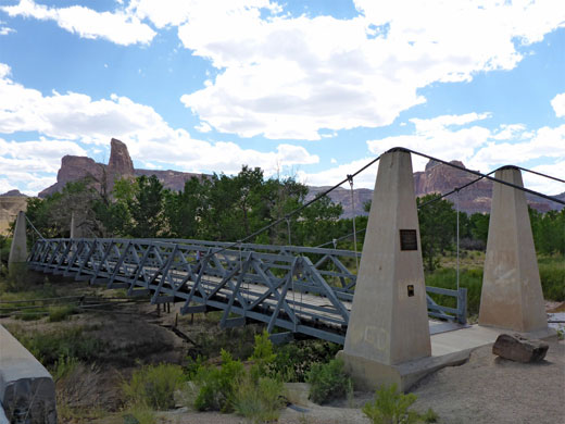
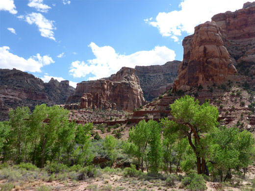
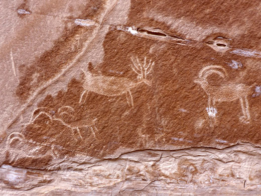
The road crosses the San Rafael River on a concrete bridge of relatively recent construction, parallel to the original single span, double intersection suspension bridge, one of only two bridges of this type in Utah. The camping area is at the far side, on sparsely wooded land close to the river. The road continues north, entering Buckhorn Wash canyon, which is deep and colorful, containing a flowing stream and big cottonwood trees. The main rock art site (Buckhorn Draw Pictograph Panel) is reached after 23 miles - a streaked, vertical cliff of Navajo sandstone, on the south side of a prominent sandstone fin. The place has a parking area, a visitor register and a series of interpretive notices. The pictographs are numerous and intricate, most of red pigment but some of yellow brown, and they are examples of the Barrier Canyon Style, at least 2,000 years old. Mixed with the pictographs are a few petroglyphs, added more recently, by the Fremont peoples. Other rock art panels are found at intervals to the north, the next largest after 26.7 miles, reached by a short, signposted path up a sandbank, on the east side of the canyon. The cliff here is adorned with a variety of petroglyphs and also a few older, black pictographs - designs include hunting scenes, bighorn sheep and human-like figures.
Wedge Overlook
The canyon becomes quickly shallower and ends after about 30 miles; the road rises to a wide plain, with distant, reddish cliffs to the north. The Buckhorn Draw route continues left at a T-junction then right 2.5 miles later, but before, after half a mile, is another junction with a cut-off road to the southwest, linking with the road to the Wedge Overlook. The cut-off (1.5 miles), is a little bumpy but the onwards route is again very smooth all the way, another 4.7 miles. Towards the end, this road passes a group campsite, set amidst juniper and pine woodland, then leads to a viewpoint on the rim of the San Rafael River canyon, the floor of which is 1,100 feet below, and continues along the rim eastwards half a mile to an even better viewpoint, on a promontory between the canyon and a major tributary to the north, Good Water Canyon. Regular camping places are arranged along this part of the road - all are very scenically located, well separated, equipped with barbecue grills, and free to use, though usually all empty, as very few people visit this remote location. The Wedge itself is the wide promontory, tapering towards the southeast, between the San Rafael River and Buckhorn Wash, and so forming the northern line of cliffs at the overlooks. The canyon rims hereabouts are one of the few locations of the rare and protected erigeron maguirei, a white-flowered fleabane.
Buckhorn Flat to Cleveland
Back on Buckhorn Draw Road, the northwards section is wide and smooth, and in places it is possible to travel at 70 mph or more. There are several more junctions, not all signposted. The road crosses Buckhorn Flat, then passes between a line of a small, bouldery hills, continuing alongside the seasonal Buckhorn Reservoir and over the similar, even emptier Jackass Flat before reaching the small settlement of Cleveland.
All Contents © Copyright The American Southwest | Comments and Questions | Contribute | Affiliate Marketing Disclosure | Site Map


