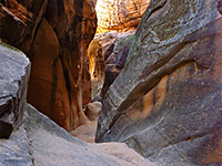
Wittwer Canyon
West-side tributary of the Santa Clara River, sheer-walled in places though generally rather shallow, containing a small stream that originates from springs in two upper forks, both of which form short, enclosed, slot-like channels just above the confluence
Length: 3 miles to the confluence then 0.4 miles along each fork through the narrows; 7.6 miles round trip
Elevation change: 300 feet
Difficulty: Easy to moderate - no major obstacles, just some minor wading
Type: Unmarked, off-trail route
Usage: Very low
Season: All year
Trailhead: Anasazi Valley, off Old Hwy 91
Rating (1-5): ★★★★★
Elevation change: 300 feet
Difficulty: Easy to moderate - no major obstacles, just some minor wading
Type: Unmarked, off-trail route
Usage: Very low
Season: All year
Trailhead: Anasazi Valley, off Old Hwy 91
Rating (1-5): ★★★★★
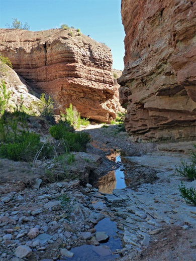
Wittwer Canyon is a west-side tributary of the Santa Clara River in southwest Utah, originating on the slopes of the Beaver Dam Mountains, from where the usually dry streambed winds across arid badlands and is very shallow at first but deepens after a few miles to form a rocky gorge, framed by sandstone cliffs up to 200 feet high.
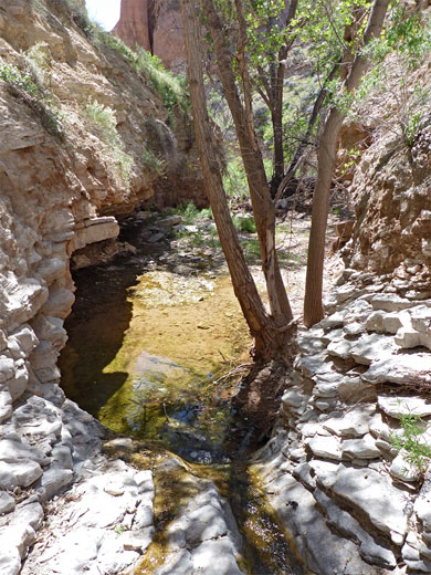
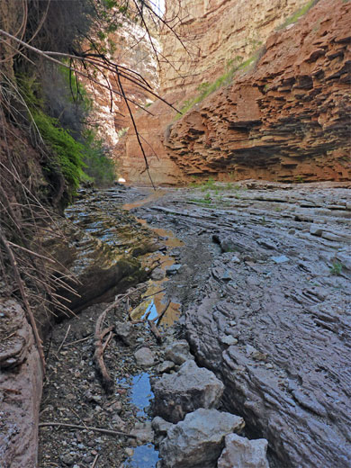
Springs near the upper end of the gorge, both in the main fork and a similarly-sized south fork, sustain over a mile of permanent stream, and for about a quarter of a mile above the confluence, in both branches, the waters flow through narrow passageways with pools and little waterfalls, in places lined with lush vegetation and seeps, in others by bare rock; unusual, sheltered, riparian corridors in the otherwise barren land of this part of the state, along the upper edge of the Mojave Desert.
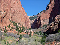
Most of the drainage is within the Paiute Indian Reservation, including the narrows, though the easiest approach is from the east, in the Santa Clara River Reserve, starting from the Anasazi Valley trailhead off Old Hwy 91. The lower end of Wittwer Canyon is reached by walking south along the sometimes overgrown river valley, initially on a trail then cross-country, while the ravine itself is largely free of blocking vegetation, apart from around the springs, so the hike is for the most part quite easy.
ATV tracks both above and below the narrows show that this place is not unknown, though it receives very few visitors, due perhaps to the lack of trails and the relatively long distance from a paved road. The round trip through the narrow part of both forks is just less than 8 miles, taking four hours or more. All rocks in the gorge are from the Moenkopi formation; the upper red member towards the lower end and the shnabkaib member across the remainder.
Map of Santa Clara River Reserve.
31 views of Wittwer Canyon.
The Anasazi Valley trailhead has a good sized parking area, 0.3 miles along a gravel track on the southwest side of Old Hwy 91 near Ivins. The track continues across the Santa Clara River to a works facility on a small patch of private land, beyond which a less-used route goes south all the way to Wittwer Canyon, however it seems best to bypass the works, walking instead along a path that forks south just before the roadbridge. The trail rounds the north edge of a line of lava cliffs, crosses a grassy area then merges with the river floodplain, which can be followed all the way to the Wittwer confluence (one mile), though the course is rather winding and the valley floor is overgrown in some places. An alternative route, after a quarter of a mile, is provided by a minor drainage that joins from the west; this very soon intersects the track, which, to the south, crosses a few other streambeds and a plateau before descending into the lower end of the target canyon.
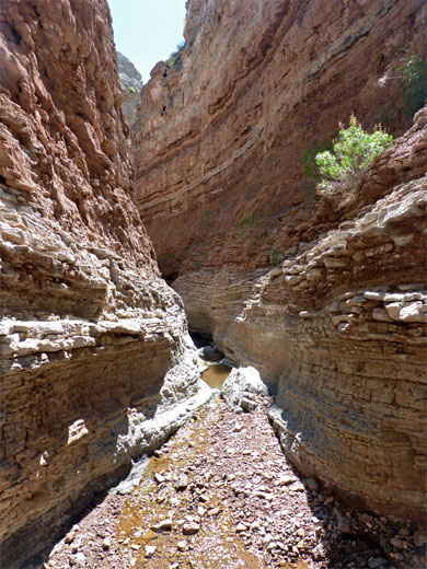
The lower end of Wittwer Canyon is wide, dry and shallow, lined by sandy slopes, but cliffs soon form, on the south side, just after a tight bend. A tributary joins from the north then another from the south, this briefly narrow around the confluence. Near here a stream starts to flow through the main canyon, which gradually narrows and has less vegetation. A group of boulders just after a temporarily wider section seems to stop most of the ATV traffic, though some tracks continue. The Moenkopi rock of the cliffs is light brown or grey, the strata thin-layered, crumbling and sometimes buckled, never particularly colorful. Three miles from the trailhead, after another group of boulders, the canyon divides into the main (north) and south forks, both of which are guarded by a large cottonwood tree just upstream. The main branch carries about twice as much water as the south fork.
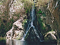
The south fork is dry above the confluence though the stream quickly resumes and is soon flowing over bare rock, forming pretty little pools and cascades, after which is an elongated, dripping spring, the canyon wall covered by ferns and crystalline gypsum. For 300 feet the canyon narrows to a good enclosed slot, before gradually widening, as the vegetation returns. The stream flows round a couple more bends before fading away, then the ravine becomes significantly wider and shallower, and the environment noticeably hotter.
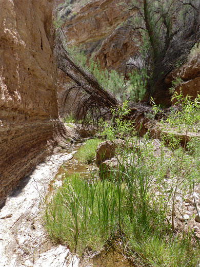
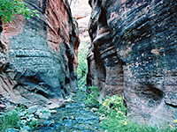
The main fork has a couple of deep pools at the start, not difficult to pass, followed by an open stretch and a longer narrow section, initially with shallow pools covering most of the floor, and then a passageway with elongated springs, on both sides. The drainage is now generally more entrenched and prettier, the creek flowing across a flat, rocky floor below fern-lined springs on the walls and thicker vegetation above. The streambed becomes steadily more overgrown and the waters dry up, then walking is harder due to more bushes and trees, their branches coming right down to the floor. The undergrowth does not extend too far, however, and beyond, like the south fork, the drainage is dry, shallow and exposed.
Springs near the upper end of the gorge, both in the main fork and a similarly-sized south fork, sustain over a mile of permanent stream, and for about a quarter of a mile above the confluence, in both branches, the waters flow through narrow passageways with pools and little waterfalls, in places lined with lush vegetation and seeps, in others by bare rock; unusual, sheltered, riparian corridors in the otherwise barren land of this part of the state, along the upper edge of the Mojave Desert.
Most of the drainage is within the Paiute Indian Reservation, including the narrows, though the easiest approach is from the east, in the Santa Clara River Reserve, starting from the Anasazi Valley trailhead off Old Hwy 91. The lower end of Wittwer Canyon is reached by walking south along the sometimes overgrown river valley, initially on a trail then cross-country, while the ravine itself is largely free of blocking vegetation, apart from around the springs, so the hike is for the most part quite easy.
ATV tracks both above and below the narrows show that this place is not unknown, though it receives very few visitors, due perhaps to the lack of trails and the relatively long distance from a paved road. The round trip through the narrow part of both forks is just less than 8 miles, taking four hours or more. All rocks in the gorge are from the Moenkopi formation; the upper red member towards the lower end and the shnabkaib member across the remainder.
Location
Map of Santa Clara River Reserve.
Photographs
31 views of Wittwer Canyon.
Approach
The Anasazi Valley trailhead has a good sized parking area, 0.3 miles along a gravel track on the southwest side of Old Hwy 91 near Ivins. The track continues across the Santa Clara River to a works facility on a small patch of private land, beyond which a less-used route goes south all the way to Wittwer Canyon, however it seems best to bypass the works, walking instead along a path that forks south just before the roadbridge. The trail rounds the north edge of a line of lava cliffs, crosses a grassy area then merges with the river floodplain, which can be followed all the way to the Wittwer confluence (one mile), though the course is rather winding and the valley floor is overgrown in some places. An alternative route, after a quarter of a mile, is provided by a minor drainage that joins from the west; this very soon intersects the track, which, to the south, crosses a few other streambeds and a plateau before descending into the lower end of the target canyon.
The Lower Canyon
The lower end of Wittwer Canyon is wide, dry and shallow, lined by sandy slopes, but cliffs soon form, on the south side, just after a tight bend. A tributary joins from the north then another from the south, this briefly narrow around the confluence. Near here a stream starts to flow through the main canyon, which gradually narrows and has less vegetation. A group of boulders just after a temporarily wider section seems to stop most of the ATV traffic, though some tracks continue. The Moenkopi rock of the cliffs is light brown or grey, the strata thin-layered, crumbling and sometimes buckled, never particularly colorful. Three miles from the trailhead, after another group of boulders, the canyon divides into the main (north) and south forks, both of which are guarded by a large cottonwood tree just upstream. The main branch carries about twice as much water as the south fork.
South Fork
The south fork is dry above the confluence though the stream quickly resumes and is soon flowing over bare rock, forming pretty little pools and cascades, after which is an elongated, dripping spring, the canyon wall covered by ferns and crystalline gypsum. For 300 feet the canyon narrows to a good enclosed slot, before gradually widening, as the vegetation returns. The stream flows round a couple more bends before fading away, then the ravine becomes significantly wider and shallower, and the environment noticeably hotter.
North Fork
The main fork has a couple of deep pools at the start, not difficult to pass, followed by an open stretch and a longer narrow section, initially with shallow pools covering most of the floor, and then a passageway with elongated springs, on both sides. The drainage is now generally more entrenched and prettier, the creek flowing across a flat, rocky floor below fern-lined springs on the walls and thicker vegetation above. The streambed becomes steadily more overgrown and the waters dry up, then walking is harder due to more bushes and trees, their branches coming right down to the floor. The undergrowth does not extend too far, however, and beyond, like the south fork, the drainage is dry, shallow and exposed.
Wittwer Canyon Wildflowers
More flowers in the canyon
 Annual redspot monkeyflower |
 Beautiful phacelia |
 Redclay suncup |
More flowers in the canyon
Wittwer Canyon - Similar Hikes
All Contents © Copyright The American Southwest | Comments and Questions | Contribute | Affiliate Marketing Disclosure | Site Map


