First Forest Point Trail, Petrified Forest National Park
Arizona > Petrified Forest National Park > Hiking > First Forest Point Trail
First Forest Point Trail
Primitive route past buttes, badlands, grassy plains and petrified wood, to a viewpoint at the edge of a mesa
Length: 2.1 miles
Elevation change: 170 feet
Difficulty: Moderate - route-finding necessary
Type: One way, mostly unmarked route
Usage: Low
Season: Spring, summer, fall - winters are cold and snowy
Trailhead: Parking lot at Jasper Forest Overlook
Rating (1-5): ★★★★★
Elevation change: 170 feet
Difficulty: Moderate - route-finding necessary
Type: One way, mostly unmarked route
Usage: Low
Season: Spring, summer, fall - winters are cold and snowy
Trailhead: Parking lot at Jasper Forest Overlook
Rating (1-5): ★★★★★
First Forest was a term in use for a while in the late 19th and early 20th centuries, referring to an area of petrified wood and eroded mounds near what is now Jasper Forest. The place was so-named as it was the first section of what became Petrified Forest National Park that was usually visited, by tourists who arrived by rail at the depot at Adamana, 6 miles north, and traveled south along a wagon track. Adamana was abandoned in the 1960s and the track is no longer used, and while there is no maintained path to the First Forest region, it can be explored along one of the park's 'Off the Beaten Path' routes - the 2.1 mile First Forest Point Trail.
Starting from the parking lot at Jasper Forest Overlook, the route descends a slope, winds through badlands strewn with much petrified wood, crosses a dry wash and the old wagon trail, then passes below a group of buttes and climbs to a grassy mesa, ending with a short loop around a promontory at its northern tip.
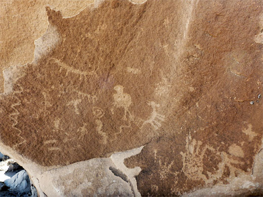
The First Forest Point Trail is rarely traveled, and not much evident once beyond the initial petrified wood area. Besides the fossils and the pastel-colored mounds, the route also passes a few petroglyph panels and a selection of springtime wildflowers, golden mariposa lily perhaps the most eye-catching.
17 views of the First Forest Point Trail.
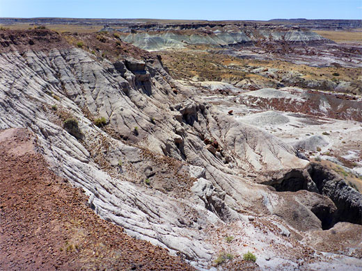
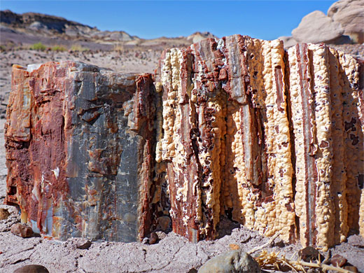
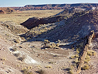
The view from the rim of the plateau at the start of the trail, and petrified logs below the mesa at the end.
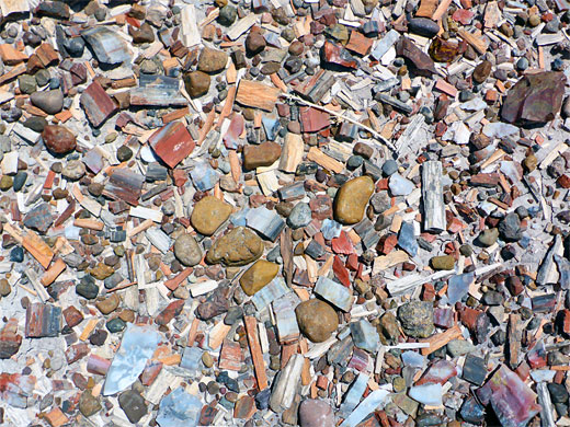
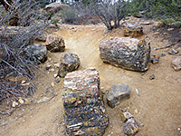
Jasper Forest Overlook is reached by a side road, west of the main highway, and ending in a loop, with the viewpoint at its north side and the start of the trail to the south; the path runs along the edge of the mesa a short distance before descending gently, following a little ravine through banded purplish badlands and then down a little wash below the south side of a mesa. Around here are many petrified logs, large and small, mostly colored dark red, extending for about half a mile, until replaced by a flat, grassy plain.
The route is along a shallow wash, which crosses a track just beyond the petrified wood area - the track was mostly constructed in the 1930s alongside a pipe that supplied water to the entrance station on the south side of the park, and has approximately the same course as the old wagon route from Adamana. After here the walking route is no longer marked, but it crosses a bigger drainage, 'Dry Wash', then proceeds over a big grassy flat, dotted with the mariposa lilies in the spring.
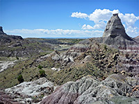
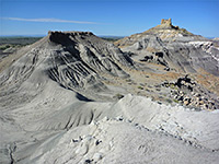
Ahead, to the west, is a line of low buttes and mesas; the route passes just south of a group of peaks, follows one dry wash and crosses another, later veering slightly northwest, into a basin at the edge of a larger mesa. A short climb reaches the plateau on top, then the route continues a short distance to its northern edge, which gives excellent views over many square miles of the park. An alternative way back is to descend the slope below, somewhat steeper than the official route to the south, walk along the base of a ridge - some more nice petrified wood here - then head into open terrain, passing by the north side of the group of peaks and heading southeast, towards the main area of petrified wood below Jasper Forest Overlook.

Starting from the parking lot at Jasper Forest Overlook, the route descends a slope, winds through badlands strewn with much petrified wood, crosses a dry wash and the old wagon trail, then passes below a group of buttes and climbs to a grassy mesa, ending with a short loop around a promontory at its northern tip.
The First Forest Point Trail is rarely traveled, and not much evident once beyond the initial petrified wood area. Besides the fossils and the pastel-colored mounds, the route also passes a few petroglyph panels and a selection of springtime wildflowers, golden mariposa lily perhaps the most eye-catching.
Photographs
17 views of the First Forest Point Trail.
First Forest Point Video
The view from the rim of the plateau at the start of the trail, and petrified logs below the mesa at the end.
Jasper Forest
Jasper Forest Overlook is reached by a side road, west of the main highway, and ending in a loop, with the viewpoint at its north side and the start of the trail to the south; the path runs along the edge of the mesa a short distance before descending gently, following a little ravine through banded purplish badlands and then down a little wash below the south side of a mesa. Around here are many petrified logs, large and small, mostly colored dark red, extending for about half a mile, until replaced by a flat, grassy plain.
Route
The route is along a shallow wash, which crosses a track just beyond the petrified wood area - the track was mostly constructed in the 1930s alongside a pipe that supplied water to the entrance station on the south side of the park, and has approximately the same course as the old wagon route from Adamana. After here the walking route is no longer marked, but it crosses a bigger drainage, 'Dry Wash', then proceeds over a big grassy flat, dotted with the mariposa lilies in the spring.
Buttes and Mesas
Ahead, to the west, is a line of low buttes and mesas; the route passes just south of a group of peaks, follows one dry wash and crosses another, later veering slightly northwest, into a basin at the edge of a larger mesa. A short climb reaches the plateau on top, then the route continues a short distance to its northern edge, which gives excellent views over many square miles of the park. An alternative way back is to descend the slope below, somewhat steeper than the official route to the south, walk along the base of a ridge - some more nice petrified wood here - then head into open terrain, passing by the north side of the group of peaks and heading southeast, towards the main area of petrified wood below Jasper Forest Overlook.
Topographic Map of the Route

First Forest Point Trail - Similar Hikes
All Contents © Copyright The American Southwest | Comments and Questions | Contribute | Affiliate Marketing Disclosure | Site Map


