There are four true deserts in the US (see map below); Great Basin, Mojave, Sonoran and Chihuahuan, all conforming to the basic definition of a desert as being a place of very low rainfall and restricted plant life. Of these, the former is a predominantly cold desert, receiving much snow in winter, and many parts are not much different in appearance to some of the adjoining lands. The other three are hot for most of the year and more closely resemble a desert of popular imagination, containing large areas with very little plant life, just sand and barren rocks, or sparse grassland, often mixed with many types of cactus.
Outside these four large areas are other regions sometimes considered to be a desert but receiving too much rainfall to match the strict definition, and these include the Colorado Plateau of north Arizona and south Utah. Additionally there are several places named as a desert that again do not strictly qualify, such as the Red Desert of southwest Wyoming, the Painted Desert of Arizona or the Escalante and San Rafael deserts of south Utah, while other named deserts fall within the larger regions, for example Black Rock Desert in the Great Basin, or Lechuguilla Desert in the Sonoran.
Table of Contents
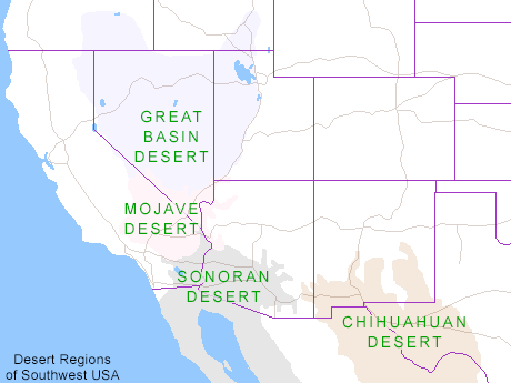
Map of the Desert Regions of Southwest USA
Outside these four large areas are other regions sometimes considered to be a desert but receiving too much rainfall to match the strict definition, and these include the Colorado Plateau of north Arizona and south Utah. Additionally there are several places named as a desert that again do not strictly qualify, such as the Red Desert of southwest Wyoming, the Painted Desert of Arizona or the Escalante and San Rafael deserts of south Utah, while other named deserts fall within the larger regions, for example Black Rock Desert in the Great Basin, or Lechuguilla Desert in the Sonoran.
Table of Contents

Map of the Desert Regions of Southwest USA
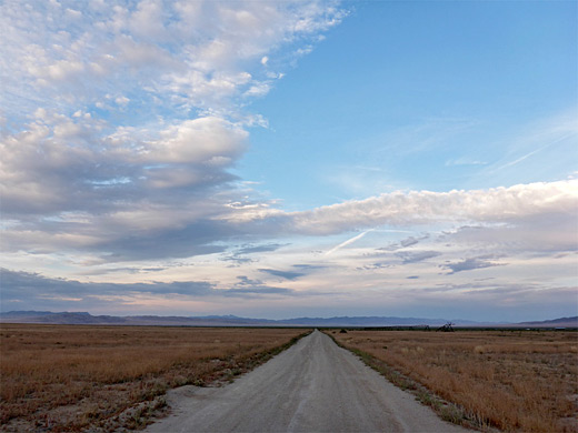
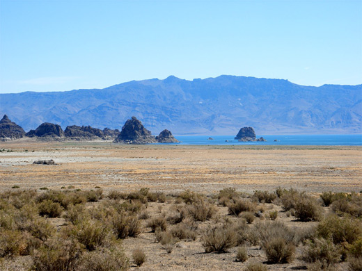
The Great Basin Desert is largest in area, covering southeast Oregon, a small portion of northeast California, most of west Utah, part of southeast Idaho, and the majority of Nevada - all except the southernmost 150 miles which are within the Mojave Desert, and some northern mountain ranges bordering Idaho. All this land is characterized by long, thin, parallel mountain ridges running north-south, separated by wider valleys, often containing dry lake beds (playas) or salt basins. The few rivers run inwards, with no outlet to the ocean; their waters ultimately either sink below ground or evaporate.
Great Basin National Park and Golden Spike National Historic Park are the only NPS units in this vast region, all of which is lightly settled and has few spectacular natural attractions but does contain many smaller sites of interest like hot springs, volcanic remains, ghost towns, old mines and peaks up to 13,000 feet, plus many scenic drives. These pass scenery that while often not very desert-like in the traditional sense, is suitably empty and desolate.
Other Great Basin Desert sites include:
- Antelope Island State Park, Utah - stark, treeless, mountainous island in the Great Salt Lake
- Arc Dome Wilderness - the southern portion of the Toiyabe Range
- Basin and Range National Monument, Nevada - BLM-administered preserve containing two vast basins and several mountain ranges
- Black Rock Desert, Nevada - very remote region centered on a vast dry lake bed
- Cathedral Gorge State Park, Nevada - curious eroded sandstone formations
- Lunar Crater National Natural Landmark, Nevada - cinder cones, lava flows, elongated fissures, ash hills, and a 430 foot deep crater
- Pyramid Lake, Nevada - saline lake with scattered tufa formations, enclosed by sagebrush flats and gaunt mountains
- Salt Lake Desert, Utah - vast white salt plains, bordering the Great Salt Lake
- Southeast Oregon - uninhabited land of sagebrush valleys, mountain ridges, hot springs, dry lakes, volcanic relics and wetlands
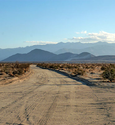
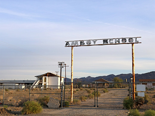
The Mojave Desert covers the southernmost 150 miles of Nevada, a tiny area of southwest Utah, lower elevation regions of northwest Arizona (bordering the Colorado River) and most of southeast California. The topography is generally similar to the Great Basin, with isolated mountains and wide, flat plains, but temperatures are hotter, vegetation sparser, and the hills are less numerous. Las Vegas is the one major city in this region, which includes some of California's most famous parks, namely Death Valley, Mojave, Anza Borrego and the northern half of Joshua Tree, together with some lesser known places like Mojave Trails National Monument, Pinnacles National Natural Landmark, Rainbow Basin, Red Rock Canyon, a long stretch of former Route 66, Saddleback Butte and much of Sand to Snow National Monument.
Nevada attractions within the Mojave Desert are Gold Butte National Monument, Lake Mead, Red Rock Canyon NCA, Tule Springs Fossil Beds National Monument, Valley of Fire State Park, Whitney Pockets and Ash Meadows NWR, while Utah has the Sand Hollow & Snow Canyon state parks, and Arizona includes the Beaver Dam Mountains Wilderness, Lake Havasu and a scenic section of old Route 66. The most recognizable plant of the Mojave is the Joshua tree; cacti are not so numerous but still include multiple species of opuntia, cylindropuntia (cholla), echinocereus and others.
Nevada attractions within the Mojave Desert are Gold Butte National Monument, Lake Mead, Red Rock Canyon NCA, Tule Springs Fossil Beds National Monument, Valley of Fire State Park, Whitney Pockets and Ash Meadows NWR, while Utah has the Sand Hollow & Snow Canyon state parks, and Arizona includes the Beaver Dam Mountains Wilderness, Lake Havasu and a scenic section of old Route 66. The most recognizable plant of the Mojave is the Joshua tree; cacti are not so numerous but still include multiple species of opuntia, cylindropuntia (cholla), echinocereus and others.
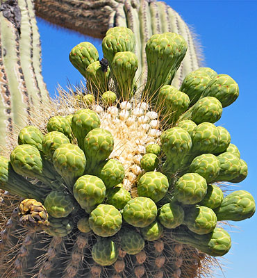
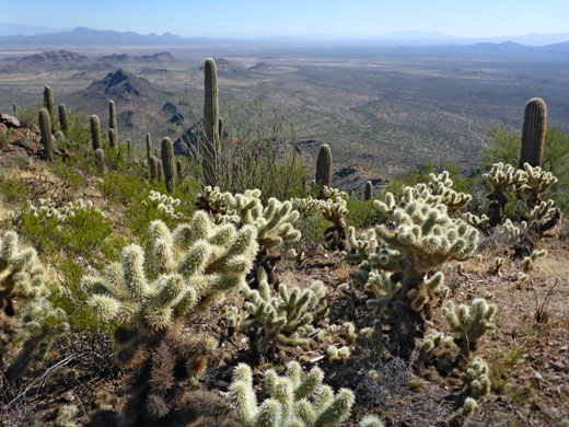
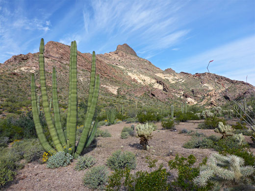
The Sonoran Desert of southwest Arizona and the south-eastern tip of California has perhaps the most archetypal desert scenery in the Southwest, with vast flat plains and abundant cacti, especially the giant saguaro, which occurs most densely in Arizona towards the higher elevation reaches of the desert, between 1,500 and 3,500 feet. The desert is itself divided into subregions including the Colorado and Yuha deserts of California, the Yuma Desert of far southwest Arizona and the Arizona desert further east. It continues a long way south into Mexico, nearly 500 miles down the east side of the Gulf of California. Much of the Sonoran Desert is protected, either as BLM or NPS preserves, although other large stretches are part of military reservations. Major cities are Phoenix, Tucson, Yuma, Palm Springs (at the western edge) and El Centro. The main parks and preserves are as follows:
- Algodones Dunes, California - extensive sand dunes, completely lacking any vegetation
- Bartlett Reservoir, Arizona - artificial lake in the low hills north of Phoenix, home to abundant wildlife and cacti
- Cabeza Prieta National Wildlife Refuge, Arizona - the most remote and hostile area of desert in the USA
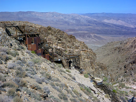
- Ironwood Forest National Monument, Arizona - pristine Sonoran Desert landscapes, including mountains, cactus plains, ghost towns and a working silver mine
- Jacumba Outstanding Natural Area and the Yuha Desert, California - little known wilderness areas bordering Mexico
- Jewel of the Creek Preserve - cottonwoods and willow alongside Cave Creek
- Kofa National Wildlife Refuge, Arizona - isolated mountain ranges and wide cactus plains
- Lost Dutchman State Park, Arizona - popular park containing a section of the Superstition Mountain foothills bordering Apache Junction
- Organ Pipe Cactus National Monument, Arizona - remote desert bordering Mexican, with particularly abundant cacti, including the rare organ pipe and senita
- Picacho Peak State Park, Arizona - ancient volcanic peak surrounded by flat cactus desert
- Salton Sea, California - large lake formed by flooding from the Colorado River in 1905, surrounded by a barren strip of salt-encrusted land
- San Tan Mountain Regional Park - rocky hills and desert flats southeast of Phoenix
- Sabino Canyon, Arizona - easily accessible canyon through the foothills of the Santa Catalina Mountains, Tucson
- Sonoran Desert National Monument, Arizona - desert expanse southwest of Phoenix, almost completely undeveloped but crossed by a few unpaved tracks
- South Mountain Park, Arizona - rocky mountain ridge, within Phoenix city limits, yet still relatively unspoilt and covered by many cacti
- Superstition Mountains, Arizona - fabled desert hills east of Phoenix, covered by saguaro and other cacti, and split by many canyons
- Tonto National Forest, Arizona - largest and most varied of Arizona's six national forests, including extensive Sonoran Desert plains
- Tortolita Mountains - isolated but scenic range 15 miles north of Tucson
- Tucson Mountain Park - large city park bordering Saguaro National Park to the south
- Saguaro National Park, Arizona - two scenic regions either side of Tucson containing particularly dense and flourishing forests of the saguaro cactus
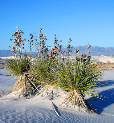
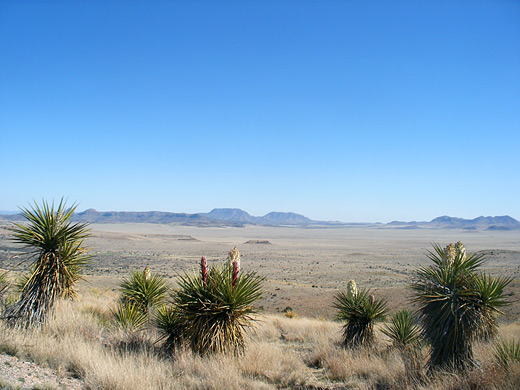
The Chihuahuan Desert is the second largest in the US, and also extends a long way into Mexico. It covers the southern third of New Mexico, excluding several mountain ranges, and all of far west Texas, west of a line between Del Rio and Monahans. Elevations are generally higher than in the Sonoran Desert (2,000 to 6,000 feet), and precipitation is a little greater, with most rain falling during the summer thunderstorm season. Cacti are still quite numerous but are generally smaller than to the west; instead, the dominant plants are yucca and agave, though even so, as with many other desert regions, large areas have only the ubiquitous creosote bushes and mesquite trees. El Paso is the largest city, while other major settlements are Las Cruces, Roswell and Pecos.
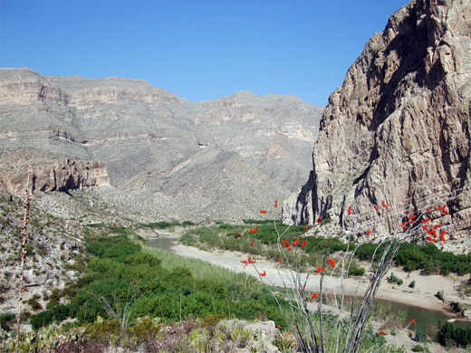
The very remote Big Bend National Park is the best place to view the plants and animals of the Chihuahuan Desert, accompanied by spectacular mountain and river scenery. Cacti are specially abundant and include two dozen rare species found nowhere else in the US. Other preserves of the Chihuahuan Desert include:
The very remote Big Bend National Park is the best place to view the plants and animals of the Chihuahuan Desert, accompanied by spectacular mountain and river scenery. Cacti are specially abundant and include two dozen rare species found nowhere else in the US. Other preserves of the Chihuahuan Desert include:
- Aguirre Spring Recreation Area, New Mexico - wooded slopes of the Organ Mountains, rising to granite peaks
- Big Bend Ranch State Park, Texas - spectacular, remote mountains and desert adjoining the Rio Grande
- Black Gap Wildlife Management Area, Texas - pristine, little-visited desert land bordering the Rio Grande
- Carlsbad Caverns National Park, New Mexico - world-famous caves, surrounded by limestone mountains
- City of Rocks State Park, New Mexico - large, rounded volcanic boulders in the middle of flat prairie
- Davis Mountains State Park, Texas - small range of hills with varied plant life, rising above the surrounding flat desert plains
- Franklin Mountains State Park, Texas - unspoilt mountain range within El Paso city limits
- Guadalupe Mountains National Park, Texas - remote, isolated mountains with diverse climate zones
- Hueco Tanks State Park and Historic Site, Texas - weathered granite outcrop east of El Paso
- Oliver Lee Memorial State Park, New Mexico - scenic desert land at the edge of the Sacramento Mountains
- Rock Hound State Park, New Mexico - isolated mountain range, a source of semi-precious stones
- White Sands National Park, New Mexico - spectacular dunes of pure white gypsum
All Contents © Copyright The American Southwest | Comments and Questions | Contribute | Affiliate Marketing Disclosure | Site Map
