Belly of the Dragon, Kanab
Unusual, very short hike along an artificially-constructed, 400 foot-long tunnel through orange-gray limestone; just long and curved enough to be dark in the middle. The tunnel takes a seasonal stream, a tributary of the Virgin River, underneath US 89
Length: 600 feet
Elevation change: 10 feet
Difficulty: Easy
Type: One way
Usage: High
Season: All year, except after heavy rains
Trailhead: 0.3 miles along a track (Elephant Gap), south of Mt Carmel Junction
Rating (1-5): ★★★★★
Elevation change: 10 feet
Difficulty: Easy
Type: One way
Usage: High
Season: All year, except after heavy rains
Trailhead: 0.3 miles along a track (Elephant Gap), south of Mt Carmel Junction
Rating (1-5): ★★★★★

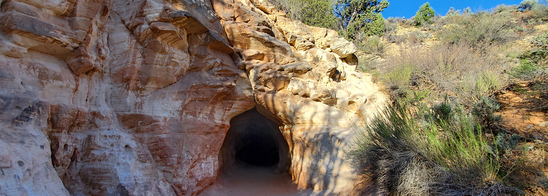
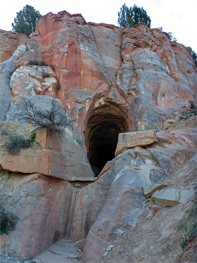
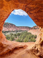
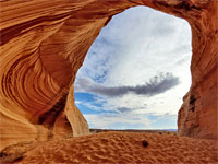
Like the Sand Caves, Belly of the Dragon is a recently popularized, artificially-created feature near Kanab; a constructed drainage channel, 400 feet long, through orange-gray limestone, taking a minor tributary of the East Fork of the Sevier River underneath US 89; before the road was constructed the water flowed through a shallow valley but this was blocked by the highway embankment and for some reason the stream was routed through a tunnel rather than down a culvert as would normally be the case.
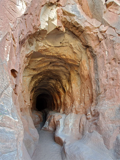
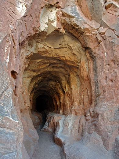
The tunnel is quite photogenic, being colorful, and the walls nicely undulating, but, also like the Sand Caves, its walls been almost completely covered with graffiti, spoiling the appearance. It only takes about five minutes to walk through, photographing the place from various angles, then turn around and walk back; the canyon upstream doesn't seem interesting, at least not initially, so there isn't anything else to do here.
Rocks around the tunnel are from two components of the Carmel Formation - the Co-op Creek Limestone Member around the passage itself, and the Temple Cap Formation just below. Both are relatively soft, hence the ease with which people can carve the walls.
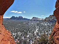
Belly of the Dragon is reached by a 0.3 mile drive along a wide gravel track (Elephant Gap), starting 16 miles north of Kanab and 0.5 miles south of Mt Carmel Junction; the track runs along a sandy bench above the east bank of the Sevier River. There is a large parking place in front of the tunnel entrance, and a primitive camping area opposite, overlooking the creek. At the mouth of the belly is a short drop, four feet, over a concrete wall, then it's an easy walk up the sandy floor. The tunnel is just long and curved enough to be almost dark in the middle, so a torch is helpful though not really necessary. The east entrance to the belly is more photogenic, lined by textured cliffs, and surrounded by green vegetation.
The tunnel is quite photogenic, being colorful, and the walls nicely undulating, but, also like the Sand Caves, its walls been almost completely covered with graffiti, spoiling the appearance. It only takes about five minutes to walk through, photographing the place from various angles, then turn around and walk back; the canyon upstream doesn't seem interesting, at least not initially, so there isn't anything else to do here.
Rocks around the tunnel are from two components of the Carmel Formation - the Co-op Creek Limestone Member around the passage itself, and the Temple Cap Formation just below. Both are relatively soft, hence the ease with which people can carve the walls.
Exploring the Tunnel
Belly of the Dragon is reached by a 0.3 mile drive along a wide gravel track (Elephant Gap), starting 16 miles north of Kanab and 0.5 miles south of Mt Carmel Junction; the track runs along a sandy bench above the east bank of the Sevier River. There is a large parking place in front of the tunnel entrance, and a primitive camping area opposite, overlooking the creek. At the mouth of the belly is a short drop, four feet, over a concrete wall, then it's an easy walk up the sandy floor. The tunnel is just long and curved enough to be almost dark in the middle, so a torch is helpful though not really necessary. The east entrance to the belly is more photogenic, lined by textured cliffs, and surrounded by green vegetation.
Belly of the Dragon - Similar Places


All Contents © Copyright The American Southwest | Comments and Questions | Contribute | Affiliate Marketing Disclosure | Site Map