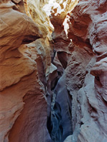
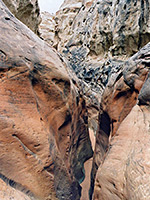
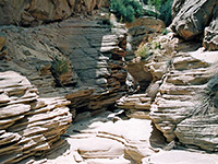
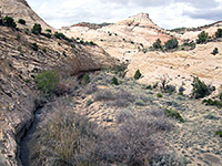
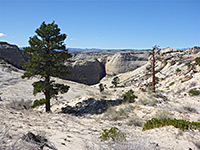
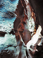
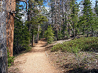
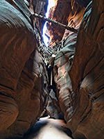
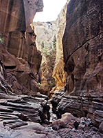
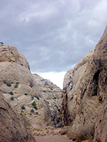
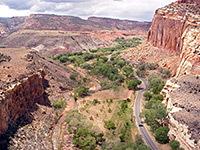
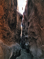
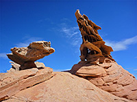
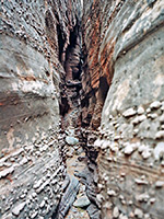
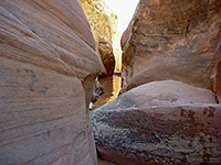
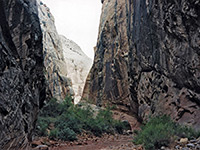
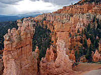
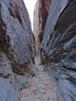
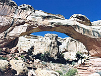
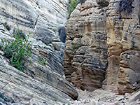
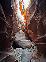
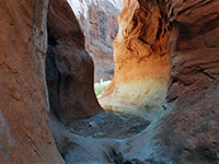
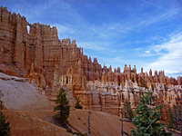
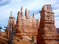
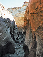
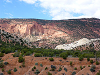
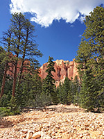
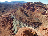
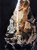
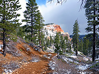
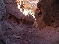
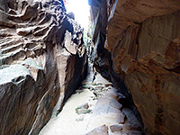
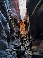
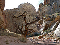
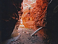
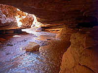
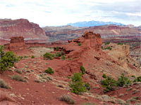
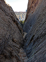
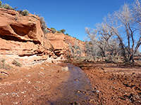
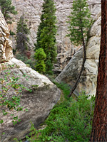
Bryce Canyon National Park, Capitol Reef National Park and Grand Staircase-Escalante National Monument are the three major hiking areas in the central part of south Utah, especially the latter, which although having few maintained trails, contains many dozens of recognized routes, mostly along narrow canyons.
Map shows trailhead locations
| 1. Angels Palace Trail, Kodachrome Basin State Park Length 1.4 miles (2.3 km); loop Elevation change 120 feet (37 meters) Difficulty Easy Rating (1-5) ★★★★★ Easy, popular path that climbs a short ravine and loops around the flat mesatop on the east side of the park road, giving fine views in most directions - south to the isolated line of spires near the park entrance, west across much more extensive outcrops of red sandstone, including several sand pipes, and north to a tall ridge of white sandstone, along the park boundary. |
| 2. Big Horn Canyon Length 3.8 miles (6.1 km); Old Sheffield Road to Harris Wash Elevation change 700 feet (213 meters) Difficulty Easy; no major obstacles Rating (1-5) ★★★★★ Medium depth drainage containing several stretches of shallow narrows. A tributary of Harris Wash, in a little visited area. |
| 3. Blue Pool Wash Length 1.2 miles (1.9 km); if exploring the upper and lower parts separately Elevation change 80 feet (24 meters) Difficulty Easy to moderate; a few climbable obstacles, and one sheer drop Rating (1-5) ★★★★★ Minor drainage with a short narrows section through light colored Entrada sandstone, interrupted by several chokestones and dryfalls, at least one of which is not free climbable. Easily reached from highway 89, and explorable in not much more than an hour. |
| 4. Booker Canyon Length 3 miles (4.8 km); to the drop off Elevation change 600 feet (183 meters) Difficulty Easy to moderate; one place requiring downclimbing (can be bypassed) Rating (1-5) ★★★★★ Short but pretty narrows in a remote, little-visited region; a tight, V-shaped slot that gives way to a deeper canyon through photogenic, angled, thin-layered rocks. |
| 5. Boulder Creek, Grand Staircase-Escalante National Monument Length 1.5 miles (2.4 km); to the creek Elevation change 400 feet (122 meters) Difficulty Easy to moderate; one pothole to pass, by climbing a steep slickrock slope Rating (1-5) ★★★★★ Short, cross country hike down a rocky ravine into the middle part of Boulder Creek, which, if water levels are not too high, can then be followed downstream through long stretches of narrows, all the way to the Escalante River. |
| 6. Boulder Mail Trail, Grand Staircase-Escalante National Monument Length 14.5 miles (23.3 km) Elevation change 1140 feet (347 meters) Difficulty Strenuous Rating (1-5) ★★★★★ Historic cross-country trail, once the only link between Escalante and Boulder, and also the route of a cable system built in the 1930s. The cairned path crosses three major drainages (Sand Creek, Death Hollow, Mamie Creek), extensive slickrock benches, and several partly wooded plateaus. Amongst the many possible side trips is to Mamie Creek Natural Bridge. |
| 7. Brimstone Gulch Length 2.9 miles (4.7 km); into the lower end of the narrows Elevation change 350 feet (107 meters) Difficulty Moderate - the lower canyon often has pools, and a 15 foot chokestone must be negotiated on the approach Rating (1-5) ★★★★★ Extremely dark and enclosed slot that eventually becomes too narrow to explore at ground level. Tributary of Dry Fork of Coyote Gulch. The passages are dimly lit with curving walls that block most sunlight and have quite dark-colored rocks, all of which make the canyon very ghostly and mysterious. |
| 8. Bristlecone Trail, Bryce Canyon National Park Length 1 mile (1.6 km); (loop) Elevation change 200 feet (61 meters) Difficulty Easy Rating (1-5) ★★★★★ Bristlecone pines are the most ancient trees in the US; some specimens in California are well over 4,000 years old but those at Bryce Canyon have been growing for up to 1,600 years. They provide one attraction of a short loop trail that starts right at the southern end of the park scenic drive, at Rainbow Point (elevation 9,115 feet), and also passes many large Douglas fir trees while giving excellent views over quite extensive hoodoos and ravines to the south and west. |
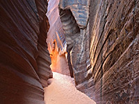
| 9. Buckskin Gulch Length 13.5 miles (21.7 km); Wire Pass entrance to the Paria confluence Elevation change 900 feet (274 meters) Difficulty Moderate; few major obstacles apart from long muddy pools, but the full hike is long and tiring. High flash flood danger Rating (1-5) ★★★★★ Longest and deepest slot canyon in the Southwest - intimidating, sheer-walled narrows that extend for 12 miles, meeting the Paria River in the middle of its own lengthy enclosed section. The whole canyon can be hiked in one day, though camping en route for one night is more common. |
| 10. Bull Valley Gorge Length 2 miles (3.2 km); to the end of the slot, 5.5 miles to Sheep Creek Elevation change 500 feet (152 meters) Difficulty Moderate to strenuous - pools, mud and chokestones Rating (1-5) ★★★★★ Good, deep narrows through colorful, thin-layered sandstone, containing long muddy pools and several dryfalls, hence quite testing to explore. Below the narrows is a wider, deeper gorge sheltering a few pine trees, before the canyon meets the larger drainage of Sheep Creek. |
| 11. Burro Wash Length 4 miles (6.4 km); to the base of the first unclimbable dryfall Elevation change 600 feet (183 meters) Difficulty Moderate - chokestones up to 6 feet tall, pools several feet deep Rating (1-5) ★★★★★ Sandy streamway leading to a watery slot; several narrow sections, some quite dark and confined, through greyish rocks of varying textures. Also has good views of the middle of Capitol Reef. |
| 12. Capitol Gorge, Capitol Reef National Park Length 1 mile (1.6 km) Elevation change level feet (0 meters) Difficulty Easy Rating (1-5) ★★★★★ A dozen or more narrow canyons cut through the Waterpocket Fold. Capitol Gorge is the easiest to explore - starting from the southern end of the park scenic drive, a level track winds through the tall sandstone rocks, reaching the far side after about a mile, and also passing a collection of historic pioneer signatures. A 0.2 mile side trail leads to The Tanks, a collection of eroded crevices that collect rainwater. The Capitol Gorge track was for many years the main route through Capitol Reef, until UT 24 was constructed in 1962. |
| 13. Cassidy Arch, Capitol Reef National Park Length 1.75 miles (2.8 km) Elevation change 600 feet (183 meters) Difficulty Easy to moderate - quite steep Rating (1-5) ★★★★★ The short, moderately steep trail an overlook of Cassidy Arch starts from the end of the track leading to Grand Wash, climbing the Wingate and Kayenta sandstone cliffs then heading back west to the arch. Continuation hikes are possible along the Frying Pan Trail which branches off to the north, over the top of Capitol Reef. The arch is named after Butch Cassidy, who once camped in Grand Wash. |
| 14. Casto Canyon Trail, Red Canyon Length 5.5 miles (8.8 km) Elevation change 200 feet (61 meters) Difficulty Easy to moderate Rating (1-5) ★★★★★ Casto Canyon is more spectacular than the adjacent and better known Red Canyon; the trail through the valley passes an ever changing variety of pink, red and orange eroded rocks, through ponderosa and bristlecone pine trees, and is especially peaceful, apart from the occasional noise of ATV traffic. |
| 15. Catstair Canyon, Grand Staircase-Escalante National Monument Length 1 mile (1.6 km); between the 2 trailheads, or a 1.7 mile loop Elevation change 210 feet (64 meters) Difficulty Moderate; an optional rappel, and scrambling to bypass obstacles Rating (1-5) ★★★★★ Short, red rock canyon through the Cockscomb, alongside US 89; narrows, dryfalls, and a stack of 1950s cars |
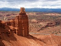
| 16. Chimney Rock, Capitol Reef National Park Length 3.5 miles (5.6 km); (loop) Elevation change 580 feet (177 meters) Difficulty Easy to moderate Rating (1-5) ★★★★★ Beginning near milepost 76 of UT 24, this hike climbs quite steeply up the hills that line the north side of the highway, then loops around the top of Mummy Cliff while passing close to Chimney Rock, a solitary pillar of Moenkopi sandstone. This trail is also used to reach Spring Canyon and then Chimney Rock Canyon, which can be followed for many miles either east or west. |
| 17. Cohab Canyon, Capitol Reef National Park Length 1.5 miles (2.4 km) Elevation change 340 feet (104 meters) Difficulty Easy to moderate - steep at the start Rating (1-5) ★★★★★ Cohab is a short, secluded canyon on the west side of Capitol Reef just south of Fruita on UT 24. The trail to it begins from the national park campground, ascends the cliffs, follows the canyon to the upper end, then descends towards the Fremont River. Junctions lead to two viewpoints of the river, and to Cassidy Arch/Grand Wash (via the Frying Pan Trail). |
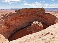
| 18. Cosmic Ashtray, Grand Staircase-Escalante National Monument Length 4.6 miles (7.4 km) Elevation change 200 feet (61 meters) Difficulty Moderate; requires route-finding Rating (1-5) ★★★★★ Cosmic Ashtray, The Volcano, or the Inselberg Pit - a huge, sand-filled crater, ringed by partly overhanging cliffs, with a rock pillar at the center; created by wind erosion. Reached by a cross-country route, over sand and slickrock |
| 19. Cottonwood Wash Length 3 miles (4.8 km) Elevation change 400 feet (122 meters) Difficulty Moderate; chokestones, slanted narrows and other obstacles, pools up to 6 feet deep Rating (1-5) ★★★★★ Deep, quite pretty canyon with pools and chokestones. The lower end is moderately enclosed, containing long but shallow slots, and becomes gradually more difficult to follow. A 35 foot dryfall eventually puts an end to upstream exploration. |
| 20. Cottonwood Wash Narrows Length 3.2 miles (5.1 km); round trip Elevation change 300 feet (91 meters) Difficulty Easy Rating (1-5) ★★★★★ Short enclosed section of canyon running parallel to Cottonwood Canyon Road, through the angled strata of the Coxcomb. Quite deep but only moderately narrow, and relatively popular due to the easy access. |
| 21. Davis Gulch Length 2.7 miles (4.3 km); to Bement Arch Elevation change 400 feet (122 meters) Difficulty Strenuous - lots of obstacles to be downclimbed Rating (1-5) ★★★★★ Testing narrows with many chokestones and tight sections requiring downclimbing - at the upper end of a canyon that becomes much wider and deeper, contains a huge natural arch, and eventually meets Lake Powell. |
| 22. Death Hollow, Grand Staircase-Escalante National Monument Length 2 miles (3.2 km); to the lower end of the canyon Elevation change 600 feet (183 meters) Difficulty Moderate; steep descent over slickrock to reach the Escalante, then wading in the canyons Rating (1-5) ★★★★★ Off trail hike into the lower end of Death Hollow, a deep canyon through sheer Navajo sandstone cliffs, containing a permanent stream. The route is down steep cliffs into the larger Escalante River canyon, then upstream a way to the confluence with the target drainage. |
| 23. Deer Creek Lake Trail, Dixie National Forest Length 3.8 miles (6.1 km) Elevation change 1200 feet (366 meters) Difficulty Easy to moderate Rating (1-5) ★★★★★ Path through meadows and light woodland to three contrasting lakes on the south side of Boulder Mountain; tree-lined Chriss Lake, the much larger and more remote Deer Creek Lake and the secluded Green Lake, scenically situated at the foot of a steep slope of scree below the summit plateau |
| 24. Dry Fork of Coyote Gulch Length 1.1 miles (1.8 km); for the slot section Elevation change 200 feet (61 meters) Difficulty Easy Rating (1-5) ★★★★★ Long drainage containing 0.7 miles of moderately deep and narrow passageways near its upper end, which alternate with wider stretches, patches of bright green shrubbery, sandbanks and pebble beaches. Usually explored in conjunction with the Peekaboo Gulch and Spooky Gulch tributaries, for a total trip of about 5 miles. |
| 25. Eagle View Trail, Kodachrome Basin State Park Length 0.5 miles (0.8 km) Elevation change 460 feet (140 meters) Difficulty Easy to moderate - steep and narrow Rating (1-5) ★★★★★ The Eagle View Trail climbs to a pass at the top of the cliffs encircling Kodachrome Basin and offers the best overall views of the area; it links with another route, outside the park boundaries, that descends a valley towards Henrieville. However, because of erosion, the trail has been closed since 2010. |
| 26. Edmaiers Secret, Vermilion Cliffs National Monument Length 2.4 miles (3.9 km) Elevation change 120 feet (37 meters) Difficulty Easy Rating (1-5) ★★★★★ Small area of strangely eroded sandstone on the east side of Buckskin Gulch, upstream of the slot canyon section; mounds, fins, hoodoos and criss-cross structures. Reached by an easy hike along a shallow canyon. |
| 27. Egypt 3 Length 2.7 miles (4.3 km); to the drop off Elevation change 400 feet (122 meters) Difficulty Moderate to strenuous - chokestones, potholes, very tight passages. The far southern end requires a rappel and possible swim Rating (1-5) ★★★★★ Excellent narrows in three distinct sections; a long succession of interlinked potholes, followed by extremely narrow passageways through strangely textured rocks, and finally a lower technical section with drop-off and pool. |
| 28. Escalante River Slot Canyon Length 1.4 miles (2.3 km) Elevation change 500 feet (152 meters) Difficulty Easy to moderate; steep slickrock approach, but no major obstacles in the narrows until a dryfall at the upper end Rating (1-5) ★★★★★ Minor tributary ravine on the south side of the Escalante River, quite easily accessible from Hwy 12. Forms a nice short slot, with shallow pools and twisting passages through dark-colored sandstone. |
| 29. Escalante River Trail, Grand Staircase-Escalante National Monument Length 2.5 miles (4 km) Elevation change 100 feet (30 meters) Difficulty Easy Rating (1-5) ★★★★★ Varied trail along the wide Escalante River canyon west of UT 12, passing two arches, some Anasazi ruins, a petroglyph panel and a narrow tributary ravine (Sand Creek). |
| 30. Fairyland Loop Trail, Bryce Canyon National Park Length 8.3 miles (13.4 km); loop, including part of the Rim Trail Elevation change 950 feet (290 meters) Difficulty Moderate; quite long, and steep in some places Rating (1-5) ★★★★★ The Fairyland Trail is a relatively strenuous route starting from the most northerly park overlook at Fairyland Point, winding down amongst the hoodoos, with a total elevation loss of about 1,000 feet, then turning back southwest and climbing 770 feet up to the rim at Sunrise Point. It passes various named formations including Chinese Wall, Boat Mesa and Tower Bridge, as well as junctions with several other paths, all of which are well signposted. The full 8.3 mile loop includes a return along part of the Rim Trail. |
| 31. Five Mile Wash Length 1.8 miles (2.9 km); to the narrows Elevation change 150 feet (46 meters) Difficulty Easy Rating (1-5) ★★★★★ A large drainage cutting right through Capitol Reef, but one blocked near the lower end, after a very short enclosed section, by a pool and difficult-to-climb dryfall. The canyon can be followed further at rim level, a hike which affords spectacular views over the surrounding domed summits, the eastern plateau beneath the Henry Mountains and of the canyon itself, far below and containing many pools and narrow sections. |
| 32. Fremont Gorge Overlook Trail, Capitol Reef National Park Length 2 miles (3.2 km) Elevation change 1040 feet (317 meters) Difficulty Moderate - steep in parts, and exposed Rating (1-5) ★★★★★ The deepest part of the Fremont River canyon is south of UT 24 and west of the reef, where for several miles the canyon walls exceed 1,000 feet in height. The Fremont Gorge Overlook is the more strenuous of two routes to viewpoints of the canyon, starting near Fruita and ending at the edge of a cliff high above the river. The path also has good views of the multicolored cliffs of Capitol Reef. |
| 33. Frying Pan Trail, Capitol Reef National Park Length 3 miles (4.8 km) Elevation change 800 feet (244 meters) Difficulty Easy to moderate Rating (1-5) ★★★★★ The Frying Pan trail connects the paths to Cohab Canyon and Cassidy Arch, following near the top of Capitol Reef and involving various climbs and descents over slickrock terraces & ravines. |
| 34. Golden Throne, Capitol Reef National Park Length 1.8 miles (2.9 km) Elevation change 700 feet (213 meters) Difficulty Easy Rating (1-5) ★★★★★ One of two hikes beginning at the far end of the park scenic drive, this climbs the cliffs on the north side of Capitol Gorge, winding around several side ravines to the top of a dome overlooking the gorge to the south and Golden Throne to the north - a rounded summit nearly 1,000 feet higher. |
| 35. Grand Wash Length 2.25 miles (3.6 km) Elevation change 200 feet (61 meters) Difficulty Easy. An official NPS trail leads through the narrows Rating (1-5) ★★★★★ Easiest explored of Capitol Reef's narrow canyons, with an official NPS trailhead at either end; route follows a deep gorge that is around 20 feet across at its most confined point. |
| 36. Harris Wash Length 5.3 miles (8.5 km); to Tunnel Slot Elevation change 300 feet (91 meters) Difficulty Easy Rating (1-5) ★★★★★ Long, deep and relatively wide drainage providing an obstruction-free hiking route to the Escalante River. The canyon becomes 1,200 feet deep and has impressive streaked Navajo sandstone walls, large rock alcoves, pools and year-round flowing water in the lower reaches which sustains many trees, bushes and flowers. Four tributaries forms slots, most unusual (and shortest) being stripy Zebra Slot and enclosed Tunnel Slot. |
| 37. Hat Shop Trail, Bryce Canyon National Park Length 2 miles (3.2 km) Elevation change 980 feet (299 meters) Difficulty Easy to moderate - steep in places Rating (1-5) ★★★★★ Hat Shop is the name given to a group of unusual pinnacles formed by narrow columns of soft, light-colored sandstone topped by flat boulders of more resistant rock. The path is also the upper end of the Under-the-Rim Trail, starting at Bryce Point. |
| 38. Headquarters Canyon, Capitol Reef National Park Length 3.6 miles (5.8 km); round trip, to both forks Elevation change 250 feet (76 meters) Difficulty Easy; no significant obstructions Rating (1-5) ★★★★★ Short but deep drainage on the east side of Capitol Reef, with two forks; both form brief sections of narrows, through generally dull-colored sandstone; the Navajo sandstone hereabouts is generally dark and drab in appearance, and the canyons do not receive much sunlight, so the passages are rather gloomy. |
| 39. Hickman Bridge, Capitol Reef National Park Length 1.2 miles (1.9 km) Elevation change 400 feet (122 meters) Difficulty Easy Rating (1-5) ★★★★★ Sandstone arches are found all over Capitol Reef though most are quite inaccessible. Hickman Bridge is one of the few reached by a maintained trail; this starts from UT 24 next to the Fremont River and climbs fairly gradually, along a dry wash to the base of the 130 foot span. |
| 40. Lick Wash Length 0.9 miles (1.4 km); to the end of the narrows Elevation change 120 feet (37 meters) Difficulty Easy Rating (1-5) ★★★★★ Brief narrows section enclosed by unusual thin-layered, cross-bedded sandstone; not especially colorful but interesting nonetheless, and quite photogenic. |
| 41. Little Death Hollow Length 8 miles (12.9 km) Elevation change 600 feet (183 meters) Difficulty Easy to moderate; a long hike, but there are few obstructions in the narrows Rating (1-5) ★★★★★ Remote, east-side Escalante tributary that after a long open section, eventually forms a fine slot canyon, with over 2 miles of narrow, twisting passageways through colorful Wingate sandstone. |
| 42. Llewellyn Gulch Length 6 miles (9.7 km); to Lake Powell - may vary Elevation change 650 feet (198 meters) Difficulty Moderate; a few dryfalls and chokestones to climb down. Some obstacles in the upper canyon can be bypassed Rating (1-5) ★★★★★ Beautiful, secluded canyon that starts beneath the red cliffs of Fiftymile Point and meets Lake Powell, forming nice, slot-like passageways in the upper part, and a wider gorge lower down, containing a permanent stream. |
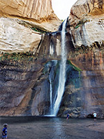
| 43. Lower Calf Creek Falls, Grand Staircase-Escalante National Monument Length 2.75 miles (4.4 km) Elevation change 200 feet (61 meters) Difficulty Easy Rating (1-5) ★★★★★ Popular path that follows a sheer-walled riparian canyon, either close to the stream or across more arid land above, to a dramatic waterfall in a sheltered alcove. |
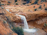
| 44. Mossy Cave Trail, Bryce Canyon National Park Length 0.8 miles (1.3 km) Elevation change 300 feet (91 meters) Difficulty Easy Rating (1-5) ★★★★★ Mossy Cave Trail is different to most in the Bryce Canyon area as it leads along a small stream (Tropic Ditch, flowing through Water Canyon) to a waterfall and a cool alcove fringed by curtains of moss. It is located not along the main scenic drive but a few miles east on UT 12, half way down Tropic Canyon, so can be seen without paying to enter the national park. |
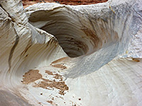
| 45. Nautilus Rock, Grand Staircase-Escalante National Monument Length 1.1 miles (1.8 km) Elevation change 130 feet (40 meters) Difficulty Easy Rating (1-5) ★★★★★ Shell-shaped outcrop of Page sandstone, split by a curving, wave-like gully, lined by thin, delicate fins and ridges; a very photogenic location. Most of the rock is white or grey in color, but enlivened by small patches of red and yellow. |
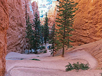
| 46. Navajo Trail, Bryce Canyon National Park Length 1.3 miles (2.1 km); round trip Elevation change 520 feet (158 meters) Difficulty Easy Rating (1-5) ★★★★★ This is a short, popular route that begins at Sunset Point and leads 520 feet downhill via a set of switchbacks into a narrow slot-like canyon known as Wall Street, returning by a parallel path alongside more formations. A continuation path further down the hill exits the park after 2 more miles, linking with a gravel road to the town of Tropic - the easiest-reached of a number of east-side entrances to the park. |
| 47. Neon Canyon Length 4.6 miles (7.4 km); to the Golden Cathedral Elevation change 1100 feet (335 meters) Difficulty Easy Rating (1-5) ★★★★★ Long slot canyon, requiring ropes to explore fully, but ending at the more accessible 'Golden Cathedral', a beautiful natural amphitheater formed by overhanging cliffs streaked with desert varnish, containing a triple natural bridge above a large pool. |
| 48. Panorama Trail, Kodachrome Basin State Park Length 6 miles (9.7 km); round trip, for all sections Elevation change 150 feet (46 meters) Difficulty Easy to moderate - relatively long Rating (1-5) ★★★★★ Longest path in the park; loops and spurs totaling 6 miles, across flat land beneath a line of red cliffs - to viewpoints, sand pipes, narrow ravines and other sandstone formations. The elevation gain along all of the trail is minimal, with just a few short descents into dry washes, and about half is over open flats, while the other half (the northern section), runs beneath the red and white sandstone cliffs that stretch right across the park. |
| 49. Paria River Length 7 miles (11.3 km); to the Buckskin Gulch confluence Elevation change 300 feet (91 meters) Difficulty Easy, but long; no significant obstructions. High flash flood danger Rating (1-5) ★★★★★ Rival of the Zion Narrows to be the best narrow, water-filled canyon in the Southwest - a usually shallow river flowing through miles of enclosed passageways between sheer cliffs up to 1,000 feet high. The wider gorge below the narrows has other interesting sites including arches and petroglyphs. |
| 50. Peekaboo Gulch Length 1.1 miles (1.8 km); to the north end of the lower narrows Elevation change 180 feet (55 meters) Difficulty Easy Rating (1-5) ★★★★★ Minor tributary of Dry Fork of Coyote Gulch forming a short slot at its southern end, containing sharp fins, interlinked potholes several small arches. |
| 51. Peekaboo Trail, Bryce Canyon National Park Length 5.5 miles (8.8 km); (loop) Elevation change 900 feet (274 meters) Difficulty Moderate; many short, steep ascents and descents Rating (1-5) ★★★★★ Starting from Bryce Point, the Peekaboo Loop Trail is one of the longer routes through the largest area of hoodoos in the national park, around the upper end of Bryce Canyon; it drops down very steeply from the plateau edge then winds amongst innumerable colorful formations. The path is shared by horses, which can sometimes cause delays for hikers. The route may also be accessed from Sunset Point via the Navajo Trail, or by a longer walk from Sunrise Point along the Queens Garden Trail. |
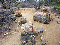
| 52. Petrified Forest and Sleeping Rainbows Trails, Escalante Petrified Forest State Park Length 1.75 miles (2.8 km); (loop) Elevation change 250 feet (76 meters) Difficulty Easy to moderate Rating (1-5) ★★★★★ The Petrified Forest Trail climbs the slope behind the camping area to the pine and juniper-covered flat land above and passes various petrified specimens. Rather more impressive is the linked Trail of the Sleeping Rainbows, which descends into one steep ravine and ascends another, passing many large logs. |
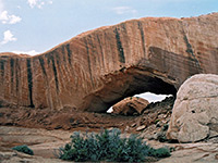
| 53. Phipps Wash, Grand Staircase-Escalante National Monument Length 5 miles (8 km); to the Escalante Elevation change 800 feet (244 meters) Difficulty Moderate Rating (1-5) ★★★★★ Large sandstone arch, reached by hiking across sand and slickrock then down the deepening drainage of Phipps Wash, which eventually meets the Escalante River after also passing a small natural bridge. |
| 54. Photo Trail, Red Canyon Length 0.3 miles (0.5 km) Elevation change 70 feet (21 meters) Difficulty Easy Rating (1-5) ★★★★★ This path crosses a short side valley and winds around slopes on the far side, passing various named formations. Rather better scenery is reached by climbing up from the official path, since the views are more wide ranging, and the formations seem more impressive when seen from above. |
| 55. Pine Creek Box Trail, Dixie National Forest Length 8.5 miles (13.7 km) Elevation change 1320 feet (402 meters) Difficulty Moderate; many stream crossings Rating (1-5) ★★★★★ Semi-maintained path along a wooded, relatively high elevation canyon, containing a permanent stream. The upper half is shady and enclosed though never particularly narrow, while the lower section is deeper and much more open |
| 56. Pink Ledges Trail, Red Canyon Length 1 mile (1.6 km); loop Elevation change 160 feet (49 meters) Difficulty Easy Rating (1-5) ★★★★★ Beginning next to the Red Canyon visitor center, this trail winds around hoodoos and pine trees close to the road, surroundings which are pretty enough though the rocks are not especially pink. |
| 57. Powell Point Trail, Dixie National Forest Length 0.8 miles (1.3 km) Elevation change 100 feet (30 meters) Difficulty Easy Rating (1-5) ★★★★★ Short path to a spectacular, high elevation, red and white rock viewpoint on the south side of Escalante Mountain, overlooking a vast area of southern Utah. Reached by a rough, 3.7 mile track through pine woods, an optional hike for some |
| 58. Queens Garden Trail, Bryce Canyon National Park Length 0.9 miles (1.4 km) Elevation change 320 feet (98 meters) Difficulty Easy, though steep in places Rating (1-5) ★★★★★ The shortest path into the best area of hoodoos, around Bryce Canyon, begins at Sunrise Point and descends into a side drainage, turning back west to the base of one tower thought to resemble Queen Victoria, surrounded by a semicircle of graceful formations. Past here the path continues another 0.7 miles to link with the south end of the Navajo Loop Trail, and the Peekaboo Trail. |
| 59. Red Breaks Length 3 miles (4.8 km) Elevation change 500 feet (152 meters) Difficulty Moderate - a few chokestones to climb over Rating (1-5) ★★★★★ Extensive, branched, north-side tributary of Harris Wash in a rarely visited area. Contains shallow slots for most of its length, but has some deeper passages in the less accessible northern stretches. |
| 60. Red Canyon, Capitol Reef National Park Length 2.7 miles (4.3 km) Elevation change 400 feet (122 meters) Difficulty Easy to moderate Rating (1-5) ★★★★★ Relatively short canyon on the east side of the Waterpocket Fold which emerges from a wide basin lined by red cliffs, reached by a trail that crosses open land to the mouth of the ravine, then follows the streambed. The hike is not signposted from the access road so is mostly done by people staying at the nearby campground, which has about half a dozen sites, and there is no charge to stay. |
| 61. Riggs Spring Trail, Bryce Canyon National Park Length 8.5 miles (13.7 km); (loop) Elevation change 1650 feet (503 meters) Difficulty Moderate; steep in places, and relatively long Rating (1-5) ★★★★★ The path to Riggs Spring is one of the more difficult in Bryce Canyon National Park. It starts from Rainbow Point, the highest part of the plateau, and passes mostly through forested land, though with some eroded formations at intervals, en route to the spring, which has an elevation of 7,440 feet. From here the trail turns west then north, climbing back to the starting point. Although relatively short for a two day hike, some people camp for one night along the route, at one of 3 back country campsites. |
| 62. Rim Overlook/ Navajo Knobs, Capitol Reef National Park Length 4.9 miles (7.9 km) Elevation change 1600 feet (488 meters) Difficulty Moderate - steep only at the end, but relatively long, and exposed Rating (1-5) ★★★★★ From the trailhead beside UT 24 (also used to reach Hickman Bridge), the longest maintained trail in the park ascends the hillside above the Fremont River and follows the gorge westwards, reaching a viewpoint on the cliff edge 1,000 feet above Fruita after 2.25 miles. From here the path turns away north, across more high ground to a region of eroded Navajo sandstone and another panoramic overlook of the Fremont River valley. |
| 63. Round Valley Draw Length 2.8 miles (4.5 km); to the junction with Hackberry Canyon Elevation change 350 feet (107 meters) Difficulty Easy to moderate; dryfalls, chokestones, muddy pools Rating (1-5) ★★★★★ Deep, dark canyon through dull-colored sandstone, thin-layered in some places and nicely eroded. The narrows extend for about a mile, then the gorge gradually opens out and pine trees grow beside the streambed. There are a couple of dryfalls to overcome but no major obstacles and the most interesting section can be explored in just 2 hours. |
| 64. Shakespeare Arch Trail, Kodachrome Basin State Park Length 1.4 miles (2.3 km); round trip Elevation change 100 feet (30 meters) Difficulty Easy to moderate Rating (1-5) ★★★★★ Loop around an isolated mesa, past a hidden arch and a tall sand pipe; good views in all directions. Part of the route splits, into an easier lower section and a slightly more challenging upper section, which climbs to the top of the mesa. The arch is just visible from the main approach road to the state park but was not discovered until 1976, since which time it has become one of the highlights of the state park. |
| 65. Sheep Creek Trail, Bryce Canyon National Park Length 2 miles (3.2 km) Elevation change 630 feet (192 meters) Difficulty Easy Rating (1-5) ★★★★★ The Sheep Creek Trail is the northernmost of 4 short paths that connect with the long distance Under-the-Rim Trail; starting from Swamp Canyon overlook, the path runs northwards through thick forest, turns east and drops over the rim of the plateau, past a few hoodoos and down a wooded valley to the junction. |
| 66. Sheets Gulch Length 4.7 miles (7.6 km); to the end of the narrowest section Elevation change 350 feet (107 meters) Difficulty Easy to moderate; a few minor obstacles and shallow pools Rating (1-5) ★★★★★ Lengthy drainage forming shallow but pretty slot sections through nicely colored rocks. No major obstructions. Lower narrows through Navajo sandstone give way to a wider Wingate canyon towards the west side of the reef. |
| 67. Spencer Canyon Length 4 miles (6.4 km) Elevation change 550 feet (168 meters) Difficulty Easy to moderate; a few pools to bypass, and some downclimbing Rating (1-5) ★★★★★ Short, branched, south side tributary of the Escalante River; longest fork is straight and vertical-walled, with a tight, dark slot in the upper end. Exploring from plateau level requires ropes, to overcome a few dryfalls, but most of the slot can be seen by walking up from below. |
| 68. Spooky Gulch Length 1.2 miles (1.9 km); to the end of the lower narrows Elevation change 220 feet (67 meters) Difficulty Easy Rating (1-5) ★★★★★ Short, narrow, claustrophobic slot canyon, a tributary of Dry Fork of Coyote Gulch. The colors and forms of the cross-bedded Navajo sandstone walls are very beautiful, and the walls have an unusual knobbly texture (similar to other Escalante slots like Egypt 3), which adds to the eerie nature of the canyon. Spooky is quite popular, and in summer there will usually be one or two other groups in or around the canyon. |
| 69. Spring Canyon, Capitol Reef National Park Length 4 miles (6.4 km); or more Elevation change 250 feet (76 meters) Difficulty Easy, apart from fording of the Fremont River at the start Rating (1-5) ★★★★★ Long, deep, twisting ravine that joins the north side of the Fremont River in the middle of Capitol Reef. A hike along the lowest few miles encounters tall cliffs, alcoves, pools and a seasonal stream. Some sections of streambed border sandbanks that support trees and bushes, while in places the seasonal water covers most of the canyon floor. |
| 70. Starlight Canyon Length 5.8 miles (9.3 km); to the short narrows section Elevation change 500 feet (152 meters) Difficulty Easy Rating (1-5) ★★★★★ Short slot canyon in a remote location. Tributary of the Paria River, wide for most of its length, that forms a pretty, enclosed passageway containing a small stream, flowing through pools and cascades. |
| 71. Sulphur Creek Length 5.3 miles (8.5 km) Elevation change 500 feet (152 meters) Difficulty Easy to moderate Rating (1-5) ★★★★★ Although there is no trail through the deep, watery narrows of Sulphur Creek, the route is well enough known to have an NPS sign at the trailhead, shared with Chimney Rock. The creek emerges beside UT 24 again next to the visitor center, from where the return journey is back along the road, by walking, using a car shuttle or hitching a lift. |
| 72. Sunset Point, Capitol Reef National Park Length 0.4 miles (0.6 km) Elevation change level feet (0 meters) Difficulty Easy Rating (1-5) ★★★★★ This short route follows close to the eastern rim of the canyon of Sulphur Creek, to a small summit with 360 degree views of cliffs and peaks, a good place for photographing the sunset. Another even shorter path starting from the same point (end of a side road off UT 24, near the western park entrance) leads to an overlook of the Goosenecks of Sulphur Creek. |
| 73. Surprise Canyon, Capitol Reef National Park Length 3.9 miles (6.3 km); round trip, for all forks Elevation change 300 feet (91 meters) Difficulty Easy; no major obstructions Rating (1-5) ★★★★★ Short drainage on the east side of the Waterpocket Fold, with three forks, all similar in appearance; briefly narrow then gaining height, enclosed by smooth, vertical cliffs of light-colored Navajo sandstone. The rocks at the edge of the reef are colorful, a mix of white, red and orange, and are eroded into little peaks and ridges, and while the tall cliffs around the narrows are rather gloomy - grey or dull red, the hike offers an easy way to see three moderately interesting canyons in close proximity. |
| 74. Swamp Canyon Trail, Bryce Canyon National Park Length 1.3 miles (2.1 km) Elevation change 630 feet (192 meters) Difficulty Easy Rating (1-5) ★★★★★ From Swamp Canyon overlook, a path descends into a wooded ravine between two small but pretty areas of sandstone pinnacles, and meets the Under-the-Rim Trail beside one of several back-country camp sites along this route. A 4.2 mile loop hike can be made by walking north along the main path, then back to the rim via the Sheep Creek Trail. |
| 75. The Gulch, Grand Staircase-Escalante National Monument Length 10 miles (16.1 km); round trip Elevation change 650 feet (198 meters) Difficulty Moderate Rating (1-5) ★★★★★ The Gulch is a lengthy tributary of the Escalante River, crossed by the Burr Trail; the downstream section is the most popular for hiking, providing generally easy walking along a relatively wide and scenic canyon. Two major side-ravines, King Bench Canyon and Halfway Hollow, contain short sections of narrows. This hike is down the Gulch for 5 miles, returning up the first of these tributaries. |
| 76. Tower Bridge Trail, Bryce Canyon National Park Length 1.5 miles (2.4 km) Elevation change 850 feet (259 meters) Difficulty Easy to moderate - steep at first Rating (1-5) ★★★★★ This is another short, well used path that starts from Sunrise Point, descends into Fairyland Canyon and leads to the Tower Bridge formation, an eroded span resembling the famous bridge in London. The path also forms part of the Fairyland Trail. |
| 77. Trail Point Trail, Dixie National Forest Length 4 miles (6.4 km) Elevation change 1700 feet (518 meters) Difficulty Moderate; one steep section Rating (1-5) ★★★★★ Path to the top of Boulder Mountain; a gentle climb up sparsely forested slopes, past Divide Lake, followed by a steeper ascent to a viewpoint at the edge of the summit plateau, covered by basalt boulders. The route contines through trees and meadows to the more scenic Circle Lake |
| 78. Upper Calf Creek Falls, Grand Staircase-Escalante National Monument Length 1.1 miles (1.8 km) Elevation change 560 feet (171 meters) Difficulty Moderate - steep slickrock Rating (1-5) ★★★★★ 88 foot waterfall close to UT 12, reached by a steep descent down a white slickrock slope. The pool drops into an enclosed, bushy chamber and is preceded by a nice series of pools across smooth sandstone. |
| 79. Upper Sand Creek, Dixie National Forest Length 3 miles (4.8 km); to the first tributary Elevation change 550 feet (168 meters) Difficulty Moderate to strenuous; many small obstacles, and much undergrowth Rating (1-5) ★★★★★ The upper reaches of a remote, overgrown, trailless drainage flowing down a deepening canyon below sandstone cliffs and ponderosa pines, part of Box-Death Hollow Wilderness |
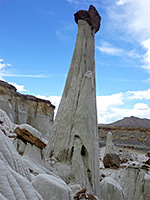
| 80. Wahweaap Hoodoos, Grand Staircase-Escalante National Monument Length 4.6 miles (7.4 km) Elevation change 300 feet (91 meters) Difficulty Easy Rating (1-5) ★★★★★ Photogenic group of pinnacles and balanced rocks surrounded by undulating mounds and cliffs of white entrada sandstone. Reached by a hike along the shallow valley of Wahweap Creek, also passing a few short slot canyons. |
| 81. West Fork Big Horn Canyon Length 3.8 miles (6.1 km); including the main, east fork Elevation change 700 feet (213 meters) Difficulty Easy; no major obstacles Rating (1-5) ★★★★★ Short but quite deep, colorful and photogenic slot; joins the main fork of the canyon near the confluence with Harris Wash. |
| 82. Willis Creek Length 0.9 miles (1.4 km); to the end of the narrows Elevation change 150 feet (46 meters) Difficulty Easy - no obstructions, shallow water Rating (1-5) ★★★★★ Permanent stream flowing through some beautiful narrow sections, between curvy, nicely eroded walls streaked with desert varnish. The narrows soon open out, and the canyon gradually deepens, eventually meeting Sheep Creek. |
| 83. Wire Pass Length 1.7 miles (2.7 km); to the Buckskin Gulch confluence Elevation change 200 feet (61 meters) Difficulty Easy; does not usually contain any major obstacles Rating (1-5) ★★★★★ Short tributary of Buckskin Gulch, used as an entrance route to that canyon, but forming a good, quite deep slot of its own, generally narrower than Buckskin. Relatively easily accessed, and with good reflected light patterns; a good introduction to slot canyon hiking. |
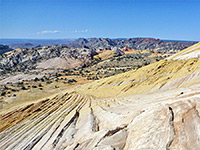
| 84. Yellow Rock, Grand Staircase-Escalante National Monument Length 1 mile (1.6 km); to the top of the dome Elevation change 780 feet (238 meters) Difficulty Easy, just a short but steep climb at the beginning Rating (1-5) ★★★★★ Smooth-sided dome of swirling, multicolored Navajo sandstone, reached by a short but steep trail; many photogenic patterns and textures, plus good views over the surrounding canyons and ridges. |
All Contents © Copyright The American Southwest | Comments and Questions | Contribute | Affiliate Marketing Disclosure | Site Map

