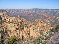
East Rim Trail
Long route between the east Zion entrance along Hwy 9, and Weeping Rock beside the Virgin River; views of mountains, narrow canyons, forests and meadows. Either end is suitable for a shorter hike, to Jolley Gulch (east) or Echo Canyon (west)
Length: 2.9 miles to Jolley Gulch, 5.9 miles to Stave Spring, 7.9 miles to Echo Canyon; 10.5 miles to Weeping Rock
Elevation change: up to 2,600 feet
Difficulty: Strenuous
Type: One way; links with 4 other trails
Usage: High for the west end, to Echo Canyon; low further east
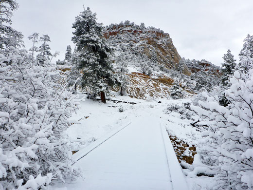
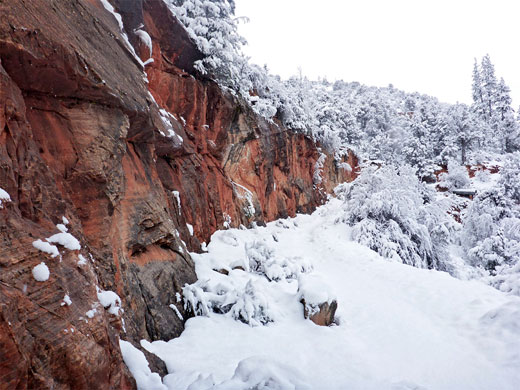
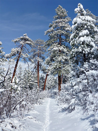
Season: Late spring, summer, fall - covered by snow in the winter
Trailhead: Parking area at the east entrance; west end is at Weeping Rock, shuttle stop 7
Rating (1-5): ★★★★★
Update, August 24th 2019 The west end of the East Rim Trail (in Zion Canyon) is closed for the foreseeable future due to a huge rockfall
The 10.5 mile East Rim Trail crosses the eastern half of Zion National Park, from the east entrance on Highway 9 to Weeping Rock in Zion Canyon, and can be combined with the longer West Rim Trail to form a traverse of the whole park. The latter route sees generally more traffic, though the west end of the East Rim Trail is often very busy, since it is used, in part, to access three popular locations: Echo Canyon, Hidden Canyon and Observation Point, all reachable on half day hikes.
The closest section to the east end is also good for shorter walks - it climbs up the scenic upper canyon of Clear Creek and the narrower tributary of Cave Canyon, then continues to the brink of Jolley Gulch, a deep, sheer-sided ravine that starts with a dramatic pour-off. This point is 3 miles from the start, approximately one third of the whole trail; beyond, the less travelled middle section crosses a high plateau with meadows and ponderosa pine forests, past two junctions, one with a link path from Zion Ponderosa Ranch Resort, the other with the trail to Cable Mountain and Deertrap Mountain. It then descends into Echo Canyon.
The full hike needs a shuttle between the two trailheads, 14 miles apart. The Zion Canyon bus runs along the first half of the route, while shuttles back to the east entrance are provided by several operators in Springdale. East to west trips along the trail are easiest, since the elevation gain is less - the path climbs just over 1,000 feet to the plateau and later descends 2,400 feet, mostly down Echo Canyon. Although there are no established campsites, overnight stays are permitted, enabling more leisurely walks along the trail, or to Cable and Deertrap mountains.
East Rim Trail topographic map, map of Zion National Park.
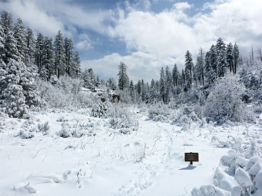
30 views along the East Rim Trail.
The western trailhead is at Weeping Rock in Zion Canyon, stop number six on the shuttle service and about half an hour's ride from Springdale, while the east end of the path is right beside the east entrance, along Hwy 9. The main parking area here is at the end of a 650 foot side road, part paved and part gravel; vehicles can also be left at a wide pullout beside the highway. This location is at the upper end of the spectacular canyon of Clear Creek, bordered to the south by the White Cliffs including Checkerboard Mesa, and to the north by more cliffs, red and white, as the creek moves away from the highway, providing a course for the first section of the trail.
The path starts off wide - the initial section was once a vehicle track - heading north up the east side of the valley of Clear Creek, and soon passes a sign marking the edge of the Zion wilderness. The land rises slightly then is level for while, before rising again and veering east at a fork in the drainage, where Jolley Gulch joins from the north. The path crosses Clear Creek on a wide footbridge and continues on the north side of the drainage about 50 feet above the streamway, below thin-layered cliffs of red or brown sandstone. The canyon divides again after 1.2 miles, and the path now turns north up the narrower tributary of Cave Canyon, still bordered by vertical cliffs, though these become noticeably less tall. The route comes close to the streambed towards the upper end then switchbacks abruptly to the south and starts a long, straight, moderate climb through oak and pine trees, coming within sight once again of the entrance station and Checkerboard Mesa.
After turning a corner, through a little pass framed by red rocks, the trail heads north again, along a bench high above the deeper drainage of Jolley Gulch. Another long straight takes the path gently down to the creekbed, immediately above a dramatic, 200 foot pour-off, which is nearly vertical, interrupted only by one intermediate pothole about half way down. At some times of year a stream is flowing, creating a small waterfall. A sign names the gulch, and points to the next destination, Stave Spring, reached in another 3 miles.
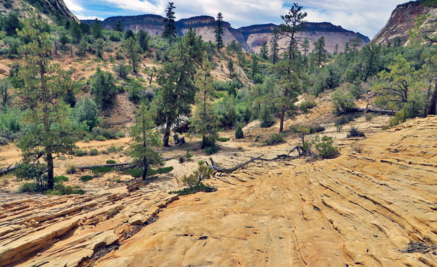
The next few miles are less spectacular. The path climbs, and soon the deep chasm of Jolley Gulch is out of sight; instead the terrain is wooded, and gently undulating. A minor ravine is passed on the south side and then, after a long curve, another small drainage on the east. The views become more extensive for a while, east to the red Elkhart Cliffs near Mt Carmel and north to distant hills on the Kolob Plateau. The path comes close to the head of another deep drainage to the south then crosses flatter land, quite thickly forested, where the views are more restricted. It passes a small drainage and continues through similar-looking woodland, dry and exposed in the summer, before descending steadily, past the intermittent water source of Stave Spring (on the west side) to a junction, 5.9 miles from the start, in an open, treeless area near the upper end of a northwards-trending valley. The Deertrap Mountain Trail forks off to the south, a route also used to reach Cable Mountain, while the East Rim Trail proceeds north along the flat, grassy valley floor to a second intersection, with the connecting path from Zion Ponderosa Ranch - the edge of the national park is less than half a mile away.
The gentle scenery persists for another few hundred feet before the streamway falls away steeply, at the head of a south side tributary of Echo Canyon. The path stays on the rim for a while, to the north, until it approaches the main canyon, and swiftly descends to the streambed via a series of tight switchbacks, down 800 feet in less than a mile. The next stretch is almost level, across wide benches and sandy slopes as the canyon starts the deepen out-of-sight to the south, forming the Echo Canyon slot. The path soon arrives at the junction with the Observation Point Trail, after which it becomes much busier; continuing along the lower portion of the canyon, right beside the streamway for a short distance, and ending with a big descent down the cliffs on the east side of the Zion Canyon, reaching the scenic drive just below Weeping Rock.
The 10.5 mile East Rim Trail crosses the eastern half of Zion National Park, from the east entrance on Highway 9 to Weeping Rock in Zion Canyon, and can be combined with the longer West Rim Trail to form a traverse of the whole park. The latter route sees generally more traffic, though the west end of the East Rim Trail is often very busy, since it is used, in part, to access three popular locations: Echo Canyon, Hidden Canyon and Observation Point, all reachable on half day hikes.
The closest section to the east end is also good for shorter walks - it climbs up the scenic upper canyon of Clear Creek and the narrower tributary of Cave Canyon, then continues to the brink of Jolley Gulch, a deep, sheer-sided ravine that starts with a dramatic pour-off. This point is 3 miles from the start, approximately one third of the whole trail; beyond, the less travelled middle section crosses a high plateau with meadows and ponderosa pine forests, past two junctions, one with a link path from Zion Ponderosa Ranch Resort, the other with the trail to Cable Mountain and Deertrap Mountain. It then descends into Echo Canyon.
The full hike needs a shuttle between the two trailheads, 14 miles apart. The Zion Canyon bus runs along the first half of the route, while shuttles back to the east entrance are provided by several operators in Springdale. East to west trips along the trail are easiest, since the elevation gain is less - the path climbs just over 1,000 feet to the plateau and later descends 2,400 feet, mostly down Echo Canyon. Although there are no established campsites, overnight stays are permitted, enabling more leisurely walks along the trail, or to Cable and Deertrap mountains.
Maps
East Rim Trail topographic map, map of Zion National Park.
Photographs
30 views along the East Rim Trail.
East Rim Trailheads
The western trailhead is at Weeping Rock in Zion Canyon, stop number six on the shuttle service and about half an hour's ride from Springdale, while the east end of the path is right beside the east entrance, along Hwy 9. The main parking area here is at the end of a 650 foot side road, part paved and part gravel; vehicles can also be left at a wide pullout beside the highway. This location is at the upper end of the spectacular canyon of Clear Creek, bordered to the south by the White Cliffs including Checkerboard Mesa, and to the north by more cliffs, red and white, as the creek moves away from the highway, providing a course for the first section of the trail.
Clear Creek and Cave Canyon
The path starts off wide - the initial section was once a vehicle track - heading north up the east side of the valley of Clear Creek, and soon passes a sign marking the edge of the Zion wilderness. The land rises slightly then is level for while, before rising again and veering east at a fork in the drainage, where Jolley Gulch joins from the north. The path crosses Clear Creek on a wide footbridge and continues on the north side of the drainage about 50 feet above the streamway, below thin-layered cliffs of red or brown sandstone. The canyon divides again after 1.2 miles, and the path now turns north up the narrower tributary of Cave Canyon, still bordered by vertical cliffs, though these become noticeably less tall. The route comes close to the streambed towards the upper end then switchbacks abruptly to the south and starts a long, straight, moderate climb through oak and pine trees, coming within sight once again of the entrance station and Checkerboard Mesa.
Jolley Gulch
After turning a corner, through a little pass framed by red rocks, the trail heads north again, along a bench high above the deeper drainage of Jolley Gulch. Another long straight takes the path gently down to the creekbed, immediately above a dramatic, 200 foot pour-off, which is nearly vertical, interrupted only by one intermediate pothole about half way down. At some times of year a stream is flowing, creating a small waterfall. A sign names the gulch, and points to the next destination, Stave Spring, reached in another 3 miles.
Stave Spring
The next few miles are less spectacular. The path climbs, and soon the deep chasm of Jolley Gulch is out of sight; instead the terrain is wooded, and gently undulating. A minor ravine is passed on the south side and then, after a long curve, another small drainage on the east. The views become more extensive for a while, east to the red Elkhart Cliffs near Mt Carmel and north to distant hills on the Kolob Plateau. The path comes close to the head of another deep drainage to the south then crosses flatter land, quite thickly forested, where the views are more restricted. It passes a small drainage and continues through similar-looking woodland, dry and exposed in the summer, before descending steadily, past the intermittent water source of Stave Spring (on the west side) to a junction, 5.9 miles from the start, in an open, treeless area near the upper end of a northwards-trending valley. The Deertrap Mountain Trail forks off to the south, a route also used to reach Cable Mountain, while the East Rim Trail proceeds north along the flat, grassy valley floor to a second intersection, with the connecting path from Zion Ponderosa Ranch - the edge of the national park is less than half a mile away.
Echo Canyon
The gentle scenery persists for another few hundred feet before the streamway falls away steeply, at the head of a south side tributary of Echo Canyon. The path stays on the rim for a while, to the north, until it approaches the main canyon, and swiftly descends to the streambed via a series of tight switchbacks, down 800 feet in less than a mile. The next stretch is almost level, across wide benches and sandy slopes as the canyon starts the deepen out-of-sight to the south, forming the Echo Canyon slot. The path soon arrives at the junction with the Observation Point Trail, after which it becomes much busier; continuing along the lower portion of the canyon, right beside the streamway for a short distance, and ending with a big descent down the cliffs on the east side of the Zion Canyon, reaching the scenic drive just below Weeping Rock.
East Rim Trail - Similar Hikes
All Contents © Copyright The American Southwest | Comments and Questions | Contribute | Affiliate Marketing Disclosure | Site Map


