Right Fork of North Creek, Zion National Park
Utah > Zion National Park > Hiking > Right Fork of North Creek
Right Fork of North Creek
Lower portion of a lengthy drainage that narrows gradually to a deep, enclosed section with many waterfalls, pools and boulders, to the larger Barrier Falls, which is impassable from below. The full canyon can be explored from above, with some rappelling, but the lower section is a good all-day hike
Length: 5.8 miles, to Barrier Falls
Elevation change: 900 feet
Difficulty: Moderate to strenuous
Type: One way route - mostly off trail
Usage: Low
Season: Spring, summer, fall; the upper parts are snow-covered in winter
Trailhead: 7 miles north of Hwy 9 along Kolob Reservoir Road
Rating (1-5): ★★★★★
Elevation change: 900 feet
Difficulty: Moderate to strenuous
Type: One way route - mostly off trail
Usage: Low
Season: Spring, summer, fall; the upper parts are snow-covered in winter
Trailhead: 7 miles north of Hwy 9 along Kolob Reservoir Road
Rating (1-5): ★★★★★
North Creek is a major tributary of the Virgin River, on the west side of Zion National Park, and just inside the park boundary it splits into left and right forks, both significant drainages, flowing through long, gradually narrowing valleys framed by cliffs and slopes of the Kayenta Formation, transitioning to slot canyons when the streams to cut into the overlying, more resistant, Navajo Sandstone layer. The Left Fork is famous because of the tubular passage of the Subway, while the Right Fork of North Creek is very little explored, and, apart from the beginning, has no proper trail.
The lack of visitors is due to several factors - the canyon takes longer to become enclosed, is rather more overgrown towards the upper end, filled in some places by huge boulders, and its narrow section extends only a short distance before an impassable waterfall - Barrier Falls, after 5 miles. But one big advantage is solitude, and the general scenery is just as good, plus there is no need for a permit. The full canyon can be explored from the top down, with some rappelling, starting from the Wildcat Canyon trailhead.
Before Barrier Falls there are, similar to the North Fork, no particular obstacles, just a number of lesser falls, all easily passable. Most of the hike is along benches or through woodland on either side of the creek, with frequent crossings towards the upper reaches. The water is just a few inches deep for much of the year and it is sometimes easiest to walk directly up the streambed. Views for the first few miles are across the wide valley to distant cliffs, becoming more confined after 4 miles, beyond the last significant tributary stream, the eighth. There are plenty of wildflowers all the way, with a different set in the drier, sunny areas compared with the shady, moist sections in the deeper part of the canyon, where more unusual plants include stream orchid and scarlet monkeyflower.
Right Fork of North Creek topographic map, location map for Zion National Park.
48 views of the Right Fork of North Creek.
The right fork is provided with a small trailhead, accommodating at most half a dozen vehicles, very different to that for the busy left fork just up the road - the Kolob Reservoir Road, at a point 7 miles north of Hwy 9. The place is surrounded by a flat lava plateau, sprinkled with black boulders and dead trees, result of a 2006 wildfire.
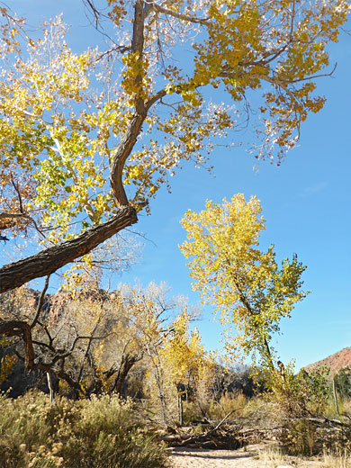
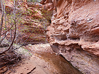
A narrow, winding path heads southeast, towards the canyon of North Creek, passing a wilderness sign just before the rim, a quarter of a mile downstream of the confluence of the two forks. The trail descends the lava layers, steep at the top then less so, over a surface partly covered with loose stones. Once on the canyon floor it turns northeast, alongside the creek to a junction, with a connecting route down the left fork and then, at the confluence, it bears right, crosses the stream and leads up the right fork, initially through a boulder-covered area, then along a bench as the stream straightens. For a short distance the creek is enclosed by vertical cliffs, forming a narrow section, ending with a little waterfall, and then the surroundings open out again; pretty scenery with a few huge cottonwood trees and many wildflowers in the spring.
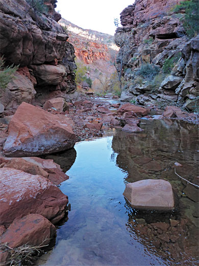
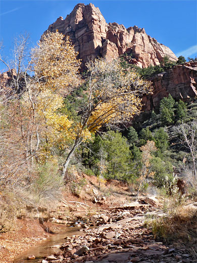
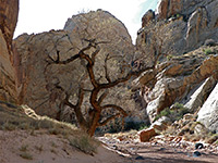
The drainage bends to the right, the streamway now rather wider, with a broad sandy bench to one side. A tributary (Trail Canyon) joins from the south. Next are some more bends and a narrow part below a big red cliff to the north, the tip of South Guardian Angel, and another group of aged cottonwoods. The stream stays fairly straight and gradually becomes a bit more enclosed. Lighter undergrowth allows for faster walking, sometimes on faint trails. Another tributary joins from the north, from a tall cliff along the edge of South Guardian Angel - ending with a cascade at the confluence. The creek curves once more, now with cliff close by to the south and enters a shady section, leading to a cascade and a pool below waterfall, then a confined channel between vertical walls, before a bigger pool that requires wading, the waters up to 3 feet deep and not easily bypassable due to the surrounding cliffs.
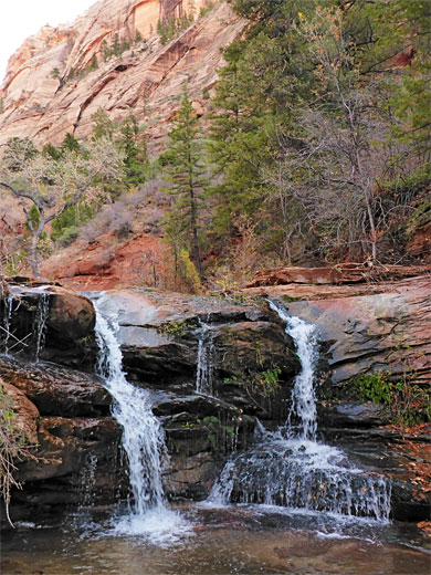
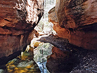
Beyond, the canyon is open again though still generally shady due to the ever-increasing cliffs. The streamway is mostly straight. Progress becomes slower due to more trees and bushes, and the need to cross the stream many times. A few more waterfalls in quick succession are followed by the larger Double Falls, the waters tumbling over a narrow, overhanging ledge, allowing walking right behind the water. This waterfall may be passed without difficulty on the right, and is followed by a few more, passed on the left, partly via a climb through many huge boulders. A grand, curving, semi-subway-like passage below a streaked cliff leads to another waterfall and then Barrier Falls, which is around 20 feet high, nearly sheer and not obviously climbable, though there is a possible route up over slippery rock on the right side, with a lot of exposure.

The lack of visitors is due to several factors - the canyon takes longer to become enclosed, is rather more overgrown towards the upper end, filled in some places by huge boulders, and its narrow section extends only a short distance before an impassable waterfall - Barrier Falls, after 5 miles. But one big advantage is solitude, and the general scenery is just as good, plus there is no need for a permit. The full canyon can be explored from the top down, with some rappelling, starting from the Wildcat Canyon trailhead.
Before Barrier Falls there are, similar to the North Fork, no particular obstacles, just a number of lesser falls, all easily passable. Most of the hike is along benches or through woodland on either side of the creek, with frequent crossings towards the upper reaches. The water is just a few inches deep for much of the year and it is sometimes easiest to walk directly up the streambed. Views for the first few miles are across the wide valley to distant cliffs, becoming more confined after 4 miles, beyond the last significant tributary stream, the eighth. There are plenty of wildflowers all the way, with a different set in the drier, sunny areas compared with the shady, moist sections in the deeper part of the canyon, where more unusual plants include stream orchid and scarlet monkeyflower.
Maps
Right Fork of North Creek topographic map, location map for Zion National Park.
Photographs
48 views of the Right Fork of North Creek.
Right Fork Trailhead
The right fork is provided with a small trailhead, accommodating at most half a dozen vehicles, very different to that for the busy left fork just up the road - the Kolob Reservoir Road, at a point 7 miles north of Hwy 9. The place is surrounded by a flat lava plateau, sprinkled with black boulders and dead trees, result of a 2006 wildfire.
Start of the Route
A narrow, winding path heads southeast, towards the canyon of North Creek, passing a wilderness sign just before the rim, a quarter of a mile downstream of the confluence of the two forks. The trail descends the lava layers, steep at the top then less so, over a surface partly covered with loose stones. Once on the canyon floor it turns northeast, alongside the creek to a junction, with a connecting route down the left fork and then, at the confluence, it bears right, crosses the stream and leads up the right fork, initially through a boulder-covered area, then along a bench as the stream straightens. For a short distance the creek is enclosed by vertical cliffs, forming a narrow section, ending with a little waterfall, and then the surroundings open out again; pretty scenery with a few huge cottonwood trees and many wildflowers in the spring.
The Narrowing Canyon
The drainage bends to the right, the streamway now rather wider, with a broad sandy bench to one side. A tributary (Trail Canyon) joins from the south. Next are some more bends and a narrow part below a big red cliff to the north, the tip of South Guardian Angel, and another group of aged cottonwoods. The stream stays fairly straight and gradually becomes a bit more enclosed. Lighter undergrowth allows for faster walking, sometimes on faint trails. Another tributary joins from the north, from a tall cliff along the edge of South Guardian Angel - ending with a cascade at the confluence. The creek curves once more, now with cliff close by to the south and enters a shady section, leading to a cascade and a pool below waterfall, then a confined channel between vertical walls, before a bigger pool that requires wading, the waters up to 3 feet deep and not easily bypassable due to the surrounding cliffs.
Double Falls and Barrier Falls
Beyond, the canyon is open again though still generally shady due to the ever-increasing cliffs. The streamway is mostly straight. Progress becomes slower due to more trees and bushes, and the need to cross the stream many times. A few more waterfalls in quick succession are followed by the larger Double Falls, the waters tumbling over a narrow, overhanging ledge, allowing walking right behind the water. This waterfall may be passed without difficulty on the right, and is followed by a few more, passed on the left, partly via a climb through many huge boulders. A grand, curving, semi-subway-like passage below a streaked cliff leads to another waterfall and then Barrier Falls, which is around 20 feet high, nearly sheer and not obviously climbable, though there is a possible route up over slippery rock on the right side, with a lot of exposure.
Right Fork Topographic Map

Right Fork of North Creek - Similar Hikes
All Contents © Copyright The American Southwest | Comments and Questions | Contribute | Affiliate Marketing Disclosure | Site Map


