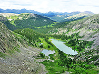
Amphitheater Lake Trail, Grand Teton National Park
Wyoming > Grand Teton National Park > Hiking > Amphitheater Lake Trail
Amphitheater Lake Trail
Route up forested slopes, consistently steep apart from a short level section at the start, reaching Surprise Lake and the more scenic Amphitheater Lake, set in a beautiful granite bowl beneath the slopes of Disappointment Peak
Length: 4.8 miles
Elevation change: 2,960 feet
Difficulty: Strenuous
Type: One way. Two junctions en route, with paths to Bradley Lake and Garnet Canyon
Usage: Low to medium
Season: Late spring, summer, fall
Trailhead: Lupine Meadows
Rating (1-5): ★★★★★
Elevation change: 2,960 feet
Difficulty: Strenuous
Type: One way. Two junctions en route, with paths to Bradley Lake and Garnet Canyon
Usage: Low to medium
Season: Late spring, summer, fall
Trailhead: Lupine Meadows
Rating (1-5): ★★★★★
With an elevation of 9,698 feet, Amphitheater Lake is not quite in Grand Teton National Park's tundra zone, but it does lie above the treeline amidst beautiful scenery of granite cliffs, white boulders and grassy slopes, and is high enough over Jackson Hole valley to allow a great panorama over many square miles of the park. Amphitheater sits in a granite bowl close to the edge of the mountains and so has good views in most directions unlike most backcountry lakes which are hidden away in deep valleys.
The 2,960 foot elevation gain of the five mile path to the lake makes the journey fairly strenuous, but still the trip is one of the most popular day hikes in the area; it also passes a smaller lake (Surprise) and climbs above two others (Bradley and Taggart). Although the trail ends at the edge of Amphitheater Lake, lesser paths climb to the ridge top at either side, revealing the dramatic valleys of Garnet Canyon and Glacier Gulch, this latter containing a sizeable glacier right beneath the highest summits in the Teton Range.
Trail map for Grand Teton National Park.
The Lupine Meadows trailhead is the start point for the Amphitheater Lake Trail, at the end of a 1.5 mile gravel track branching off Teton Park Road just south of Jenny Lake. The track crosses woods and meadowland, good habitat for elk, bison and black bears; it finishes at a shady parking area with rest rooms, information board and trail map.
The Amphitheater Lake Trail starts off level, entering moist, marshy woodland at the side of the meadows, and is partly paved at first, changing to dirt as it begins to climb quite gently, still through thick forest that restricts any sight of the wider surroundings. The route bends round to the west and climbs more steeply along the top of a narrow ridge to a junction (1.7 miles from the start) with a connecting path to Bradley Lake and Taggart Lake, both of which are now clearly visible to the south. The forest fades away and the views remain good for the next mile or so as the main trail starts to ascend via several wide switchbacks up a seemingly endless slope, crossing land covered initially by grass and wildflowers then later by trees once more. The gradient is quite steep but not excessively so - each 1/3 mile zig-zag gains about 250 feet of elevation - and the surface is good, with just a few rocky sections.
A second junction is reached about half way up the hillside, with a one mile spur path into Garnet Canyon, the first ravine south, which contains a year-round stream fed by Middle Teton Glacier. Amphitheater Lake Trail then has three more long switchbacks, now across fully wooded land, followed by a few smaller turns as the surroundings become rockier, the grass and trees interrupted by exposed cliffs and granite boulders. The trail nears the edge of Glacier Gulch to the north, close enough to see the Tetons ahead, though there is still nothing visible above, to the west, except the same tree-clad slopes of the last few miles. But soon the route finally stops climbing, arrives at a plateau, and after a short walk through more trees and past a meadow, the path emerges at the edge of circular Surprise Lake, which is quite pretty despite being mostly ringed by trees, apart from an open, boulder-strewn hillside on the far side.
One last short, gentle climb past a primitive camping area takes the path to the edge of Amphitheater Lake, and to a much more impressive vista since the lake is encircled by tall cliffs on three sides, with white boulders and short yellow grass on the lower slopes, and bare granite higher up. The trail follows the north shore a way, passing plenty of nice places for picnics and photographs. A faint path continues a short distance northwards to the top of a narrow ridge for views of Mount Owen, Teton Glacier and the upper part of Glacier Gorge; the best perspective requires a short climb down the far side of the ridge. A second, better-defined path ascends the south side of the lake to the edge of precipitous, vertical cliffs bordering Garnet Canyon, and an hour or two could be spent exploring the general area. To the west, 11,618 foot Disappointment Peak rises above the lake - still 2,000 feet higher though the peak appears to be fairly easily climbable as the slopes are not too steep.
The 2,960 foot elevation gain of the five mile path to the lake makes the journey fairly strenuous, but still the trip is one of the most popular day hikes in the area; it also passes a smaller lake (Surprise) and climbs above two others (Bradley and Taggart). Although the trail ends at the edge of Amphitheater Lake, lesser paths climb to the ridge top at either side, revealing the dramatic valleys of Garnet Canyon and Glacier Gulch, this latter containing a sizeable glacier right beneath the highest summits in the Teton Range.
Location
Trail map for Grand Teton National Park.
Trailhead for Amphitheater Lake
The Lupine Meadows trailhead is the start point for the Amphitheater Lake Trail, at the end of a 1.5 mile gravel track branching off Teton Park Road just south of Jenny Lake. The track crosses woods and meadowland, good habitat for elk, bison and black bears; it finishes at a shady parking area with rest rooms, information board and trail map.
Start of the Path
The Amphitheater Lake Trail starts off level, entering moist, marshy woodland at the side of the meadows, and is partly paved at first, changing to dirt as it begins to climb quite gently, still through thick forest that restricts any sight of the wider surroundings. The route bends round to the west and climbs more steeply along the top of a narrow ridge to a junction (1.7 miles from the start) with a connecting path to Bradley Lake and Taggart Lake, both of which are now clearly visible to the south. The forest fades away and the views remain good for the next mile or so as the main trail starts to ascend via several wide switchbacks up a seemingly endless slope, crossing land covered initially by grass and wildflowers then later by trees once more. The gradient is quite steep but not excessively so - each 1/3 mile zig-zag gains about 250 feet of elevation - and the surface is good, with just a few rocky sections.
End of the Path
A second junction is reached about half way up the hillside, with a one mile spur path into Garnet Canyon, the first ravine south, which contains a year-round stream fed by Middle Teton Glacier. Amphitheater Lake Trail then has three more long switchbacks, now across fully wooded land, followed by a few smaller turns as the surroundings become rockier, the grass and trees interrupted by exposed cliffs and granite boulders. The trail nears the edge of Glacier Gulch to the north, close enough to see the Tetons ahead, though there is still nothing visible above, to the west, except the same tree-clad slopes of the last few miles. But soon the route finally stops climbing, arrives at a plateau, and after a short walk through more trees and past a meadow, the path emerges at the edge of circular Surprise Lake, which is quite pretty despite being mostly ringed by trees, apart from an open, boulder-strewn hillside on the far side.
Amphitheater Lake
One last short, gentle climb past a primitive camping area takes the path to the edge of Amphitheater Lake, and to a much more impressive vista since the lake is encircled by tall cliffs on three sides, with white boulders and short yellow grass on the lower slopes, and bare granite higher up. The trail follows the north shore a way, passing plenty of nice places for picnics and photographs. A faint path continues a short distance northwards to the top of a narrow ridge for views of Mount Owen, Teton Glacier and the upper part of Glacier Gorge; the best perspective requires a short climb down the far side of the ridge. A second, better-defined path ascends the south side of the lake to the edge of precipitous, vertical cliffs bordering Garnet Canyon, and an hour or two could be spent exploring the general area. To the west, 11,618 foot Disappointment Peak rises above the lake - still 2,000 feet higher though the peak appears to be fairly easily climbable as the slopes are not too steep.
Amphitheater Lake - Similar Hikes
All Contents © Copyright The American Southwest | Comments and Questions | Contribute | Affiliate Marketing Disclosure | Site Map


