National Parks, National Monuments and National Recreation Areas in Wyoming
Other Wyoming listings: state parks.
| Bighorn Canyon National Recreation Area (NPS) A long, branched reservoir on the Big Horn River enclosed by steep cliffs is the main attraction of Bighorn Canyon NRA, extending for 60 miles across north Wyoming and south Montana. The mountainous surroundings mean that overland access to the lake is rather limited; the two main centers for visitors are near Fort Smith, MT and 9 miles north of Lovell, WY. |
|
| Devils Tower National Monument (NPS) The distinctive sheer-sided, flat-topped volcanic peak known as Devils Tower has been protected as a national monument since 1906, first to be created in the USA. The monument is small in size, just 2 square miles, containing the peak and an area of woodland and meadows around the base. The nearest major town is Sundance, 27 miles south along interstate 90. |
|
Formed by a concrete dam built in 1964 across the Green River in northeast Utah, Flaming Gorge Reservoir extends for 91 miles northwards into Wyoming - a long, branched lake surrounded by sloping, treeless hills for most of its extent, but enclosed within a deep, red rock canyon at the southern end. Fishing, boating, swimming, camping and rock climbing are the main activities, together with driving along the scenic roads around the lake. Description | Map | Photographs |
|
| Fort Laramie National Historic Site (NPS) In east Wyoming near the border with South Dakota, Fort Laramie was built during 1834 and saw service for 56 years as a supply center, trading post and military base. The well preserved collection of buildings is now protected as a national historic site, viewable on a self-guided tour. |
|
One of the most productive locations in the USA for fossils of the Eocene era is preserved as a little-visited national monument, occupying a small area of grassy mesas and sagebrush valleys 15 miles from Kemmerer in southwest Wyoming. There are two loop trails, one to an old cabin and the site of a historic fossil quarry, the other through aspen groves at the foot of the main fossil-bearing mesa, plus a seven mile park road which climbs to the mesa top and offers good views of the wider landscape. Description and Map | Photographs |
|
The Teton Range rises over 5,000 feet in a horizontal distance of just a few miles, without any intervening foothills, making this perhaps the most spectacular series of mountains in the USA. The eastern half of the range is contained within Grand Teton National Park, one of the top hiking and climbing destinations in the country, and also famous for its varied and plentiful wildlife. The other two major features of the park are 25,540 acre Jackson Lake and the wide valley of the Snake River, known as Jackson Hole. Description | Map | Photographs | Hiking | Teton Park Road | US 191/89 |
|
| John D Rockefeller Jr Memorial Parkway (NPS) The 8 mile section of US 89/191 linking the Yellowstone and Grand Teton National Parks was designated a memorial parkway in 1972, in recognition of the philanthropic efforts of John D Rockefeller Jr, which included a major contribution to the protection of the Teton Range. The preserve also contains part of the forest on both sides of the highway, mostly to the west. |
|
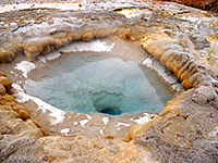
The incomparable Yellowstone National Park in northwest Wyoming is world-famous for three factors: the amazing geothermal features - over 10,000 geysers, hot springs, fumaroles & mudpots, the beautiful mountain scenery and the abundant wildlife, which includes bison, elk, moose, wolves, black bears and grizzly bears. Yellowstone was the World's first national park when created in 1872, and would be even more popular were it not for its rather remote location and limited visitor season - heavy snow causes closure for 5 months during winter. Description | Map | Southeast | East | North | Northwest | Southwest |
All Contents © Copyright The American Southwest | Comments and Questions | Contribute | Affiliate Marketing Disclosure | Site Map


