West Wyoming Hiking Trails
Other places include Fossil Butte National Monument and the Wind River Range.
Map shows trailhead locations
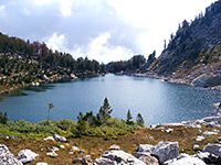
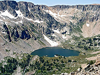
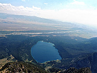
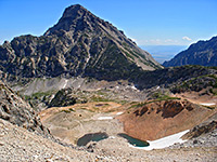
| 1. Amphitheater Lake, Grand Teton National Park Length 4.8 miles (7.7 km) Elevation change 2960 feet (902 meters) Difficulty Strenuous Rating (1-5) ★★★★★ Route up forested slopes, consistently steep apart from a short level section at the start, reaching Surprise Lake and the more scenic Amphitheater Lake, set in a beautiful granite bowl beneath the slopes of Disappointment Peak. |
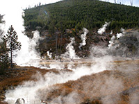
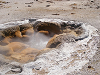
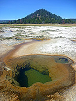
| 2. Artists Paintpots, Yellowstone National Park Length 0.6 miles (1 km) Elevation change 80 feet (24 meters) Difficulty Easy Rating (1-5) ★★★★★ Many people drive through Gibbon Geyser Basin without stopping, en route to Norris, but just half a mile from the road is an especially colorful and varied collection of hot pools, mudpots and small geysers, reached by an easy path. The starting point is 4.5 miles south of Norris and well signposted - the trail crosses a meadow and enters pine forest on the slopes of Paintpot Hill, ending with a small loop around the formations. |
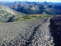
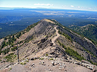
| 3. Avalanche Peak, Yellowstone National Park Length 2.5 miles (4 km) Elevation change 2120 feet (646 meters) Difficulty Strenuous - steep, and mostly straight uphill with no switchbacks Rating (1-5) ★★★★★ The unmarked but well maintained path to Avalanche Peak, one of several mountains along the eastern park boundary, starts just west of Eleanor Lake along the East Entrance Road, and climbs steadily through forest to bare rock and scree slopes around the summit. |
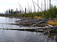
| 4. Beaver Ponds, Yellowstone National Park Length 5.0 miles (8 km); (loop) Elevation change 450 feet (137 meters) Difficulty Easy Rating (1-5) ★★★★★ The pleasant trail to a group of beaver-inhabited ponds north of Mammoth village has two trailheads 1/4 mile apart, one near Liberty Cap, the other at the end of the old Gardiner High Road, next to Mammoth Hotel. The clockwise loop starts by a steepish climb through fir and spruce trees along Clematis Creek then forks north (straight on leads to the Sepulcher Mountain Loop Trail) across the foothills of Sepulcher Mountain, the route now mostly level, to the ponds. The return is at a lower elevation, through an area often frequented by elk, moose and deer. |
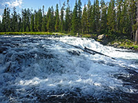
| 5. Bechler Falls, Yellowstone National Park Length 1.3 miles (2.1 km) Elevation change 60 feet (18 meters) Difficulty Easy Rating (1-5) ★★★★★ This short hike follows the southernmost section of the Bechler River Trail starting at Cave Falls, past the Bechler River-Falls River confluence to Bechler Falls, a small waterfall but still quite powerful. The trailhead is at the end of Cave Falls Road, in the remote southwest corner of the park. |
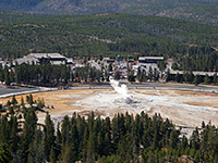
| 6. Biscuit Basin, Yellowstone National Park Length 0.4 miles (0.6 km); (loop) Elevation change level feet (0 meters) Difficulty Easy Rating (1-5) ★★★★★ Biscuit Basin contains a group of small geysers and springs next to the highway, at the north edge of the Upper Geyser Basin. The loop trail passes all main features, and links with longer hikes to Mystic Falls, Fairy Creek and Summit Lake. |
| 7. Black Sand Basin, Yellowstone National Park Length 0.3 miles (0.5 km); (loop) Elevation change level feet (0 meters) Difficulty Easy Rating (1-5) ★★★★★ On the west side of the highway near Old Faithful, Black Sand Basin contains five large geysers and pools plus other smaller features, viewable from a short, branched footpath. |
| 8. Blacktail Deer Creek, Yellowstone National Park Length 3.5 miles (5.6 km) Elevation change 1100 feet (335 meters) Difficulty Moderate Rating (1-5) ★★★★★ Blacktail Deer Creek provides the main access into the Black Canyon of the Yellowstone River from the south. Most of the trail crosses relatively open ground with grassy meadows and patches of woodland though the last part is steep, down a narrow ravine as it approaches the river, which is crossed on a footbridge. On the far side the path joins the Yellowstone River Trail, close to Crevice Lake and 3 primitive campsites. The trailhead is 7 miles east of Mammoth. |
| 9. Boundary Creek, Yellowstone National Park Length 8.4 miles (13.5 km); to Dunanda Falls Elevation change 350 feet (107 meters) Difficulty Moderate - not strenuous, but long Rating (1-5) ★★★★★ Boundary Creek is a tributary of the Bechler River on which are found 2 major waterfalls. From the Bechler River ranger station, a trail passes through flat forest and meadowland for 8 miles to the edge of a plateau, where the creek enters a ravine and flows over 150 foot Dunanda Falls. A nearby side canyon contains the 250 foot Silver Scarf Falls. Above the falls, the path continues further up Boundary Creek Canyon to the west boundary of the national park. |
| 10. Bunsen Peak, Yellowstone National Park Length 4 miles (6.4 km) Elevation change 1380 feet (421 meters) Difficulty Moderate Rating (1-5) ★★★★★ Bunsen Peak, a circular, solitary, volcanic summit, affords excellent views of the Mammoth area and the surrounding mountains. Starting from the main road just south of its descent into Golden Gate Canyon, a 2 mile trail winds up the partially wooded west side to the summit, then continues 2 more miles down the east slope to the disused Bunsen Peak Road. From here the trailhead is 3 miles west. The full route over the peak could be combined with a trip to Osprey Falls for a 9 mile round trip. |
| 11. Cascade Canyon, Grand Teton National Park Length 11.6 miles (18.7 km); to Paintbrush Divide Elevation change 3975 feet (1212 meters) Difficulty Strenuous Rating (1-5) ★★★★★ Most popular hiking destination in the park; a forested, glacial canyon leading deep into the mountains, eventually reaching Lake Solitude and Paintbrush Divide. At the lower end, two oft-visited locations are Hidden Falls and Inspiration Point. |
| 12. Cascade Lake, Yellowstone National Park Length 2.25 miles (3.6 km) Elevation change 80 feet (24 meters) Difficulty Easy Rating (1-5) ★★★★★ This easy half day hike descends into the valley of Cascade Creek, through meadows and across several small streams then along the main creek westwards to Cascade Lake, from where other trails continue further west, including the ascent up Observation Peak. |
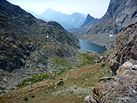
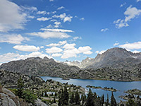
| 13. Cirque of the Towers, Wind River Range Length 8.5 miles (13.7 km) Elevation change 1700 feet (518 meters) Difficulty Moderate and fairly level for the first 6 miles, steep and strenuous thereafter Rating (1-5) ★★★★★ Spectacular glacial basin high in the Wind River Range, surrounded on three sides by a curving line of 12,000 foot granite peaks. Reached by a long but not too difficult hike, mostly on the Big Sandy Trail. |
| 14. Crater Hills, Yellowstone National Park Length 1 mile (1.6 km) Elevation change 200 feet (61 meters) Difficulty Easy Rating (1-5) ★★★★★ There is no trail to the Crater Hills, location of a fascinating and colorful collection of hot springs and sulphurous vents, but this backcountry thermal area near Hayden Valley can be visited by an easy hike across bison-frequented grasslands. |
| 15. Death Canyon and Albright Peak, Grand Teton National Park Length 7 miles (11.3 km); to Albright Peak Elevation change 3770 feet (1149 meters) Difficulty Strenuous Rating (1-5) ★★★★★ The Death Canyon Trail passes through woodland and meadows, while climbing quite steeply at first then less so, and finally peaks at 9,600 foot Fox Creek Pass on the park boundary, where other routes branch off to the north, south and west. But for a day hike, one suitable target is the junction with the Alaska Basin Trail after 3.8 miles - in quite an open and scenic part of the canyon. This trail rises very steeply from the valley floor passing close to Albright Peak and reaching a highpoint of 10,800 feet at Static Peak Divide, before crossing the park boundary and descending into Alaska Basin. |
| 16. Divide Lookout, Yellowstone National Park Length 1.5 miles (2.4 km) Elevation change 740 feet (226 meters) Difficulty Easy to moderate Rating (1-5) ★★★★★ Beginning on the main road 7 miles east of Old Faithful, this short, unmarked trail climbs up a steep, wooded ravine to a summit on the continental divide, at 8,779 feet. Along the way are good views over the southwest of the national park, including Shoshone Lake and Mount Sheridan. |
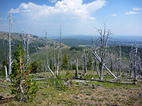
| 17. Duck Lake, Yellowstone National Park Length 0.5 miles (0.8 km) Elevation change 100 feet (30 meters) Difficulty Easy Rating (1-5) ★★★★★ This short path passes over land recovering from the 1988 fires - starting at the parking area for the West Thumb Geyser Basin, the trail climbs a small hill to a viewpoint of Duck Lake then leads down to a beach on its north shore. |
| 18. Elephant Back Mountain, Yellowstone National Park Length 3.6 miles (5.8 km); (loop) Elevation change 800 feet (244 meters) Difficulty Moderate Rating (1-5) ★★★★★ Elephant Back Mountain is a straight, flat-topped, steep-sided peak overlooking the northwest corner of Yellowstone Lake. Starting at Lake Village, a loop trail climbs the east corner, follows the rim for a short distance then descends by an alternative route, giving excellent views over the lake and surrounding mountains, though most of the route is densely forested. Grizzly bear activity sometimes causes the trail to be temporarily closed. |
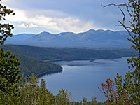
| 19. Emma Matilda Lake, Grand Teton National Park Length 1.8 miles (2.9 km) Elevation change 100 feet (30 meters) Difficulty Easy Rating (1-5) ★★★★★ Pleasant trail, good for wildlife, that starts across marshy ground near Christian Creek, climbs slightly to a viewpoint of pretty Christian Pond then leads through partly wooded land to the south edge of a large lake. |
| 20. Fairy Falls and Imperial Geyser, Yellowstone National Park Length 2.4 miles (3.9 km); 3 miles to the geysers Elevation change 0 feet (0 meters) Difficulty Easy Rating (1-5) ★★★★★ At Fairy Falls, Fairy Creek cascades 200 feet down the edge of Madison Plateau then flows northwards across marshy ground into the Lower Geyser Basin. The easiest way to reach the falls is from a trail that starts at the end of a very short side road leading to a footbridge over the Firehole River, a mile south of Midway Geyser Basin - this is the south end of an old vehicle track that links with the main road again at Fountain Flats after 4.5 miles, and provides alternative access to the falls from the north. This level track follows the side of the valley for a mile, past Grand Prismatic Spring to a junction with a narrower path that heads west to Fairy Falls, and links with the Fairy Creek Trail to reach several nearby geysers. |
| 21. Fossil Lake Trail, Fossil Butte National Monument Length 1.5 miles (2.4 km); (loop) Elevation change 300 feet (91 meters) Difficulty Easy Rating (1-5) ★★★★★ The one trail along the main park road loops around the foothills of Fossil Butte for 1.5 miles, through land once under the subtropical lake, en route passing a small quarry where fossils are still being unearthed. |
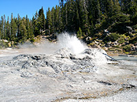
| 22. Fountain Paint Pots, Yellowstone National Park Length 0.5 miles (0.8 km); (loop) Elevation change 0 feet (0 meters) Difficulty Easy Rating (1-5) ★★★★★ Several dozen hot pools, mudpots, fumaroles and geysers are found along this short path near the Firehole Lake Drive in the Lower Geyser Basin. |
| 23. Gibbon Hill and Geyser Creek Groups, Yellowstone National Park Length 3.6 miles (5.8 km); (loop) Elevation change 300 feet (91 meters) Difficulty Moderate - cross-country navigation, in places across boggy and or overgrown terrain Rating (1-5) ★★★★★ Off-trail hike to two backcountry thermal areas within Gibbon Geyser Basin, west of Artists Paintpots, containing several active geysers, plus many pools, vents and mudpots. Great care needed in many locations due to unstable ground and thin sinter crusts. |
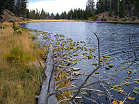
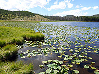
| 24. Harlequin Lake, Yellowstone National Park Length 0.4 miles (0.6 km) Elevation change 100 feet (30 meters) Difficulty Easy Rating (1-5) ★★★★★ Harlequin is a minor, shallow lake at the foot of Purple Mountain, on the north side of the highway, 1.5 miles west of Madison Junction. The path leading to it passes through new growth pine woodland and ends next to the water, which is lined with reeds and pond lilies. |
| 25. Heart Lake, Yellowstone National Park Length 16 miles (25.7 km) Elevation change 700 feet (213 meters) Difficulty Moderate Rating (1-5) ★★★★★ This relatively popular trail into one of Yellowstone's backcountry geyser basins also passes varied scenery of pine forest, open plateauland, mountains, river valleys and Heart Lake itself. The north end begins from the park road, opposite the northeast corner of Lewis Lake, while the south trailhead is along the South Boundary Trail, 5.5 miles east of the road. The full distance needs at least one night camping though Heart Lake Geyser Basin is easily reached on a day hike, being between 4 and 7 miles from the road. Aside from the thermal features, all unfenced and undamaged, the main attractions are the lake - the best in Yellowstone for fishing, and the wildlife, with moose and bears quite frequently encountered. |
| 26. Hermitage Point, Grand Teton National Park Length 4.7 miles (7.6 km) Elevation change 100 feet (30 meters) Difficulty Easy to moderate Rating (1-5) ★★★★★ Loop trail across a fairly flat but heavily wooded promontory on the east side of Jackson Lake. Two scenic pools (Heron Pond and Swan Lake) are reached near the trailhead; thereafter the hike is mostly through the woods, until arriving at a stony beach at the end of the peninsula. |
| 27. Heron Pond/Swan Lake, Grand Teton National Park Length 3.0 miles (4.8 km); (loop) Elevation change 40 feet (12 meters) Difficulty Easy Rating (1-5) ★★★★★ South of the Colter Bay visitor center, three interconnected paths lead to two marshy pools (Heron Pond and Swan Lake), which are likely places to spot wildlife such as beaver and moose. There are several route options for a loop hike. |
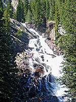
| 28. Hidden Falls and Inspiration Point, Grand Teton National Park Length 2.5 miles (4 km); less 2 miles if using the shuttle boat Elevation change 417 feet (127 meters) Difficulty Easy Rating (1-5) ★★★★★ At the far side of Jenny Lake (reached by trail or shuttle boat), the first point of interest is Hidden Falls, a pretty, 100 foot whitewater cascade on the creek emerging out of the canyon. A side path climbs a little further to Inspiration Point, on a cliff high above the lake, from where the views extend all across Jackson Hole and the Snake River towards the distant Wind River Mountains. |
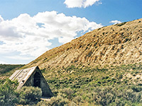
| 29. Historic Quarry Trail, Fossil Butte National Monument Length 2.5 miles (4 km); (loop) Elevation change 600 feet (183 meters) Difficulty Moderate Rating (1-5) ★★★★★ The longer of the two maintained paths in Fossil Butte National Monument begins along county road 300, close to the railway bridge. The trail sets off into a range of small hills along the south edge of Fossil Butte and climbs to the site of an old fossil quarry, in operation until the 1960s. Nearby is a short diversion to a log dwelling used by David C Haddenham and his family during their excavations at the quarry. |
| 30. Ice Lake, Yellowstone National Park Length 0.3 miles (0.5 km) Elevation change 30 feet (9 meters) Difficulty Easy Rating (1-5) ★★★★★ This very short trail leads to a pretty, tree-lined lake in fairly level land beside the Gibbon River, covered by fir and pine trees partly burned in 1988. The trailhead is on the north side of the highway and 3.5 miles east of Norris; once at Ice Lake, the path continues 0.7 miles to a junction with a section of the Howard Eaton Trail. Left leads to Norris campground while right joins the Wolf Lake Trail after 1.5 miles. |
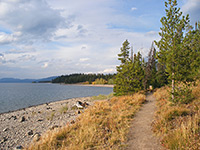
| 31. Lakeshore Trail, Grand Teton National Park Length 1.8 miles (2.9 km); (loop) Elevation change 0 feet (0 meters) Difficulty Easy Rating (1-5) ★★★★★ Easy path along the Jackson Lake shoreline near Colter Bay, across a causeway and all around the edge of a small, isolated forested peninsula, passing a few secluded pebbly beaches. |
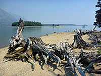
| 32. Leigh Lake and Moran Bay, Grand Teton National Park Length 6.5 miles (10.5 km); to the lagoon and a view of Moran Bay Elevation change 140 feet (43 meters) Difficulty Moderate Rating (1-5) ★★★★★ A mostly level trail that starts at String Lake, runs all along the forested east shore of Leigh Lake then reaches two much smaller lakes (Bearpaw and Trapper). A continuation path descends a little to Bearpaw Bay on Jackson Lake, where the shoreline can be followed northwest towards Moran Bay, past several islands and a scenic lagoon filed with dead tree stumps |
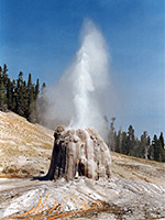
| 33. Lone Star Geyser, Yellowstone National Park Length 2.5 miles (4 km) Elevation change 60 feet (18 meters) Difficulty Easy Rating (1-5) ★★★★★ The most accessible backcountry geyser basin in Yellowstone - centered around Lone Star Geyser - is reached by an easy trail that follows an old service road through undamaged forest beside the Firehole River, starting at the parking area for the Kepler Cascades. |
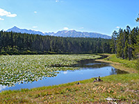
| 34. Lost Lake, Yellowstone National Park Length 4 miles (6.4 km); (loop) Elevation change 600 feet (183 meters) Difficulty Easy to moderate Rating (1-5) ★★★★★ Starting right next to Roosevelt Lodge at Tower Junction, this loop trail climbs a wooded hillside and enters a hidden valley containing lily pad-covered Lost Lake, then follows Yancey Creek at the far side of the lake to a petrified redwood tree, which can also be reached by a short spur road branching off the main highway. From here, the return to the trailhead is due east, across a grassy hill. Near the start, a short side path leads to the 40 foot Lost Creek Falls. |
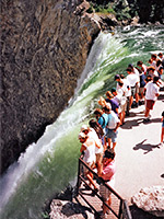
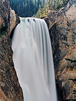
| 35. Lower Falls, Yellowstone National Park Length 0.75 miles (1.2 km) Elevation change 600 feet (183 meters) Difficulty Easy to moderate Rating (1-5) ★★★★★ The steep but very popular path to the brink of the lower falls of the Yellowstone River begins from the southernmost parking area along the one-way North Rim Drive. It switchbacks down the wooded canyon walls to a fenced viewpoint right beside the fast-flowing river. |
| 36. Mallard Lake, Yellowstone National Park Length 3 miles (4.8 km) Elevation change 660 feet (201 meters) Difficulty Easy to moderate Rating (1-5) ★★★★★ The relatively popular trail to Mallard Lake starts on the east side of the Old Faithful visitor complex by crossing the Firehole River on a footbridge then begins a steady ascent up a narrow ravine through pine forest partly burned in 1988. A stream running close to the trail flows past a number of hot pools and mudpots after about half a mile. Above the ravine is a rather steeper climb to flat-topped ridge, and a junction with the Mallard Creek Trail. The lake is a short distance further, down a slope. |
| 37. Mammoth Terraces, Yellowstone National Park Length 2.8 miles (4.5 km); loop, for all areas Elevation change 520 feet (158 meters) Difficulty Easy Rating (1-5) ★★★★★ The terraces, pools and dormant thermal features of Mammoth Hot Springs; the lower section is viewed by a series of short, interconnected loop trails (totaling one mile), while the more overgrown, less visited upper section is crossed by a narrow, one-way road, also suitable for hiking. A longer loop, still relatively easy, accesses all areas. |
| 38. Midway Geyser Basin, Yellowstone National Park Length 0.5 miles (0.8 km); (loop) Elevation change 40 feet (12 meters) Difficulty Easy Rating (1-5) ★★★★★ The smallest of the three geyser basins along the Firehole River is viewed from a short boardwalk trail that crosses the river then loops around Grand Prismatic Spring and Excelsior Geyser. |
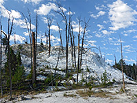
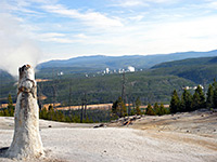
| 39. Monument Geyser Basin, Yellowstone National Park Length 1 mile (1.6 km) Elevation change 600 feet (183 meters) Difficulty Moderate - steep climb to the basin Rating (1-5) ★★★★★ Monument is a largely extinct geyser basin on a hillside at the south edge of Gibbon Meadows, consisting of dormant white geyserite cones, a few of which occasionally emit puffs of steam. The trail begins half a mile south of the Artist Paintpots beside a road bridge over the Gibbon River; it follows the river northwards then bends back southwest, climbing steeply through new growth pine woods to the basin. |
| 40. Morning Mist Springs and the Quagmire Group, Yellowstone National Park Length 2.5 miles (4 km); round trip Elevation change 250 feet (76 meters) Difficulty Easy Rating (1-5) ★★★★★ Loop hike, partly off trail, to two backcountry thermal areas of the Lower Geyser Basin; a group of small pools in open grassland near Nez Perce Creek, and a more secluded collection of larger springs, beneath a wooded hillside |
| 41. Mount Washburn, Yellowstone National Park Length 3 miles (4.8 km); from the south trailhead Elevation change 1600 feet (488 meters) Difficulty Moderate Rating (1-5) ★★★★★ Three routes climb to the summit of Mount Washburn, a 10,243 foot peak north of the Canyon area and the site of the main fire lookout point in the national park. The shortest (2.25 miles) begins at the end of a gravel track (Chittenden Road) forking off the main road from Norris to Canyon Junction, and ascends a ridge on the north side of the peak. The other short option (3 miles) leaves the road by its highpoint at Dunraven Pass and switchbacks up the steeper south face of the mountain. The third route begins 3 miles along the Seven Mile Hole Trail, where a 5.5 mile spur path branches northwards, crossing woodland, meadows and the Washburn Hot Springs thermal area before climbing the east side of Mount Washburn. Views from the top extend south to the Grand Teton range on a clear day. Other attractions are spectacular displays of wildflowers in early summer, and the chance to see bighorn sheep. |
| 42. Mystic Falls, Yellowstone National Park Length 1.2 miles (1.9 km) Elevation change 150 feet (46 meters) Difficulty Easy to moderate Rating (1-5) ★★★★★ Mystic Falls is a cascade on the Little Firehole River, where the waters drop 70 feet within a narrow ravine, shortly before joining the main river, and can be reached by an easy spur path that branches off the southern end of the Fairy Creek Trail. Starting at the edge of Biscuit Basin, the route is to follow the path heading west towards the forest, past one junction, fork left at the next junction (right is to Fairy Creek) and right at the third junction (left is to Summit Lake); this trail soon enters the ravine and passes the falls, 1.2 miles from the start. The path continues by climbing another 350 feet up the hillside and rejoining the Fairy Creek Trail. Turning right leads to an overlook of Biscuit Basin before descending back towards the starting point, a total loop of about 3 miles. |
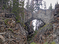
| 43. Natural Bridge, Yellowstone National Park Length 1.25 miles (2 km) Elevation change 100 feet (30 meters) Difficulty Easy Rating (1-5) ★★★★★ The small natural rhyolite bridge along Bridge Creek, on the west side of Yellowstone Lake, was discovered in 1871 and used to be accessible by car, but the narrow road leading to it has recently been closed to vehicular travel so approach is by foot or bicycle only. Alternative access is from Bridge Bay campsite, from where a 1 mile path crosses woodland and joins the road about half way along. |
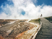
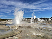
| 44. Norris Geyser Basin, Yellowstone National Park Length 2.25 miles (3.6 km); (loops) Elevation change 100 feet (30 meters) Difficulty Easy Rating (1-5) ★★★★★ Two wide footpaths loop through the fascinating volatile landscapes at Norris Geyser Basin - a 3/4 mile boardwalk trail across the white expanse of Porcelain Basin and a 1.5 mile route through the more isolated geysers and springs of Back Basin. This is by far the most popular hike in the Norris region. |
| 45. Observation Peak, Yellowstone National Park Length 3 miles (4.8 km) Elevation change 1400 feet (427 meters) Difficulty Moderate Rating (1-5) ★★★★★ The route to the top of 9,397 foot Observation Peak starts at Cascade Lake, 2.25 miles west of the main road near Canyon Junction; it switchbacks up steep slopes then follows a more open ridge to the summit, passing through forests of whitebark pine mixed with grassy meadows. From the top stretches a 360° view of the north Yellowstone wilderness, over Norris Basin, the Grand Canyon, Hayden Valley and towards even higher peaks in the Washburn Range to the north. |
| 46. Observation Point, Yellowstone National Park Length 1.1 miles (1.8 km); (loop) Elevation change 160 feet (49 meters) Difficulty Easy Rating (1-5) ★★★★★ The Observation Point loop trail branches off the main path through the Upper Geyser Basin, climbs a short, steep, wooded hillside to a viewpoint of Old Faithful and nearby features, then continues across the hill to Solitary Geyser, a bubbling pool in an open area of the forest. |
| 47. Paintbrush Canyon, Grand Teton National Park Length 7.9 miles (12.7 km); to Paintbrush Divide Elevation change 3870 feet (1180 meters) Difficulty Strenuous Rating (1-5) ★★★★★ Long, testing but very scenic trail starting near String Lake and climbing all the way up U-shaped Paintbrush Canyon, past Holly Lake to a highpoint at 10,700 foot Paintbrush Divide |
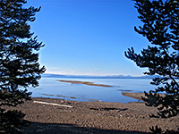
| 48. Pelican Creek, Yellowstone National Park Length 1 mile (1.6 km); (loop) Elevation change 0 feet (0 meters) Difficulty Easy Rating (1-5) ★★★★★ At the mouth of Pelican Creek, this easy path loops through marshes and woodland south of the park road to the shore of Yellowstone Lake. The trailhead is a mile east of Fishing Bridge. The beaches of this part of the lake are a good place for bird watching and for photographing the sunset. |
| 49. Pelican Valley, Yellowstone National Park Length 12 miles (19.3 km) Elevation change 500 feet (152 meters) Difficulty Moderate Rating (1-5) ★★★★★ The lower few miles of the valley of Pelican Creek are very wide, flat and grassy - perfect wildlife conditions, and all the large mammals of Yellowstone may be found here, including wolves. The upper section is rather narrower, winding northwards between hills of increasing height, through several groups of hot springs and pools. Pelican Valley Trail begins at the end of a short side road branching off the highway at the north end of Yellowstone Lake, cuts across a low ridge and follows beside the creek for most of its 12 miles, past several junctions with other backcountry trails. Bear activity sometimes causes the trail to be closed, and when open it is recommended hikers travel in groups of 4 or more. |
| 50. Periodic Spring, Periodic Spring Length 1 mile (1.6 km) Elevation change 550 feet (168 meters) Difficulty Easy Rating (1-5) ★★★★★ Secluded mountain stream near Afton which starts and stops at regular intervals; one of only a few such intermittent springs in the world. Reached by a 4 mile forest track then a one mile trail. |
| 51. Purple Mountain, Yellowstone National Park Length 2.5 miles (4 km) Elevation change 1560 feet (475 meters) Difficulty Moderate Rating (1-5) ★★★★★ The trailhead for the relatively short but steep trail to the top of 8,433 foot Purple Mountain begins along the main road a quarter mile east of the junction at Madison. The path crosses a meadow then climbs the south-facing slopes, which bear dense lodgepole pine woodland. At the summit is a lookout point and extensive views in some directions; the peak is the highest for some distance though the mountain is flat topped so the outlook to the north and west is rather restricted. |
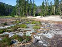
| 52. Rabbit Creek Group, Yellowstone National Park Length 3 miles (4.8 km); round trip Elevation change 200 feet (61 meters) Difficulty Moderate; requires cross-country navigation Rating (1-5) ★★★★★ Off trail hike across meadows and through woodland, to a backcountry thermal area around the upper end of a short, east-side tributary of the Firehole River; about 40 major hot springs, of varying colors and activity levels. The springs are divided into two dispersed groups, separated by a short, wooded slope; land around the lower section is quite open, mostly extensive white flats, while the upper area is wooded and some pools are completely enclosed by dense forest. |
| 53. Ribbon Lake, Yellowstone National Park Length 2 miles (3.2 km) Elevation change 120 feet (37 meters) Difficulty Easy Rating (1-5) ★★★★★ Ribbon is one of a small group of lakes on the south rim of Yellowstone's Grand Canyon, and reached by several routes; the shortest begins at the end of the rim road at Artist Point, following the South Rim Trail for a while then branching off to the south, and later bending back east. A spur path continues 1/4 mile past the lake to the top of Silver Cord Cascade, while an alternative return is via the hot pools and mudpots of Forest Springs. |
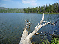
| 54. Riddle Lake, Yellowstone National Park Length 1.75 miles (2.8 km) Elevation change 80 feet (24 meters) Difficulty Easy Rating (1-5) ★★★★★ From a trailhead along the main road, 2.5 miles south of Grant Village and right on the continental divide, this easy hike descends gradually through new growth lodgepole forest to the upper end of Riddle Lake. The shallow mountain lake is lined with reeds and marshland, and is a good place to spot wildlife including bear and moose. |
| 55. Sentinel Meadows, Yellowstone National Park Length 2.2 miles (3.5 km) Elevation change 40 feet (12 meters) Difficulty Easy Rating (1-5) ★★★★★ At the north edge of the Lower Geyser Basin, Sentinel Meadows offers a quick hike to a backcountry thermal region, containing geyser cones and a selection of hot pools of varying sizes. The trail begins at the end of the Fountain Flats road, crosses the Firehole River and follows Sentinel Creek westwards into the meadows. |
| 56. Sepulcher Mountain, Yellowstone National Park Length 7 miles (11.3 km); (loop) Elevation change 3360 feet (1024 meters) Difficulty Strenuous Rating (1-5) ★★★★★ Sepulcher is the highest peak in the Mammoth area, at 9,652 feet. The strenuous route to the top begins a mile along the path to Beaver Ponds - from here, the path continues its ascent up Clematis Creek then climbs to a ridge high above, following this northwards to the summit. The loop continues by descending the southern slopes into the valley of Glen Creek and on to the end of the Snow Pass Trail. Including the access trails, the full loop is 11 miles. |
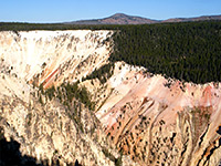
| 57. Seven Mile Hole, Yellowstone National Park Length 5.5 miles (8.8 km) Elevation change 1400 feet (427 meters) Difficulty Moderate to strenuous Rating (1-5) ★★★★★ One of the best hikes in all of Yellowstone, this route winds through dense pine forest, past active and inactive thermal areas, then descends to the edge of the Yellowstone River, deep within its Grand Canyon. |
| 58. Shoshone Lake, Yellowstone National Park Length 20.5 miles (33 km) Elevation change 400 feet (122 meters) Difficulty Moderate - not difficult, but long Rating (1-5) ★★★★★ The trail to Shoshone Geyser Basin and Shoshone Lake begins at the parking area for the Kepler Cascades, and first reaches Lone Star Geyser after 2.5 miles. A short distance beyond are more hot springs and pools in meadows and woodland along the upper Firehole River, then the path climbs a ridge to Grants Pass on the continental divide and drops down the far side into the valley of Shoshone Creek, where the Bechler River Trail forks off to the south. The geyser basin, and the west side of the lake, are 2 miles further at the mouth of the valley (8.5 miles from the start). From the basin the Shoshone Lake Trail winds eastwards through the forest, rejoining the lake at its southeast corner, after crossing the Lewis River. The De Lacy Creek Trail allows for a continuation hike around the east edge of the lake, while the main route enters deep forest once more, crossing several minor drainages and eventually meeting the south entrance road just north of Lewis Lake. |
| 59. Solfatara Creek, Yellowstone National Park Length 6.5 miles (10.5 km) Elevation change 430 feet (131 meters) Difficulty Easy Rating (1-5) ★★★★★ The longest and least-used trail in the Norris area is along Solfatara Creek, a tributary of the Gibbon River that crosses a hilly region containing a number of small hot springs and gas vents. The path starts and finishes beside the main road; the south end is at the Norris campground and the north trailhead is at the mouth of Lemonade Creek, 3/4 mile south of Beaver Lake picnic area. The southernmost 2/3 of the route is along the creek, while the northern third passes the largely dormant but sulphurous-smelling Whiterock Springs then climbs over a ridge, within sight of other springs and Lake of the Woods. |
| 60. South Rim, Yellowstone National Park Length 3 miles (4.8 km) Elevation change feet ( meters) Difficulty Easy Rating (1-5) ★★★★★ The partially paved path along the south rim of the Grand Canyon starts at the road bridge over the Yellowstone River and passes numerous viewpoints of the Upper Falls, the Lower Falls and the canyon. The first 2 miles parallels the road and is quite busy in places, but not many people walk the final mile to Point Sublime. |
| 61. Storm Point, Yellowstone National Park Length 2.3 miles (3.7 km); (loop) Elevation change 0 feet (0 meters) Difficulty Easy Rating (1-5) ★★★★★ A longer version of the Pelican Creek Trail, this loop passes through lodgepole pine woodland and meadows to the shores of Yellowstone Lake, starting at Indian Pond/Squaw Lake next to the main road. Bison are often seen in the open land along the lakeside, with bears and elk also common at some times of year. |
| 62. String Lake Loop, Grand Teton National Park Length 3.3 miles (5.3 km); (loop) Elevation change 100 feet (30 meters) Difficulty Easy Rating (1-5) ★★★★★ The short circuit of String Lake makes for an easy, mostly level hike taking not much more than an hour. Some of the route is through thick forest but other parts are open, giving good views of the lake and the steep mountain slopes to the west. |
| 63. Sylvan Springs, Yellowstone National Park Length 2 miles (3.2 km) Elevation change 170 feet (52 meters) Difficulty Moderate; some steep and overgrown sections. Route-finding needed Rating (1-5) ★★★★★ On the west edge of both Gibbon Meadows and Gibbon Geyser Basin, Sylvan Springs are a group of hot pools, bubbling springs and sulphurous fumaroles. There is no path to this area but the springs can be explored by careful off-trail hiking; the approach is quite easy, across open grassland, though the ground becomes more uneven and overgrown around the thermal region. |
| 64. Taggart and Bradley Lakes, Grand Teton National Park Length 4.5 miles (7.2 km); round trip Elevation change 400 feet (122 meters) Difficulty Easy Rating (1-5) ★★★★★ Two scenic and quite easily reached lakes are the main destinations from the Taggart Lake trailhead, Bradley being the other, though paths also link with the adjacent trailheads to the north and south (Lupine Meadows and Death Canyon). Taggart Lake is the closest; the slightly longer path to Bradley Lake forks off northwards after 1.1 miles, ascending a partly forested ridge then leading down the far side to the shoreline. |
| 65. Titcomb Basin, Wind River Range Length 16.4 miles (26.4 km); to the far end of the basin Elevation change 1200 feet (366 meters) Difficulty Moderate - long but relatively level, with only short steep sections Rating (1-5) ★★★★★ Lakes and granite slopes beneath the west face of the mountain crest, reached by a long hike through forests, meadows and valleys, passing streams, ponds and several other lakes. Usually reached on backpacking trips, spending at least 2 nights camping. |
| 66. Turbid Lake, Yellowstone National Park Length 5.5 miles (8.8 km) Elevation change 500 feet (152 meters) Difficulty Easy to moderate Rating (1-5) ★★★★★ Turbid is a shallow, acidic, effervescent lake adjacent to a small region of hot springs. A trail runs past the west side starting, in the north, 3 miles along the Pelican Valley Trail, and in the south, from the East Entrance Road just as it bends away from Yellowstone Lake. The southern end passes over the slopes of Lake Butte, climbing then descending 500 feet but the rest of the route is mostly level. |
| 67. Two Ocean Lake, Grand Teton National Park Length 6.2 miles (10 km); (loop) Elevation change 80 feet (24 meters) Difficulty Easy, though relatively long Rating (1-5) ★★★★★ Starting 1.2 miles northwest of Moran Junction, a 4 mile drive on partly unpaved roads leads to a picnic area at the east end of Two Ocean Lake, which is surrounded by gently sloping, wooded hillsides with higher mountains visible in most directions. The Two Ocean Lake Trail circles around the whole shoreline, while a longer trip leads to nearby Emma Matilda Lake. |
| 68. Uncle Toms Trail, Yellowstone National Park Length 0.25 miles (0.4 km) Elevation change 500 feet (152 meters) Difficulty Moderate Rating (1-5) ★★★★★ The famous Uncle Tom's Trail descends very steeply to the foot of Lower Yellowstone Falls via raised metal walkways and over 300 steps. It begins a short distance along the South Rim Trail, from the main parking area on the south rim drive. |
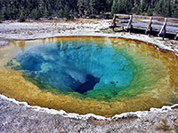
| 69. Upper Geyser Basin, Yellowstone National Park Length 2.5 miles (4 km) Elevation change 80 feet (24 meters) Difficulty Easy Rating (1-5) ★★★★★ Not everyone walks the full length of the path through the Upper Geyser Basin, but the lower end is the most used trail in the park. From Old Faithful Inn, the flat, paved path follows alongside the Firehole River through the greatest concentration of geysers in the world. Short side trails lead to particular groups, and one longer diversion (Observation Point Trail) heads up into the hills. After Morning Glory Pool (1.5 miles), the path enters the forest for half a mile, but reaches more geysers (the Cascade Group) when it returns to the river. |
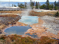
| 70. West Thumb Geyser Basin, Yellowstone National Park Length 0.75 miles (1.2 km); (loop) Elevation change 20 feet (6 meters) Difficulty Easy Rating (1-5) ★★★★★ Two level, wheelchair accessible, intersecting loop trails pass around all the thermal features of West Thumb basin, on the shores of Yellowstone Lake. The small but very scenic geyser basin contains many hot springs and is a must-see attraction of the park. |
| 71. Wolf Lake, Yellowstone National Park Length 3.5 miles (5.6 km) Elevation change 250 feet (76 meters) Difficulty Easy to moderate Rating (1-5) ★★★★★ 0.25 miles east of the Ice Lake trailhead is the unmarked start point for the hike to Wolf Lake, another tranquil pool tucked away in the forest around the far upper end of the Gibbon River. The route follows the north edge of the wooded Solfatara Plateau, crossing the river and smaller tributary streams various times, so is wet and muddy during early summer. After 1.5 miles it joins the Howard Eaton Trail from Norris and Ice Lake, while after Wolf Lake the route continues another mile to the larger Grebe Lake (see hikes in the east). |
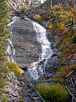
| 72. Wraith Falls, Yellowstone National Park Length 0.3 miles (0.5 km) Elevation change 120 feet (37 meters) Difficulty Easy Rating (1-5) ★★★★★ The very short route to 100 foot Wraith Falls starts a quarter mile east of the Lava Creek Picnic area, 5 miles from Mammoth. The drop is more of a cascade than a waterfall, as Lupine Creek flows over a steep cliff on its way to joining Lava Creek. The trail crosses a sagebrush meadow then runs alongside a small stream. |
| 73. Yellowstone Lake Overlook, Yellowstone National Park Length 1 mile (1.6 km) Elevation change 500 feet (152 meters) Difficulty Easy Rating (1-5) ★★★★★ The second of two short hikes to viewpoints that begin from the West Thumb Geyser Basin parking area, this climbs past a few small pools and gas vents to a vantage point at the edge of a wildflower-filled meadow up in the mountains. |
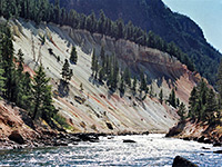
| 74. Yellowstone River Picnic Area, Yellowstone National Park Length 2 miles (3.2 km) Elevation change 400 feet (122 meters) Difficulty Easy Rating (1-5) ★★★★★ This easy trail follows the east side of the cliffs at the downstream end of the Grand Canyon of the Yellowstone River, to a place known as The Narrows. Here the canyon is only 400 feet deep, much smaller than the 1,200 foot gorge witnessed from the more well known viewpoints at the upper end, but the views are still dramatic. After 2 miles the path reaches a 4-way junction - left and straight on is the Specimen Ridge Trail, while right is a one mile path that descends into the Grand Canyon to the site of the historic Bannock Indian Ford, opposite Tower Falls on the far side of the river. The path begins at the Yellowstone Picnic Area, 1.2 miles east of Tower Junction. |
All Contents © Copyright The American Southwest | Comments and Questions | Contribute | Affiliate Marketing Disclosure | Site Map
